


![]()


Durata
 5:00 h
Distanza
 15,9 km
 Ascesa
 592 m
592 mDiscesa
 592 m
592 mH Max
 532 m
532 mH Min
 0 m
0 mMonte Monaco from San Vito Lo Capo
DESCRIPTION
From the coast to the summit cross: a journey between sea, rock, and Mediterranean scrub.
Geographical Location
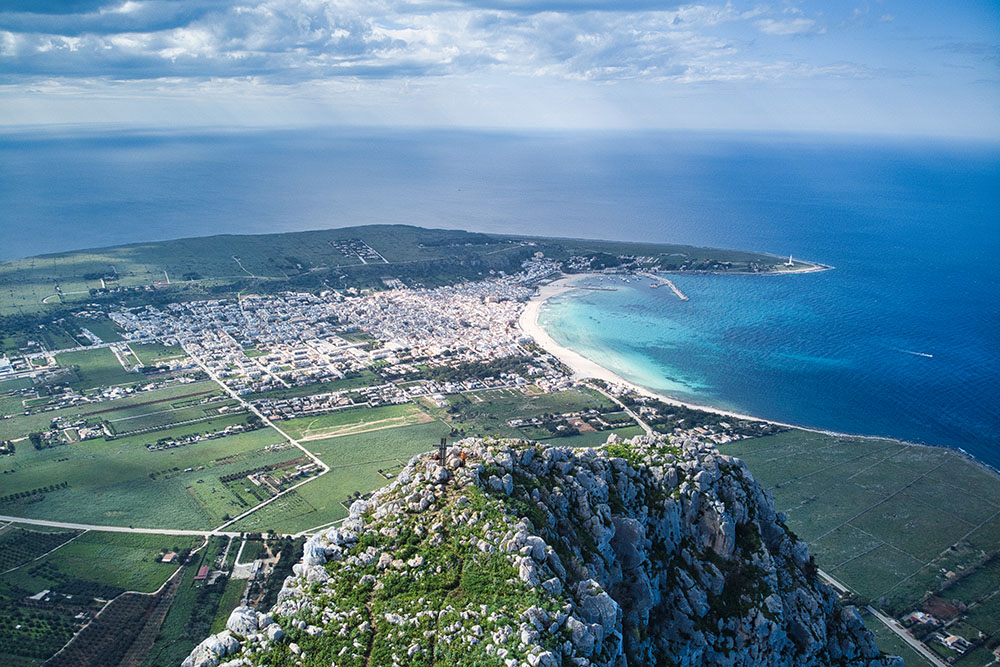
Monte Monaco (532 m) is a distinctive rocky massif dominating the northern tip of the San Vito Lo Capo promontory in northwestern Sicily. Part of the Monti di Trapani mountain system, its name comes from its unique silhouette, which—when viewed from the ancient tonnara (tuna fishery) of San Vito Lo Capo—resembles a monk kneeling in prayer. The mountain overlooks the namesake seaside resort, famous for its 3 km stretch of golden beach lapped by crystal-clear waters.
Hike
The proposed itinerary offers a complete experience, combining the ascent of Monte Monaco with a walk along the stunning northeastern coast to Cala Firriato. The moderately challenging route spans about 16 km and requires a reasonable level of fitness.
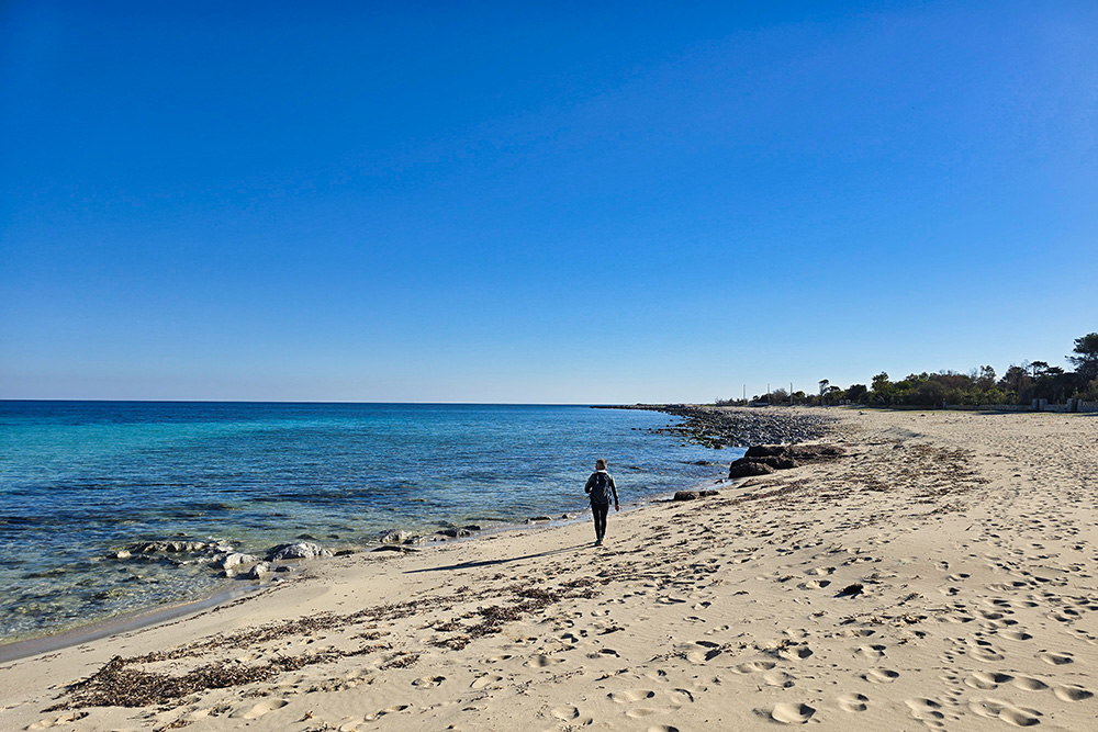
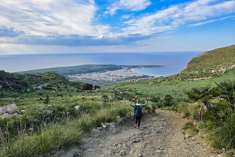
Starting from the center of San Vito Lo Capo, the trail heads toward the northeastern coast. Along the way, hikers traverse flat stretches along the shoreline, characterized by typical Mediterranean scrub dominated by dwarf palms and wooded areas. Upon reaching Cala Firriato, a charming bay with turquoise waters, a short break can be taken to admire the view.
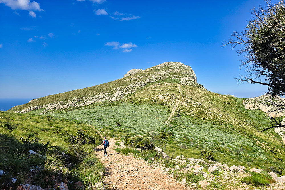
Continuing onward, the path begins to climb along a dirt road, later narrowing into a rocky trail. During the ascent, hikers will encounter the remains of the Rosso San Vito or Contorrana quarries, where prized reddish-brown limestone from the Jurassic period was once extracted.
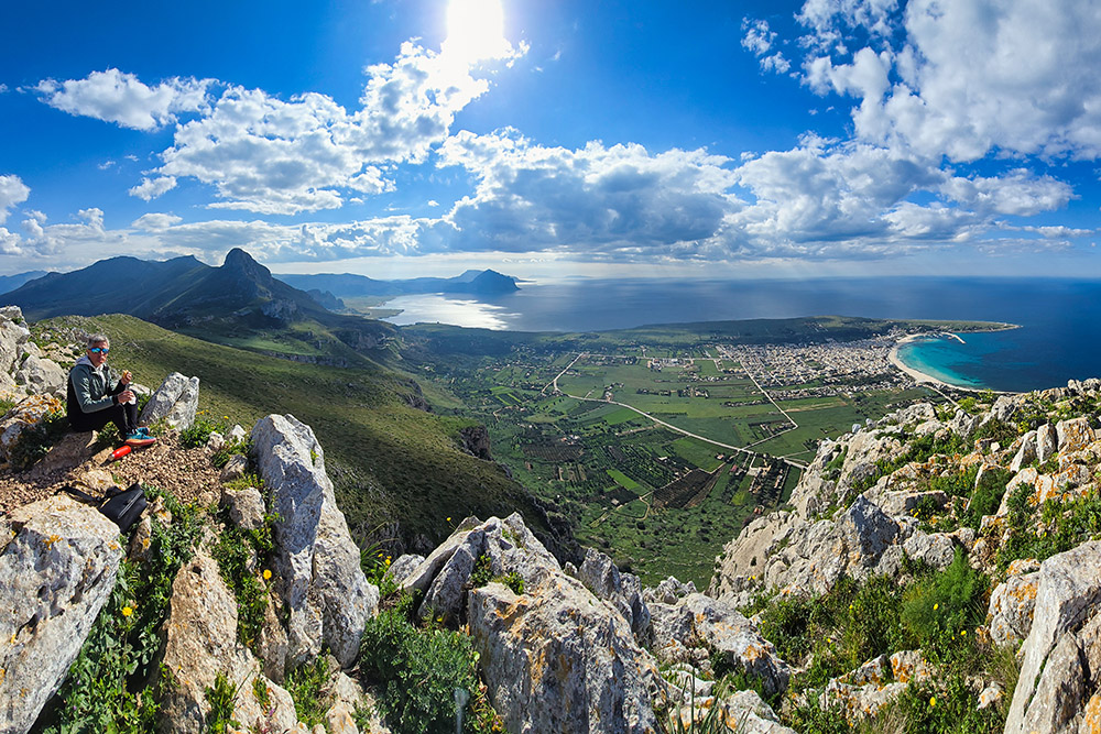
Further up, surrounded by lush Mediterranean scrub, the trail leads to the summit cross at 532 meters. Here, a breathtaking 360-degree panorama unfolds, encompassing Monte Cofano, the medieval village of Erice, the Gulf of Castellammare, and—on clear days—the Egadi Islands resting on the crystalline sea. This natural spectacle more than compensates for the effort of the hike.
ITINERARY
From the parking area (17 m), head to San Vito Lo Capo’s beach, then turn right onto the coastal trail. Along this stretch, you’ll pass a WWII bunker, Punta di Solanto, and Torre dell’Usciere (11 m). Continue on a mix of dirt and paved roads until reaching Cala Firriato (1 m), accessed via a short trail. From here, ascend on a dirt road, follow a section of SP63, and take trail marker 609 up to the summit of Monte Monaco (532 m). For the return, partially retrace your steps, then take the descending trail on the western slope and follow the paved road back to the starting point.
EXCURSION DATE
March 6, 2025
STARTING POINT
San Vito Lo Capo
REFRESHMENT POINT
None
AUTHOR’S SUGGESTIONS
Use our GPX track, as trail markings are scarce.
SAFETY TIPS
The feasibility of this itinerary, like all mountain terrain, is subject to environmental changes due to natural events and weather conditions. Before setting out, check with local tourist offices and/or mountain huts.
Our GPX tracks are only indicative—the route was completed under optimal trail and weather conditions. Always assess the situation on-site.
Evaluate the hike based on your physical fitness, experience, and equipment.
Inform someone of your planned route.
Emergency number: 112.
EQUIPMENT
Bring gear appropriate for the trail, weather, and season: windproof/waterproof jacket, map and/or GPS device, sunglasses, sunscreen, hiking boots, first-aid kit, proper clothing, gloves, and a backpack with food and water.
RECOMMENDED MAPS
No printed maps were found—use the Outdoor.Active or Komoot app.
INTERESTING LINKS
https://www.sanvitoweb.com/it
HOW TO ARRIVE
From Trapani, take SS187, then SP16 to San Vito Lo Capo.
PARKING AREA
Free, unsupervised municipal parking in San Vito Lo Capo
GPS coordinates: 38.169254, 12.743744
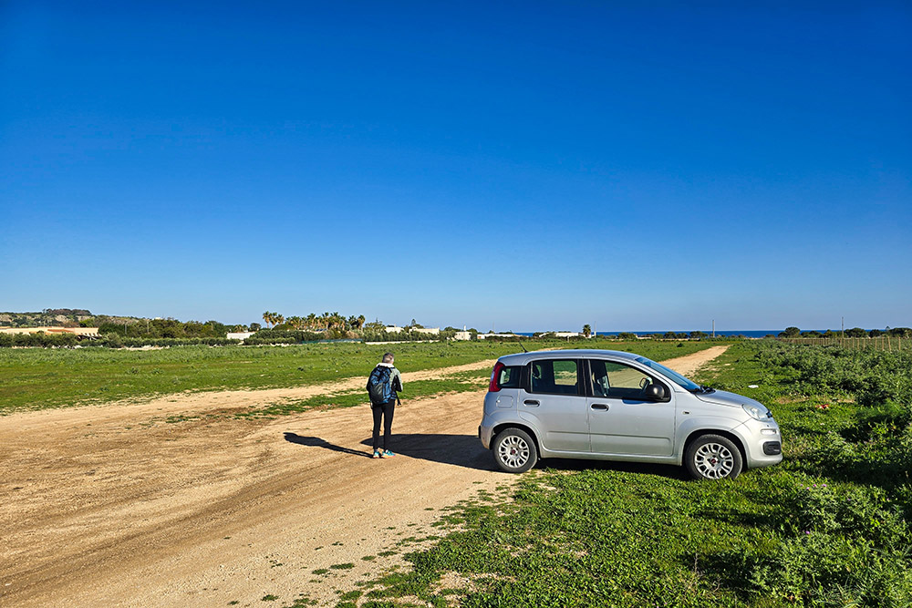
Parcheggio pubblico a San Vito Lo Capo
Sentiero lungo la costa
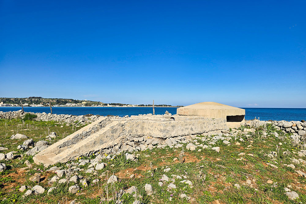
Un bunker della Seconda Guerra Mondiale
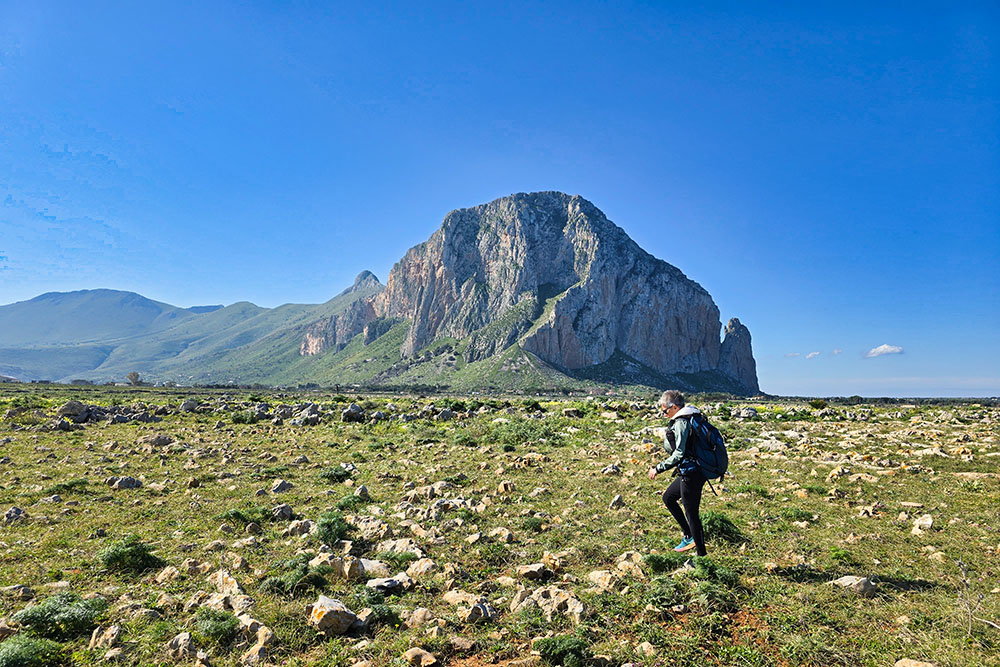
Monte Monaco sullo sfondo
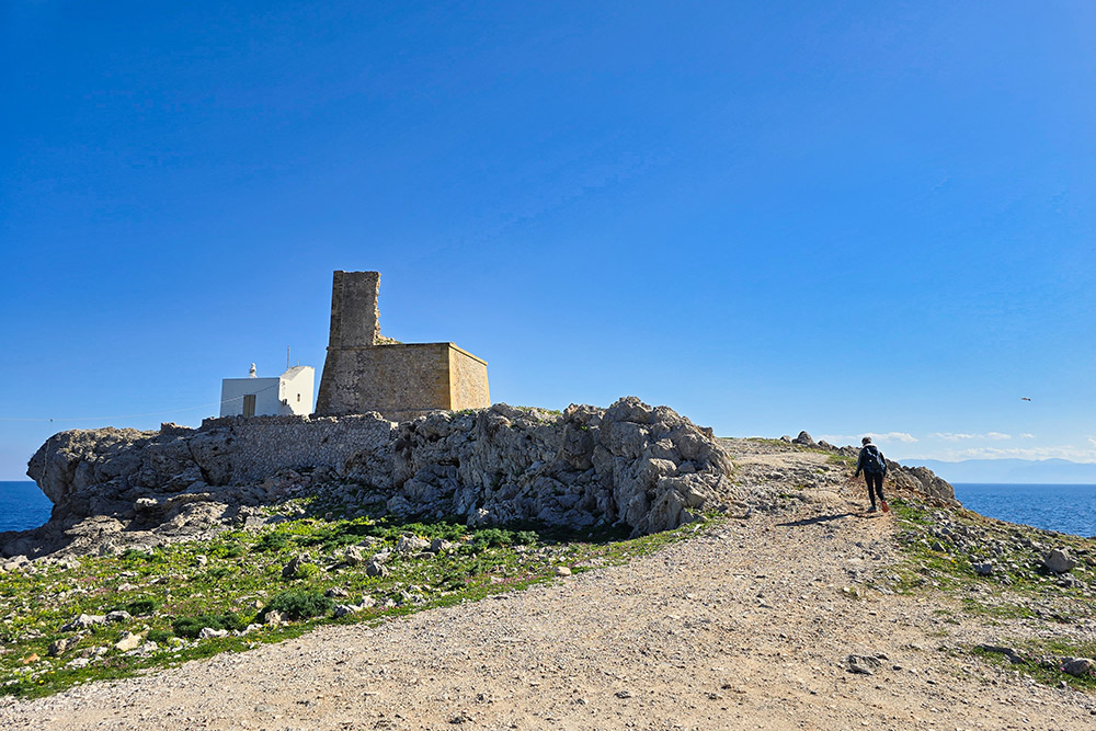
La Torre dell'Usciere
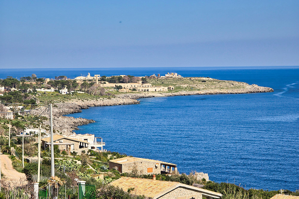
La Tonnara del Secco in lontananza
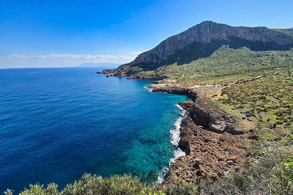
La Cala Firriato
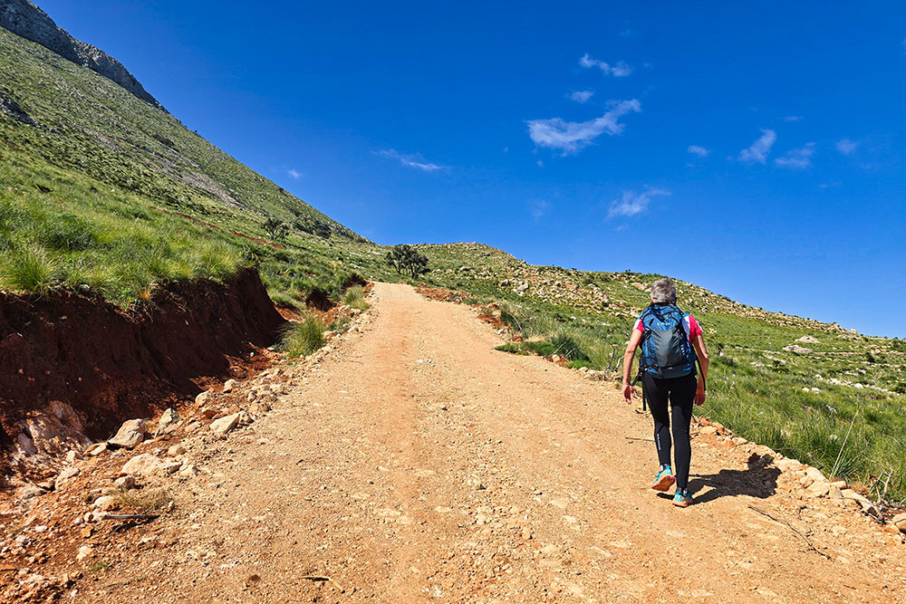
Si sale sul Monte Monaco
Breve tratto pianeggiante
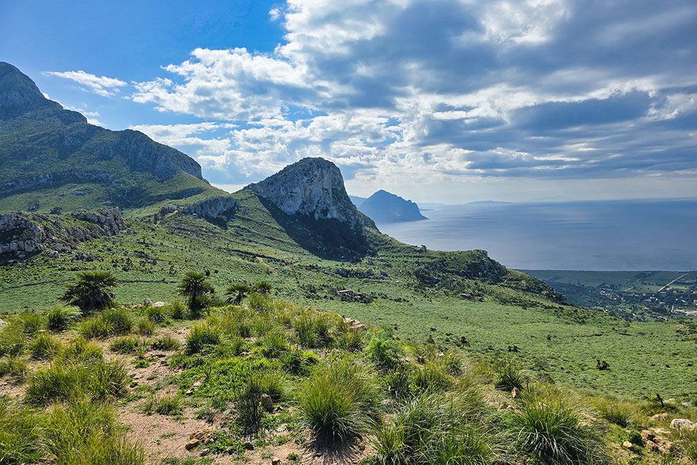
Inizia la vista verso ovest
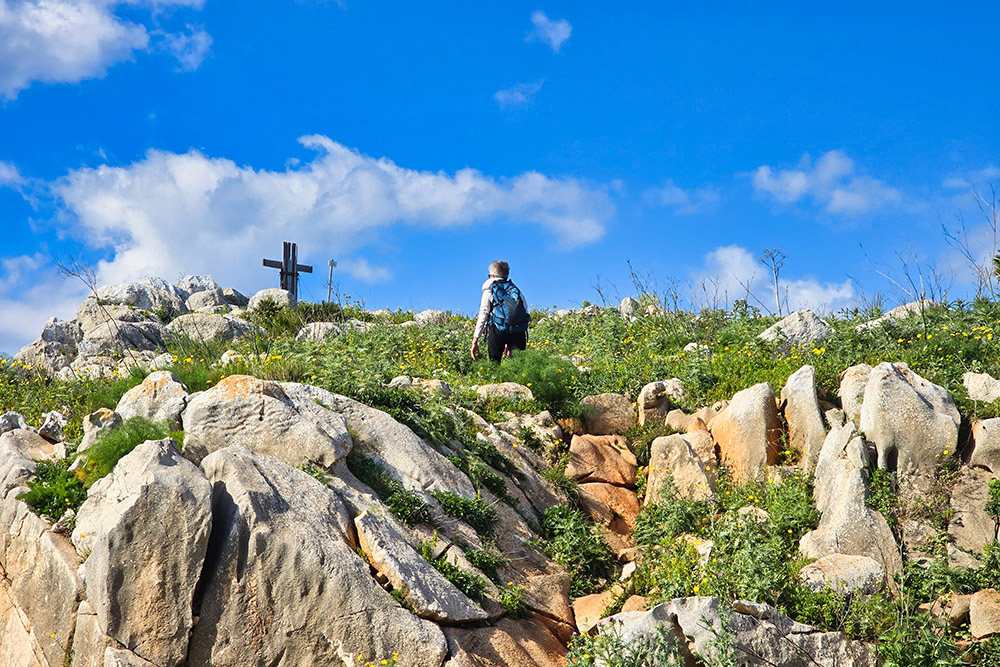
Ancora pochi metri
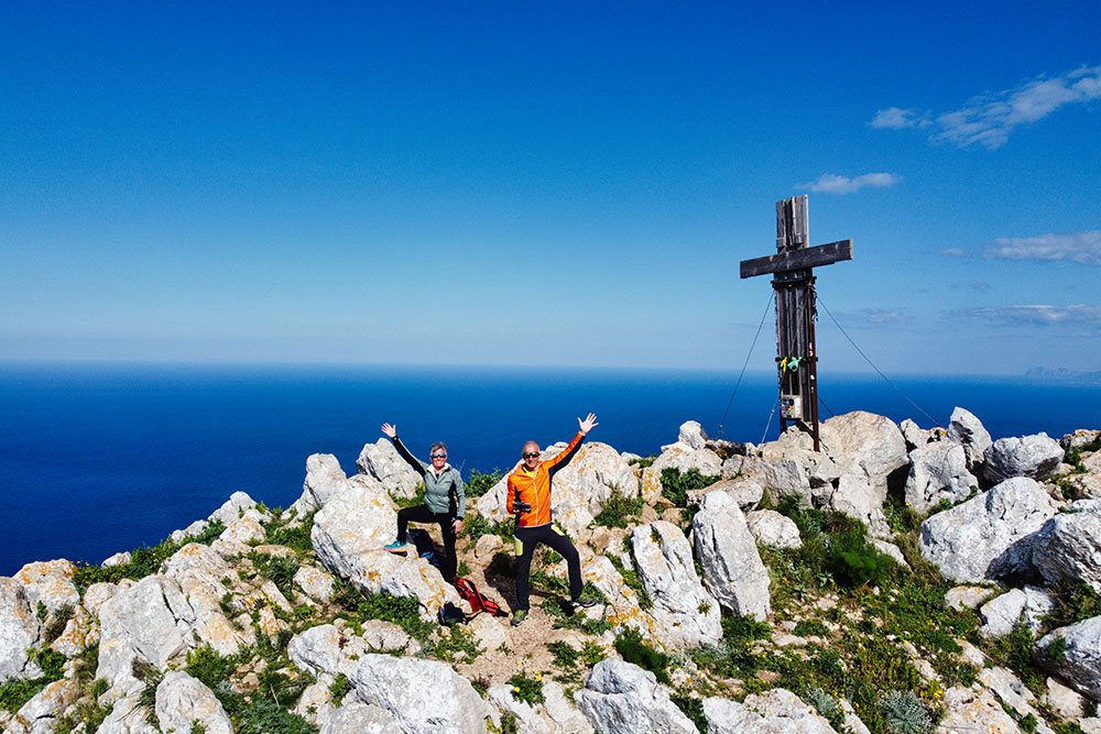
Arrivati in vetta a Monte Monaco
Vista verso San Vito Lo Capo
Vista verso il Monte Cofano
Si scende verso San Vito Lo Capo


