


![]()


Durata
 4:45 h
Distanza
 11,6 km
 Ascesa
 860 m
860 mDiscesa
 860 m
860 mH Max
 2235 m
H Min
 1437 m
Son Forca Mountain Hut from Baita Col Tondo
DESCRIPTION
Panoramic hike in the Cortina d’Ampezzo area.
Geographical Location
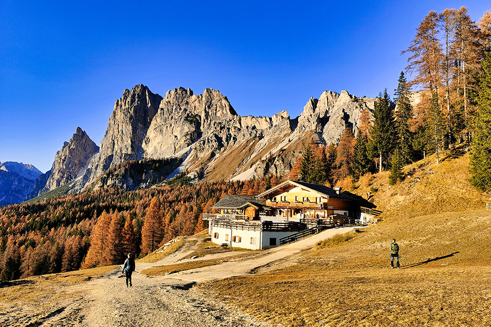
The Son Forca Mountain Hut is located in the Cristallo mountain group of the Ampezzo Dolomites, Veneto, within the municipality of Cortina d’Ampezzo.
It was built near the homonymous Forcella Son Forca and is situated at the arrival station of the Rio Gere - Son Forca chairlift.
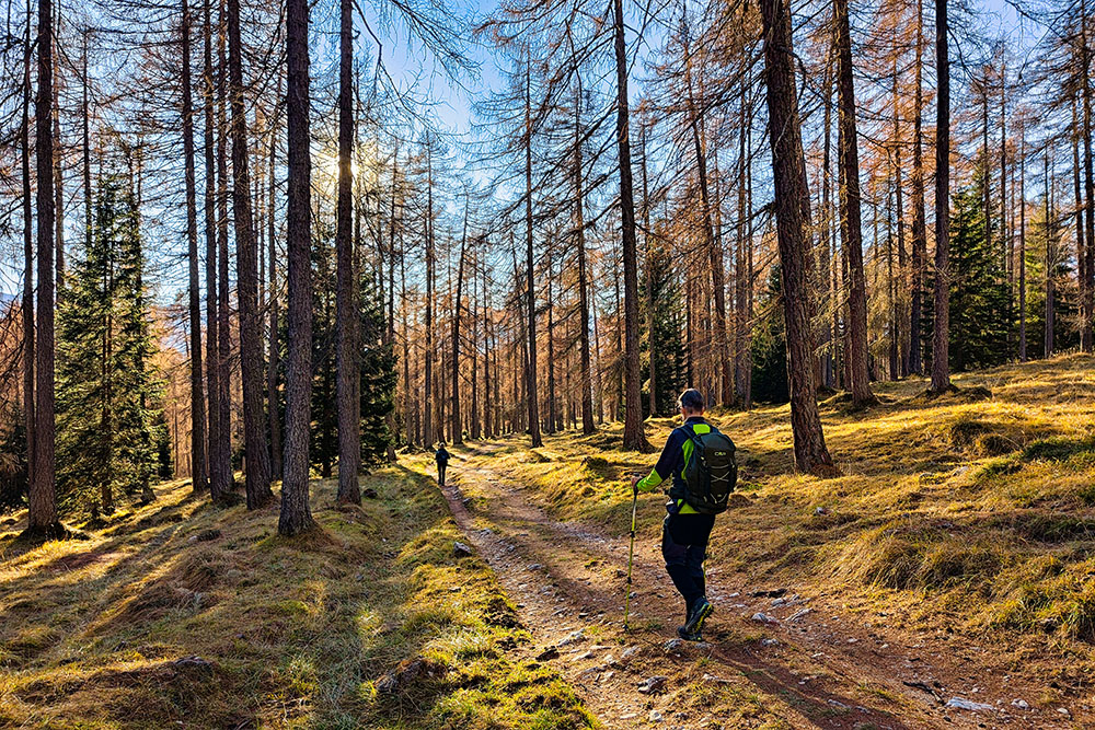
Hike
The Son Forca Mountain Hut, being close to Cortina d’Ampezzo and accessible via a nearby chairlift, is very popular. However, if you take the route we propose—climbing the steep Forcella Zumèles—the number of hikers decreases significantly. Moreover, as we did in November, you’ll enjoy the hike in peace, encountering very few people.
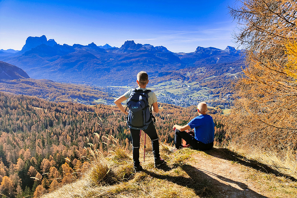
The hike is worth it, as the steep climb up Forcella Zumèles offers stunning views of the Cortina d’Ampezzo basin and the fantastic surrounding Dolomite peaks. In autumn, the area explodes with colors thanks to the many larches in the region.
History
Built alongside the opening of the first section of the Monte Cristallo cable car between 1955 and 1956, it was initially called the Baron Franchetti Mountain Hut.
In 1961, it was acquired by Roberto Siorpaes. During the 1960s and 1970s, he expanded it, transforming it into the current Son Forca Mountain Hut.
ITINERARY
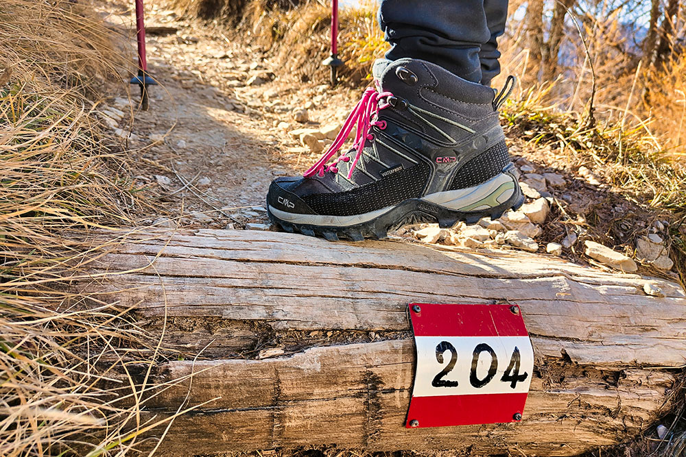
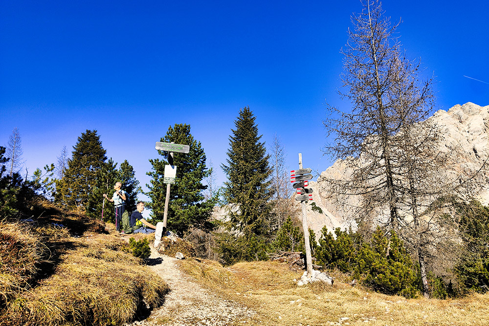
From the former lower station of the Mietres ski lift in Cortina d’Ampezzo (1429 m) at Col Tondo, follow a dirt road and then trail no. 204 to Forcella Zumèles (2072 m). Turn right onto trail no. 205 to reach Passo Son Forca (2109 m) and the Son Forca Mountain Hut (2235 m).
Return to Passo Son Forca and descend via trails no. 203 and no. 206 to Malga de Larieto (1660 m). Finally, return to the starting point by following trails no. 211 and no. 204, passing by the Mietres Mountain Hut (1710 m).
EXCURSION DATE
November 10, 2024
STARTING POINT
Former lower station of the Mietres ski lift in Cortina d’Ampezzo
REFRESHMENT POINT
Son Forca Mountain Hut (2235 m), Malga de Larieto (1660 m), Mietres Mountain Hut (1710 m)
AUTHOR’S SUGGESTIONS
Plan this itinerary for the autumn season.
SAFETY TIPS
The accessibility of the proposed route, like all mountainous terrain, is subject to environmental changes due to natural events and weather conditions. Therefore, before setting off, consult local tourist offices and/or the relevant mountain huts.
Our GPX tracks are for reference only and indicate the route as it was followed under the trail and weather conditions of that day. Always assess the situation on-site.
Additionally, consider the route based on your physical abilities, fitness level, and available equipment. Inform someone about your planned itinerary. Remember, the emergency number is 112.
EQUIPMENT
It is recommended to carry appropriate equipment for the route, weather conditions, and season: windproof and/or waterproof jacket, map and/or GPS device, sunglasses, sunscreen, hiking boots, first aid kit, specialized clothing, gloves, and a backpack with food and beverages.
RECOMMENDED MAPS
Tabacco 03 Cortina d'Ampezzo - Ampezzo Dolomites
USEFUL LINKS
https://www.caiveneto.it/rifugio/son-forca
HOW TO ARRIVE
From Cortina d’Ampezzo, follow the SS51 road toward Dobbiaco. Upon reaching Hotel Menardi, turn right and drive up to the former lower station of the Mietres ski lift.
PARKING AREA
Near the former lower station of the Mietres ski lift in Cortina d’Ampezzo
GPS Coordinates: 46.554280, 12.146948
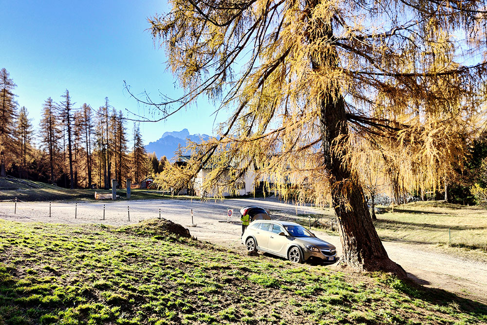
Parcheggio presso la Baita Col Tondo
La Baita Col Tondo
Si sale su strada sterrata
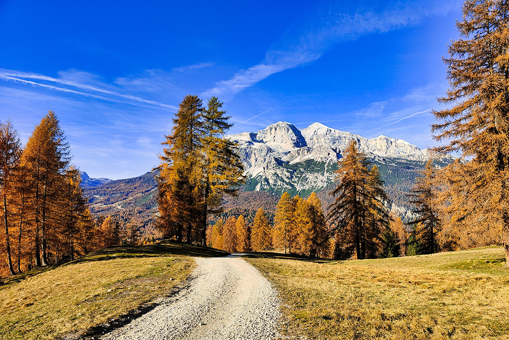
Alle spalle le magnifiche Tofane
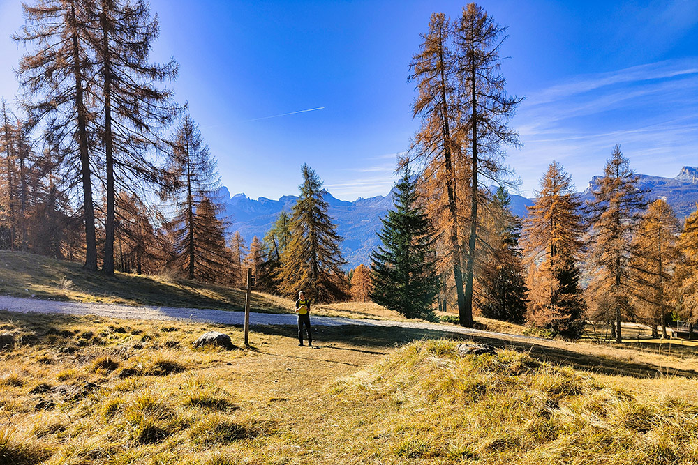
Al bivio si prende il segnavia 204
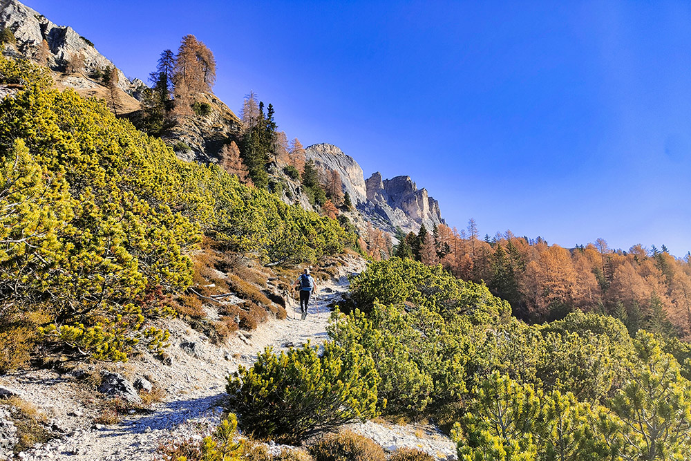
Si sale in mezzo ai pini mughi
Sempre sul 204
Panorama verso Cortina d'Ampezzo
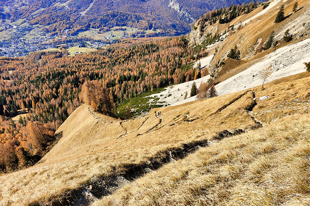
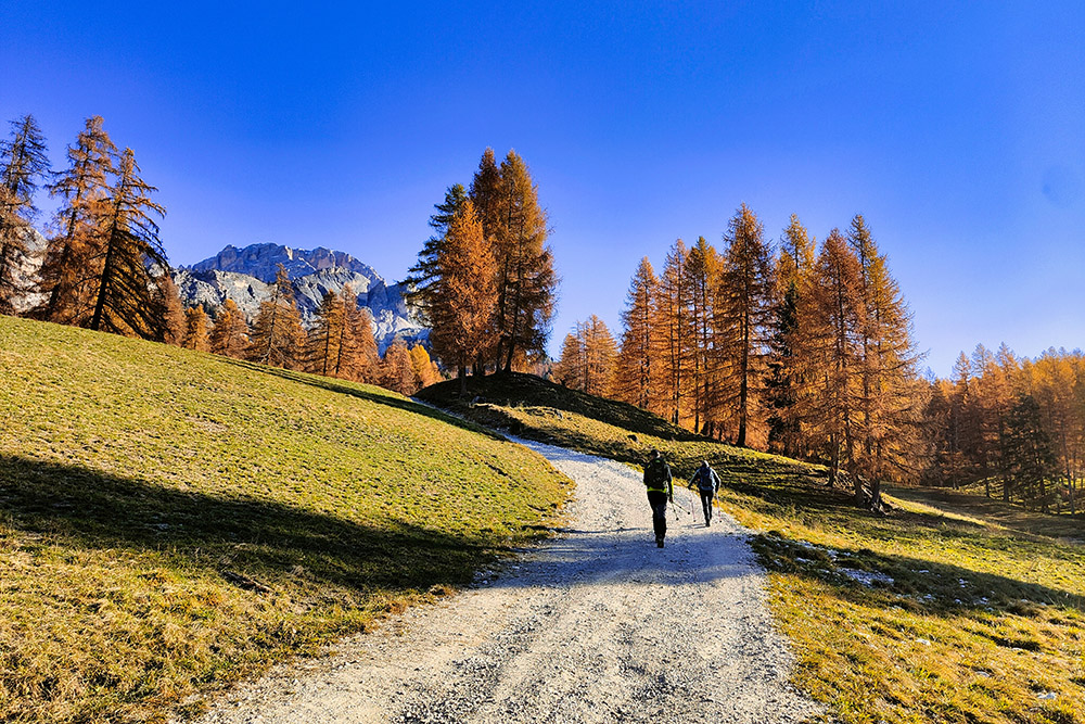
Si sale molto velocemente su ripido sentiero
Ultimo tratto per la Forcalla Zumèles
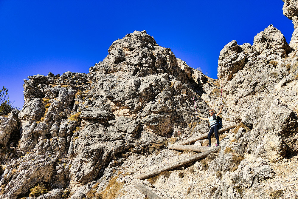
Arrivati alla Forcella Zumèles
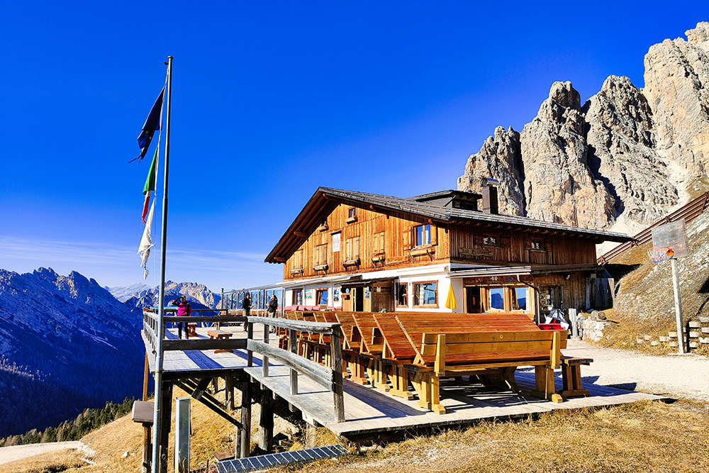
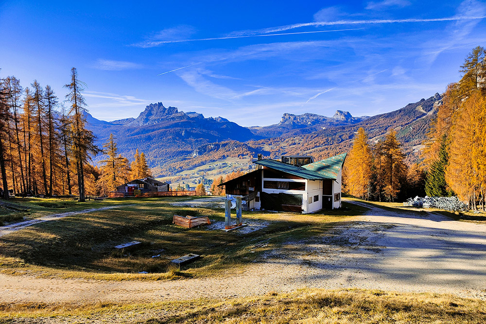
Rifugio Son Forca
Attraversiamo uno stupendo lariceto
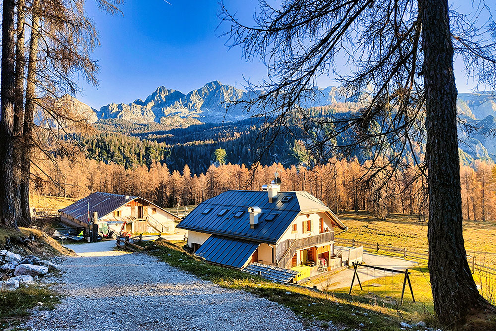
Malga de Larieto
Il Rifugio Mietres


