


![]()


Durata
 5:30 h
Distanza
 12,9 km
 Ascesa
 837 m
837 mDiscesa
 837 m
837 mH Max
 2452 m
H Min
 2052 m
Col di Lana from Valparola Pass
DESCRIPTION
From the trenches of World War I to the peaks of the Dolomites.
Col di Lana, standing at 2,452 meters, is a prominent peak in the Dolomites, recognized as a UNESCO World Heritage Site. Located in the municipality of Livinallongo del Col di Lana in Alto Agordino, Belluno Province, Veneto Region, it is a must-visit for nature and history enthusiasts.
The hike to the summit of Col di Lana, a symbol of the Great War, offers a unique experience. This trail not only immerses visitors in the breathtaking nature of the Fodom Valley but also serves as a historical lesson on the wartime events that marked these mountains.
Col di Lana overlooks the hamlet of Pieve di Livinallongo and plays a crucial role in World War I history. During the early stages of the conflict, along the famous Yellow Line, fierce battles took place here between the Italian troops and those of the Austro-Hungarian Empire. The mountain, known as the “Mountain of Blood” or “Blutberg,” was the site of such intense combat that it left an indelible mark on collective memory.
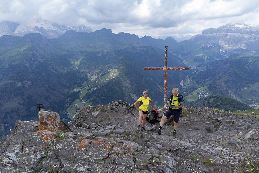
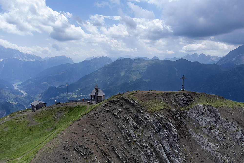
One of the most dramatic episodes occurred on the night of April 17, 1916, when the summit of Col di Lana was blown up with 5 tons of dynamite, killing more than half of the Austro-Hungarian soldiers present and allowing Italian occupation of the peak, which was later nullified by the defeat at Caporetto. The impressive crater from the explosion is still visible and attracts many history enthusiasts. At the top stands a small church that hosts annual commemorations and religious services in memory of the carnage.
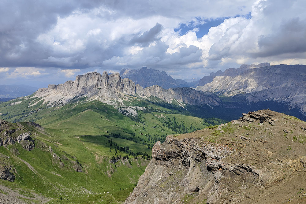
Beyond its historical significance, Col di Lana is a popular hiking destination. Its central location offers a 360-degree panoramic view of the most famous Dolomite groups, including: Tofane, Civetta, Settsass, Sassonger, Conturines, Sass de Stria, Sella, Marmolada, Nuvolau Group, Pelmo, and Pale di San Martino. This magnificent panorama makes the hike to Col di Lana an unforgettable experience, combining natural beauty and historical reflection.
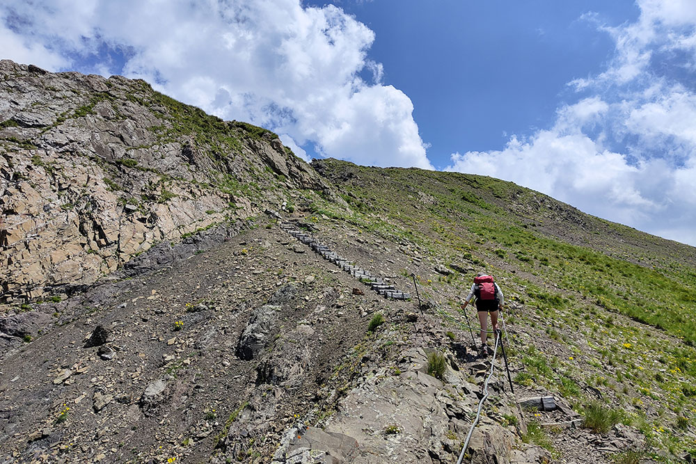
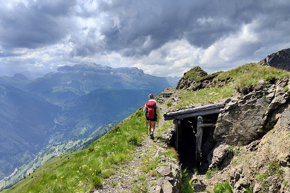
The hike is technically easy, except for the section between Cima Sief and Col di Lana, which follows a via ferrata path. In this part, surefootedness and a head for heights are required.
ITINERARY
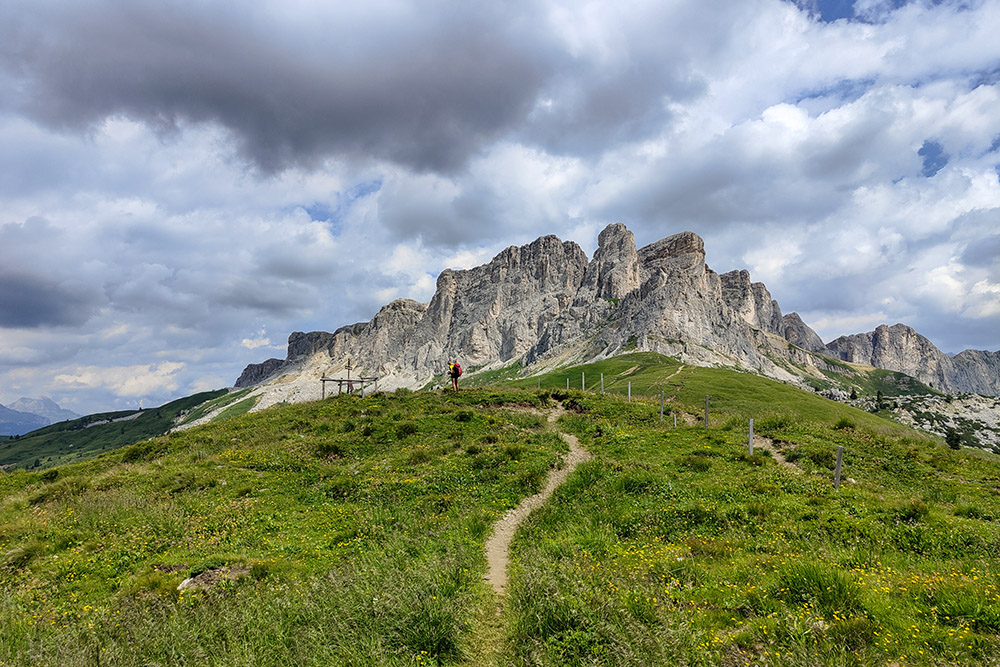
From Valparola Pass (2,168 m), take trail number 23 to Bivacco Sief (2,263 m), then turn left onto trail 21 and, passing through Sief Pass (2,209 m), ascend to Cima Sief (2,424 m). Now descend to the Mine Crater (2,352 m) - from here the path is a via ferrata - then climb to the summit of Col di Lana (2,452 m). Return by the same route.
EXCURSION DATE
July 16, 2024
STARTING POINT
Valparola Pass
REFRESHMENT POINT
None
AUTHOR’S SUGGESTIONS
Be cautious on the exposed and equipped section - from Cima Sief to Col di Lana - where surefootedness and no fear of heights are necessary.
SAFETY TIPS
The viability of the proposed itinerary, like all mountain morphology, is subject to environmental changes due to natural events and weather conditions. Therefore, before leaving, consult the competent tourist offices and / or the refuges of reference.
Our GPX tracks are only indicative, that is, the route was carried out at best with the conditions of the trails and weather of that day. So always consider what to do on site.
Also remember to evaluate the route based on your physical abilities, training and the equipment you have.
You should leave someone the route you intend to do told.
Remember that the emergency number is 112.
EQUIPMENT
It is recommended to have the appropriate equipment for the route, weather conditions and season: windproof and / or rain jacket, map and / or GPS device, goggles, sunscreen, boots, first aid kit, specific clothing, gloves, backpack with food and drink.
RECOMMENDED MAPS
Tabacco 07 Alta Badia - Arabba - Marmolada
INTERESTING LINKS
https://www.cortinamuseoguerra.it/
HOW TO ARRIVE
SP24 from Val Badia, SR48 from Cortina d’Ampezzo
PARKING AREA
Between Valparola Pass and Forte Tre Sassi
GPS Coordinates: 46.529135, 11.989742
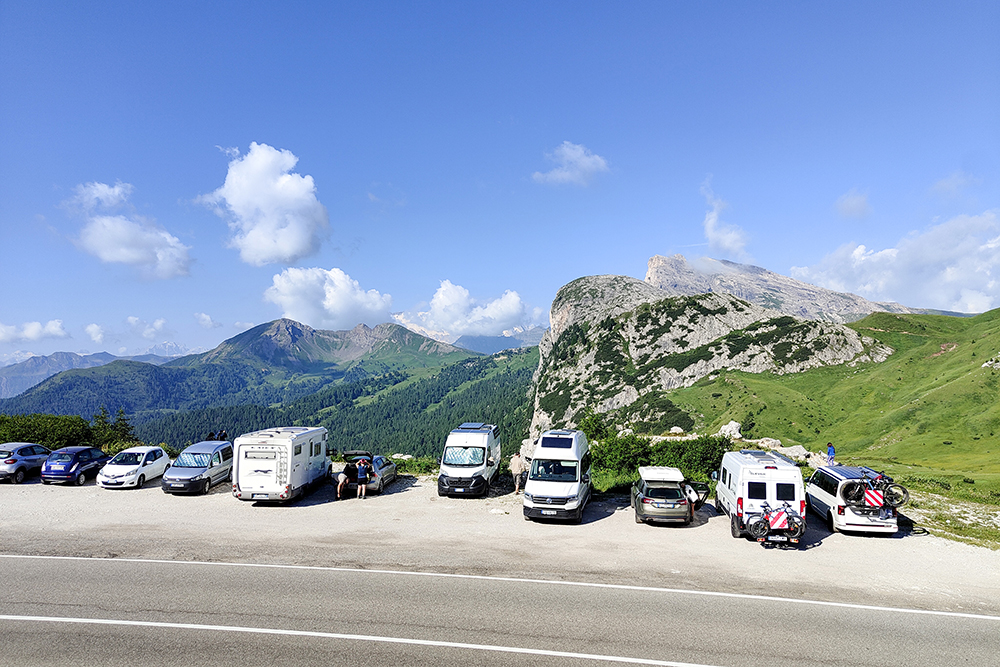
Parcheggio nei pressi del Forte Tre Sassi
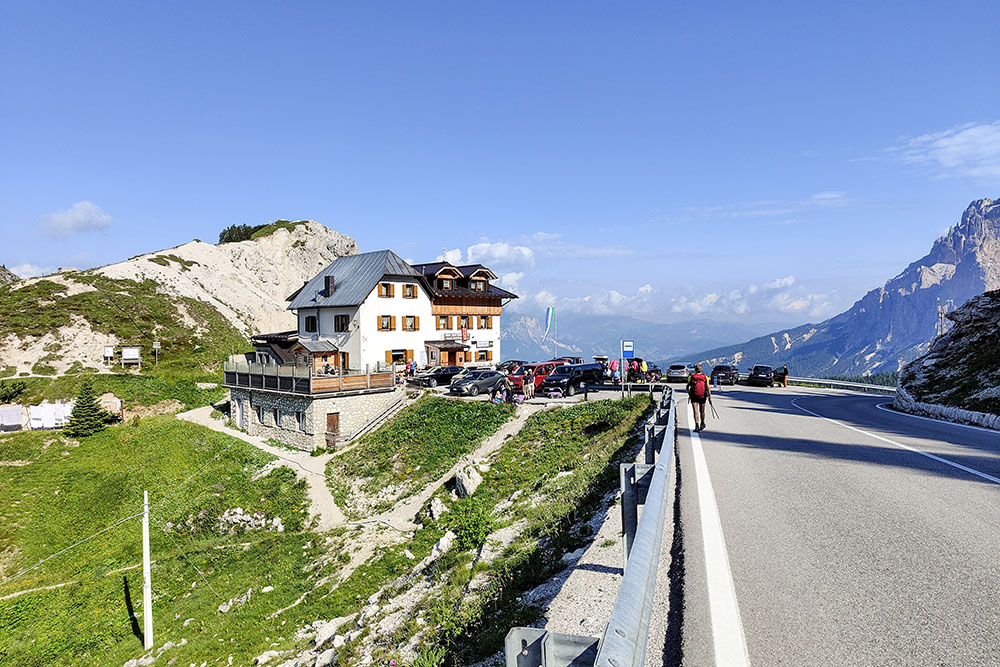
Passo di Valparola
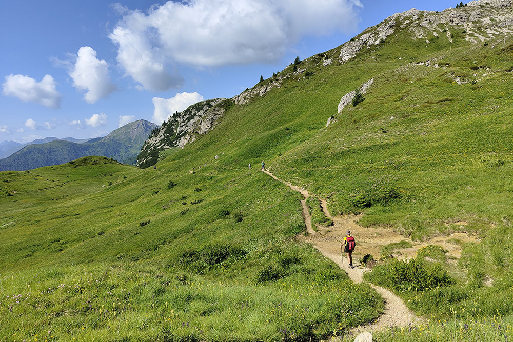
Sul sentiero 23
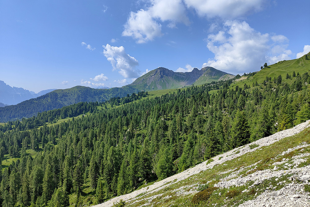
Il lontananza il Col de Lana
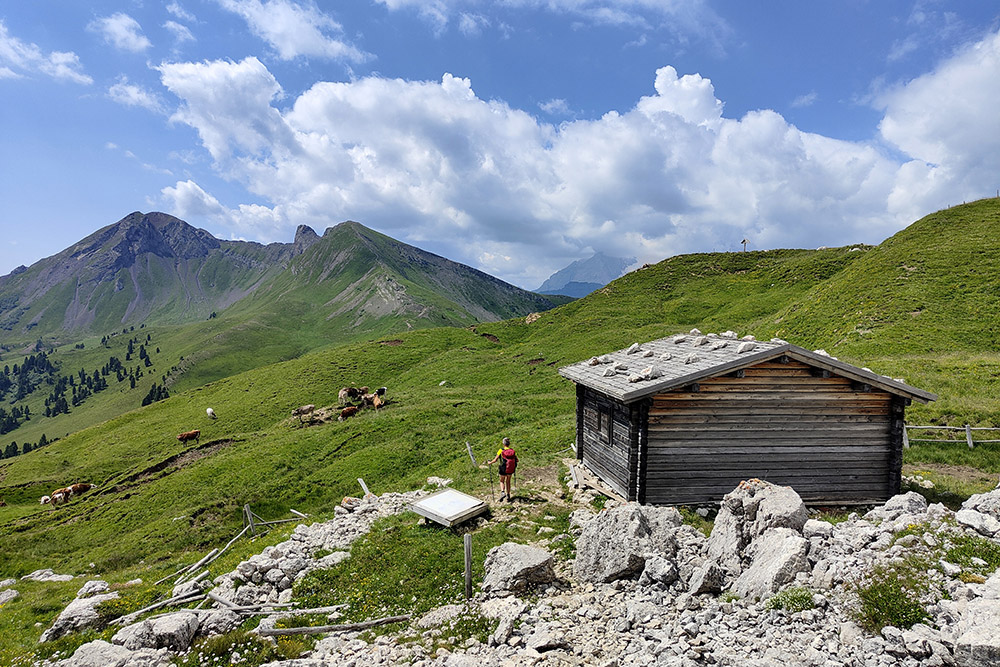
Il Bivacco Sief
Il Passo Sief
La Cima Sief
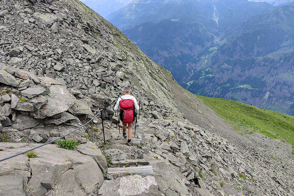
Si scende al Cratere di Mina
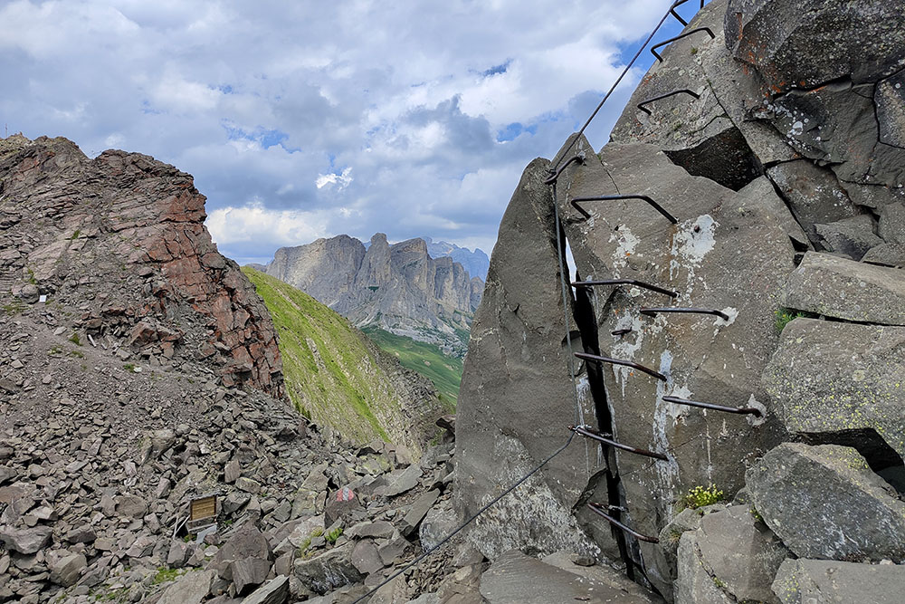
Cratere di Mina con tratti attrezzati
Si sale al Col di Lana
Col di Lana
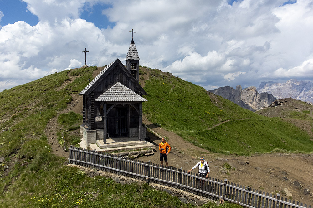
Cappella di Col di Lana
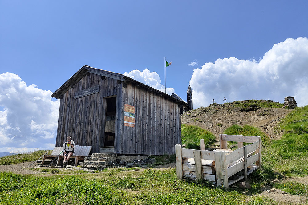
Bivacco Brigata Alpina Cadore
Vista verso il Passo di Valparola
Si ritorna al Passo di Vaparola


