


![]()


Durata
 4:45 h
Distanza
 8,5 km
 Ascesa
 790 m
790 mDiscesa
 790 m
790 mH Max
 2664 m
H Min
 1910 m
Monte Cernera North Summit
DESCRIPTION
Monte Cernera: the hidden pearl in the Dolomites of Cortina d'Ampezzo.
We are located in the suggestive Dolomite area of Passo Giau, near Cortina d'Ampezzo.
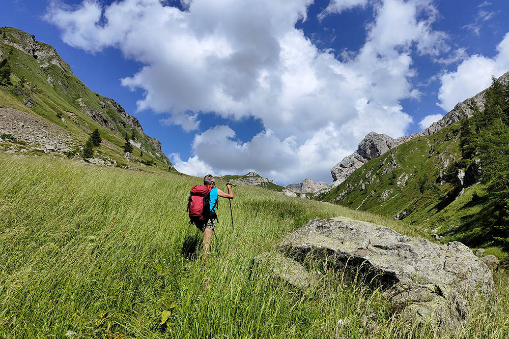
Monte Cernera, despite being little mentioned in Dolomite hiking guides together with peaks such as Pore, Crot and Formin, stands out for its extraordinary panorama. In fact, it has nothing to envy of the most renowned peaks surrounding Cortina d'Ampezzo.
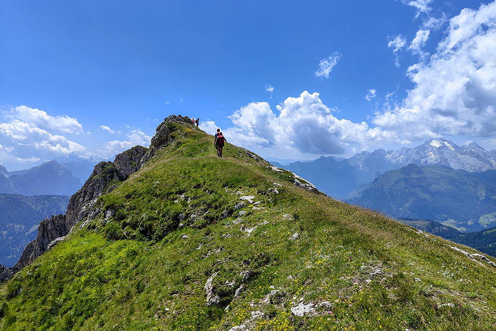
In fact, the northern peak of Monte Cernera stands out for its extraordinary panoramic views, making it an ideal option for a short but satisfying excursion.
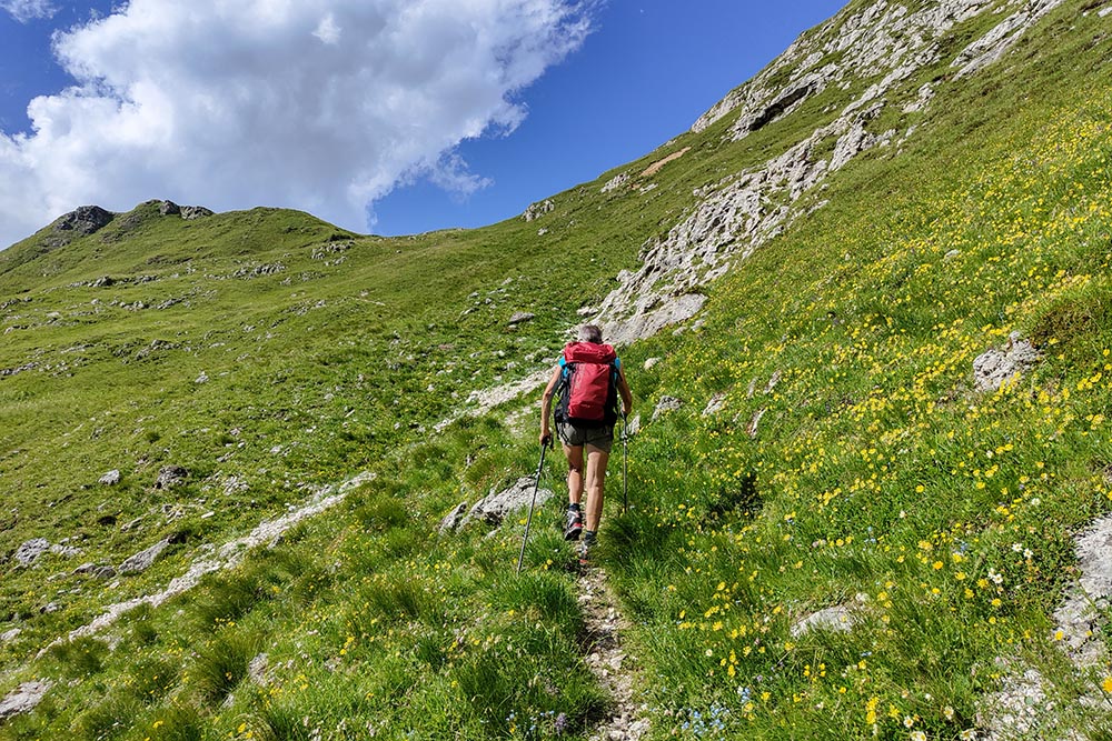
It is important to note that, on the map, the route is not marked as aided, however, there are aided sections that are not difficult. The via ferrata sections (EEA) preceding Monte Cernera are short and equipped exclusively with steel cable. Although technically easy, they should not be underestimated as they wind uphill on a rocky slab. These sections give a touch of adventure to the excursion without being banal.
To make the excursion even more exciting, we have included the summit of Monte Verdal and the ascent of the suggestive Zonia Valley. This broadens the experience by offering new vistas and adding an additional element of challenge to the adventure. The combination of these elements makes this summer excursion in the tourist area of Cortina d'Ampezzo an unforgettable experience for lovers of nature and hiking challenges.
ITINERARY
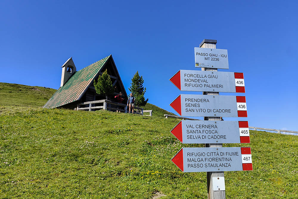
From Passo Giau (2236 m) take path 436, pass the Forcella Zonia (2229 m) and once you reach the Forcella Col Piombin (2239 m) take the path without a trail sign up to the summit of Monte Cernera Cima Nord (2664 m). Here you retrace your steps for a while and then go left towards Monte Verdal (2493 m). Now you descend into Valle di Zonia and when you reach the crossroads in Val di Zonia (1910 m) you go up along the valley following the trail sign 462 up to Forcella Zonia (2229 m). You return to the pass via path 436.
EXCURSION DATE
July 16, 2023
STARTING POINT
Giau Pass
REFRESHMENT POINT
Nobody
AUTHOR’S SUGGESTIONS
Be very careful in the equipped sections in case of bad weather.
SAFETY TIPS
The viability of the proposed itinerary, like all mountain morphology, is subject to environmental changes due to natural events and weather conditions. Therefore, before leaving, consult the competent tourist offices and / or the refuges of reference.
Our GPX tracks are only indicative, that is, the route was carried out at best with the conditions of the trails and weather of that day. So always consider what to do on site.
Also remember to evaluate the route based on your physical abilities, training and the equipment you have.
You should leave someone the route you intend to do told.
Remember that the emergency number is 112.
EQUIPMENT
It is recommended to have the appropriate equipment for the route, weather conditions and season: windproof and / or rain jacket, map and / or GPS device, goggles, sunscreen, boots, first aid kit, specific clothing, gloves, backpack with food and drink.
RECOMMENDED MAPS
Tabacco 03 Cortina d'Ampezzo/Dolomiti Ampezzane
INTERESTING LINKS
https://www.dolomiti.it/it/passo-giau
HOW TO ARRIVE
From Cortina d'Ampezzo SR48 and then SP638
PARKING AREA
Free at Passo Giau
GPS coordinates: 46.483179, 12.052980
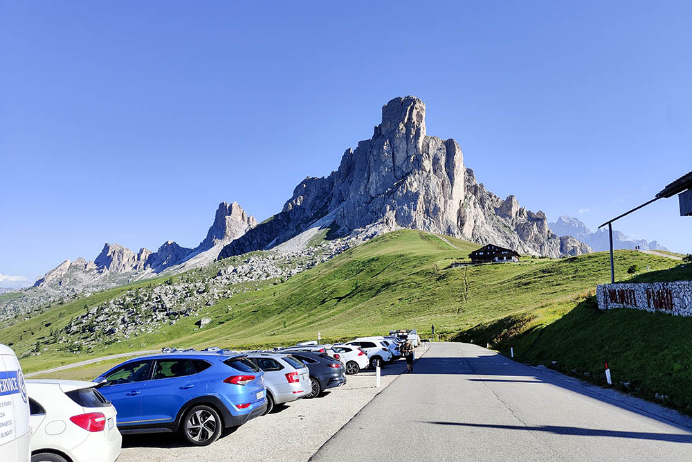
Parcheggio a Passo Giau
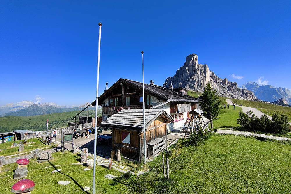
Berghotel Passo Giau
Punto di partenza del sentiero
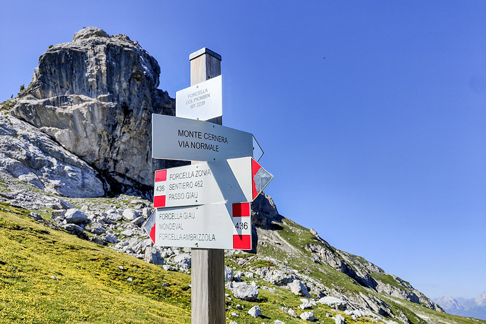
Forcella Col Piombin

Si sale su roccette
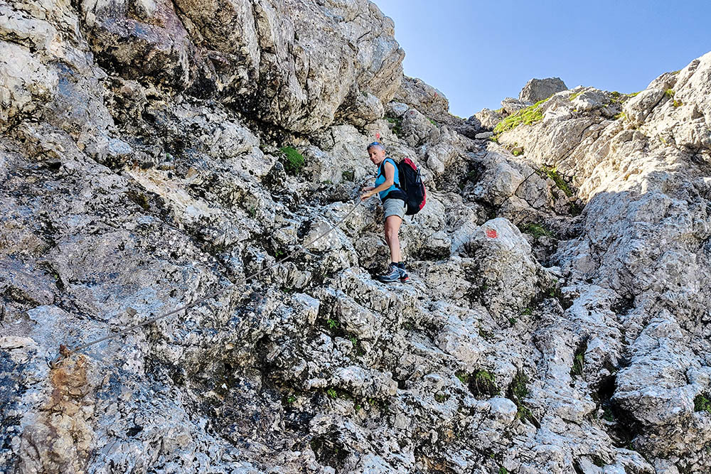
Breve tratto attrezzato
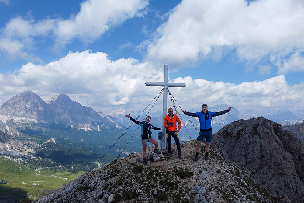
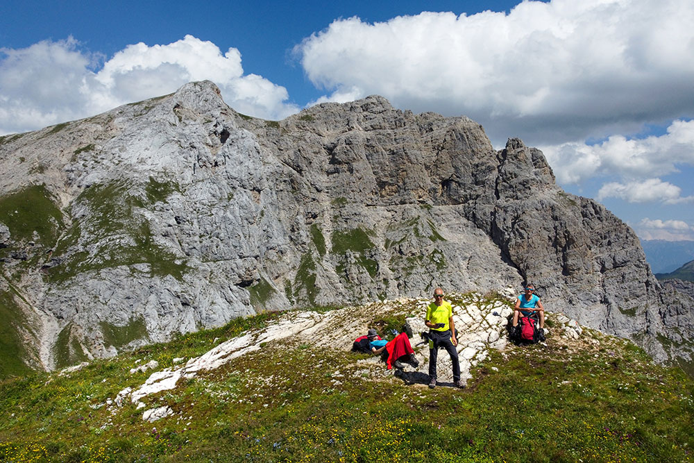
In cima al Monte Cernera Cima Nord
Panorama verso il Nuvolau
Monte Cernera Cima Nord
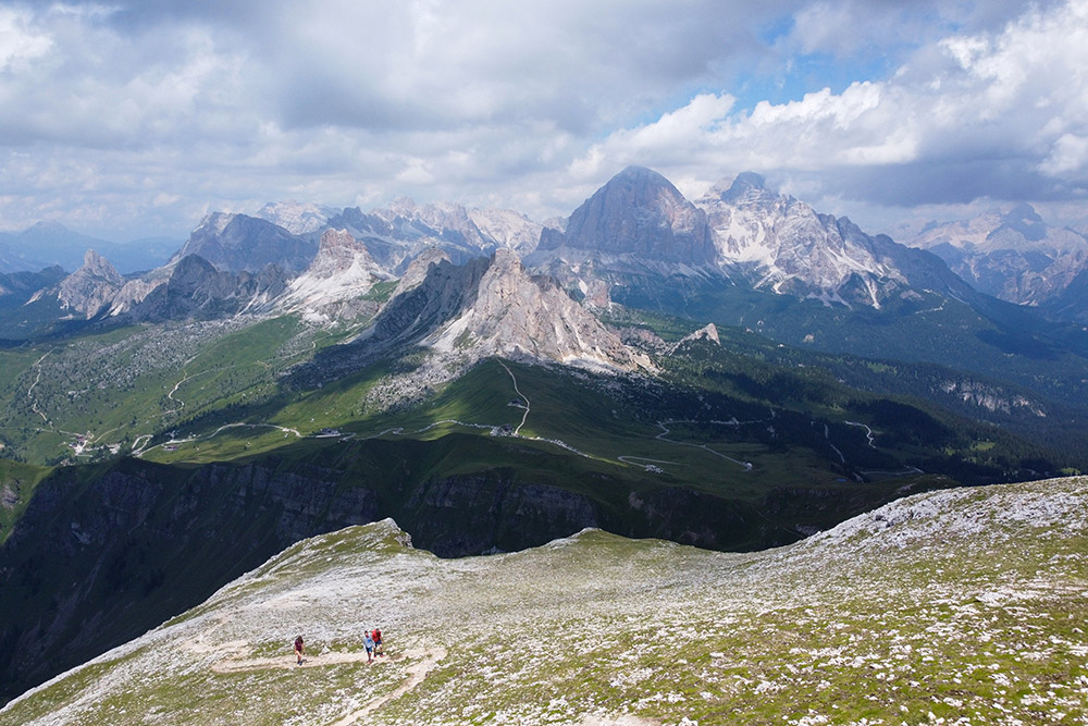
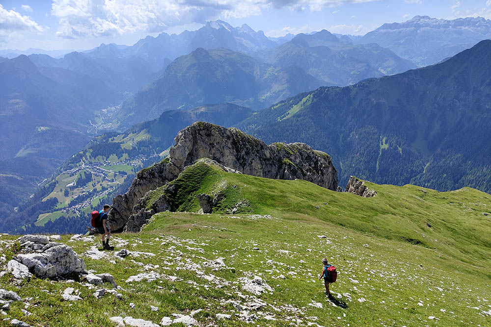
Si va verso Monte Verdal
Monte Verdal con alle spalle Cima Cernera Nord
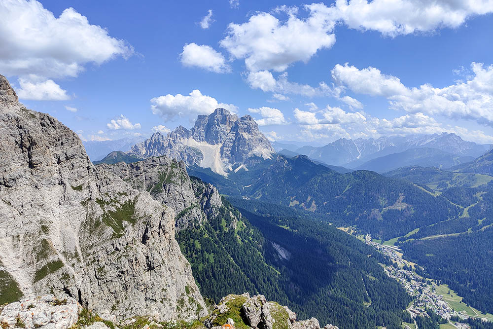
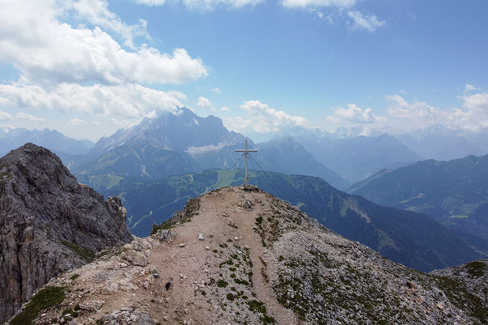
Panorama verso il Monte Pelmo
Si scende verso la Val di Zonia
In Val di Zonia
Si risale a Forcella Zonia


