


![]()


Durata
 4:55 h
Distanza
 14,8 km
 Ascesa
 547 m
547 mDiscesa
 547 m
547 mH Max
 600 m
600 mH Min
 185 m
185 mTour of Monte Isola - Lake Iseo
DESCRIPTION
Monte Isola: an oasis of beauty in Lake Iseo.
On this excursion we let ourselves be carried away on an exciting adventure on the enchanting Monte Isola, nestled in the heart of the picturesque Lake Iseo, one of the most beautiful villages in Italy. With its 4.5 km2 of extension, a circumference of approximately 9 km and a peak that reaches 600 meters above sea level, this lake pearl boasts twelve villages scattered between the hills and the banks.
Its beauty is enhanced by the nearby island of San Paolo to the south and by the rocky and characteristic Loreto to the north. Exploring Monte Isola is a pleasure thanks to the network of paths in the woods, old mule tracks and paved roads, all made even more magical by the absence of car traffic. Here you can only wander around on foot, by bicycle or by scooter, with the additional option of using the minibus.
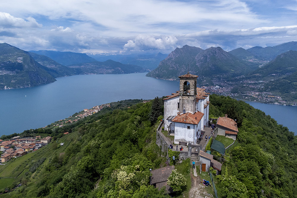
The highest point of the island is home to the ancient Sanctuary of the Madonna della Ceriola and offers a spectacular panoramic view of the lake and the majestic surrounding peaks, such as Mount Guglielmo which stands out on the horizon towards the north-east, on the Brescia shore.
The landscape, both along the coast and inland, is a succession of delightful sceneries. The climbs along the way may be challenging, but the rewards are guaranteed. Along the way there is no shortage of refreshment points and picnic areas, allowing you to fully enjoy this wonderful experience.
The main embarkation ports to reach Monte Isola with departures approximately every 20 minutes are Sulzano and Sale Marasino. Otherwise, you can opt for other departure ports such as Iseo, Pisogne, Lovere, Tavernola Bergamasca and Sarnico.
ITINERARY
From Peschiera Maraglio (185 m) take the lakeside, heading west, towards Sensole. After passing Sensole (190 m) and arriving in Menzino (250 m) you go up to Rocca Martinango (285 m). We return to Menzino and continue towards Senzano (335 m) arriving at Cure (460 m). Here you pass through the small town, and take a mule track, which then becomes a path, which leads to the Ceriola Sanctuary. Once you reach the Ceriola Sanctuary (600 m), you descend and, passing through Masse (400 m), you go to Siviano (280 m) and Porto Siviano (185 m). Now we return to Siviano and head towards Carzano. Once you arrive in Carzano (185 m) you return to Peschiera Maraglio following the lakeside road.
EXCURSION DATE
May 5, 2024
STARTING POINT
Peschiera Maraglio
REFRESHMENT POINT
Along the itinerary there are many refreshment points and picnic areas.
AUTHOR’S SUGGESTIONS
Since the ferry operates 24 hours a day, we recommend taking a break on the island for a delicious dinner.
SAFETY TIPS
The viability of the proposed itinerary, like all mountain morphology, is subject to environmental changes due to natural events and weather conditions. Therefore, before leaving, consult the competent tourist offices and / or the refuges of reference.
Our GPX tracks are only indicative, that is, the route was carried out at best with the conditions of the trails and weather of that day. So always consider what to do on site.
Also remember to evaluate the route based on your physical abilities, training and the equipment you have.
You should leave someone the route you intend to do told.
Remember that the emergency number is 112.
EQUIPMENT
It is recommended to have the appropriate equipment for the route, weather conditions and season: windproof and / or rain jacket, map and / or GPS device, goggles, sunscreen, boots, first aid kit, specific clothing, gloves, backpack with food and drink.
RECOMMENDED MAPS
4LAND, Lago d'Iseo 1:25.000
INTERESTING LINKS
https://www.visitmonteisola.it/
HOW TO ARRIVE
A4 Exit Brescia center. Follow the SP11 Southern Ring Road, then the SP510 and exit at the Sulzano exit.
PARKING AREA
Paid parking in Sulzano
GPS coordinates: 45.690101, 10.100992
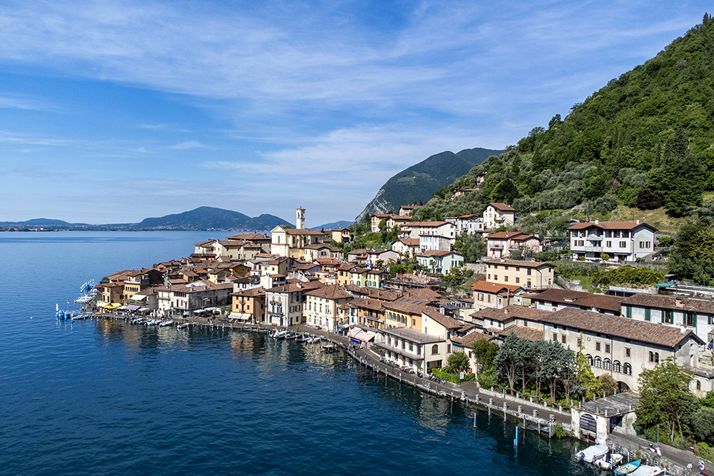
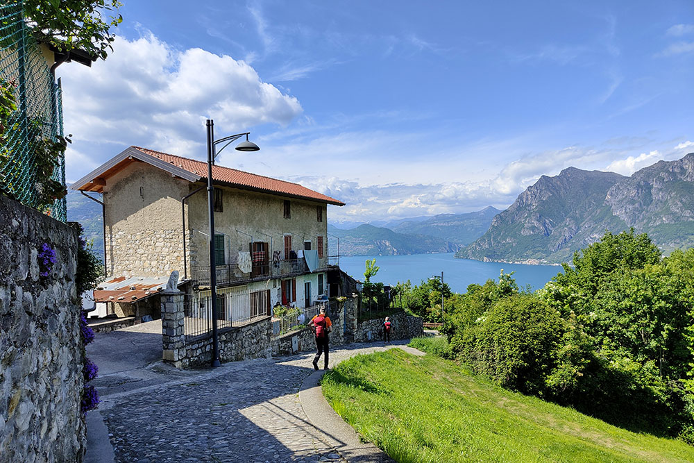
Peschiera Maraglio
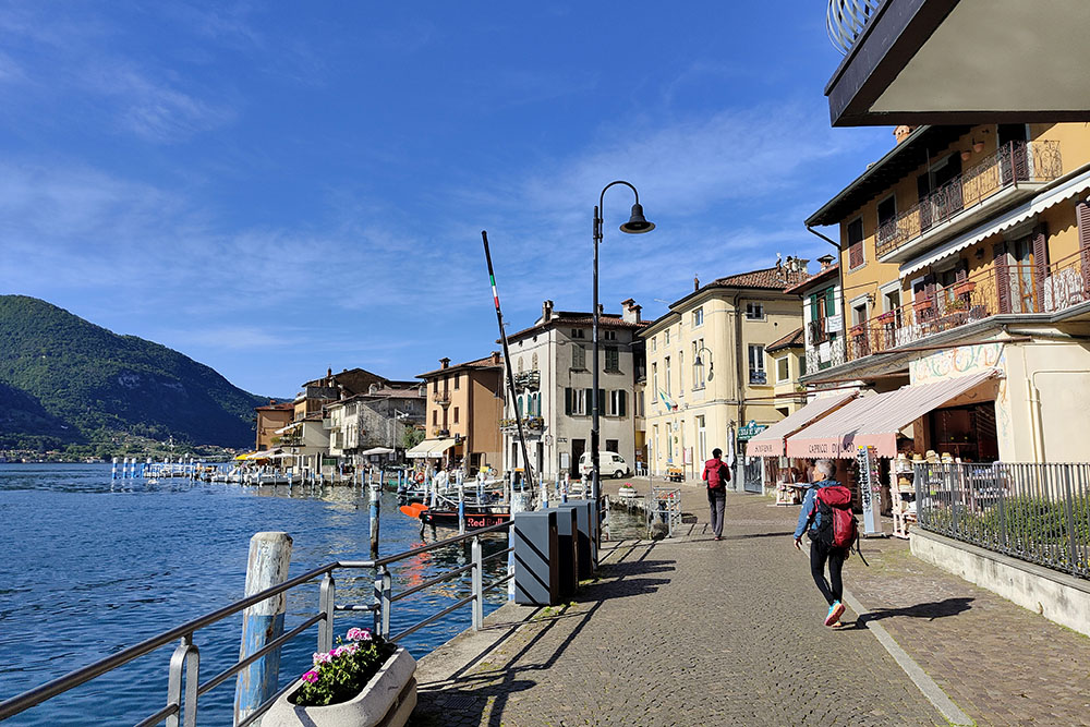
Peschiera Maraglio
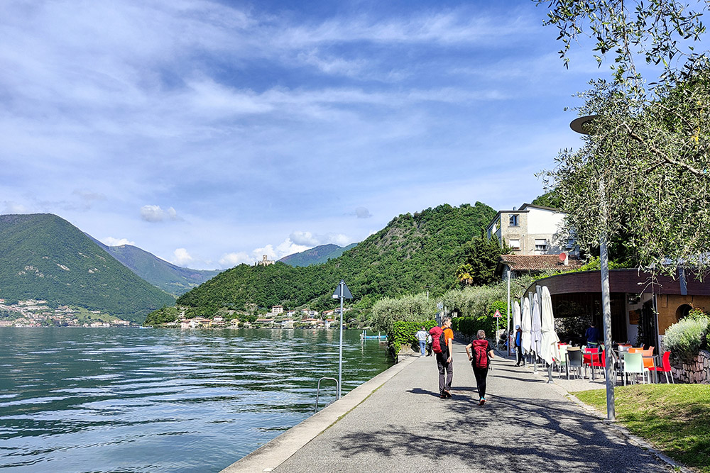
Si va verso Sensole
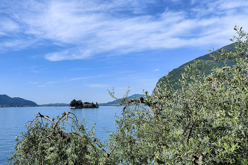
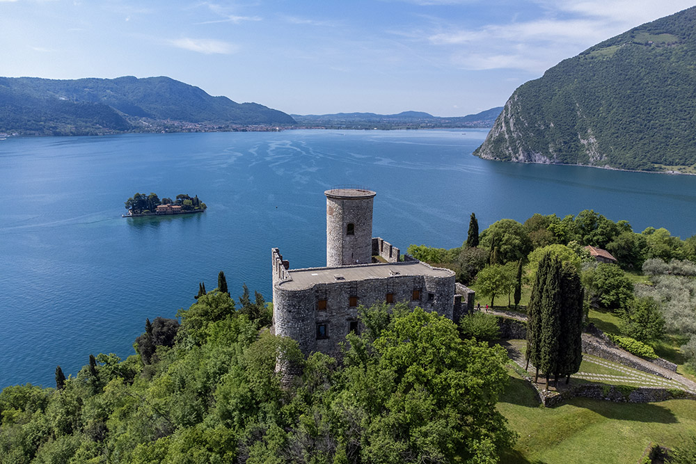
L'isoletta di San Paolo
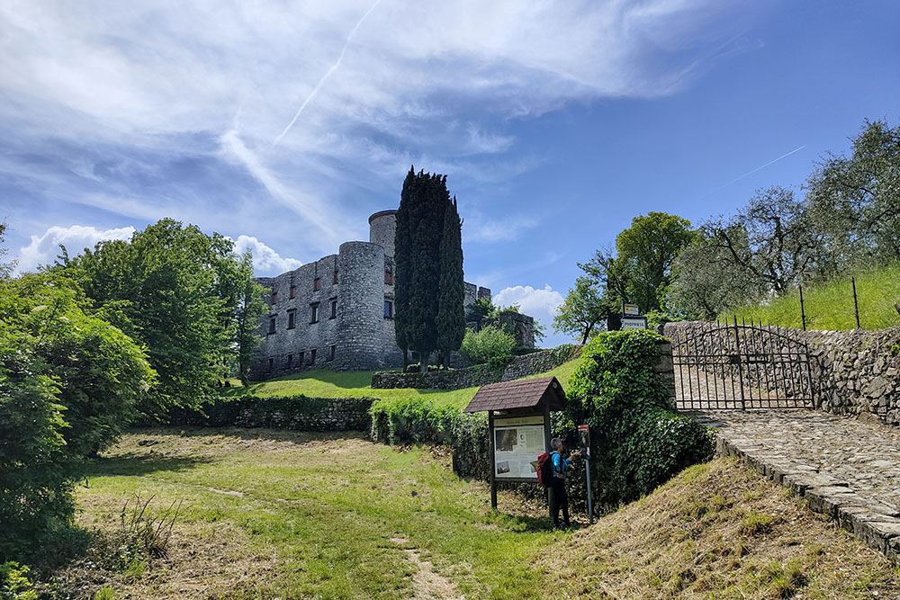
Arrivati alla Rocca Martinengo
La Rocca Martinengo
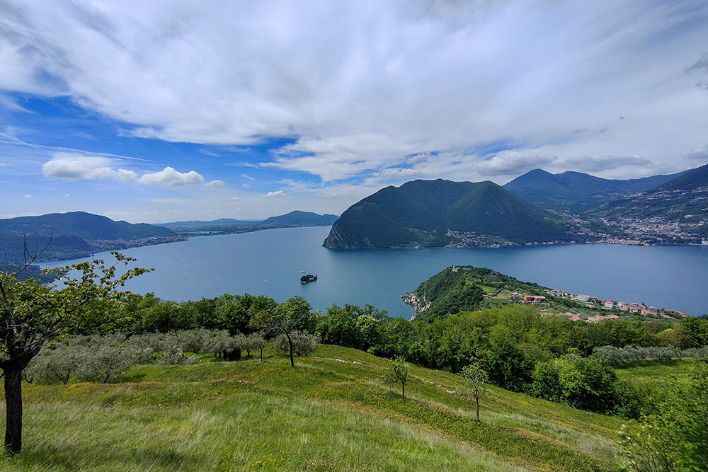
Vista del Lago d'Iseo parte sud
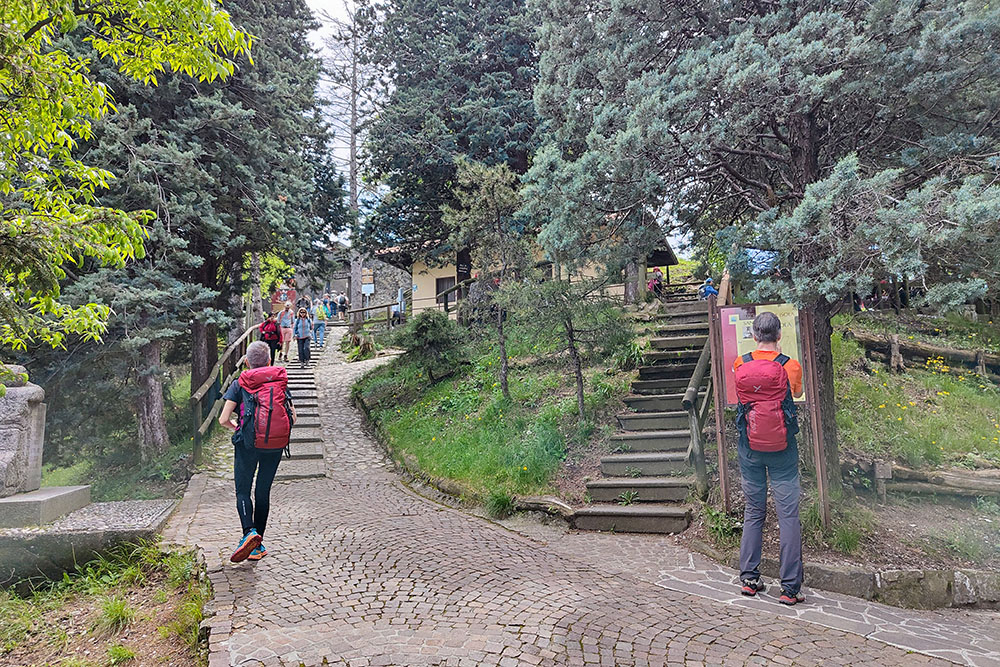
Arrivati al Santuario della Ceriola
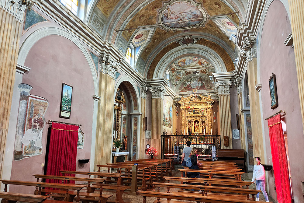
L'interno della chiesa
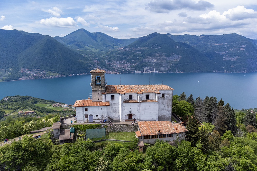
Santuario della Ceriola
Santuario della Ceriola
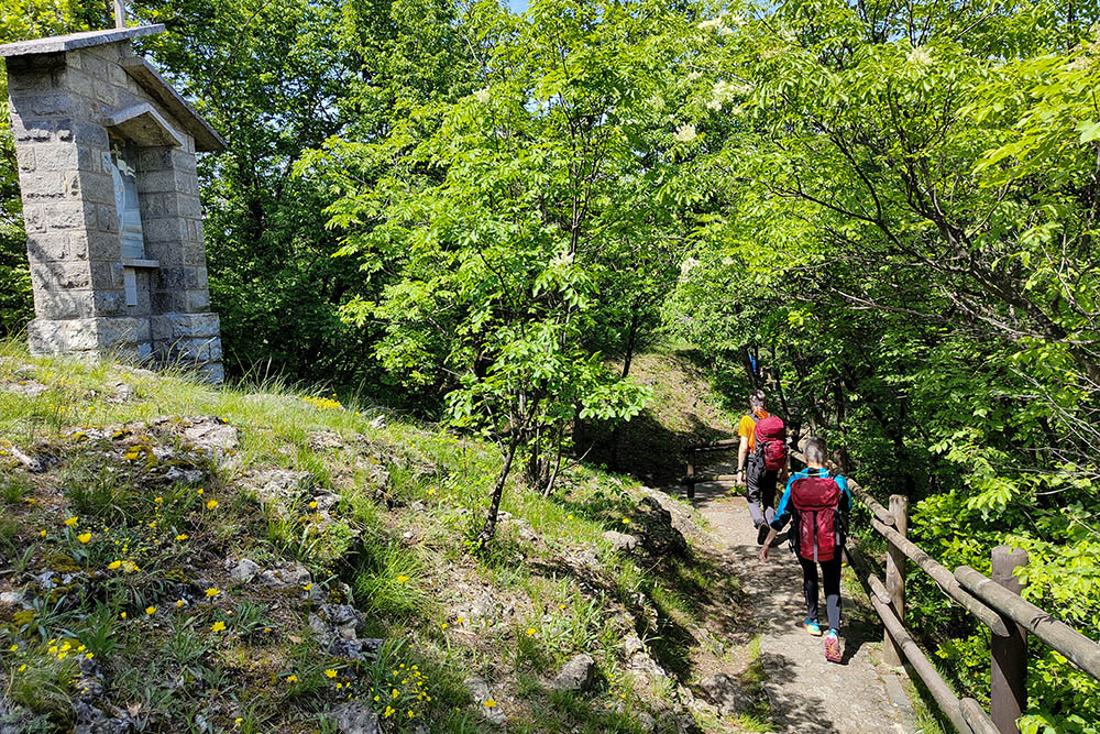
Si scende per il sentiero della Via Crucis
Si scende verso Siviano
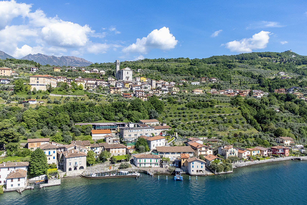
Siviano e Porto Siviano
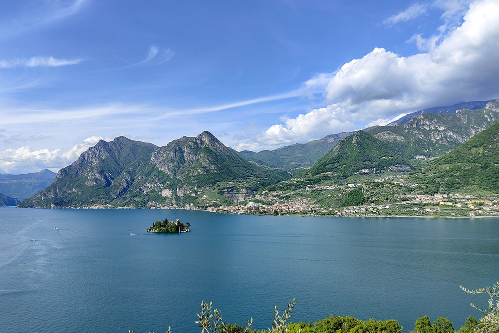
L'isoletta di Loreto


