


![]()


Durata
 3:15 h
Distanza
 7,7 km
 Ascesa
 574 m
574 mDiscesa
 574 m
574 mH Max
 1868 m
H Min
 1294 m
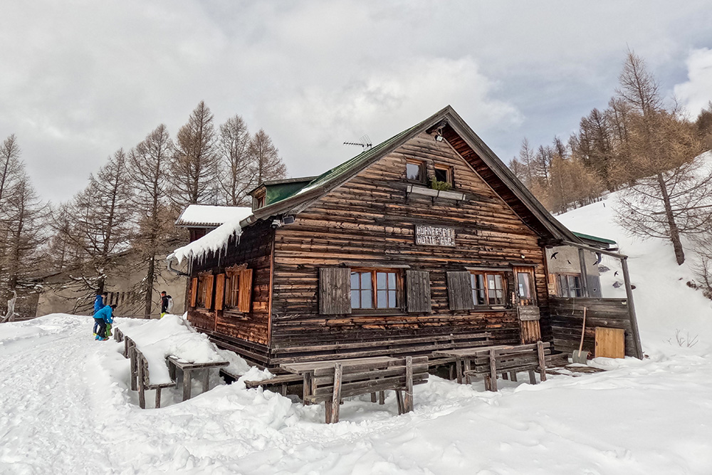
From Colle Isarco to the Hühnerspielhütte
DESCRIPTION
Vipiteno and surroundings: winter excursion with snowshoes.
We are in the Upper Isarco Valley, also known as Wipptal, where the most significant inhabited center is the suggestive medieval city of Vipiteno. The excursion we propose starts from the Dasht Parking area, located between Colle Isarco and Brennero, near the state border with Austria.
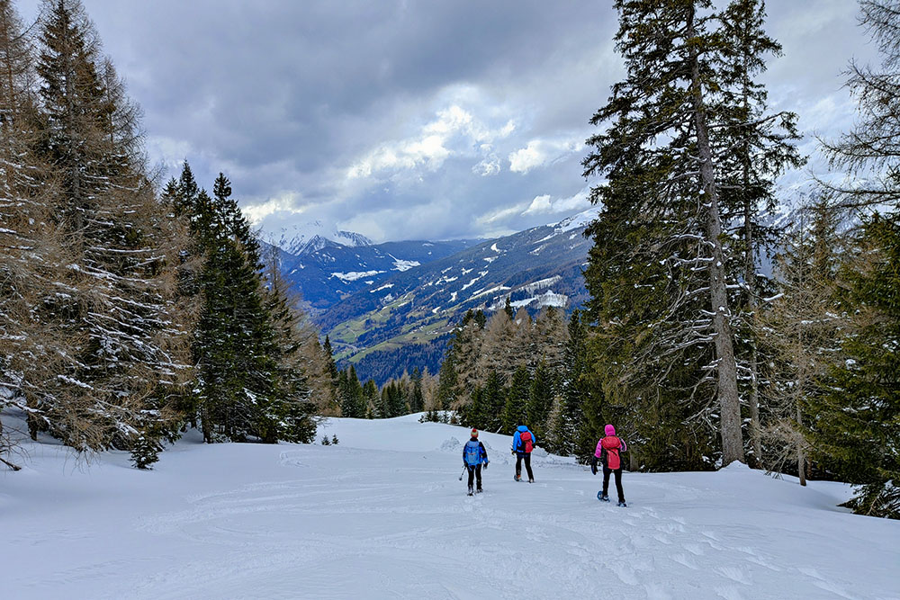
The itinerary does not present particular difficulties, neither technical nor risks of avalanches: it is accessible to everyone, including family groups. You walk mainly in the middle of the woods and, when clearings open up, you can enjoy a splendid view of the Isarco valley, the Fleres valley and the majestic surrounding mountains, both Italian and Austrian.
The Hühnerspielhütte is a small refuge that still retains the typical characteristics of South Tyrolean refuges: it offers quality cuisine, professional and kind managers.
During the ascent, it is possible to follow the dirt road entirely or opt for the various sections of trail that shorten the distance, even if they are quite steep.
ITINERARY
From the Dachs car park (1294 m) go up a dirt road, signpost 22B. After a while, turn left following signs 22A and 22 arriving at Hühnerspielhütte (1868 m). We return along the same road.
EXCURSION DATE
March 9, 2024
STARTING POINT
Dachs car park
REFRESHMENT POINT
Hühnerspielhütte
AUTHOR’S SUGGESTIONS
Be careful when you arrive by car not to take the motorway exit.
SAFETY TIPS
Snowpack stability is subject to sudden and unpredictable changes. For your safety, always consult the avalanche bulletin, because the snowpack is subject to rapid changes, ask the competent local offices for information. Our GPX tracks are indicative only, that is, the route was best done with the snow and weather conditions of that day. So always evaluate what to do on site. Also remember to evaluate the route based on your physical abilities, training and the equipment you have. It is appropriate to let someone know the itinerary you intend to take. Remember that the emergency number is 112.
EQUIPMENT
It is recommended to have the appropriate equipment: kit for self-rescue in avalanches (consisting of Artva, shovel and probe), snowshoes, sticks, crampons, glasses, sunscreen, hiking boots, winter clothing, gloves, cap, backpack hot drinks.
RECOMMENDED MAPS
Tabacco 038 Sterzing - Stubaier Alpen / Vipiteno - Alpi Breonie
INTERESTING LINKS
https://www.colleisarco.org/it/esperienze-colle-isarco/malghe-e-rifugi/86-rifugio-cima-gallina.html
HOW TO ARRIVE
From Vipiteno follow the signs for Brennero SS12. After passing Colle Isarco after about 3 km you come across two hairpin bends. On the second, immediately after the motorway exit, you have to take a small and narrow asphalt road and follow it to the car park.
PARKING AREA
Dachs parking, free.
GPS coordinates: 46.953468, 11.459896
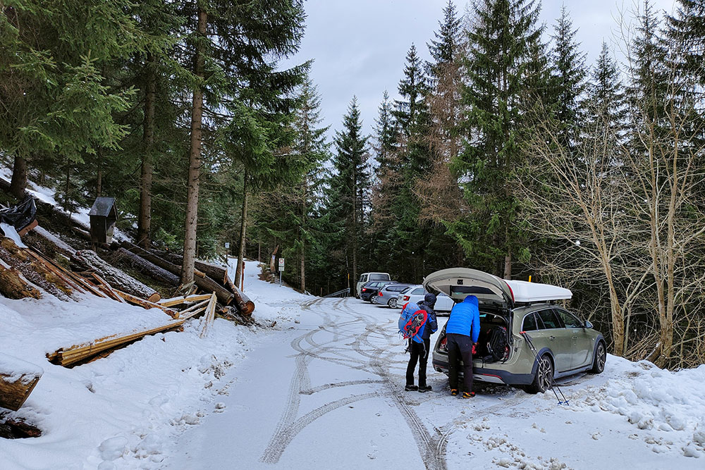
Parcheggio Dachs
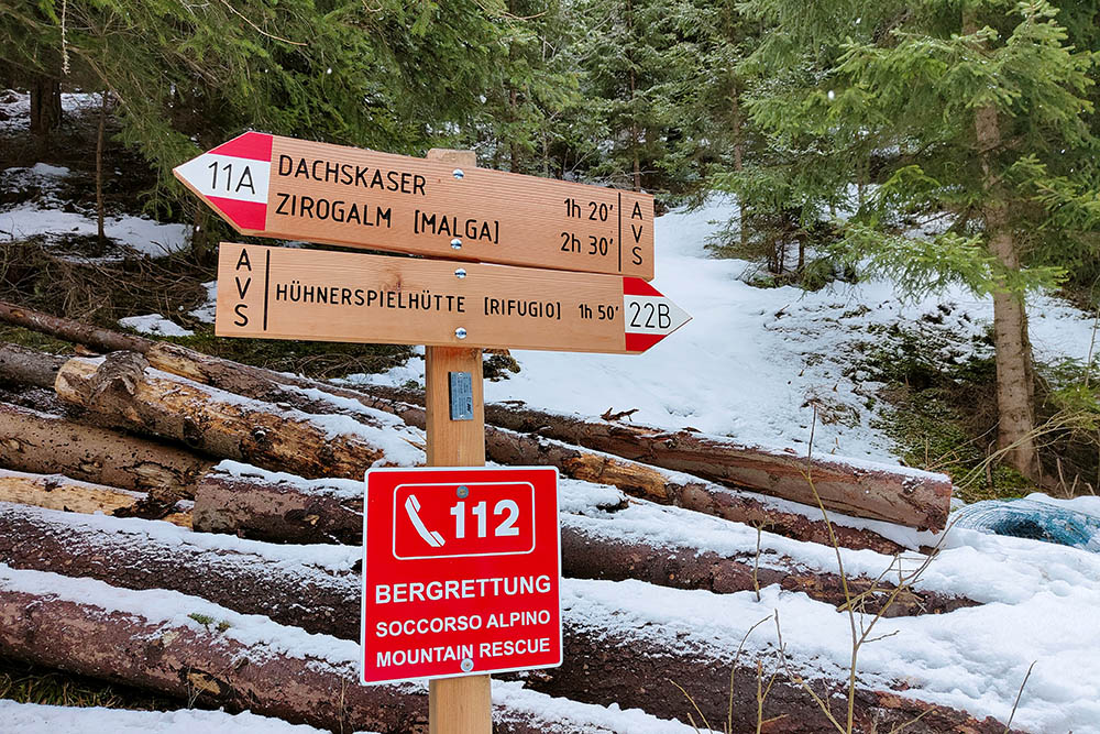
Seguiamo il segnavia 22B
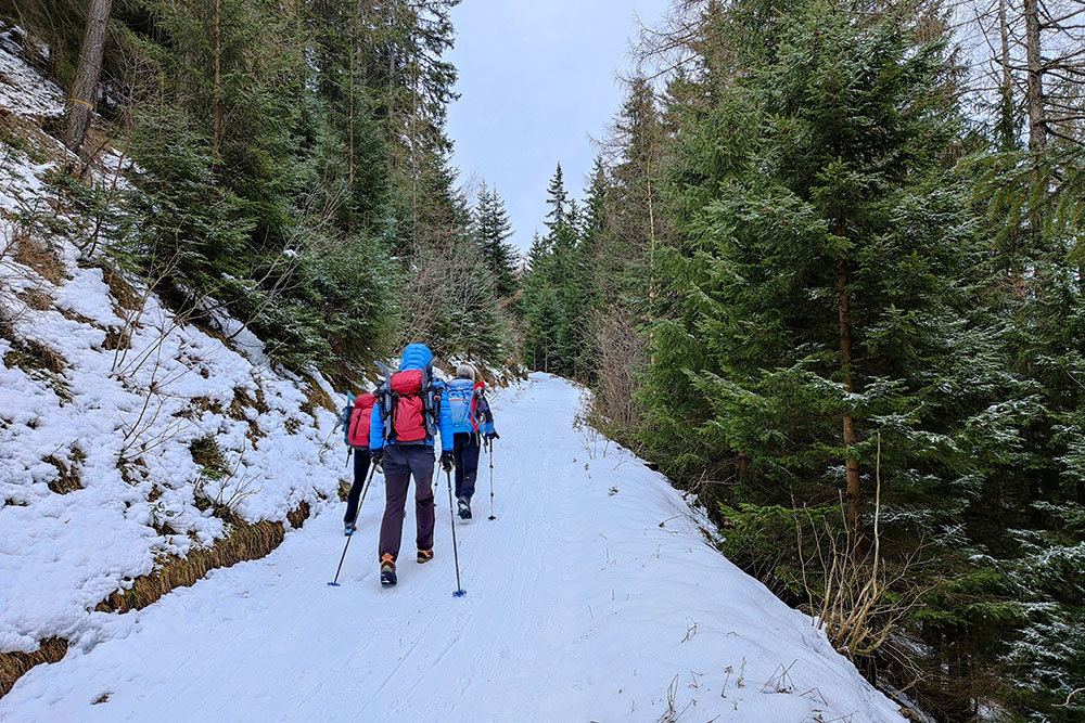
Si inizia a salire su strada sterrata
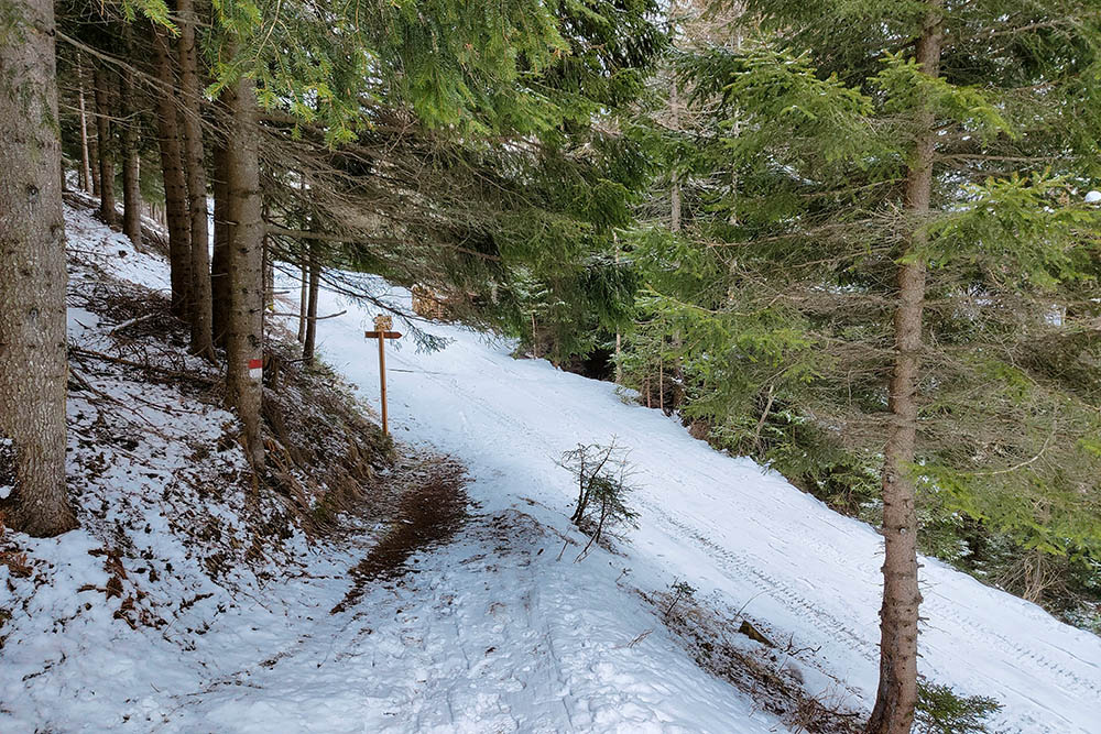
Primo bivio, prendiamo il 22A
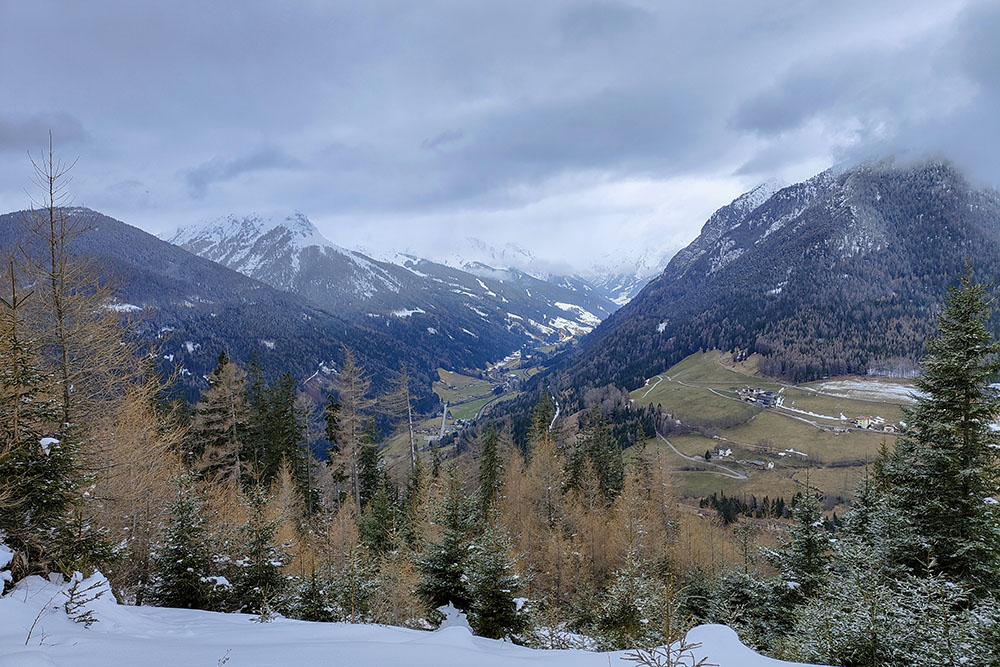
Vista verso la Val di Fleres
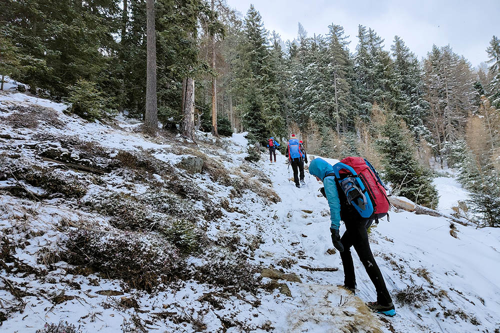
Saliamo seguendo il sentiero
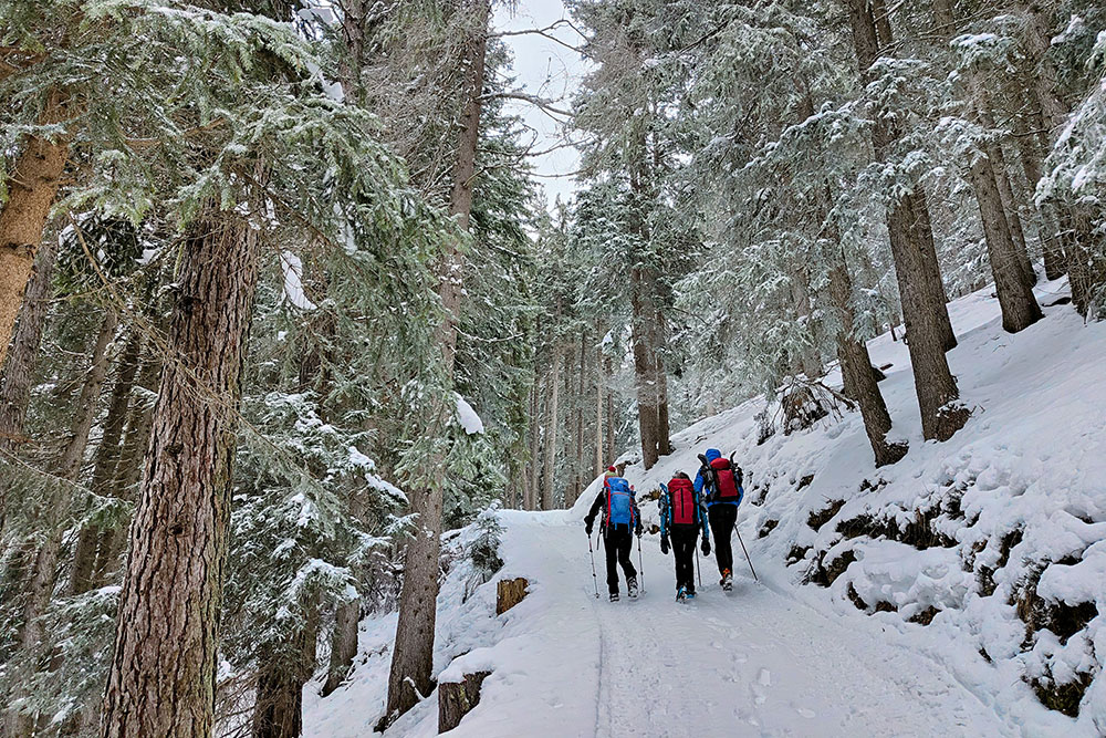
Riprendiamo la strada sterrata
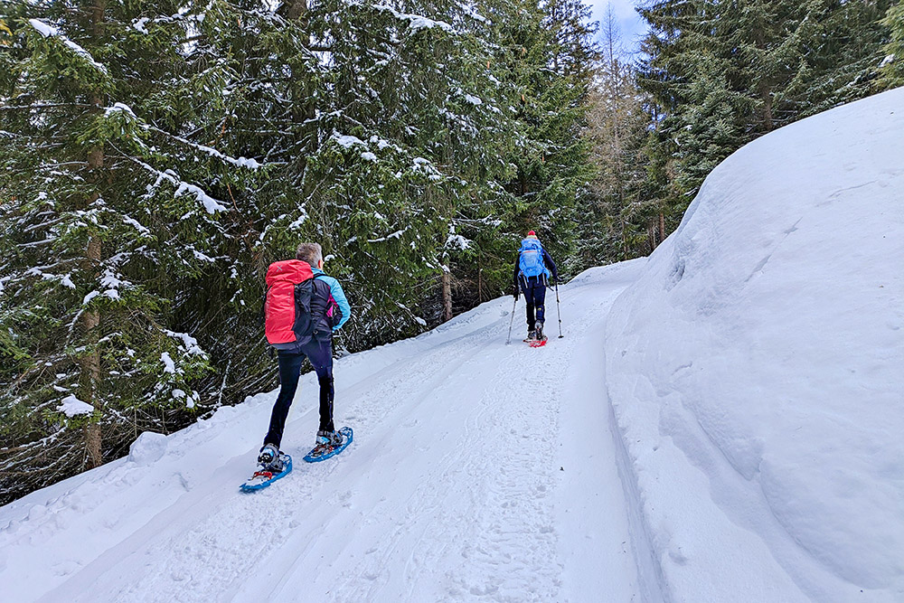
Abbiamo messo le ciaspole
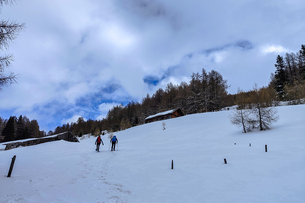
Prime baite
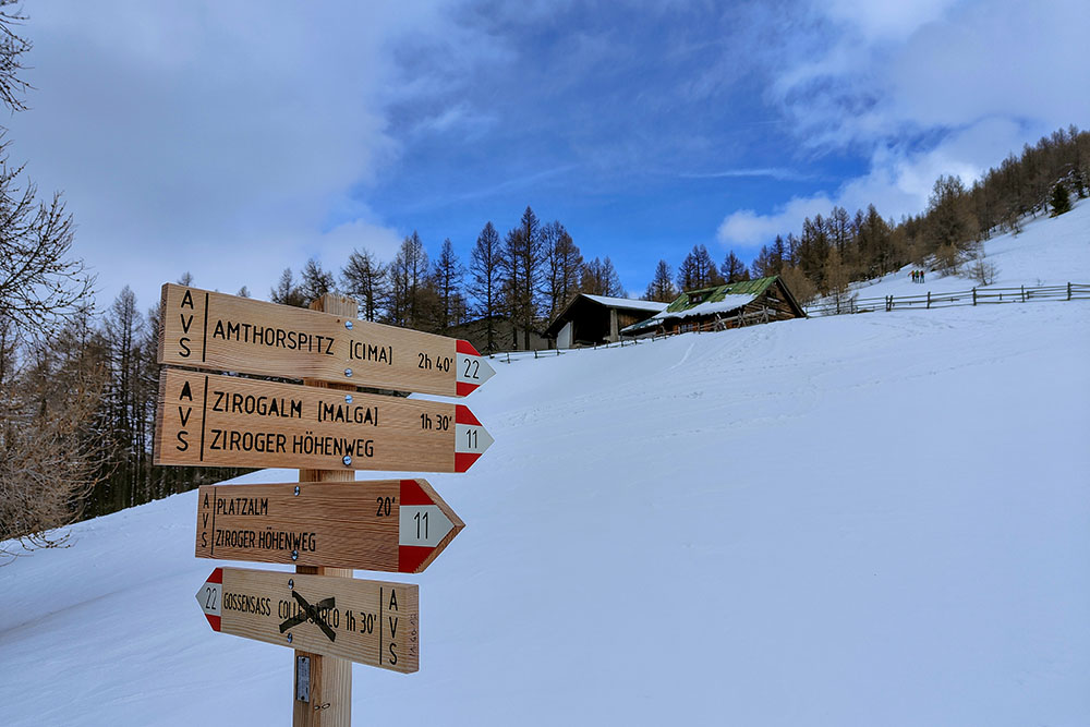
Il rifugio è in vista

Il Rifugio Cima Gallina
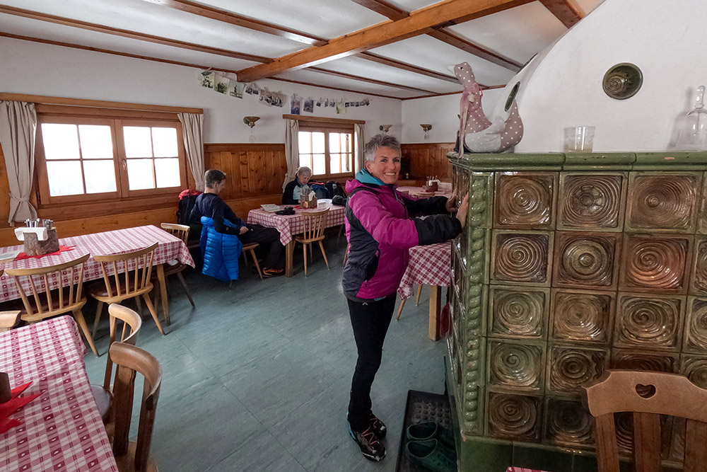
Ci riscaldiamo con la stufa a olle
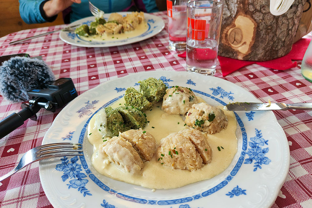
Tris di canederli
Lasciamo il rifugio
Si ritorna a valle


