


![]()


Durata
 2:30 h
Distanza
 11,7 km
 Ascesa
 624 m
624 mDiscesa
 624 m
624 mH Max
 1996 m
H Min
 1380 m
By sleigh from the Rifugio Odle to Ranui
DESCRIPTION
Sledding and flavours: a snowy adventure in the Puez-Odle Natural Park.
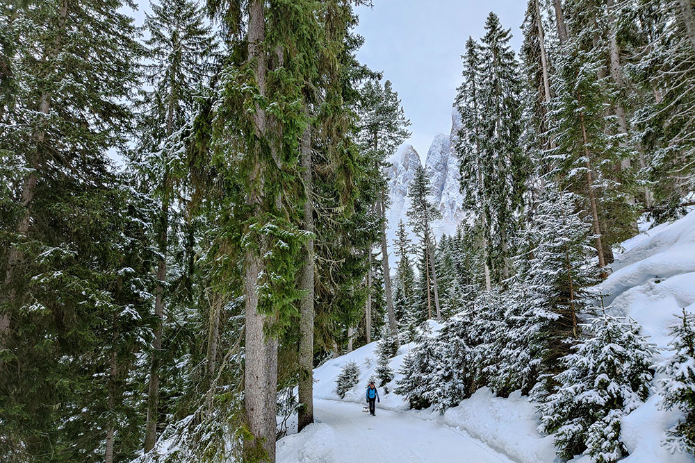
The proposed itinerary takes place in the evocative setting of Alto Adige, precisely in the Val di Funes, in the heart of the Puez-Odle Natural Park. This location offers an atmosphere of serene tranquility surrounded by nature, giving visitors an enchanting 360 degree panorama of the majestic Odle peaks and within fantastic woods, ideal for breathing clean air. The Val di Funes is thus configured as one of the most fascinating places in Alto Adige, becoming a favorite destination for both Italian and foreign hikers.
The proposed excursion, 11.7 km long of which 5.5 km of toboggan run, does not present particular difficulties and is usually characterized by a well-preserved snow cover. This aspect makes it suitable for a wide range of hikers, even those who wish to enjoy the beauty of the landscape without tackling excessively demanding routes.
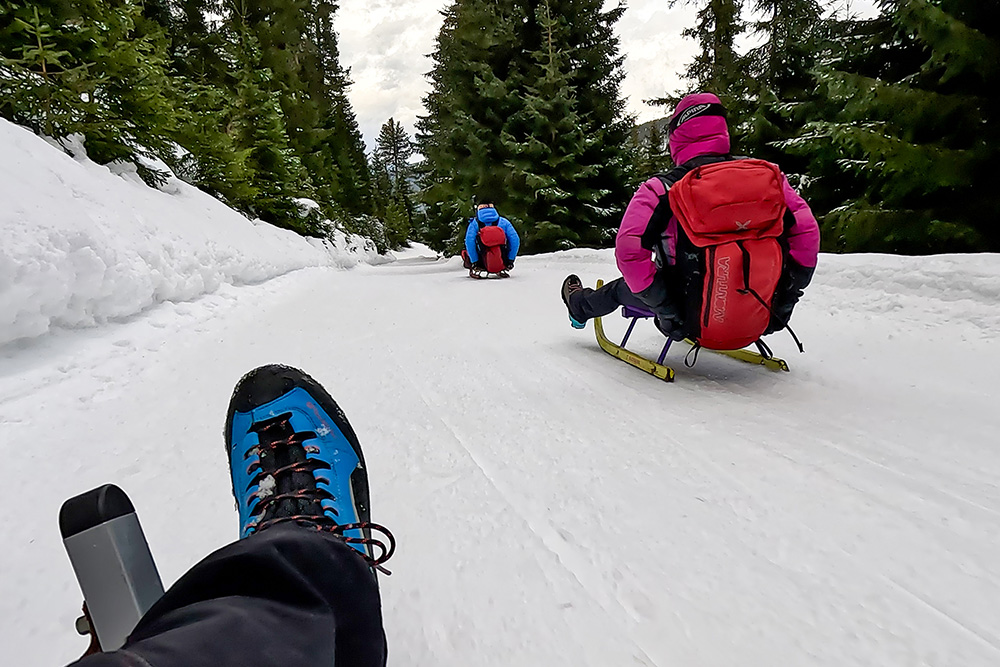
To make the experience even more pleasant, from the refuge's website it is possible to book sleds, a fun and alternative way to experience the descent in the snow. This option is ideal for those who want to add a playful touch to the excursion and fully enjoy the beauty of the surroundings.
For those planning to stop at the refuge, it is advisable to book in advance, especially if you want to savor the delicious local dishes on offer. This precaution will avoid the risk of having to settle for a simple sandwich, allowing you to fully enjoy the refuge's cuisine and make the entire experience even more memorable.
ITINERARY
From the car park at the Waldschenke Restaurant (1380 m) follow the trail signs 28, 34A and 34 and in about 2 hours you arrive at the Rifugio delle Odle/Gleisleralm (1996 m). Return to Ranui following the toboggan run, sign 34.
EXCURSION DATE
March 3, 2024
STARTING POINT
Parking at the Waldschenke Restaurant - Ranui
REFRESHMENT POINT
Gleisleralm
AUTHOR’S SUGGESTIONS
If you have children, put helmets on them.
SAFETY TIPS
The stability of the snow cover is subject to sudden and unpredictable changes. For your safety, always consult the avalanche bulletin because the snow cover is subject to rapid changes, ask for information from the competent offices of the place. Our GPX tracks are only indicative, that is, the route was carried out as best as possible with the snow and weather conditions of that day. So always evaluate locally what needs to be done.
In addition, remember to evaluate the route based on your physical abilities, training, and equipment that you have.
It is advisable to tell someone the itinerary that you intend to do.
Remember that the emergency number is 112.
EQUIPMENT
It is recommended to have the appropriate equipment for the trail, weather conditions and season: sled, windbreaker and/or rain jacket, map and/or GPS device, sunglasses, sunscreen, hiking boots, first aid kit, specific winter clothing, crampons, gloves, backpack with food and hot drinks.
RECOMMENDED MAPS
Tabacco 030 Bressanone - Val di Funes / Brixen – Villnössertal
INTERESTING LINKS
https://www.geisleralm.com/it
HOW TO ARRIVE
Dall’uscita autostrada A22 Chiusa-Val Gardena prendere per Teis/Tiso/Villnößtal/Val di Funes. Arrivati a Santa Maddalena dirigersi in località Ranui.
PARKING AREA
For a fee at the Waldschenke Restaurant - Ranui
GPS coordinates: 46.633681, 11.728536
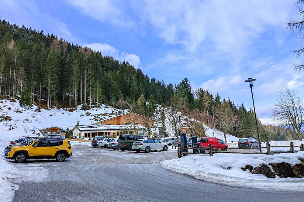
Parcheggio a Ranui
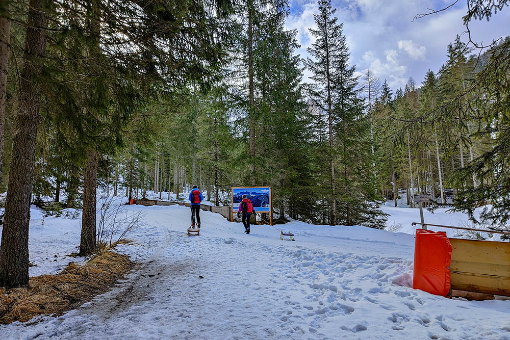
Si sale seguendo il segnavia 28
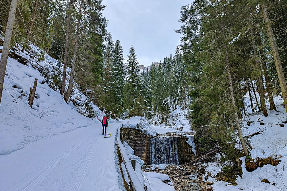
Si sale seguendo il segnavia 28
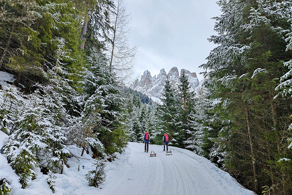
Si inizia ad avere un a bella vista sulle Odle
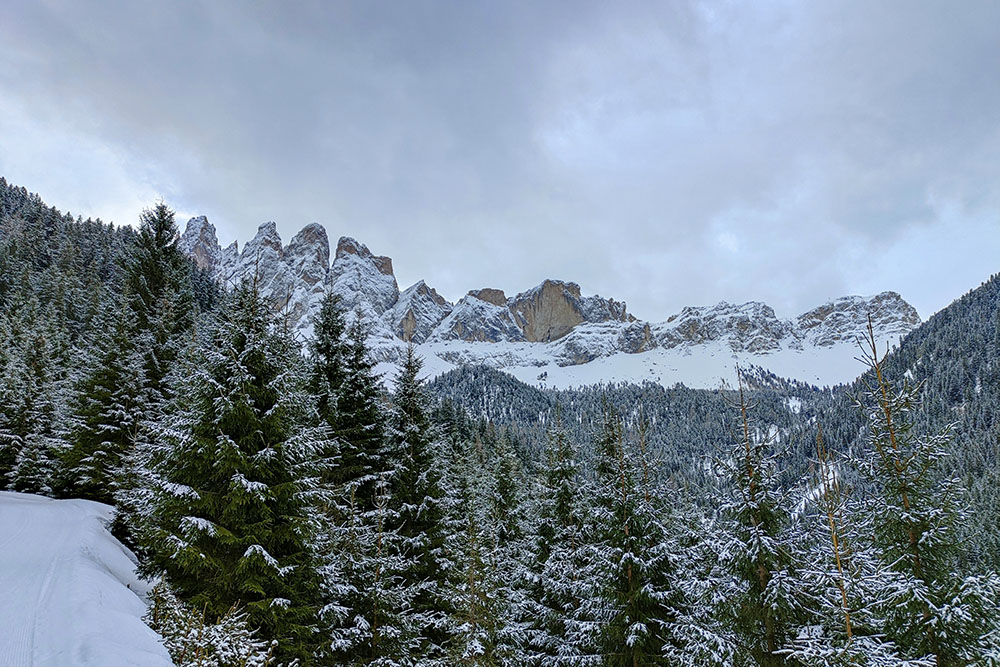
Il Gruppo delle Odle
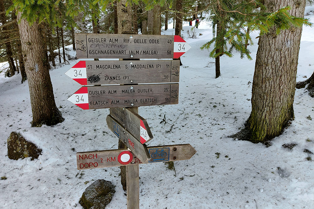
Ultimo tratto di salita, segnavia 34
Ancora pochi metri
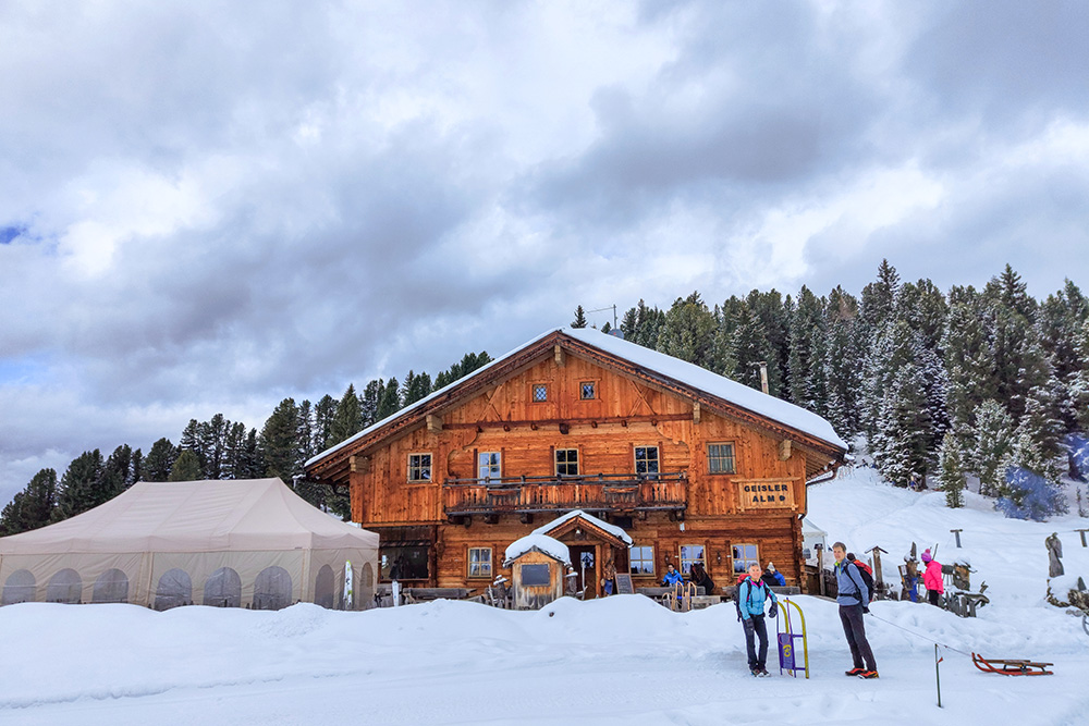
Siamo arrivati al Rifugio delle Odle
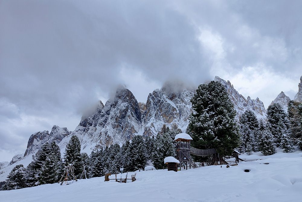
Vista sulle Odle
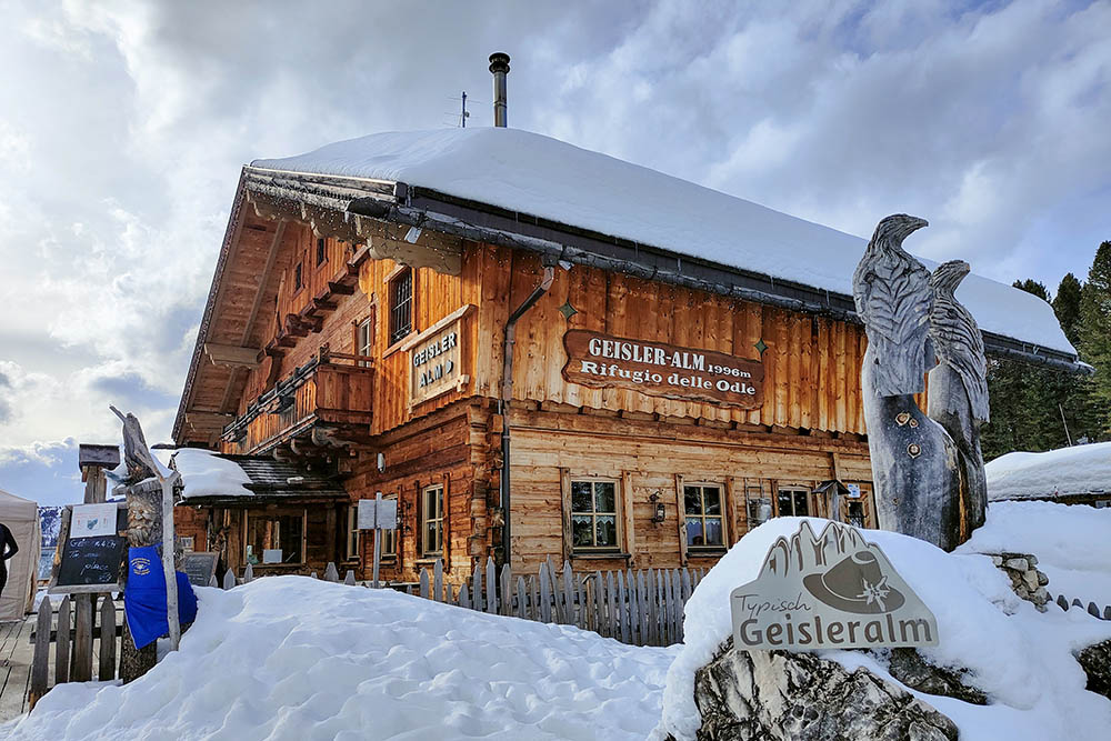
Il rifugio delle Odle
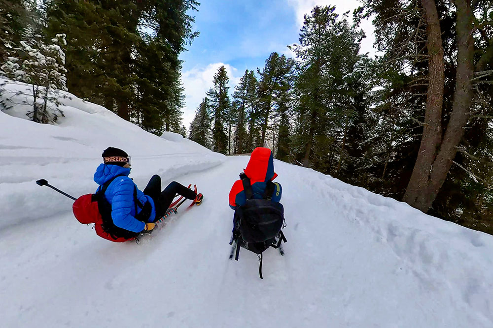
Si ritorna in slittino
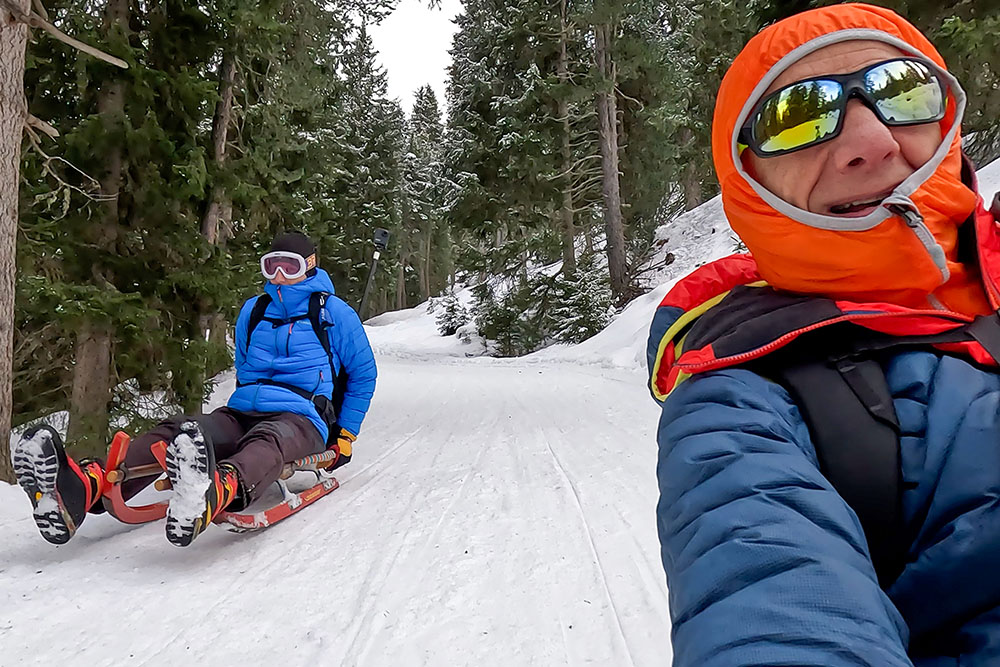
Momenti della discesa
Momenti della discesa
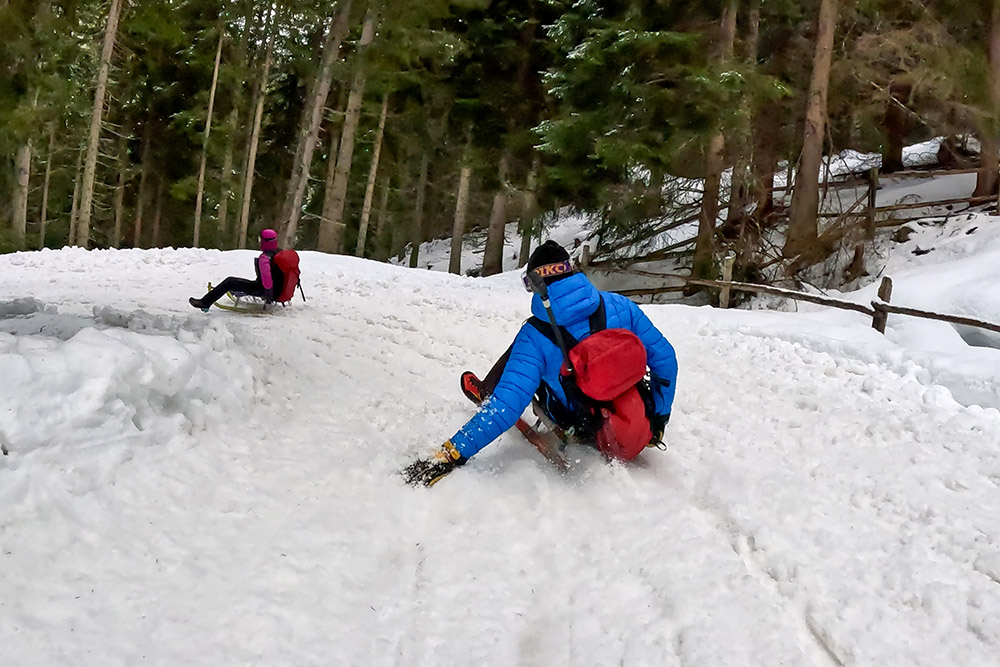
Momenti della discesa
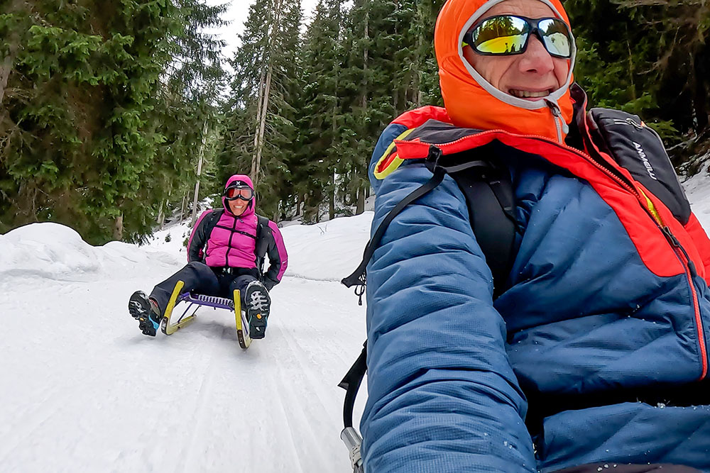
Momenti della discesa


