


![]()


Durata
 4:05 h
Distanza
 10,1 km
 Ascesa
 589 m
589 mDiscesa
 589 m
589 mH Max
 2413 m
H Min
 1872 m
Cinque Torri and Rifugio Averau
DESCRIPTION
One of the most beautiful excursions in the Ampezzo Dolomites of Cortina.
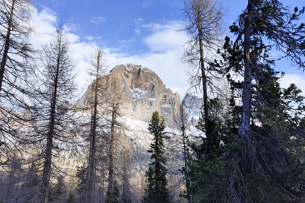
This suggestive winter walk with snowshoes stands out for its accessibility and the modest variation in altitude, while guaranteeing safety from possible avalanches thanks to the favorable morphology of the terrain. The first phase of the route offers an extraordinary panorama that embraces the Tofane, the Cinque Torri and the Lagazuoi, while arriving at the Averau refuge, the gaze opens onto a vast view that ranges from the Marmolada to the Cristallo: Pale di San Martino, Civetta and Sorapis .
In addition to the unique beauty of the landscape, this place is steeped in history, as many battles took place here during the Great War. Along the itinerary, it is possible to explore various testimonies of those years, such as the open-air museum of the Cinque Torri, where stone walkways and trenches wind their way. In the Cinque Torri area, the Command of the Italian mountain artillery group was established, with the general staff and command at Averau, from which various observers directed the war operations from the other side of the valley.
In 1915, eight 75 mm guns were deployed, to which were added in 1916 two 149G howitzers. In September 1917, a powerful 210 mm howitzer was placed, aimed at the Austrian positions of Lagazuoi, Col dei Boss and Valon Tofana. During the conflict, King Vittorio Emanuele III visited the area several times, leaving tangible evidence of the presence and strategic importance of these places during the Great War.
ITINERARY
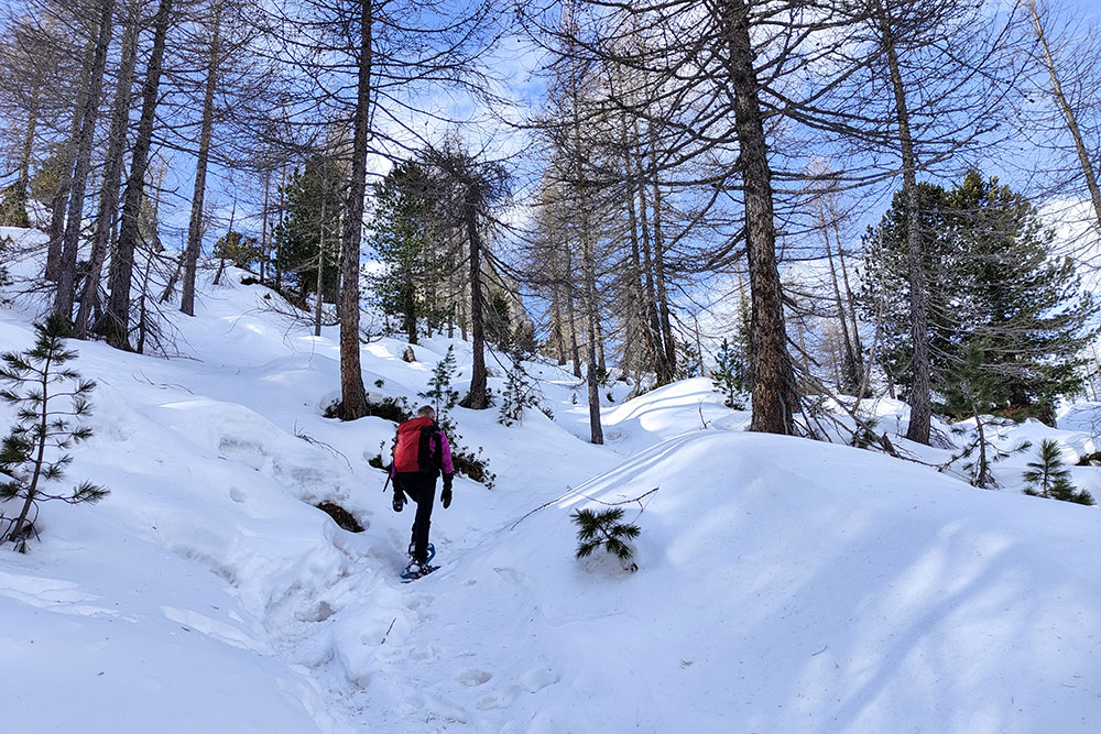
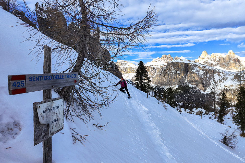
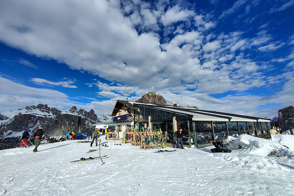
From the car park at the Baita Bai de Dònes (1872 m) take path 425. At an altitude of 2100, turn right following the signs for Trincee. Follow the Sentiero delle Trincee until you reach the Rifugio Scoiattoli (2255 m). Now you go up to the Rifugio Averau, being careful not to walk on the ski slopes. Once you arrive at the Rifugio Averau (2413 m) you return along the same road to the Rifugio Scoiattoli. Here via path 437 you descend to Rifugio Cinque Torri (2137 m) and then following paths 439 and 425 you return to the starting point.
EXCURSION DATE
December 26, 2023
STARTING POINT
Parking at the Baita Bai de Dònes
REFRESHMENT POINT
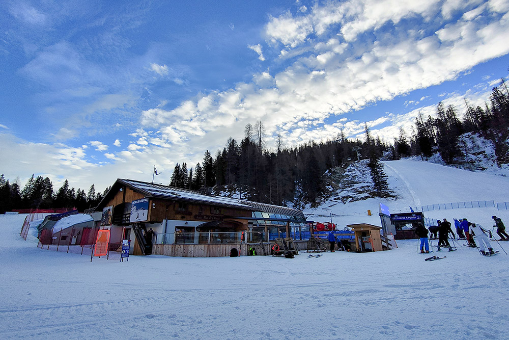
Rifugio Scoiattoli and Rifugio Averau
AUTHOR’S SUGGESTIONS
Walking the Trenches Path in winter you realize what life must have been like for soldiers during the conflict.
SAFETY TIPS
Snowpack stability is subject to sudden and unpredictable changes. For your safety, always consult the avalanche bulletin, because the snowpack is subject to rapid changes, ask the competent local offices for information. Our GPX tracks are indicative only, that is, the route was best done with the snow and weather conditions of that day. So always evaluate what to do on site. Also remember to evaluate the route based on your physical abilities, training and the equipment you have. It is appropriate to let someone know the itinerary you intend to take. Remember that the emergency number is 112.
EQUIPMENT
It is recommended to have the appropriate equipment: kit for self-rescue in avalanches (consisting of Artva, shovel and probe), snowshoes, sticks, crampons, glasses, sunscreen, hiking boots, winter clothing, gloves, cap, backpack hot drinks.
RECOMMENDED MAPS
Tabacco 07 Alta Badia - Arabba - Marmolada
INTERESTING LINKS
https://www.dolomiti.org/it/cortina/
HOW TO ARRIVE
SP24 from Val Badia, SR48 from Cortina d'Ampezzo
PARKING AREA
At Baita Bai de Dònes
GPS coordinates: 46.519026, 12.037641
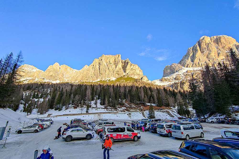
Parcheggio presso il Rifugio Baita Bai de Dònes
Rifugio Baita Bai de Dònes
Si sale con la vista sul Gruppo delle Tofane
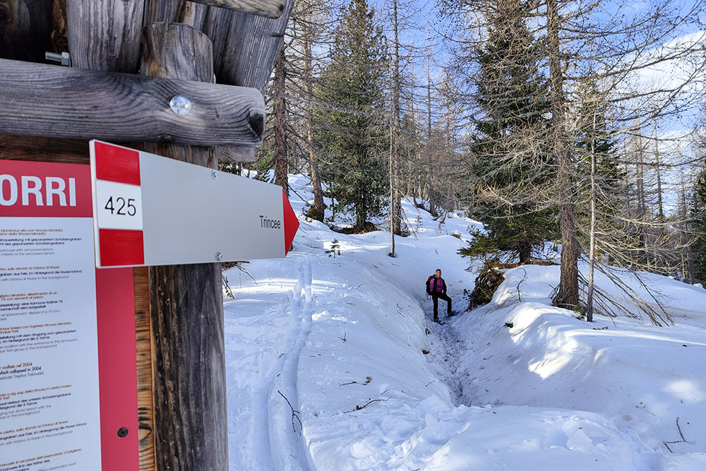
Si devia per il Sentiero delle trincee
Sentiero delle trincee

Alzandosi si migliora la vista
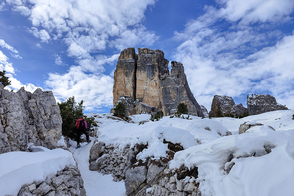
Le 5 Torri
Si continua sul Sentiero delle trincee
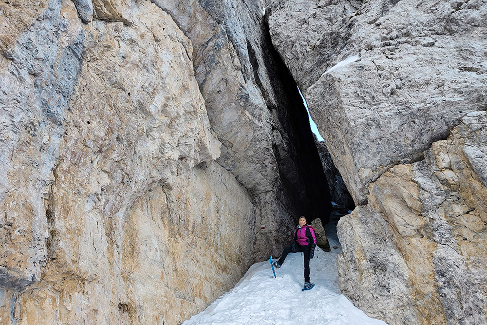
Si passa attraverso una fenditura
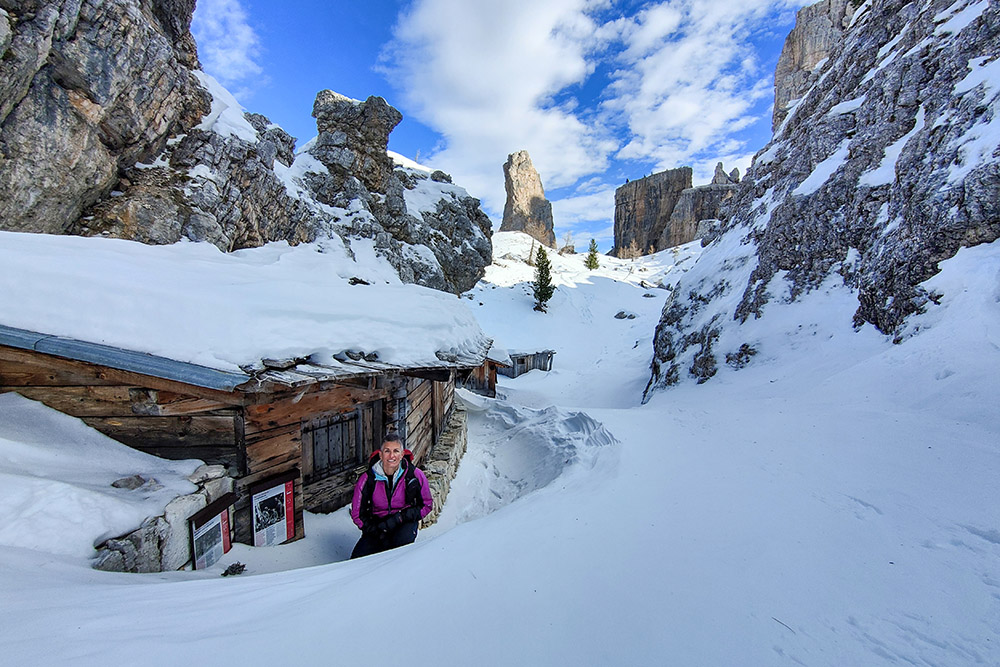
Baraccamenti della Grande Guerra
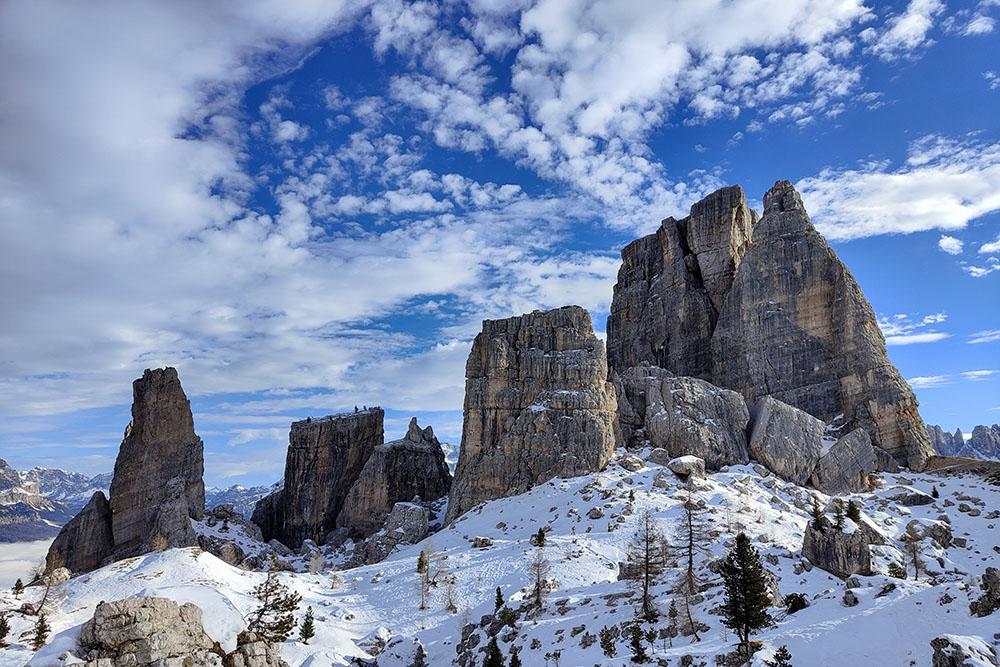
Le 5 Torri
Rifugio Scoiattoli
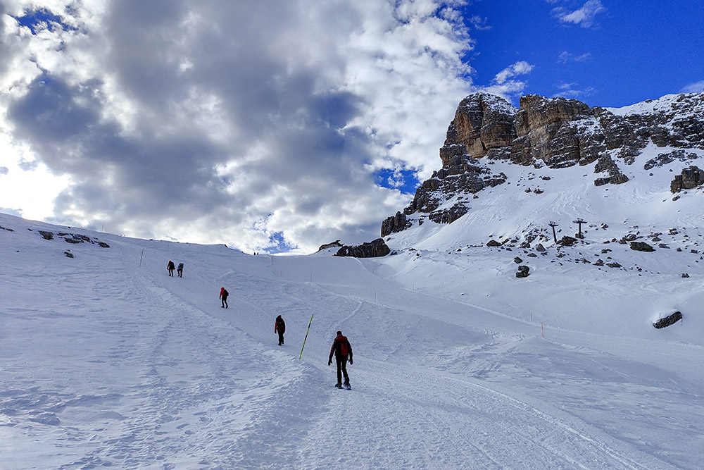
Si sale al Rifugio Averau
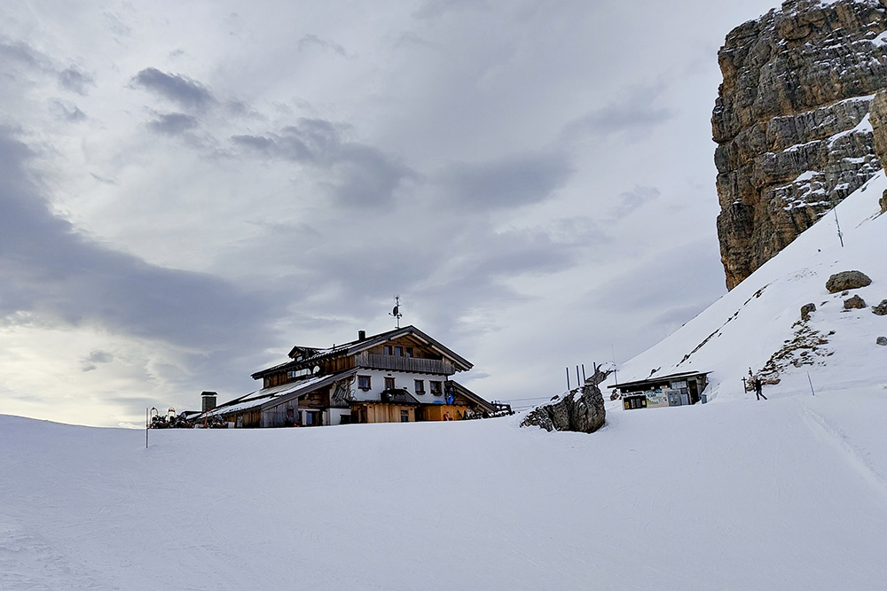
Rifugio Averau
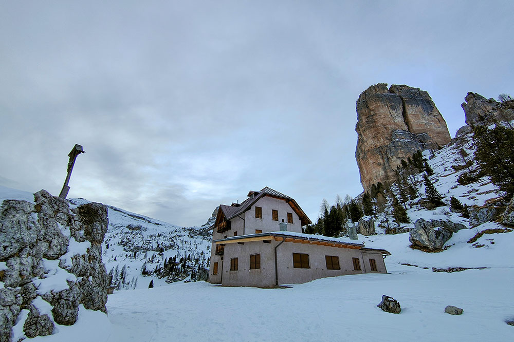
Rifugio Cinque Torri


