


![]()


Durata
 4:00 h
Distanza
 6,4 km
 Ascesa
 700 m
700 mDiscesa
 700 m
700 mH Max
 1090 m
H Min
 399 m
399 mVia Ferrata Cima Rocca
DESCRIPTION
A route that combines a spectacular overview of Lake Garda with considerable historical value.
The proposed excursion is a via ferrata located in the Alto Garda area of Trentino. It is worth underlining that it is a route that is not particularly demanding from a technical point of view, but extremely fascinating from a historical point of view. This excursion is also ideal for those who wish to approach the world of via ferratas.
Its main attraction is the combination of a wonderful view of Lake Garda and a notable historical value. During the route, you cross easily equipped sections and enjoy a splendid panorama of Lake Garda, all enriched by an interesting itinerary along the trenches and tunnels dating back to the Great War.
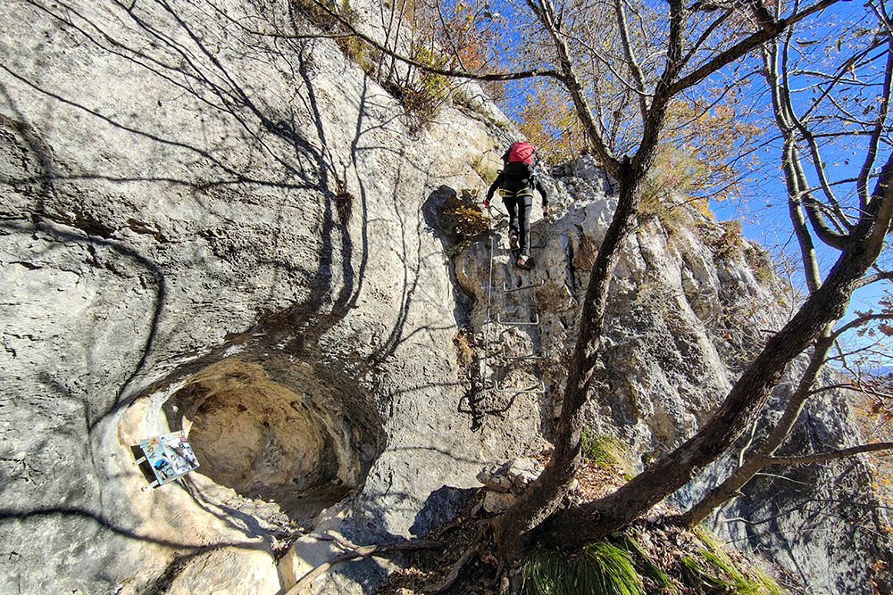
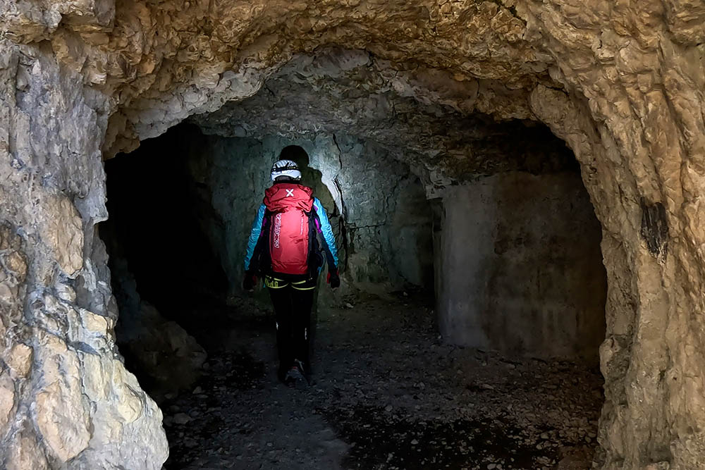
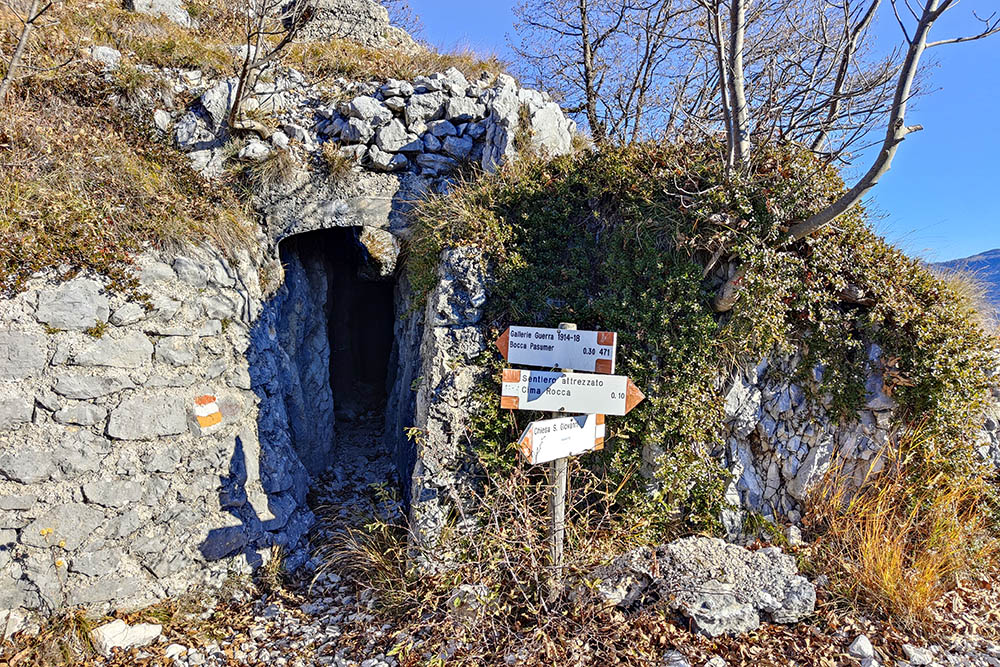
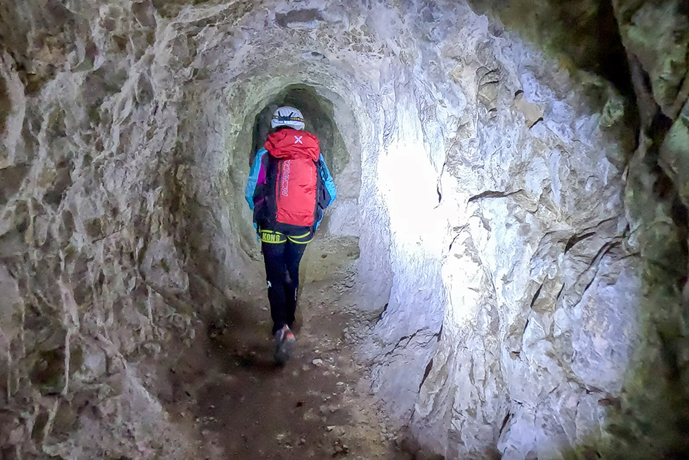
The excursion offers the opportunity to walk along the walkways and trenches of the Italian outposts in the lower part, and those of the Austro-Hungarians in the upper part. Particularly fascinating are the three tunnels, which can be explored with the aid of a torch, making this experience also suitable for families with children who love mountains and adventure.
ITINERARY
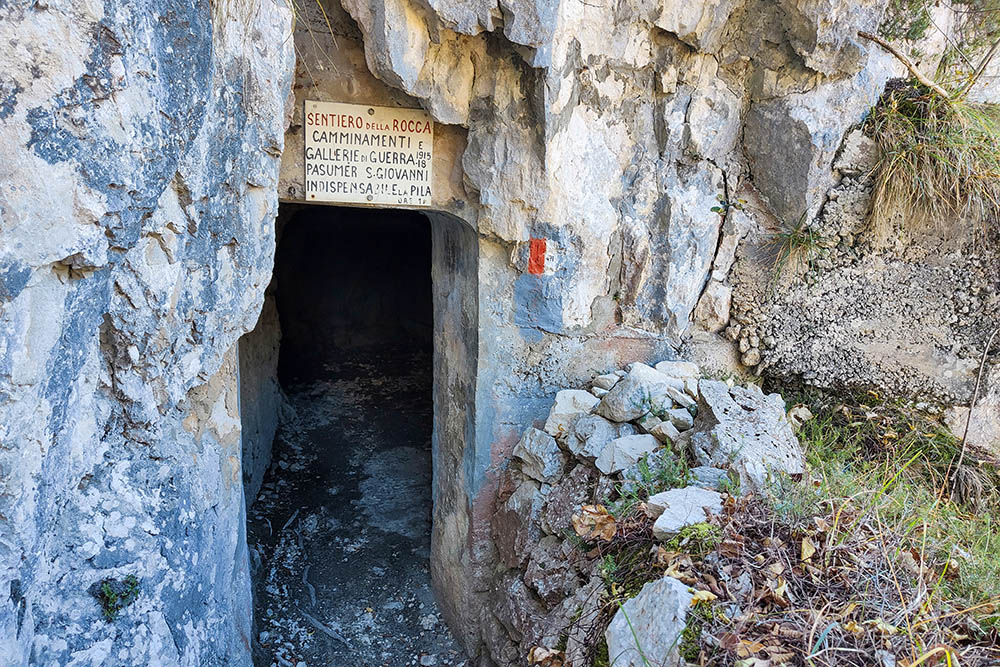
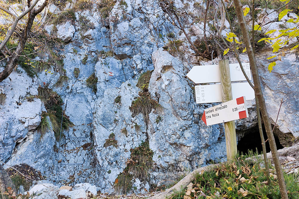
From the Biacesa car park (399 m), proceed towards the town center following the trail sign for Cima Rocca. After a few minutes, turn right, following the “Sentiero del Bech” n. 470. At the first crossroads, turn left, taking path 471, known as the Laste equipped path, and you reach the suggestive Church of San Giovanni (865 m). Continue along path 471, passing three tunnels. After the last tunnel, you go up to the right, finally reaching the summit of Cima Rocca (1090 m).
The descent takes place in a southerly direction, returning to the entrance of the third tunnel. Go through the third tunnel again and continue towards Bocca Pasumer. Just before reaching the mouth, turn left and go down to Biacesa following paths 460B and 417.
EXCURSION DATE
November 26, 2023
STARTING POINT
Biacesa
REFRESHMENT POINT
Nobody
AUTHOR’S SUGGESTIONS
Bring a torch, essential in the tunnels.
SAFETY TIPS
The viability of the proposed itinerary, like all mountain morphology, is subject to environmental changes due to natural events and weather conditions. So, before leaving, consult the competent tourist offices and / or the refuges of reference.
Our GPX tracks are only indicative, that is, the route was carried out at best with the conditions of the trails and weather of that day. So always evaluate what to do on site.
Also remember to evaluate the route based on your physical abilities, training and the equipment you have.
You should leave someone the route you intend to do told.
Remember that the emergency number is 112.
EQUIPMENT
It is recommended to have the appropriate equipment: technical mountain clothing, boots with vibram sole or similar, via ferrata set, harness, helmet, via ferrata gloves, goggles, sunscreen, backpack with drinks.
RECOMMENDED MAPS
Tabacco 061 Alto Garda - Ledro - Monte Baldo Nord
INTERESTING LINKS
https://www.trentinograndeguerra.it/
HOW TO ARRIVE
From Riva del Garda take SS240 and after 7 km you arrive in Biacesa.
PARKING AREA
Free in Biacesa
GPS coordinates: 45.865088, 10.807707
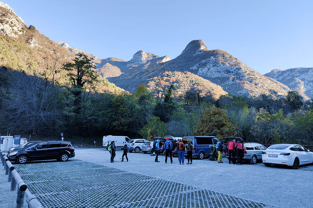
Parcheggio a Biacesa
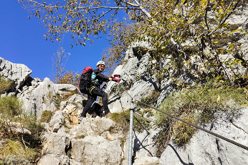
Tratto del Sentiero attrezzato delle Laste
Si continua a salire
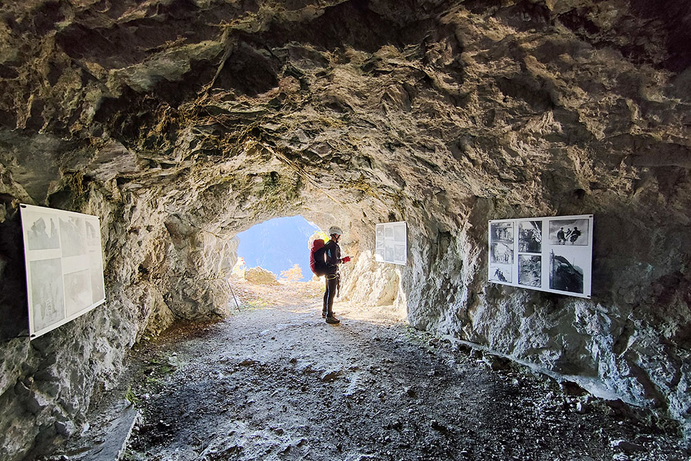
Mostra fotografica della Grande Guerra
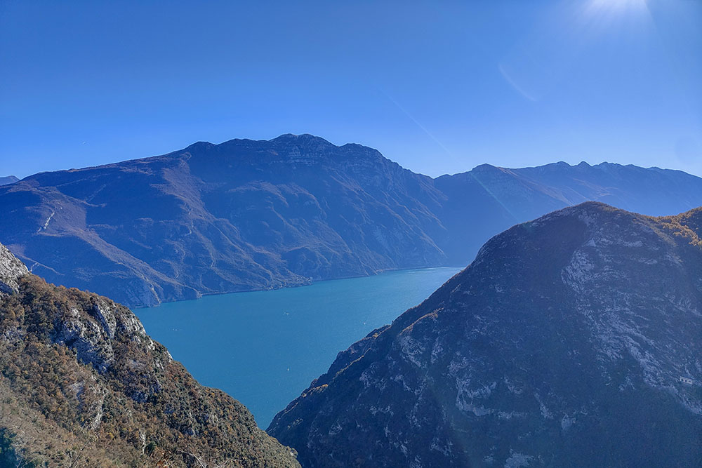
Vista sul Lago di Garda
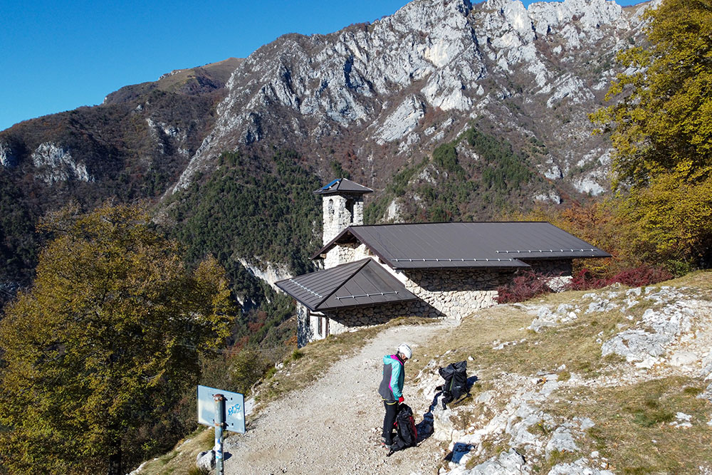
Siamo arrivati alla Chiesa di San Giovanni
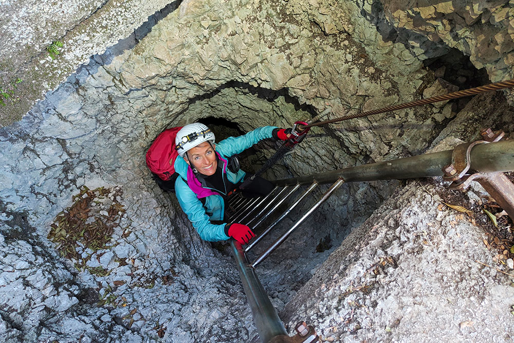
Scala della prima galleria
Seconda galleria
Entrata della terza galleria
All'interno della terza galleria
Uscita della terza galleria
Si sale alla Cima Rocca
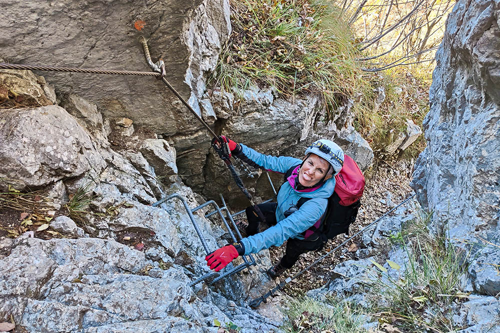
Tratto di ferrata
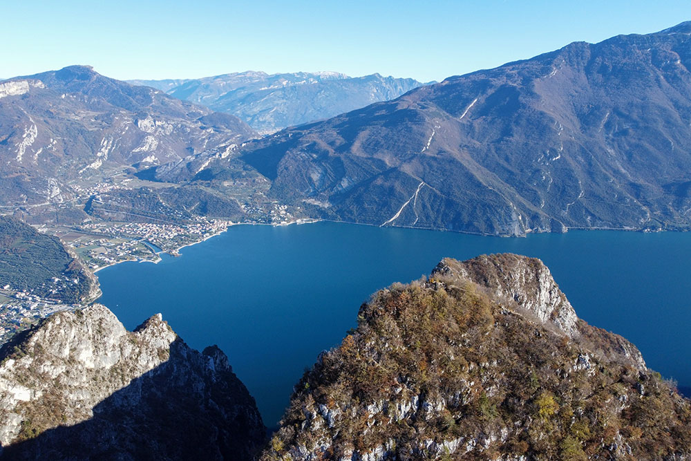
Panorama dalla vetta
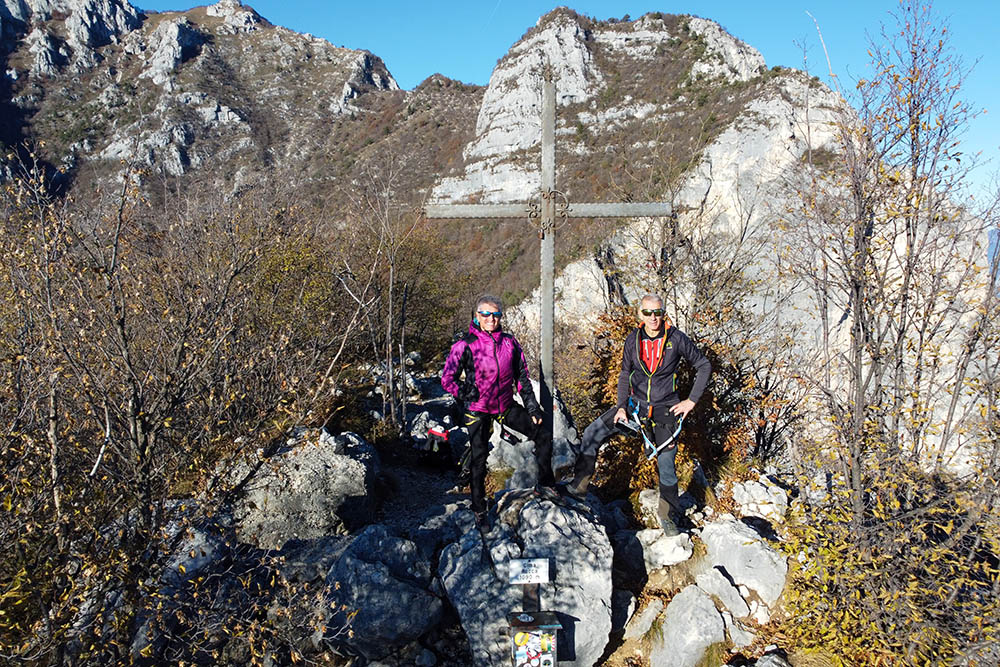
Cima Rocca


