


![]()


Durata
 3:00 h
Distanza
 5,3 km
 Ascesa
 310 m
310 mDiscesa
 310 m
310 mH Max
 1050 m
H Min
 753 m
753 mVertical Challenge: The Via Ferrata Lady of the Waters
DESCRIPTION
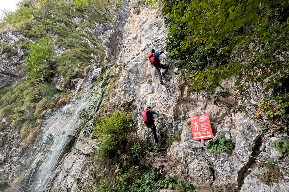
Vertical sections and Tibetan bridges next to the Sajant waterfall.
If you are looking for an extraordinary outdoor experience in the Lake Garda area, look no further: the Via Ferrata Signora delle Acque is a must. This via ferrata offers you the unique opportunity to immerse yourself in a breathtaking environment.
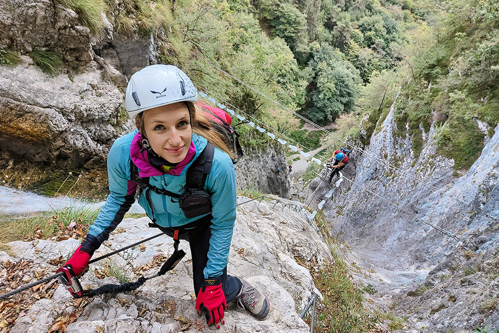
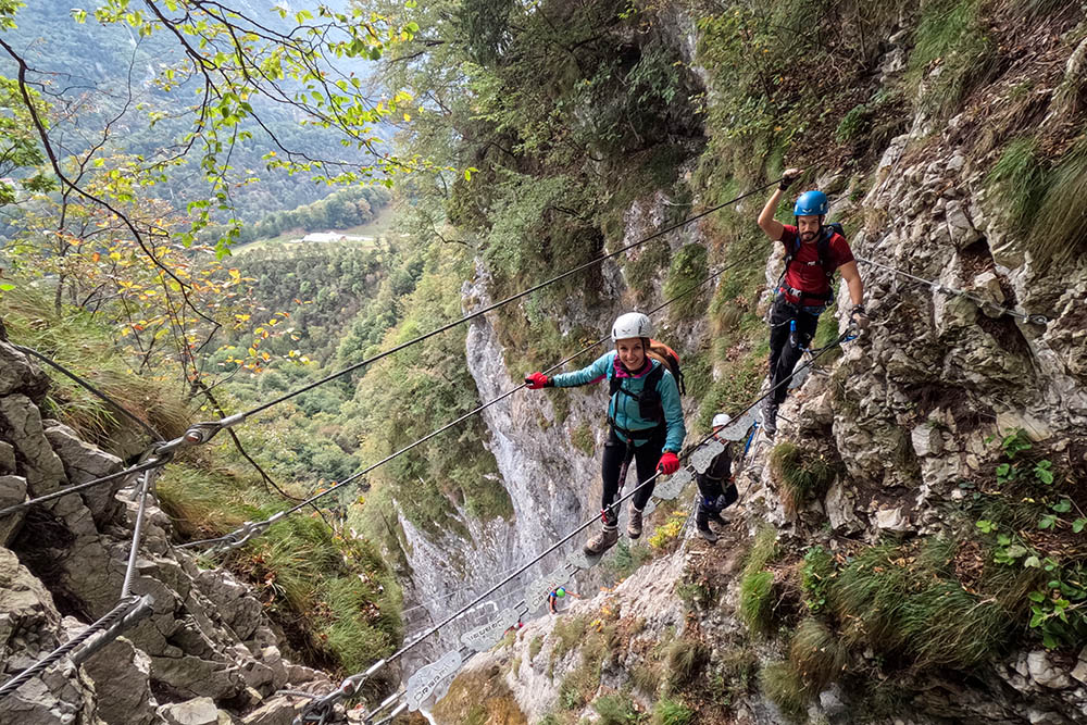
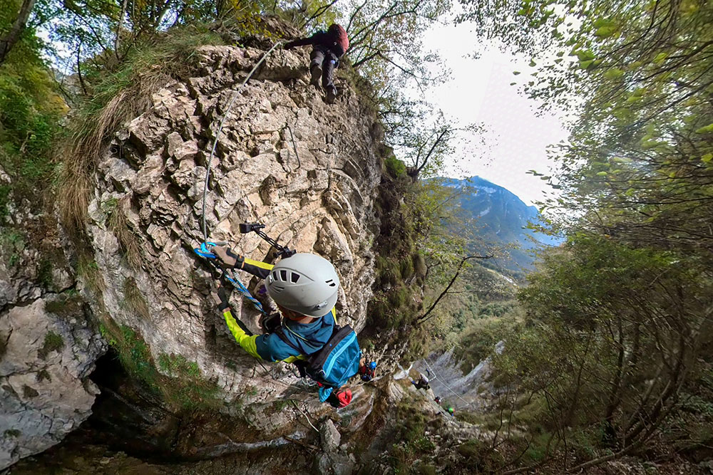
Located in Ballino, near the Pass of the same name, it climbs up the wall next to the majestic Rio Ruzza waterfall. The route, opened in 2017 and completed in 2019 with a new upper section, offers a vertical experience and is incredibly well equipped. However, it is important to note that it is not suitable for beginners or those who suffer from vertigo.
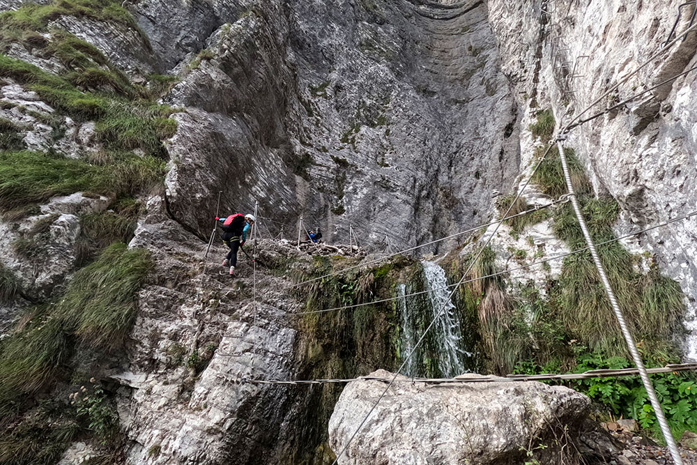
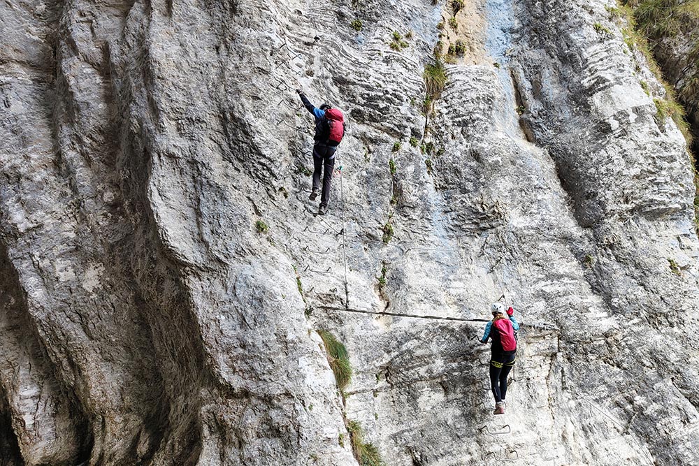
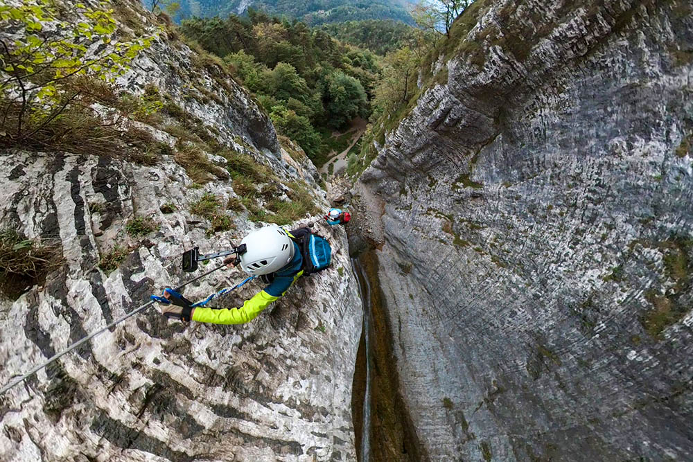
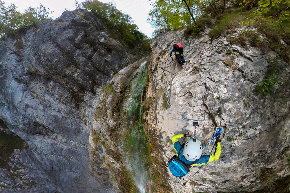
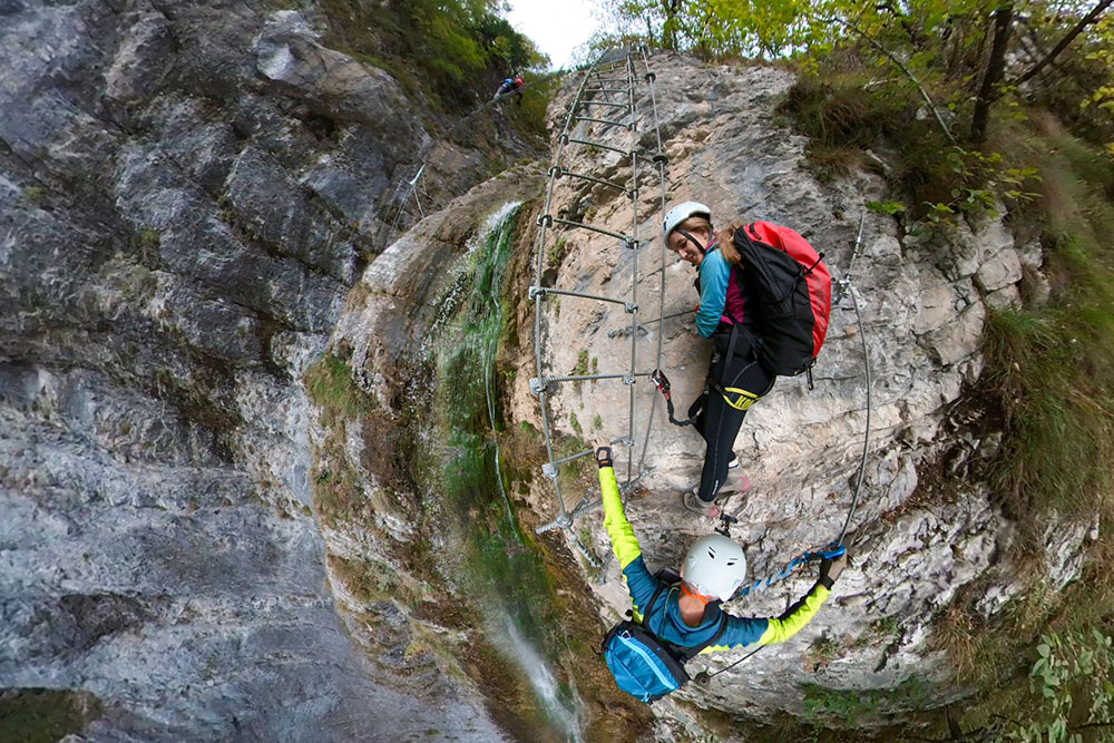
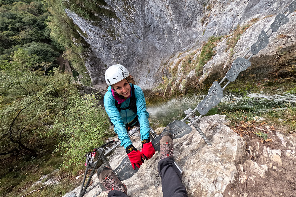
The climb to the top is quite steep, with vertical sections and suggestive Tibetan bridges that cross the waterfall. These suspension bridges give the unique sensation of being suspended between waterfalls and rushing water.
One of the special features of this via ferrata is that it is not visible from the valley floor, but you can only see its grandeur by arriving at its foot. Going up the ravine into which the Rio Ruzza waterfall, the Sajant waterfall, flows, this via ferrata offers suggestive views.
The itinerary is not long but it is very demanding, requiring good physical shape and via ferrata skills. During the hike, you will have to overcome vertical and aerial passages.
At the end of the via ferrata, you will find the signature book, where you can leave a sign of your adventure.
In summary, the Via Ferrata Signora delle Acque is an experience that will bring you into contact with nature in a unique and unforgettable way. However, remember that it is important to be prepared, have the correct equipment and a good dose of courage. This is not a walk in the park, but a vertical adventure that will leave you with indelible memories of the beauty of the Trentino mountains.
Being inside a valley, this via ferrata is always cool even during the summer, offering a refreshing excursion.
Note: The times mentioned for the ascent and descent are approximate and may vary depending on the experience of the participants and the conditions of the route.
ITINERARY
From the center of the town of Ballino follow the signs for Ferrata Signora delle Acque. The first stretch is asphalted, then a dirt road and finally a path. Go up the via ferrata and once finished follow the Return sign.
EXCURSION DATE
October 15, 2023
STARTING POINT
Center of Ballino
REFRESHMENT POINT
Nobody
AUTHOR’S SUGGESTIONS
It is always advisable to be well prepared before embarking on a via ferrata and to follow the safety guidelines.
SAFETY TIPS
The viability of the proposed itinerary, like all mountain morphology, is subject to environmental changes due to natural events and weather conditions. So, before leaving, consult the competent tourist offices and / or the refuges of reference.
Our GPX tracks are only indicative, that is, the route was carried out at best with the conditions of the trails and weather of that day. So always evaluate what to do on site.
Also remember to evaluate the route based on your physical abilities, training and the equipment you have.
You should leave someone the route you intend to do told.
Remember that the emergency number is 112.
EQUIPMENT
It is recommended to have the appropriate equipment: technical mountain clothing, boots with vibram sole or similar, via ferrata set, harness, helmet, via ferrata gloves, goggles, sunscreen, backpack with drinks.
RECOMMENDED MAPS
Tabacco 055 Arco - Valle del Sarca - Valle Dei Laghi
INTERESTING LINKS
https://www.visittrentino.info/it/trentino/destinazioni/fiave_md_244
HOW TO ARRIVE
From Riva del Garda: SP37 to Tenno. Then SS421 up to Ballino.
PARKING AREA
In Ballino
GPS coordinates: 45.965528, 10.811524
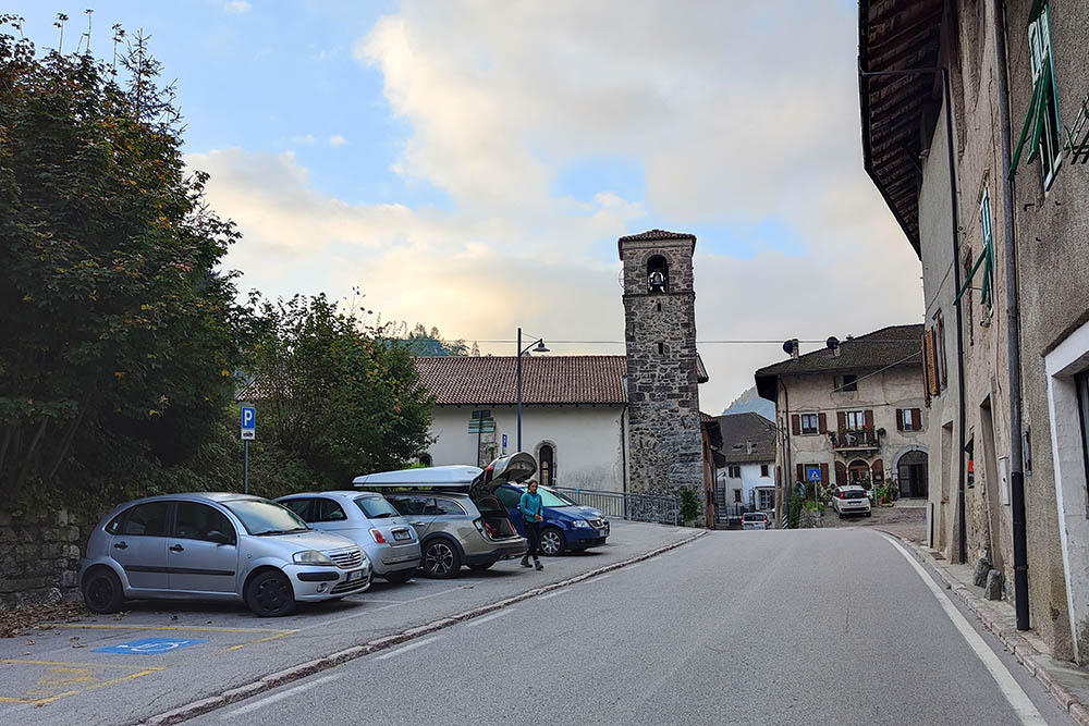
Parcheggio a Ballino
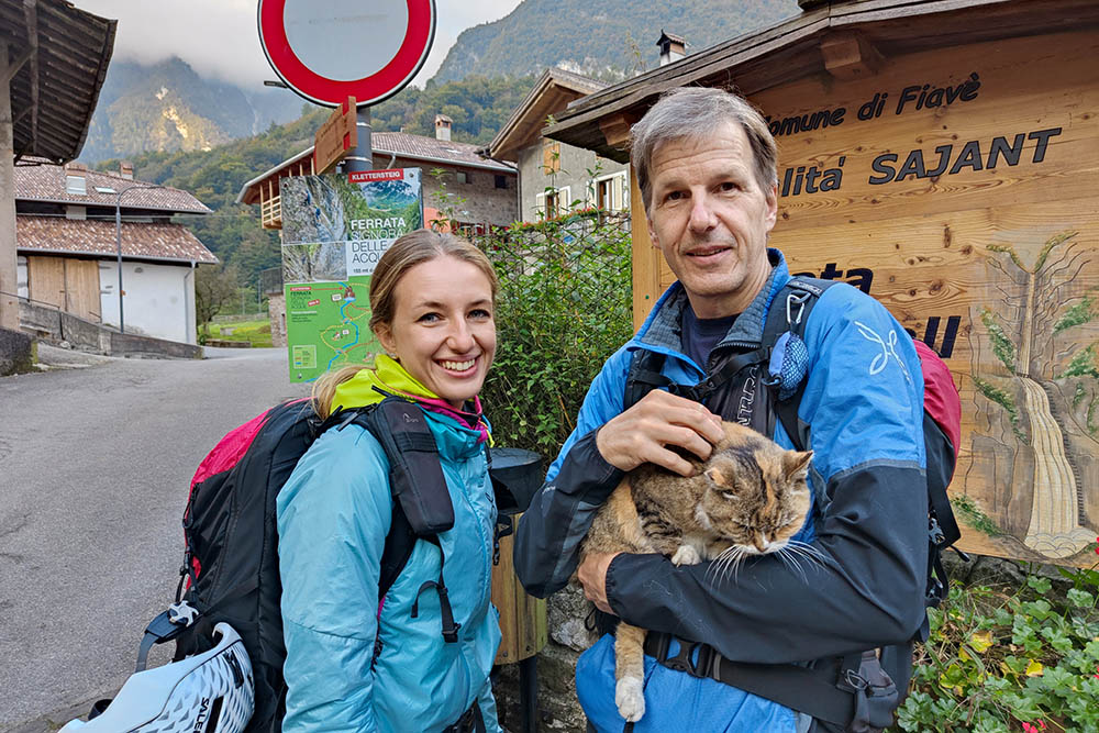
Si inizia coccolando un gatto
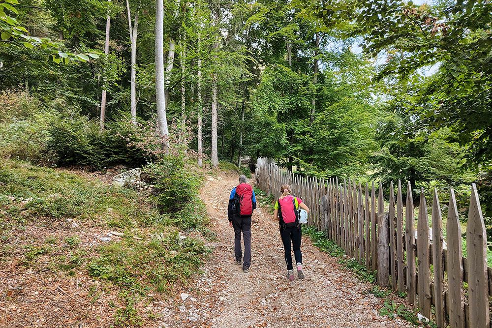
Si sale per strada sterrata
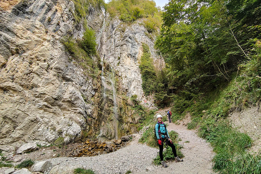
Arrivati alla cascata del Rio Ruzza
Si inizia la Via Ferrata
Primo tratto e primo ponte
Si sale in verticale
L'altezza inizia ad essere importante
La cascata è sempre più vicina
Affrontiamo un scala
Il secondo ponte
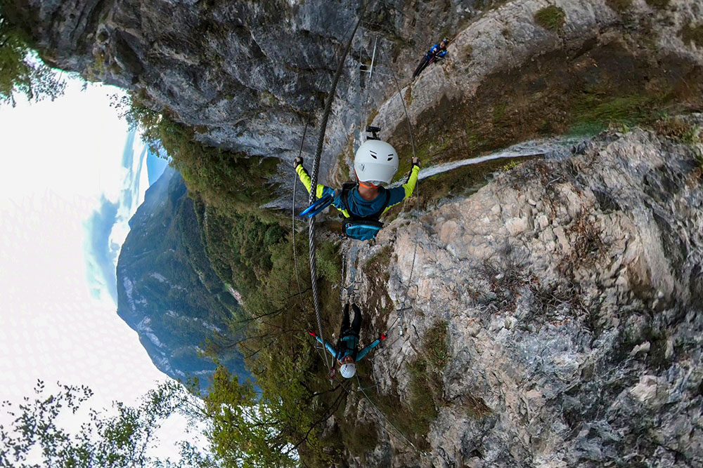
Lo attraversiamo sospesi nel vuoto
Siamo entrati nell'ultimo tratto
Terzo e ultimo ponte
Ancora pochi metri e terminiamo la ferrata


