


![]()


Durata
 4:25 h
Distanza
 12,8 km
 Ascesa
 329 m
329 mDiscesa
 329 m
329 mH Max
 1716 m
H Min
 1499 m
Malga Hagner from Passo Nigra
DESCRIPTION
Walk with wonderful views of the Catinaccio Group.
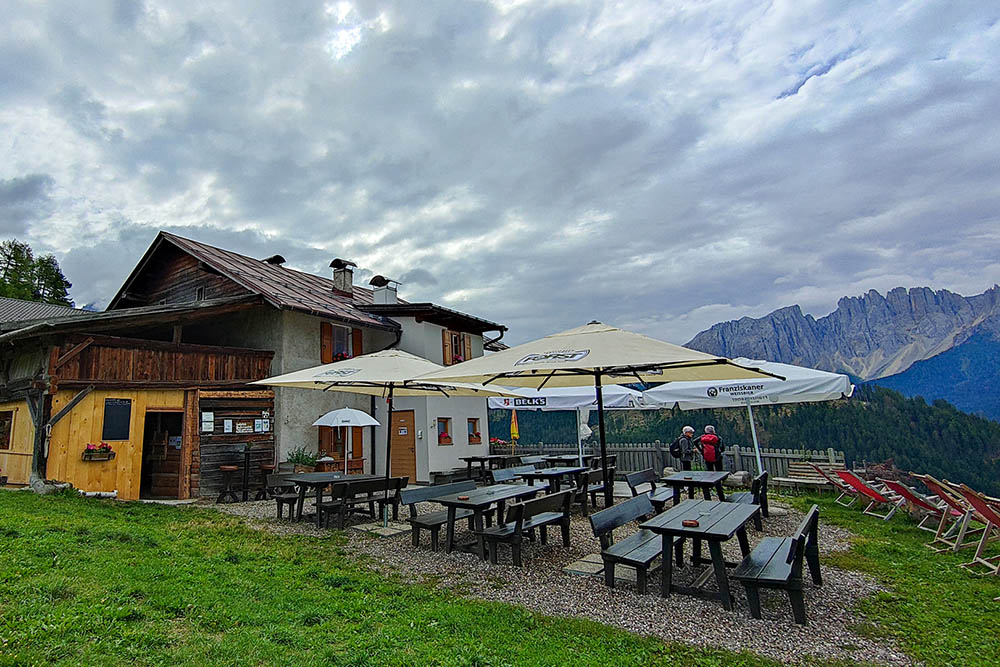
Malga Hagner, a gem nestled in the mountains, is a true paradise for nature lovers. This magical place, located 1,550 meters above sea level above Nova Levante, can only be reached on foot or by mountain bike, guaranteeing an authentic and immersive experience.
Hagneralm is much more than a simple mountain hut, it is an authentic panoramic point from which you can admire a fantastic show. From here, the panorama embraces the majestic peaks of the Dolomites, from the Sciliar to the Catinaccio, continuing up to the Latemar and the Corno Nero and Corno Bianco.
On Hagner Hill, you will find approximately 25 hectares of meadows and pastures, framed by a vast forest. This uncontaminated environment offers a variety of paths and routes that will allow you to explore the flora and fauna of the Dolomites in complete tranquility.
ITINERARY
At Passo Nigra (1685 m) take the 4B trail sign and arrive slightly downhill at Maso Jocher (1554 m). Continuing on the same path, you reach Malga Hagner (1550 m). Here you go to Maso Schiller (1558 m) and then continue the ring along paths 4A and 1 returning to Passo Nigra.
EXCURSION DATE
August 20, 2022
STARTING POINT
Nigra Pass 1685 m
REFRESHMENT POINT
Maso Jocher (1554 m), Malga Hagner (1564 m) and Maso Schiller (1558 m).
AUTHOR’S SUGGESTIONS
Make the ring clockwise.
SAFETY TIPS
The viability of the proposed itinerary, like all mountain morphology, is subject to environmental changes due to natural events and weather conditions. Therefore, before leaving, consult the competent tourist offices and / or the refuges of reference.
Our GPX tracks are only indicative, that is, the route was carried out at best with the conditions of the trails and weather of that day. So always consider what to do on site.
Also remember to evaluate the route based on your physical abilities, training and the equipment you have.
You should leave someone the route you intend to do told.
Remember that the emergency number is 112.
EQUIPMENT
It is recommended to have the appropriate equipment for the route, weather conditions and season: windproof and / or rain jacket, map and / or GPS device, goggles, sunscreen, boots, first aid kit, specific clothing, gloves, backpack with food and drink.
RECOMMENDED MAPS
Tabacco 029 Schlern - Rosengarten / Sciliar - Catinaccio - Latemar
INTERESTING LINKS
http://www.hagneralm.com/
HOW TO ARRIVE
A22 Bolzano Nord exit. SS12 direction Brenner. Once you reach Prato Isarco SP24 and then turn right following the signs for Tires. Once in Tires, continue until you reach Passo Nigra. Total 28 km.
PARKING AREA
Free at Passo Nigra
GPS coordinates: 46.455784, 11.586015
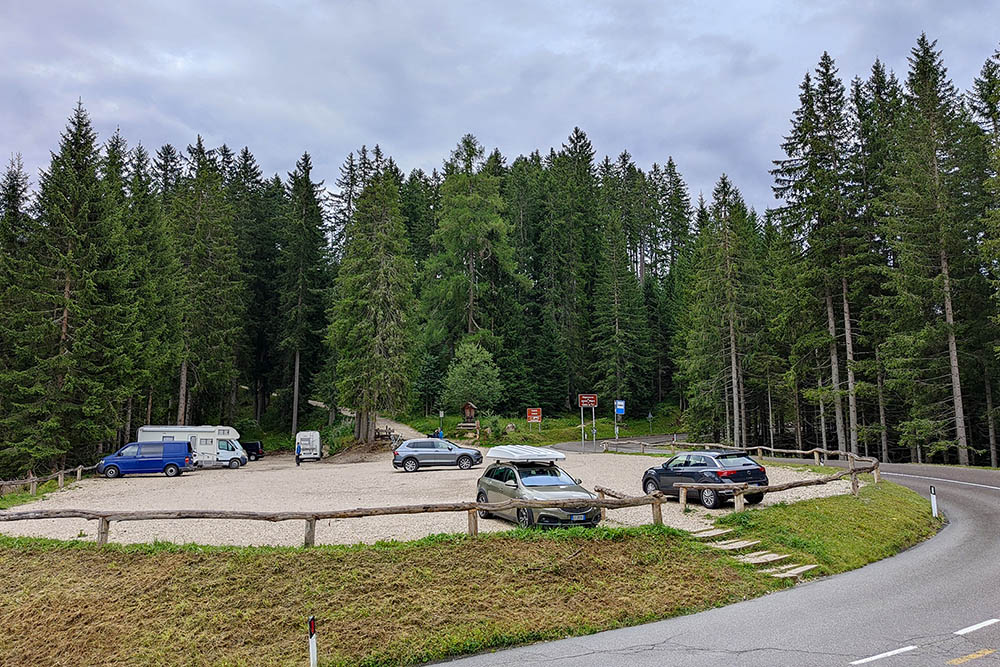
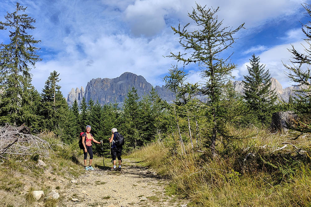
Parcheggio a Passo Nigra
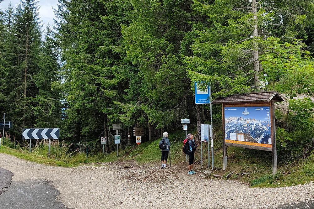
Prendiamo il sentiero 4B
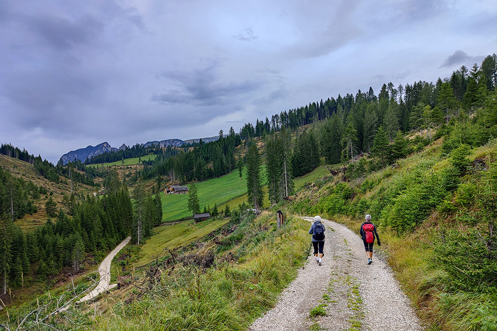
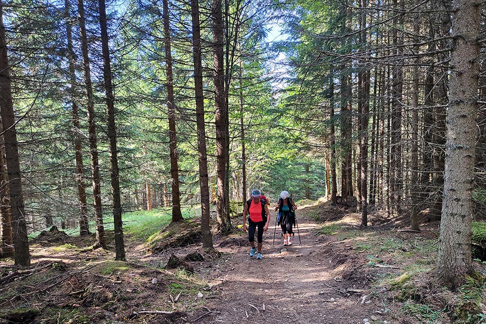
Si scende per strada sterrata
Maso Jocher
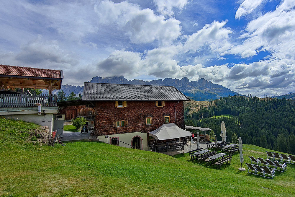
Malga Hagner
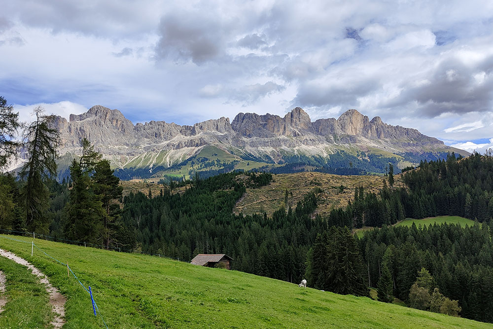
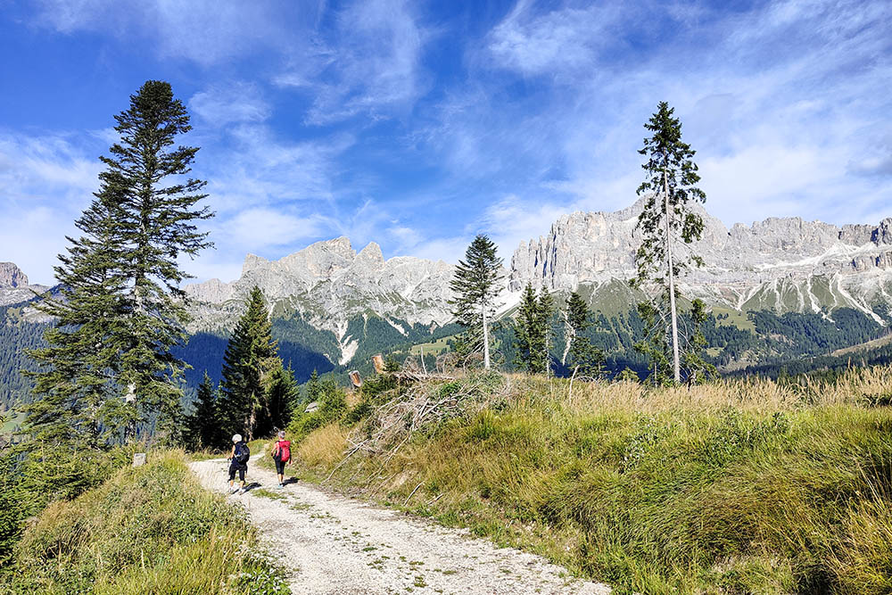
Vista sul Catinaccio
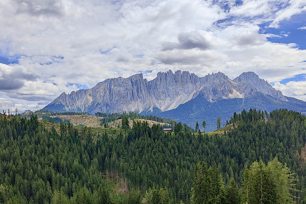
Vista sul Gruppo del Latemar
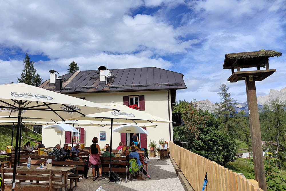
Maso Schiller
Si ritorna a Passo Nigra sul sentiero 1
Ora si segue il segnavia 1C
Il Gruppo del Catinaccio illuminato dal sole
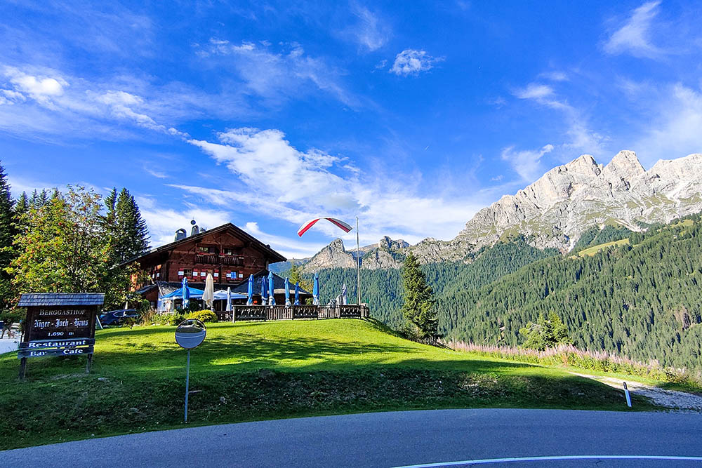
Ritornati a Passo Nigra


