


![]()


Durata
 8:00 h
Distanza
 16,6 km
 Ascesa
 1383 m
Discesa
 1383 m
H Max
 3025 m
H Min
 1752 m
Via Ferrata Sass Rigais
DESCRIPTION
Climbing to the summit of Sass Rigais is a unique experience.
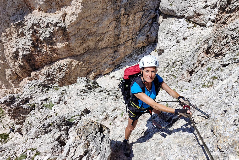
Undertaking the ascent to the Cima Sass Rigais is a thrilling experience for every expert hiker. Also known as Sas Rigais in Ladin and German, this majestic mountain stands at an impressive altitude of 3,025 meters above sea level and is part of the evocative Odle group, a jewel of the Dolomites.
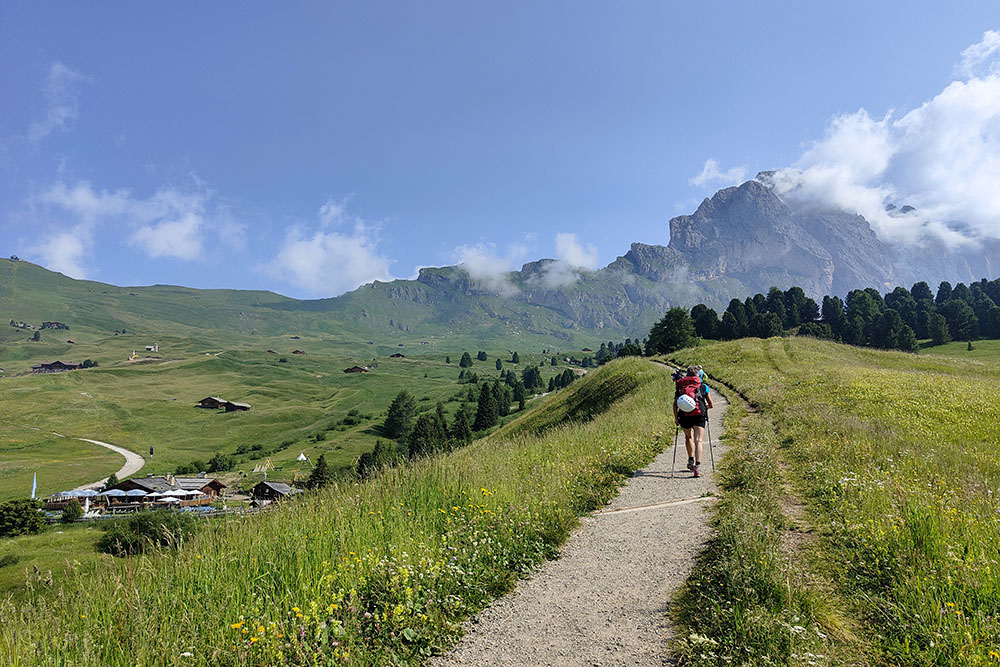
The starting point of this exciting adventure is the Val Gardena side, a spectacular entrance into the heart of nature. Sass Rigais is also set in the magnificent Puez-Odle Natural Park, giving us a unique natural environment. Access to the summit is possible via two via ferratas, one from the south side and the other from the east side of the mountain. In our journey, we faced the ascent via the southern route and the descent via the eastern one.
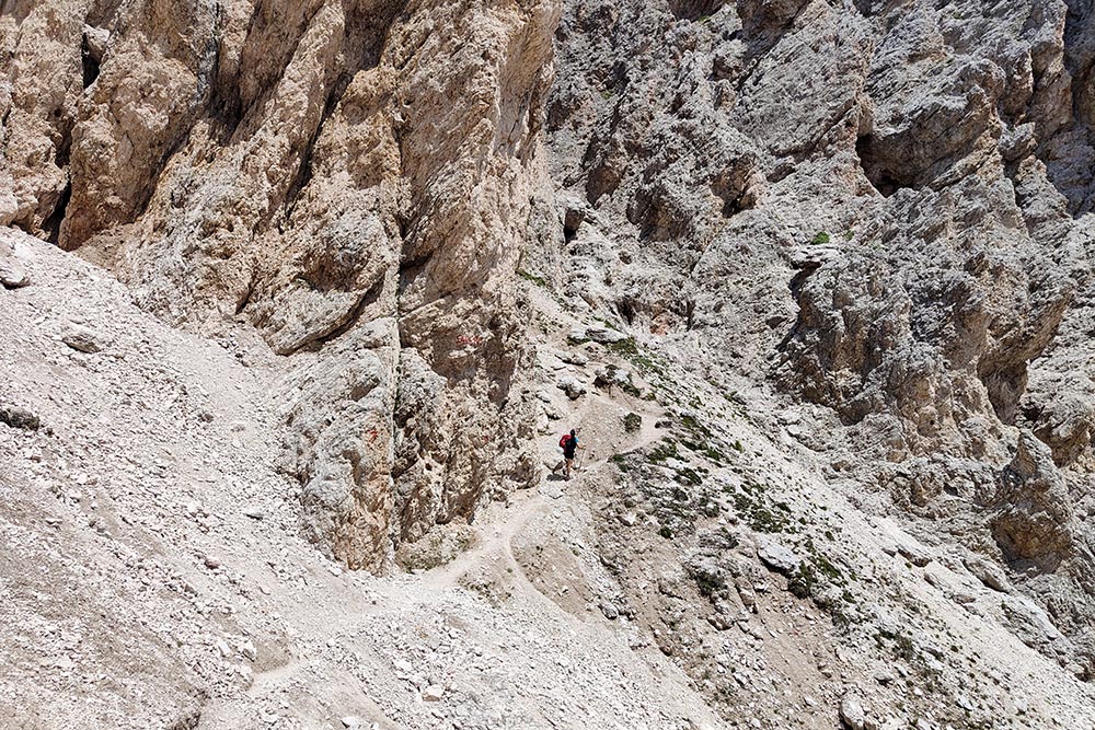
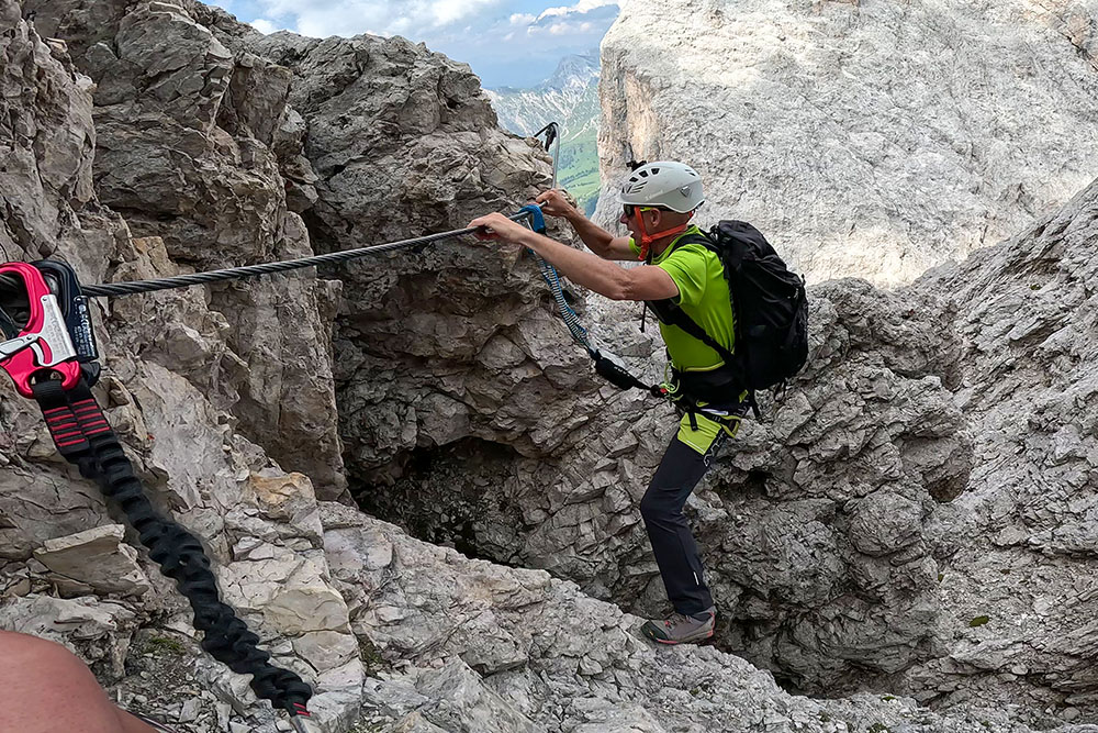
The view from the top is simply stunning, with a sweeping sweep of majestic mountains in every direction. The challenge of the via ferrata itself is not overly demanding, but some sections require more skill, especially when there are no wire ropes and you have to climb over rocks. Here, a firm step and a lack of vertigo play a major role in confidently meeting this challenge.
It's worth noting that the hike, while incredibly rewarding, is a significant challenge in several respects. With a length of 16.6 km and a vertical drop of 1383 metres, it requires adequate physical preparation and consolidated mountain experience. Furthermore, it is essential to tackle it only in decidedly favorable weather conditions, thus guaranteeing safe driving.
For those wishing to make the route less demanding, it is possible to make use of the lifts, an ideal choice to shorten the excursion without renouncing the marvel of the panoramas that this extraordinary mountain has to offer. We invite you to prepare yourself adequately for this challenge and to face it with the right determination, so as to conquer the summit and experience a real adventure in the Dolomites.
ITINERARY
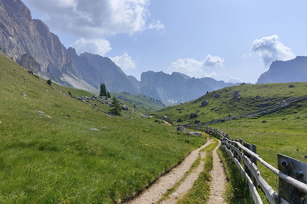
From the Cristauta car park (1752 m) go up along path no. 4 and you arrive at the Baita Gamsblut Hütte (1965 m). Continue on the 1A and then on the 4A passing to the right of the Cuca Hütte. Arrived at Pieralongia (2295 m) keep to the right and take path 2B and then to the left go up towards the Forcella de Mesdì, path PU, for the start of the Via Ferrata Sass Rigais Sud. Before the fork on the right you will find the start of the via ferrata and climb up to the summit of Sass Rigais (3025 m). Now descend along the Via Ferrata Sass Rigais Est, passing through the Forcella Salieres (2696 m), and making the scree of Val Salieres. Return to the 2B and then take the 13 reaching the Firenze Hut (2040 m). You return to the Gamsblut Hütte hut (1965 m) passing through the Odles hut (2098 m) and the Col Raiser hut (2102 m). Return to the parking lot along path 4.
EXCURSION DATE
July 11, 2023
STARTING POINT
Cristauta parking
REFRESHMENT POINT
Baita Gamsblut Hütte (1965 m), Malga Pieralongia (2297 m), Rifugio Firenze (2040 m), Baita Odles (2098 m) and Col Raiser (2102 m)
AUTHOR’S SUGGESTIONS
Obviously it is not recommended for people suffering from vertigo.
SAFETY TIPS
The viability of the proposed itinerary, like all mountain morphology, is subject to environmental changes due to natural events and weather conditions. So, before leaving, consult the competent tourist offices and / or the refuges of reference.
Our GPX tracks are only indicative, that is, the route was carried out at best with the conditions of the trails and weather of that day. So always evaluate what to do on site.
Also remember to evaluate the route based on your physical abilities, training and the equipment you have.
You should leave someone the route you intend to do told.
Remember that the emergency number is 112.
EQUIPMENT
It is recommended to have the appropriate equipment: technical mountain clothing, boots with vibram sole or similar, via ferrata set, harness, helmet, via ferrata gloves, goggles, sunscreen, backpack with drinks.
RECOMMENDED MAPS
Tabacco 05 Val Gardena - Alpe di Siusi / Gröden – Seiseralm
INTERESTING LINKS
https://www.ferrate365.it/vie-ferrate/ferrata-sass-rigais/
HOW TO ARRIVE
SS242 della Val Gardena at Selva Gardena, take Str. Plesdinaz on the left and go up to the Cristauta - Praplan car park.
PARKING AREA
Cristauta paid parking
GPS coordinates: 46.566449, 11.725109
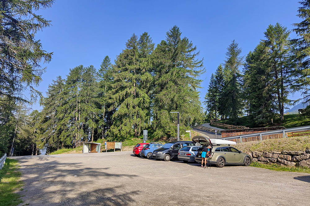
Parcheggio Cristauta
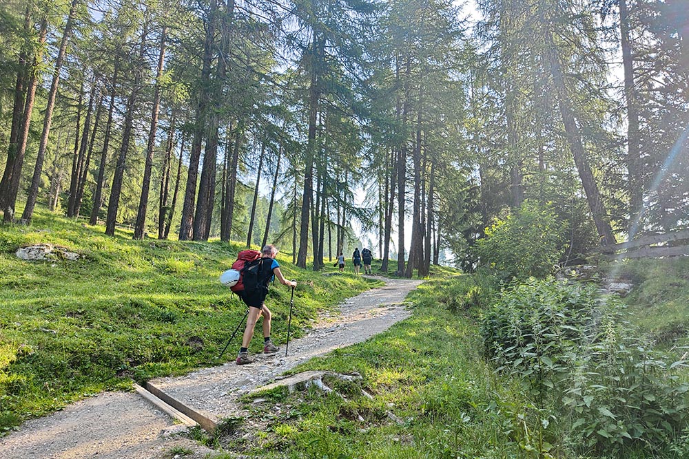
Si sale per il sentiero n 4
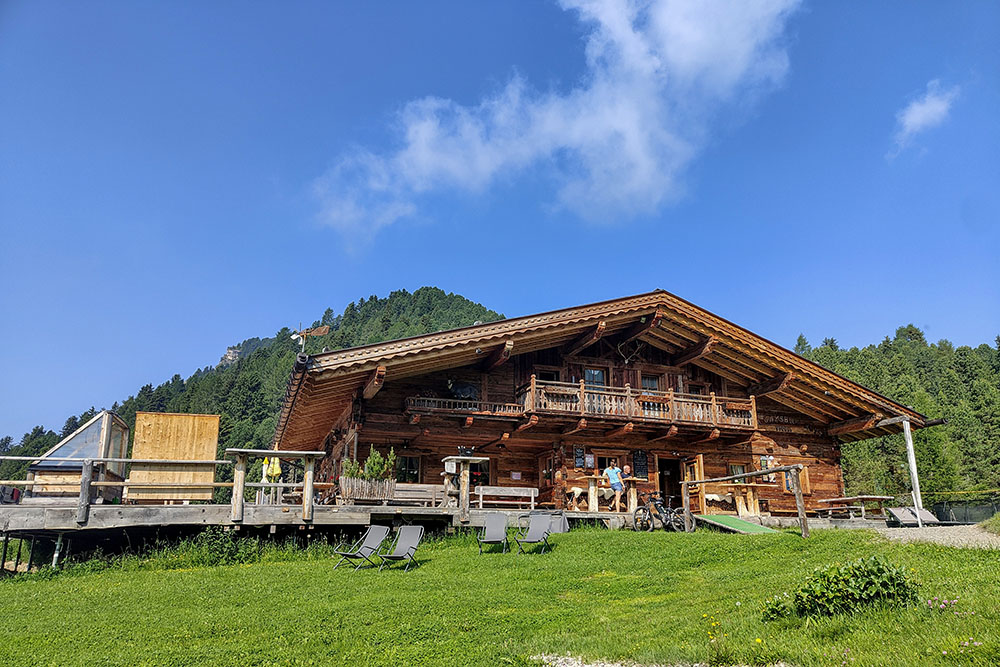
La Baita Gamsblut Hütte
Si passa vicino alla Cuca Hütte
Siamo in località Pieralongia
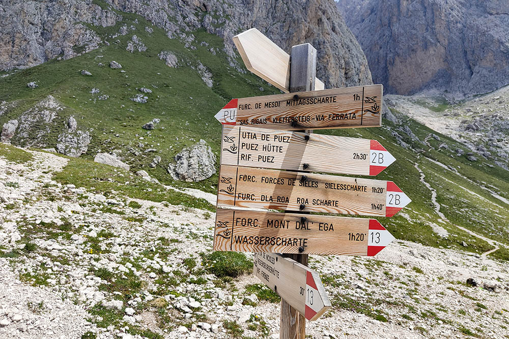
Bivio per la Forcella de Mesdì
Attacco della Via Ferrata Sass Rigais Sud
Primo tratto attrezzato
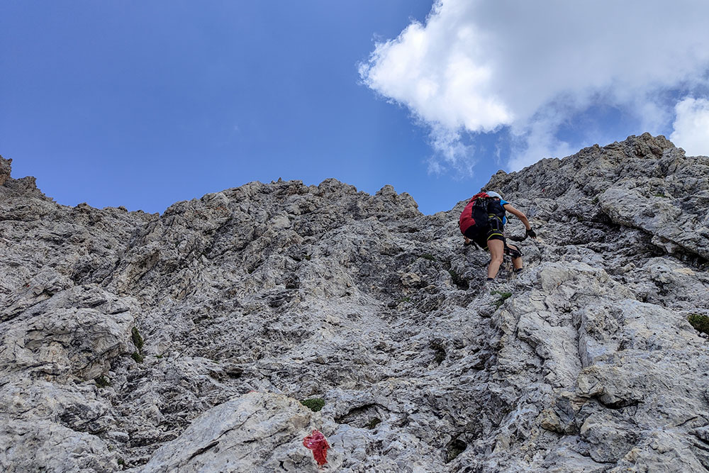
Lungo tratto su roccette
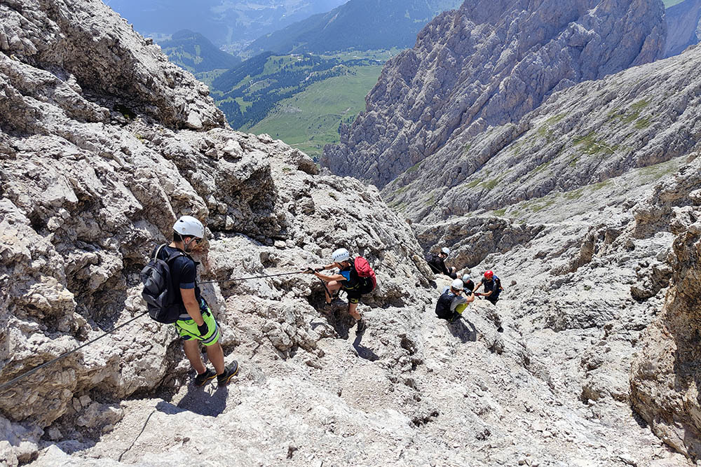
Secondo tratto attrezzato
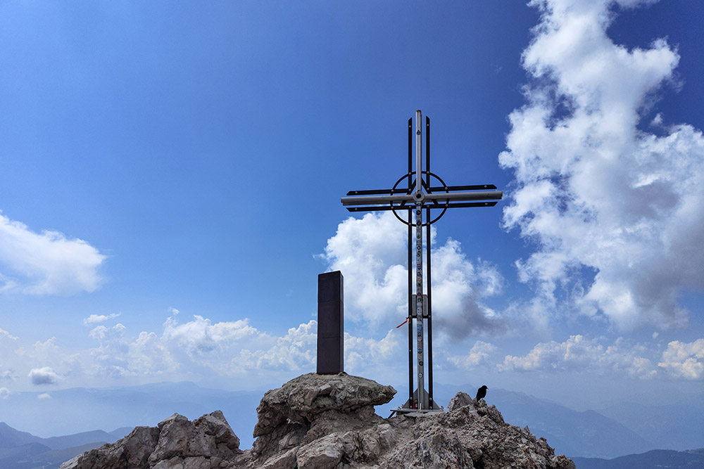
La Croce di Vetta del Sass Rigais
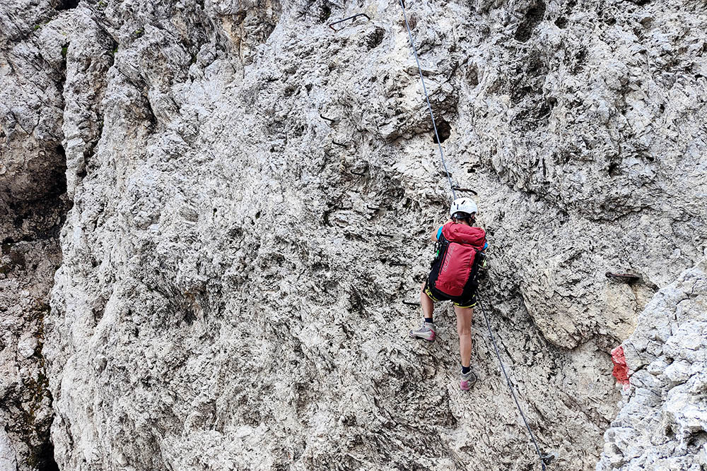
Si scende dal versante Est
Si scende dal versante Est
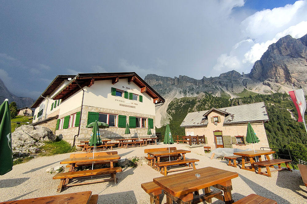
Rifugio Firenze
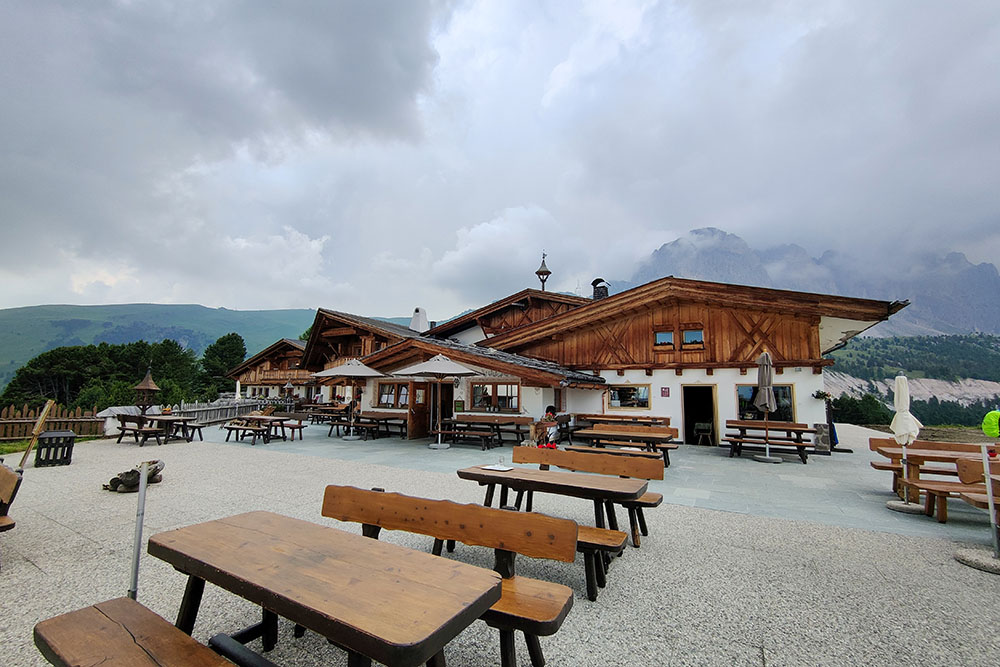
Rifugio Col Raiser


