


![]()


Durata
 3:50 h
Distanza
 10,1 km
 Ascesa
 460 m
460 mDiscesa
 460 m
460 mH Max
 1746 m
H Min
 1312 m
Fanes waterfalls: two fantastic itineraries
DESCRIPTION
Discovering the spectacular Fanes waterfalls along deep valleys, gorges and canyons.
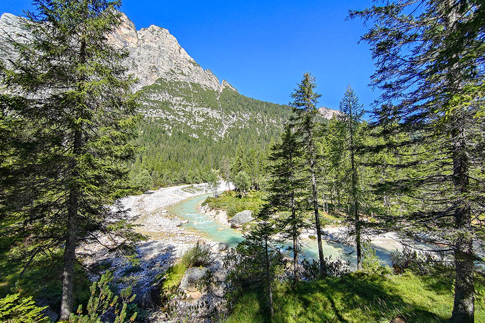
We are located north of Cortina in the heart of the Ampezzo Dolomites Park, where the valleys of Fanes, Travenanzes and Ra Vales intersect, creating a beautiful landscape and hydrogeological scenario.
Here it is possible to do various types of excursions: easy, medium and a little more complex.
Here are our two proposals.
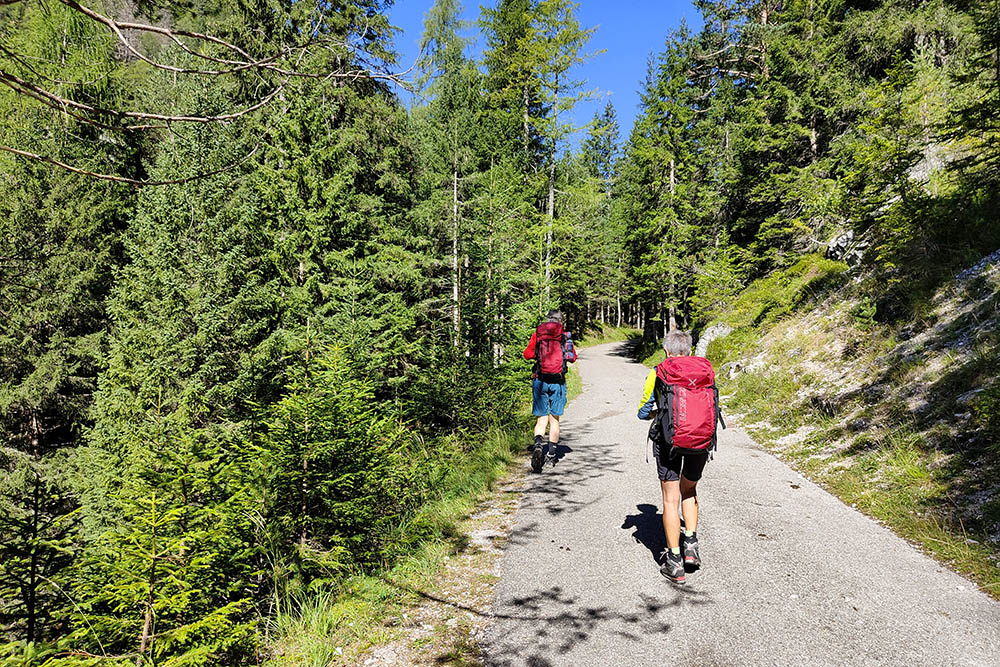
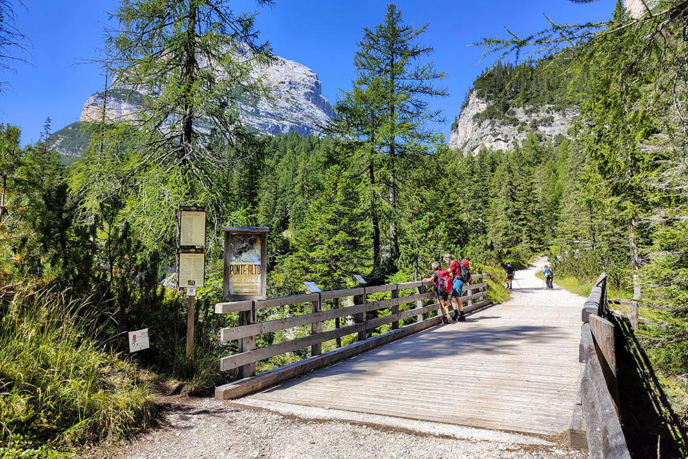
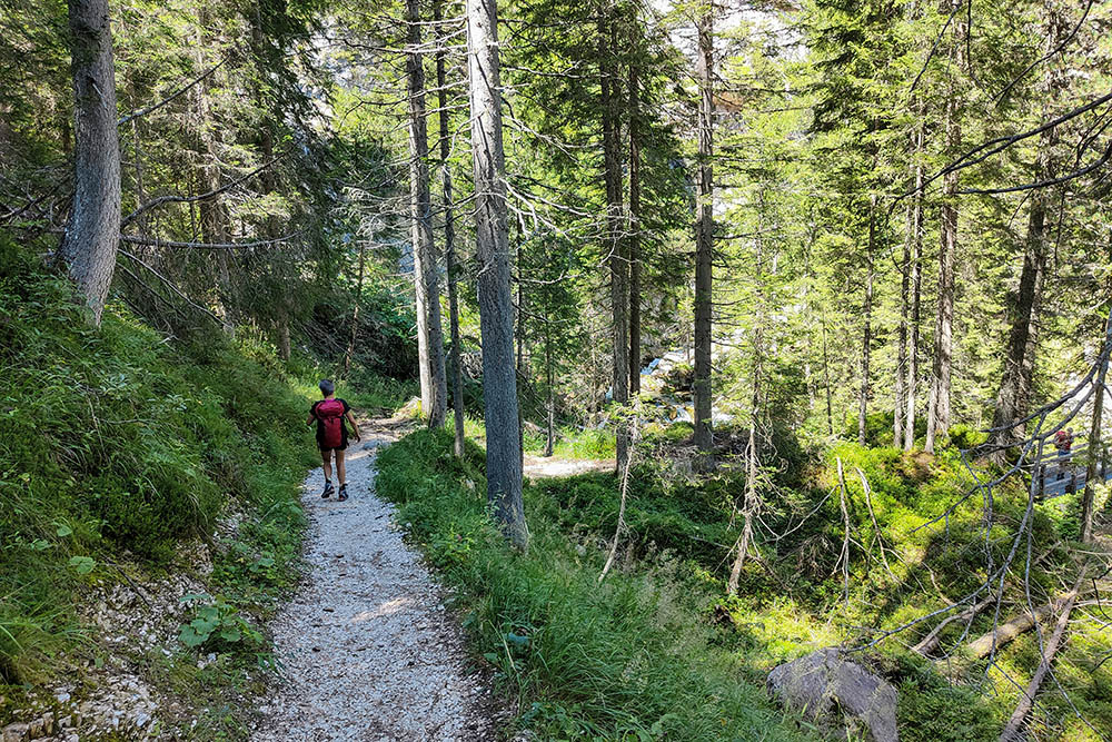
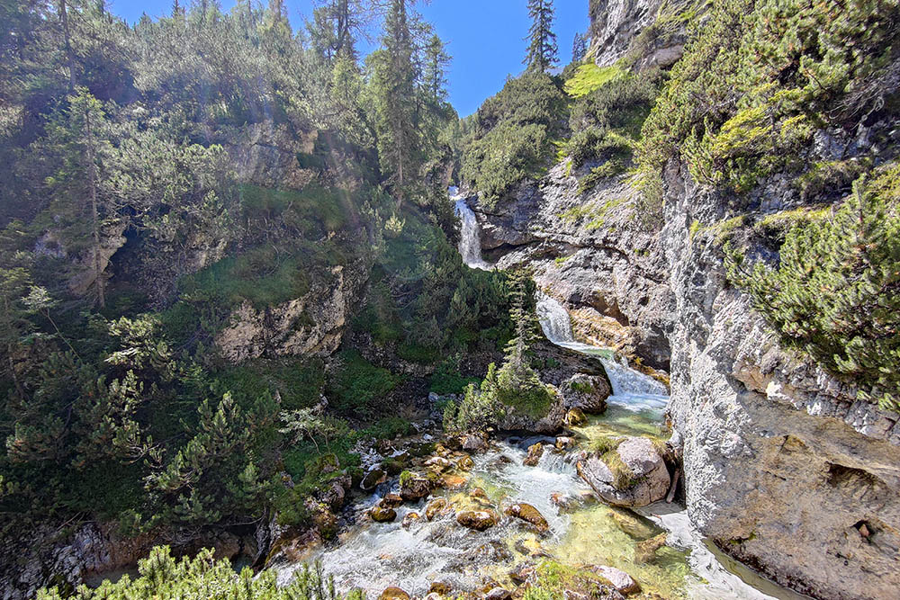
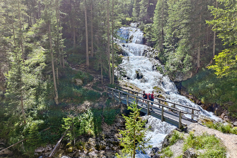
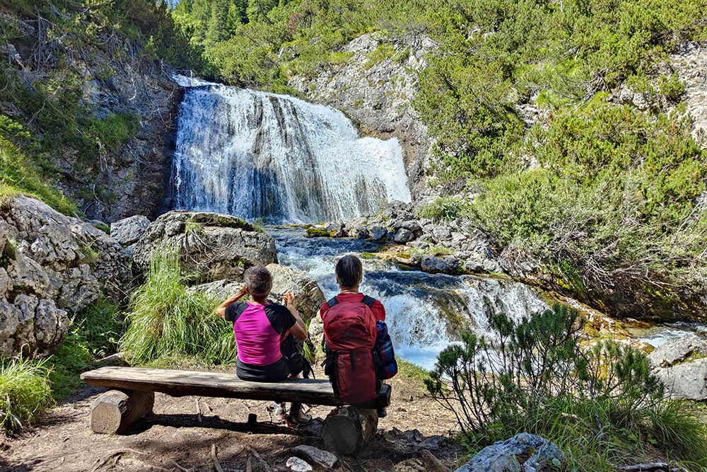
The first is a relaxing walk, initially on a paved road and then a dirt road. First stop at Ponte Alto, to admire the gorges - hitherto accessible even with a stroller. Subsequently a fairly steep path, which runs alongside the Rio Fanes and which offers a wonderful view of pools and waterfalls, will lead us to the splendid Sbarco waterfalls.
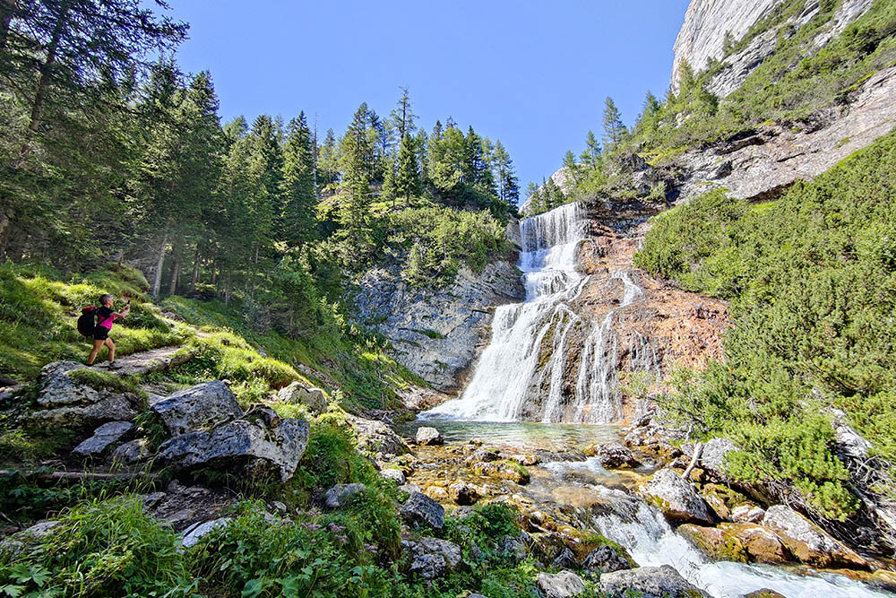
The second is more challenging. Three via ferratas are added to the first route: Via Ferrata Giovanni Barbara, Via Ferrata Lucio Dalaiti and the short Ferrata della Cascata Sbarco. Here, you get remarkably close to the falls, even passing under them in two cases. You descend into the canyon and reach an extraordinary panoramic balcony. From there, the view of the Cascate Basse di Fanes, one of the highest in the Dolomites, is simply extraordinary.
ITINERARY
Proposal 1
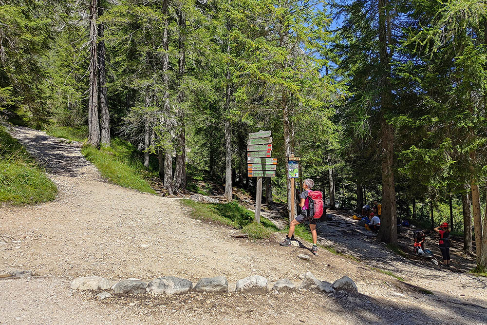
From the car park (1312 m) take the paved road, signpost 10. After a while the road becomes a dirt road and you arrive at Ponte Alto (1445 m) where there is a nice picnic area nearby. You always follow trail number 10 and now you walk on a steep but very beautiful path, until you reach the Sbarco waterfall (1728 m). Return to the dirt road.
Proposal 2
From the car park (1312 m) take the paved road, signpost 10. After a while the road becomes a dirt road and you arrive at Ponte Alto (1445 m) where there is a nice picnic area nearby. Here we take the Via Ferrata Giovanni Barbara which, after passing under a waterfall, will take us to the bottom of the canyon (1400 m). Now go up a very steep path to the Belvedere Pian de Loa Felizon waterfall (1475 m) and then return along the same path. Cross the bridge and take the second aided section, the Via Ferrata Lucio Dalaiti, which will take us back to the vicinity of Ponte Alto.
From the picnic area, take path 10 which leads us to the Sbarco waterfall (1728 m).
Here we have the third and last aided section. It is a very short stretch which, making us pass under the waterfall, leads us to make a small loop and takes us back to the main road.
Return to the dirt road.
EXCURSION DATE
August 19, 2023
STARTING POINT
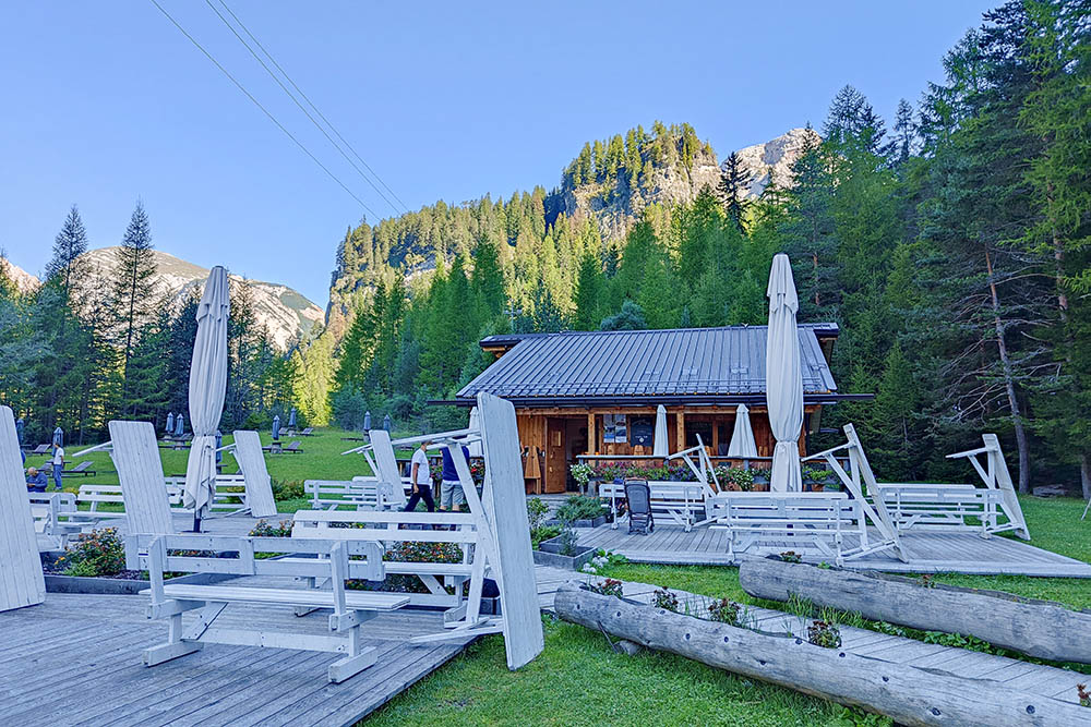
Baita Spiaggia Verde
REFRESHMENT POINT
Nobody
AUTHOR’S SUGGESTIONS
For those wishing to make the second proposal, we recommend using the via ferrata kit.
SAFETY TIPS
The viability of the proposed itinerary, like all mountain morphology, is subject to environmental changes due to natural events and weather conditions. Therefore, before leaving, consult the competent tourist offices and / or the refuges of reference.
Our GPX tracks are only indicative, that is, the route was carried out at best with the conditions of the trails and weather of that day. So always consider what to do on site.
Also remember to evaluate the route based on your physical abilities, training and the equipment you have.
You should leave someone the route you intend to do told.
Remember that the emergency number is 112.
EQUIPMENT
It is recommended to have the appropriate equipment for the route, weather conditions and season: windproof and / or rain jacket, map and / or GPS device, goggles, sunscreen, boots, first aid kit, specific clothing, gloves, backpack with food and drink.
RECOMMENDED MAPS
Tabacco 03 Cortina d'Ampezzo Dolomiti Ampezzane
INTERESTING LINKS
https://www.dolomiti.org/it/cortina/
HOW TO ARRIVE
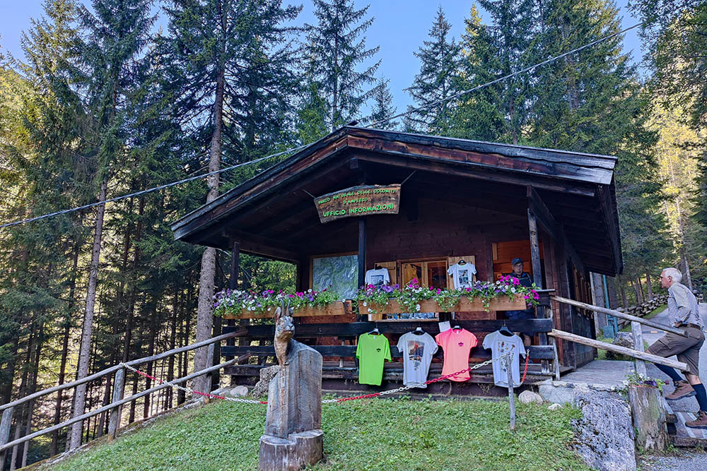
From Cortina d'Ampezzo SS51 towards Dobbiaco for about 5.5 km. On the left, take the road that leads to the Visitor Center of the Ampezzo Dolomites Natural Park.
PARKING AREA
At the Baita Spiaggia Verde
GPS coordinates: 46.591567, 12.112610

Parcheggio presso la Baita Spiaggia Verde
Arrivati al Ponte Alto
Inizio della Via Ferrata Giovanni Barbara
Si passa sotto la cascata
Si scende nel canyon
La cascata vista dal basso
Si sale al punto panoramico
Vista dal punto panoramico
Via Ferrata Lucio Dalaiti
Si rientra al Ponte Alto
Favolose cascate
La Cascata Sbarco da sotto
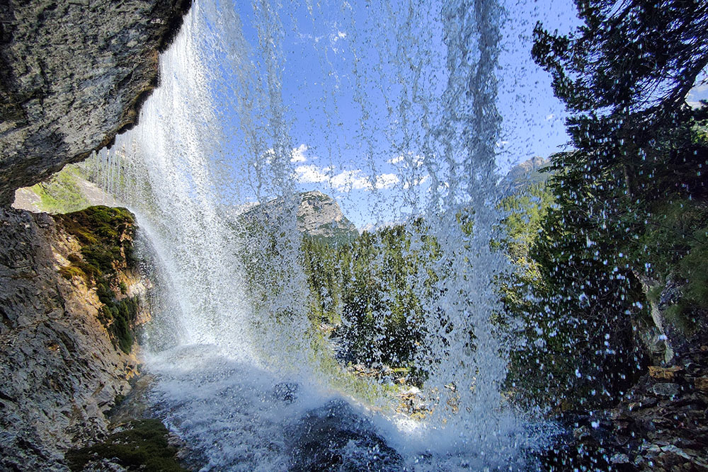
Si può passare sotto la Cascata Sbarco
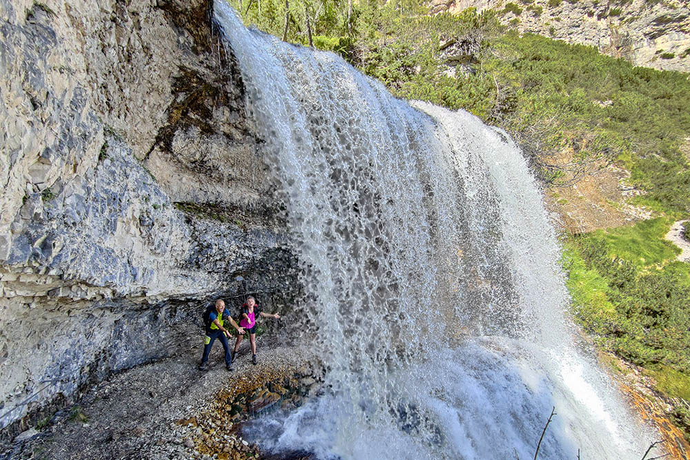
Si passo sotto la Cascata Sbarco
Si sale sopra la Cascata Sbarco


