


![]()


Durata
 8:30 h
Distanza
 16,2 km
 Ascesa
 1660 m
Discesa
 1660 m
H Max
 3011 m
H Min
 1446 m
Cima Ombretta Orientale
DESCRIPTION
Ascent to the Eastern Ombretta peak: breathtaking views of the Dolomites.
It is an itinerary that is just over 3000 meters and is located in the Marmolada area. The destination of the excursion is part of a mountain massif in the Fassa Dolomites which includes three peaks: the Occidentale (2998 m), di Mezzo (2983 m) and the Orientale (3011 m). Despite the 1660 meters of ascent, the climb does not present particular difficulties, except for the length and the consequent effort.
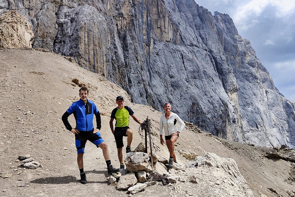
Despite being in the Marmolada area, the excursion is not very popular, thus offering the possibility of enjoying the spectacular panorama from the summit alone or in the company of a few people. At the top, there is an iron cross. From the summit, it is possible to admire the spectacular south wall of the Marmolada, the Sasso Vernale, the Cima Dell'Uomo, the Formenton Group and the Cime D'Auta.
On the way back, it is advisable to taste the typical products of the local huts to round off the experience in style.
ITINERARY
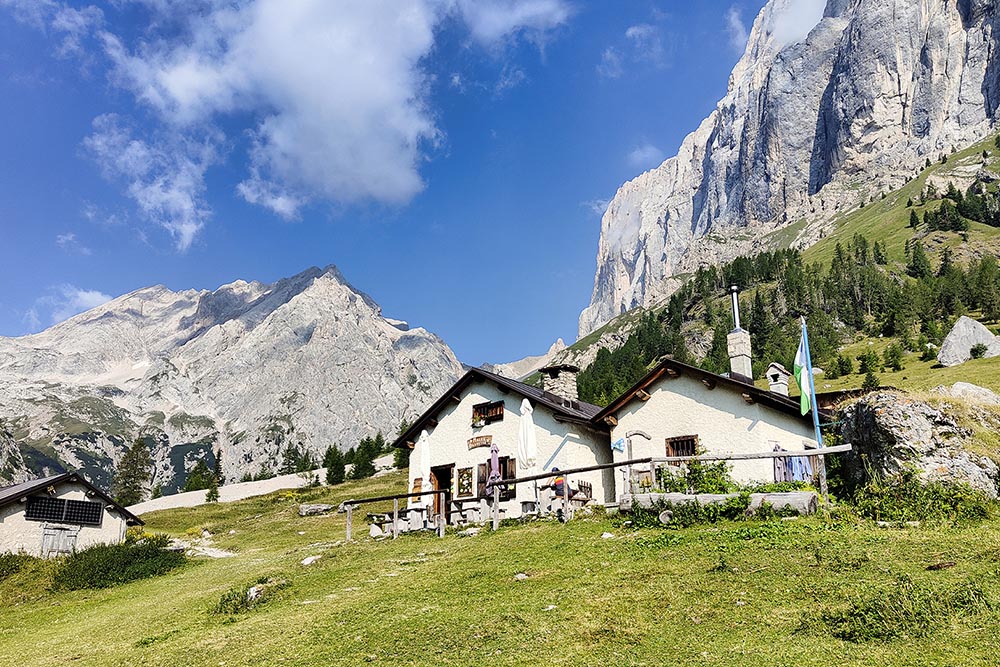
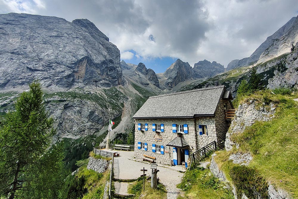
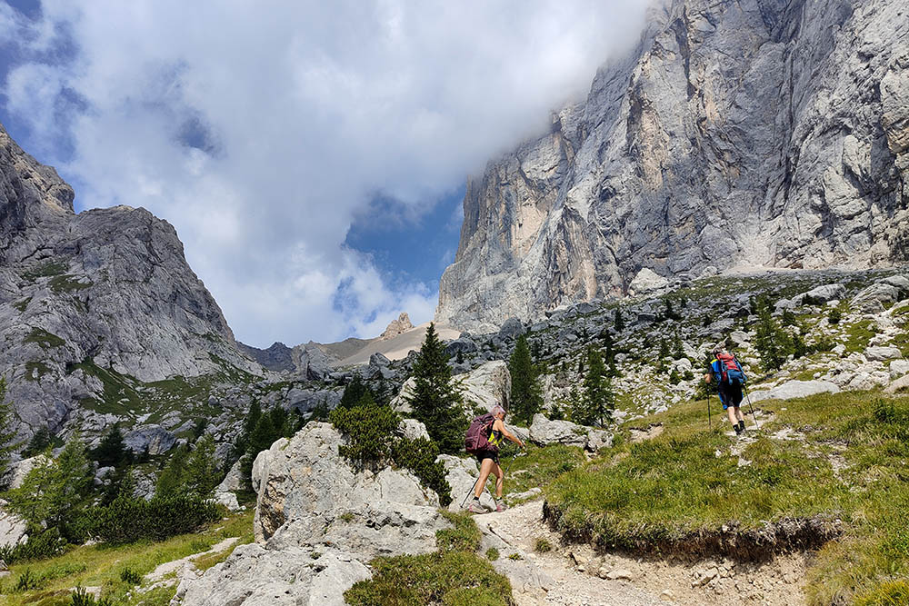
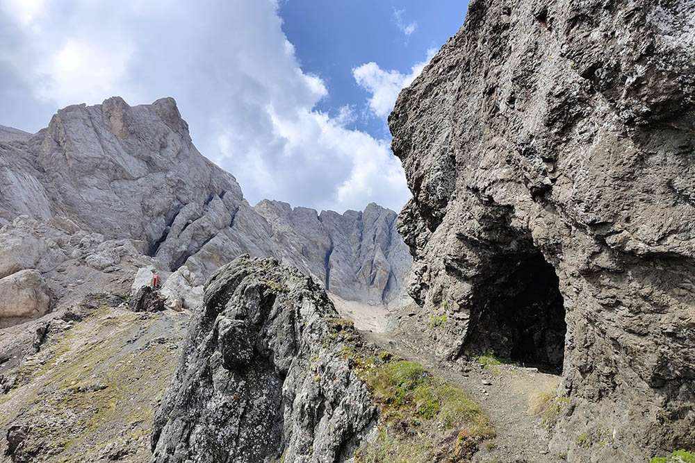
From the parking lot (1449 m) go up a dirt road quickly arriving at the Agritur Malga Ciapela (1544 m). Here, following trail no. 610 you arrive first at Malga Ombretta (1904 m) and then at Rifugio Falier all'Ombretta (2100 m). After a brief stop, continue on the 610 arriving at Passo Ombretta (2700 m). Turn left on the 650 and, passing the Bivacco Marco Dal Bianco (2727 m), you reach the summit of Cima Ombretta Orientale (3011 m) after a short equipped section. We return by the same path.
EXCURSION DATE
July 22, 2022
STARTING POINT
Parking near the Camping Marmolada Malga Ciapela
REFRESHMENT POINT
Malga Ciapela (1559 m), Malga Ombretta (1904 m) and Rifugio Falier all'Ombretta (2100 m)
AUTHOR’S SUGGESTIONS
Pay a little attention to the aided section immediately after the Bivacco Marco Dal Bianco.
SAFETY TIPS
The viability of the proposed itinerary, like all mountain morphology, is subject to environmental changes due to natural events and weather conditions. Therefore, before leaving, consult the competent tourist offices and / or the refuges of reference.
Our GPX tracks are only indicative, that is, the route was carried out at best with the conditions of the trails and weather of that day. So always consider what to do on site.
Also remember to evaluate the route based on your physical abilities, training and the equipment you have.
You should leave someone the route you intend to do told.
Remember that the emergency number is 112.
EQUIPMENT
It is recommended to have the appropriate equipment for the route, weather conditions and season: windproof and / or rain jacket, map and / or GPS device, goggles, sunscreen, boots, first aid kit, specific clothing, gloves, backpack with food and drink.
RECOMMENDED MAPS
Tabacco 015 Marmolada - Pelmo - Civetta – Moiazza
INTERESTING LINKS
http://www.rifugiofalier.altervista.org/
HOW TO ARRIVE
From Canazei: SS641 Passo Fedaia road. Once you reach Passo Fedaia, continue and go down to Malga Ciapela. Here at the Malga Ciapela hotel, go right up to the Parking lot.
PARKING AREA
Parking lot near the Camping Marmolada Malga Ciapela
GPS coordinates: 46.425303, 11.907049
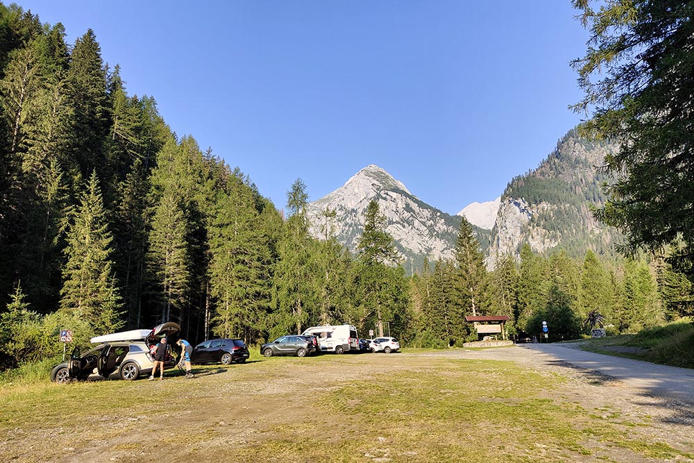
Parcheggio
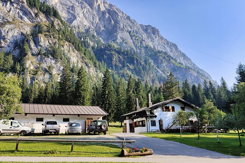
Malga Ciapela
Malga Ombretta
Rifugio Falier all'Ombretta
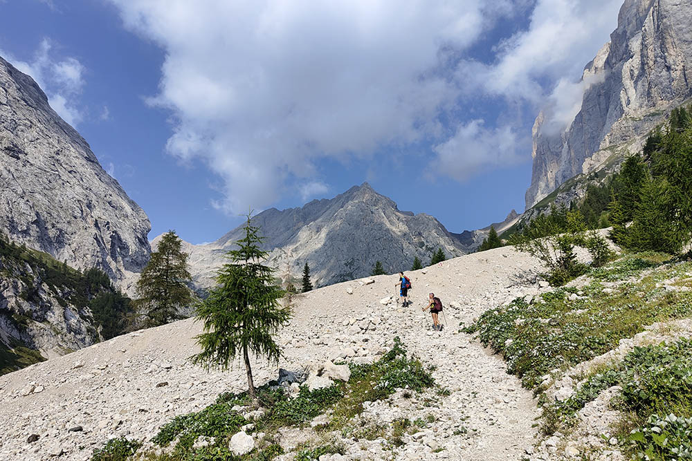
La bella Val Ombretta
Si sale verso il Passo Ombretta
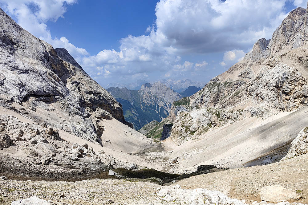
Valle da cui siamo saliti
Passo Ombretta
Resti della Prima Guerra Mondiale
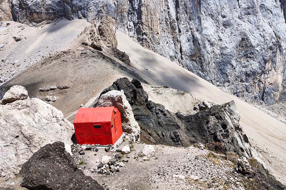
Bivacco Marco Dal Bianco
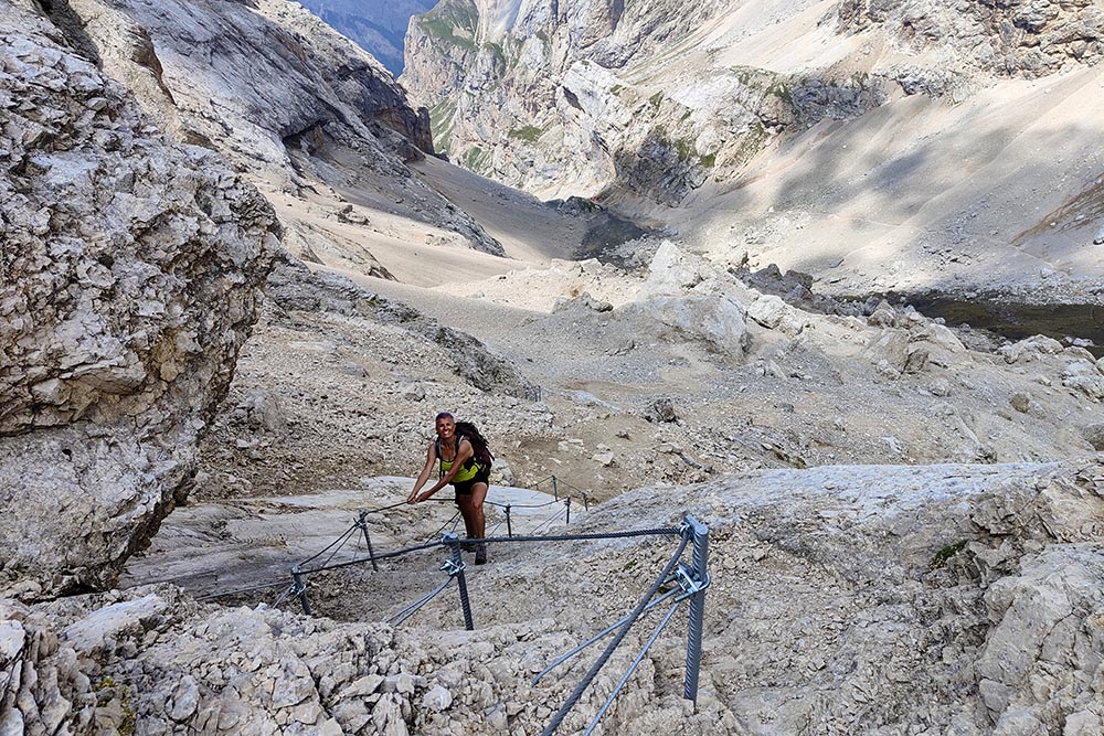
Breve tratto attrezzato
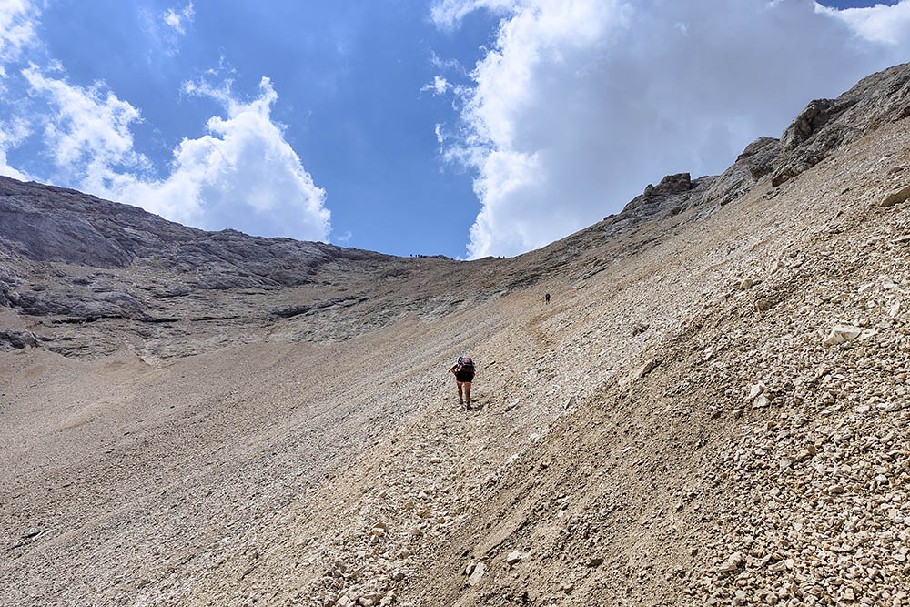
Si sale su ghiaioni instabili
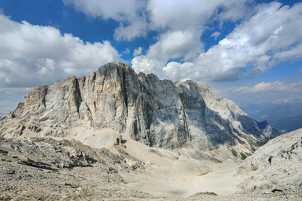
Parete Sud della Marmolada
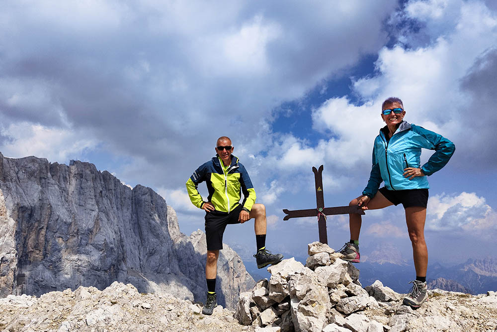
Cima Ombretta Orientale
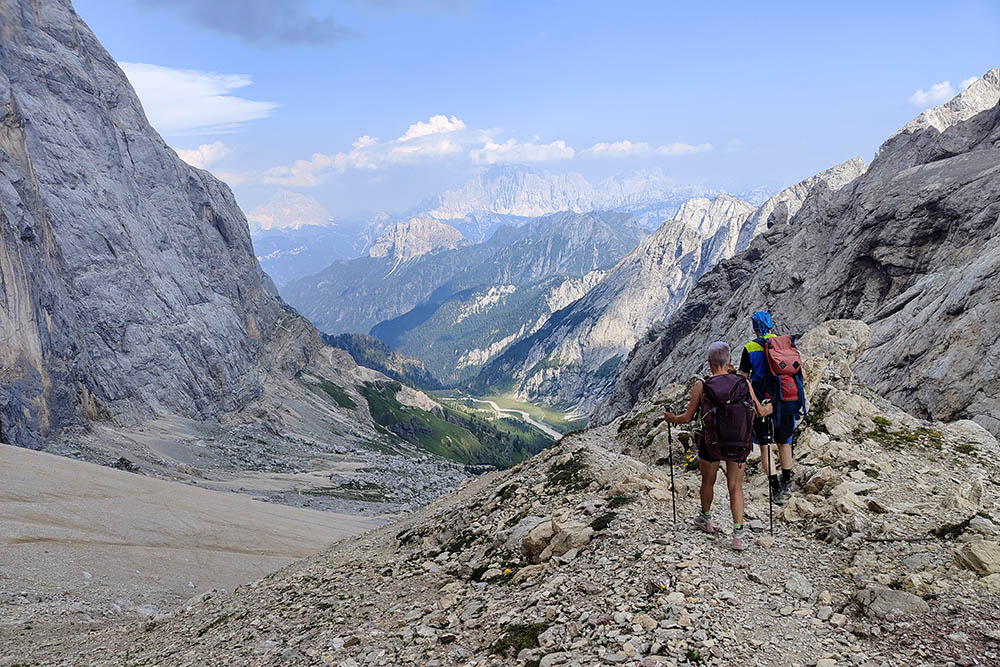
Si ritorna in valle


