


![]()


Durata
 4:00 h
Distanza
 6,3 km
 Ascesa
 470 m
470 mDiscesa
 470 m
470 mH Max
 2456 m
H Min
 2008 m
Ferrata Larix in Val Senales
DESCRIPTION
Emotions and adrenaline in the magnificent Val Senales.
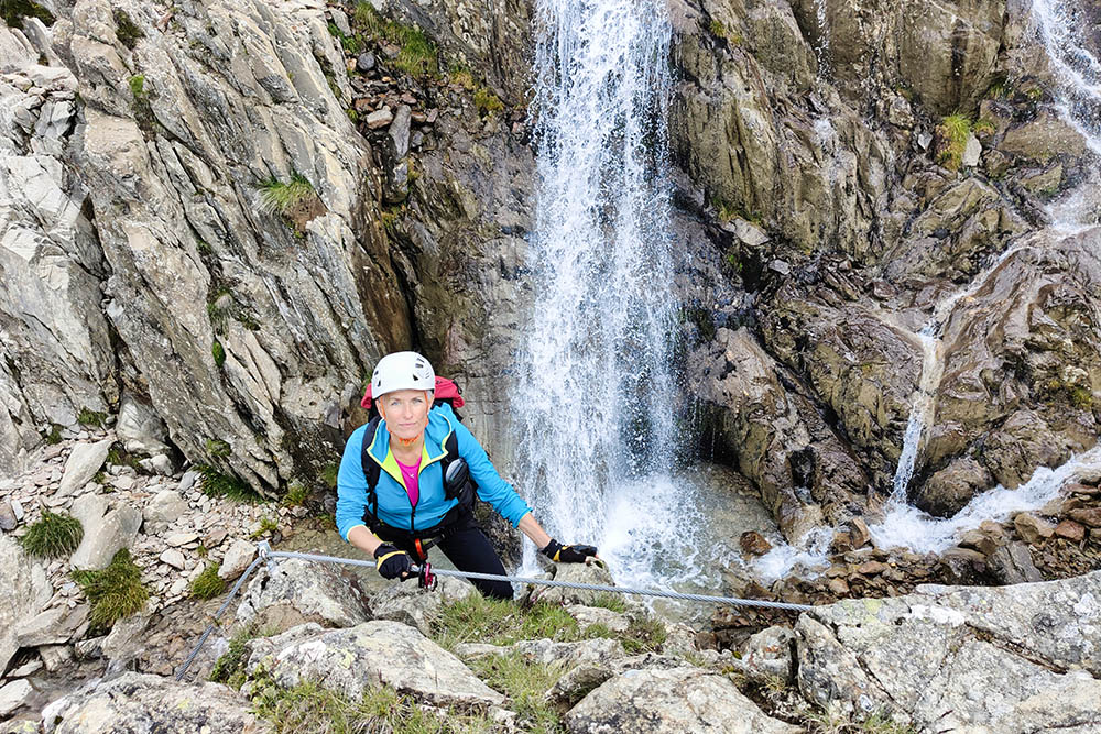
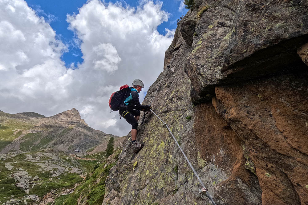
An extraordinary adventure on the Via Ferrata Larix, located in the suggestive Val Senales. This exciting route winds along the Rio Senales, offering an unforgettable experience in the heart of this enchanting valley.
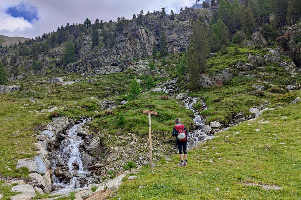
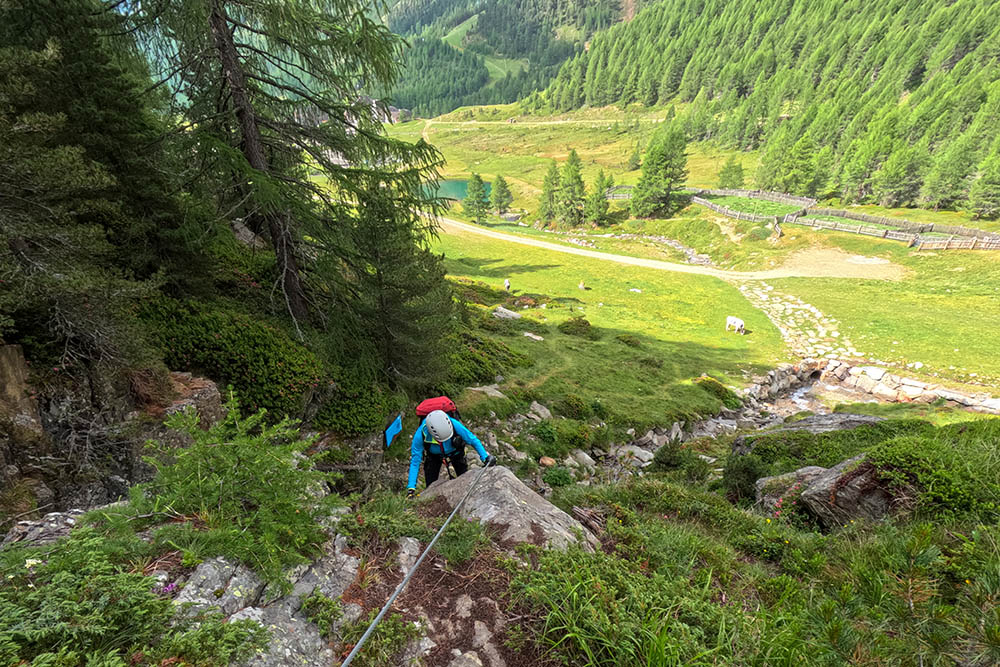
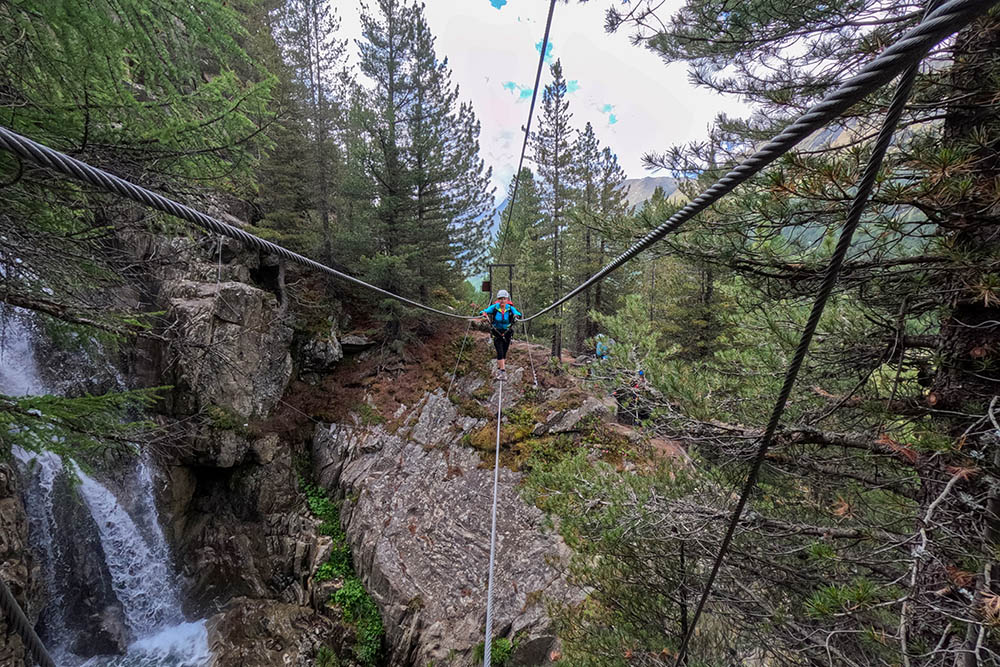
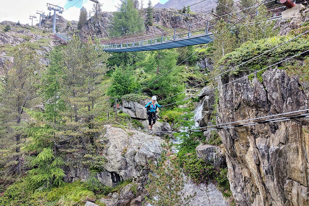
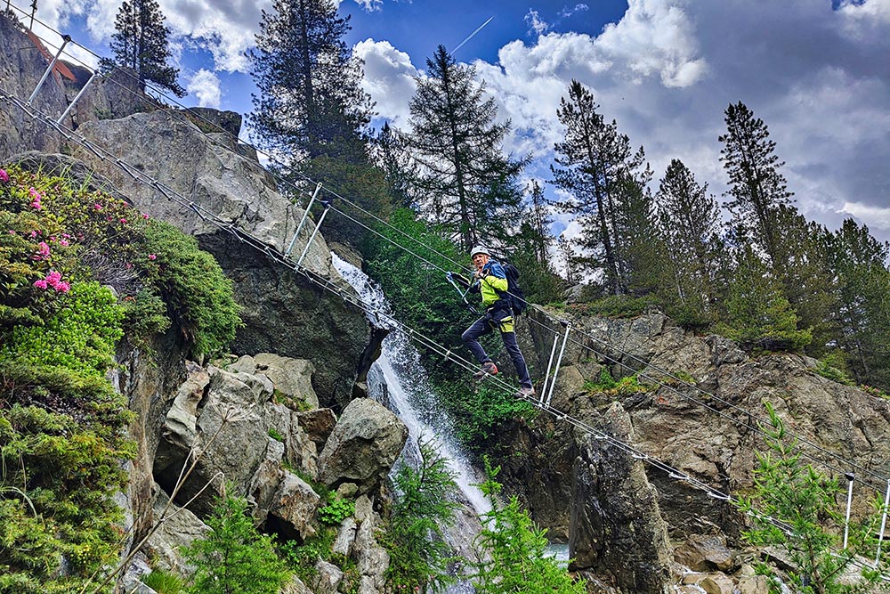
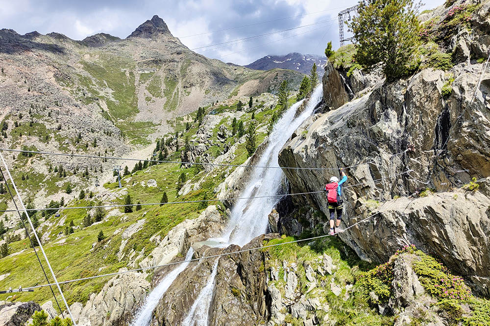
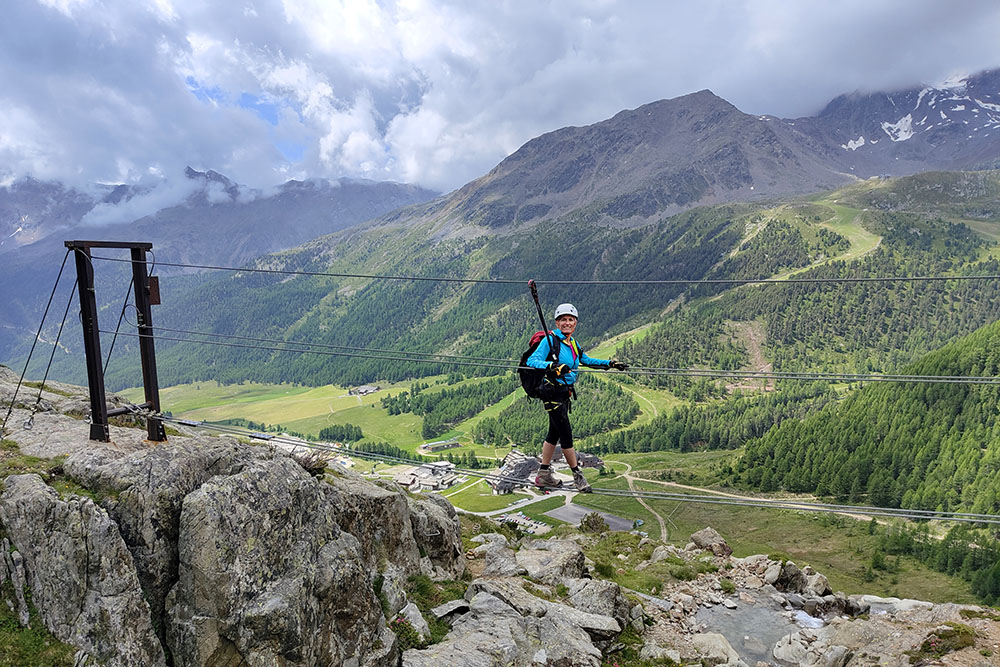
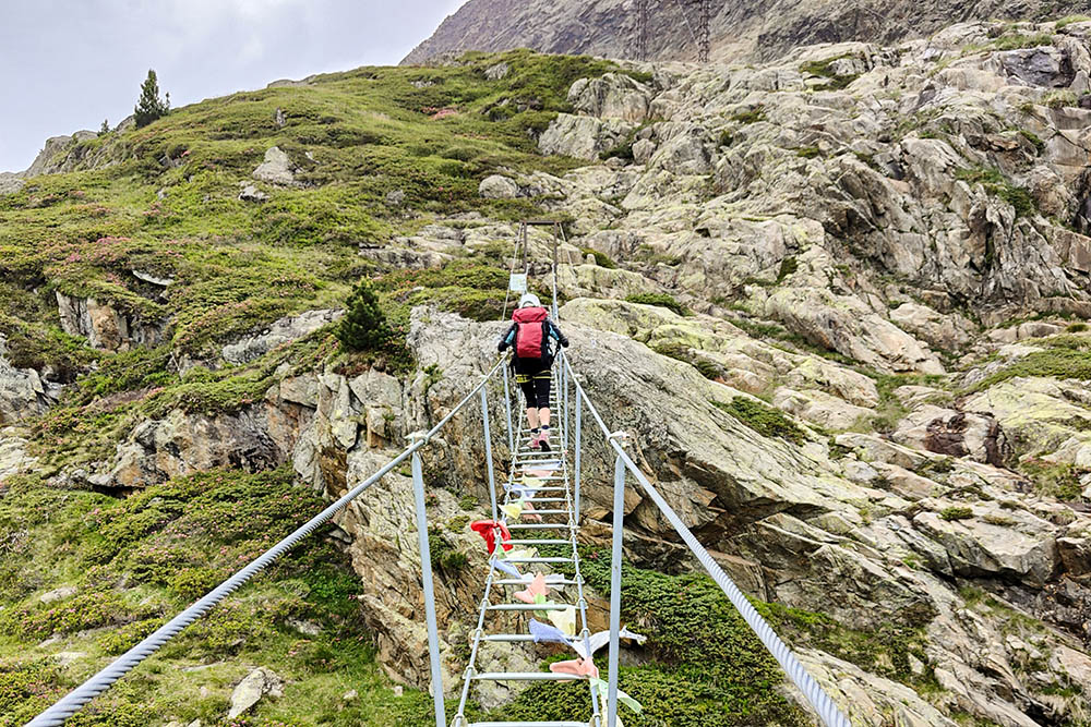
During the excursion, you will be surprised by a number of interesting and adrenaline-pumping attractions that will make your trip even more enjoyable. You'll traverse suspension bridges, wire rope stairways, and even a pulley passageway, all of which will make you feel like you're part of a real adventure. Along the entire route, you will be accompanied by water, with its waterfalls and streams, which will help make the experience even more magical and evocative.
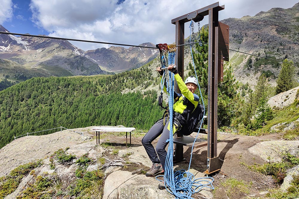
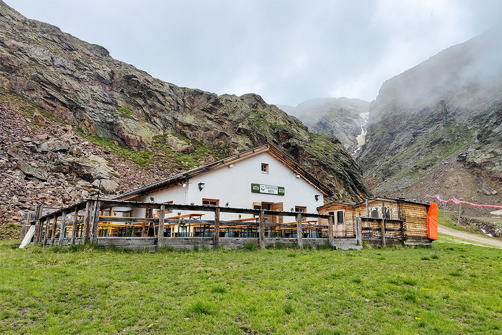
The Via Ferrata Larix can be classified as moderately difficult, with grade B/C passages. The challenge will be stimulating, offering a perfect balance between excitement and safety. In the upper part of the route, from the Rotkofelsee lake to the Rifugio Teufelseeg, the via ferrata becomes easier and the sections of the path increase considerably, offering moments of relaxation and the possibility of enjoying the surrounding panoramas.
ITINERARY
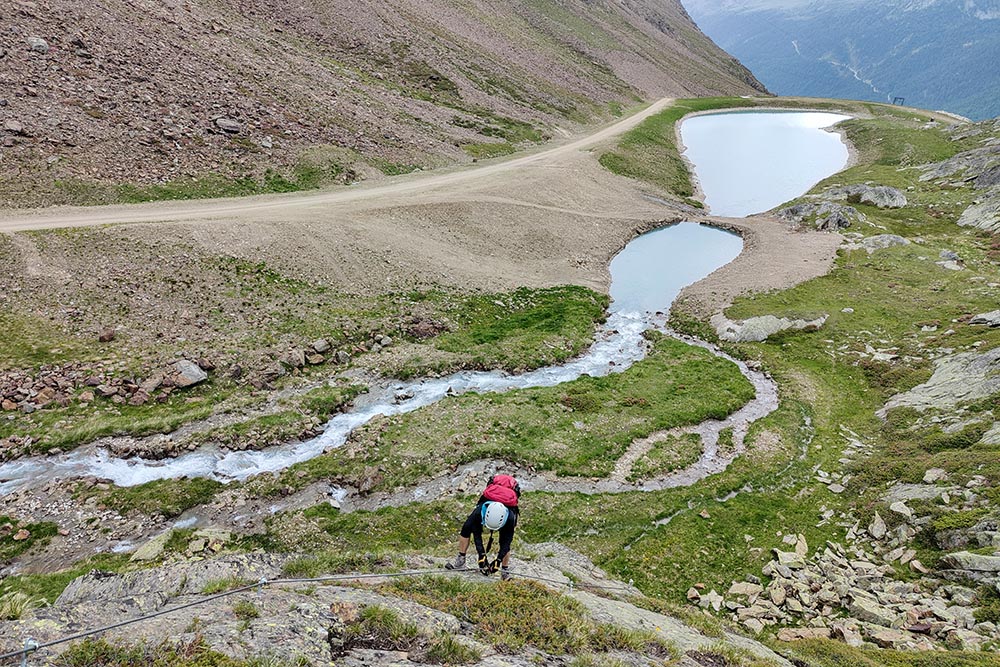
From the Maso Corto car park (2008 m) go towards the Roter Kofel chairlift, because that is where the path starts. After a few minutes you arrive at the start of the via ferrata. You pass some suspension bridges, stairs and a passage with a pulley. Once you reach the Rotkofelsee lake (2340 m) the sections of via ferrata decrease, leaving space only for the path that leads to the Rifugio Teufelsegg (2444 m). Now you return to the starting point along the Alpine Trail.
EXCURSION DATE
July 4, 2023
STARTING POINT
Maso Corto
REFRESHMENT POINT
Rifugio Teufelsegg
AUTHOR’S SUGGESTIONS
If someone in the group does not want to do the via ferrata, they can follow the other participants along the Alpin Trail hiking trail (marked by red Sant Andrea crosses) which runs parallel to the via ferrata.
SAFETY TIPS
The viability of the proposed itinerary, like all mountain morphology, is subject to environmental changes due to natural events and weather conditions. So, before leaving, consult the competent tourist offices and / or the refuges of reference.
Our GPX tracks are only indicative, that is, the route was carried out at best with the conditions of the trails and weather of that day. So always evaluate what to do on site.
Also remember to evaluate the route based on your physical abilities, training and the equipment you have.
You should leave someone the route you intend to do told.
Remember that the emergency number is 112.
EQUIPMENT
It is recommended to have the appropriate equipment: technical mountain clothing, boots with vibram sole or similar, via ferrata set, harness, helmet, via ferrata gloves, goggles, sunscreen, backpack with drinks.
RECOMMENDED MAPS
Tabacco 04 Val Senales - Naturno / Schnalstal – Naturns
INTERESTING LINKS
https://www.valsenales.com/it/
HOW TO ARRIVE
From Merano SS38. After Naturno, turn right towards Val Senales/Schnalstal, pass the Vernagt basin and climb up to Maso Corto.
PARKING AREA
For a fee at Maso Corto
GPS coordinates: 46.756147, 10.783683
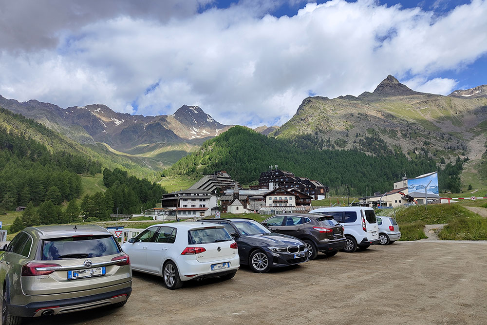
Parcheggio a Maso Corto
Siamo in prossimità dell'attacco
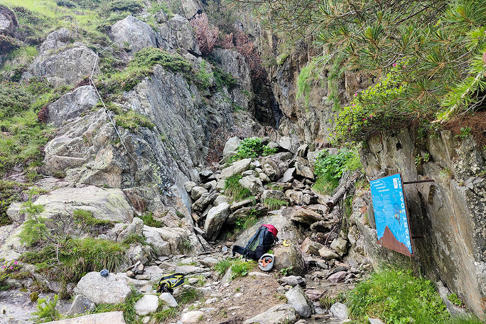
Attacco della via ferrata
Si inizia a salire
Primo ponte
Secondo ponte
Si sale su una scala metallica
Passaggio con carrucola
La via ferrata è sempre accompagnata dal torrente
Altro bellissimo ponte
Ultimo ponte
Altra scala
Piccolo traverso
Superato il laghetto Rotkofelsee
Il Rifugio Teufelseeg


