


![]()


Durata
 3:30 h
Distanza
 7,5 km
 Ascesa
 594 m
594 mDiscesa
 594 m
594 mH Max
 710 m
710 mH Min
 221 m
221 mMonte Corno di Nago: rings of Perlone and Predabusa
DESCRIPTION
Pleasant excursion in the Upper Garda Trentino between history and breathtaking views.
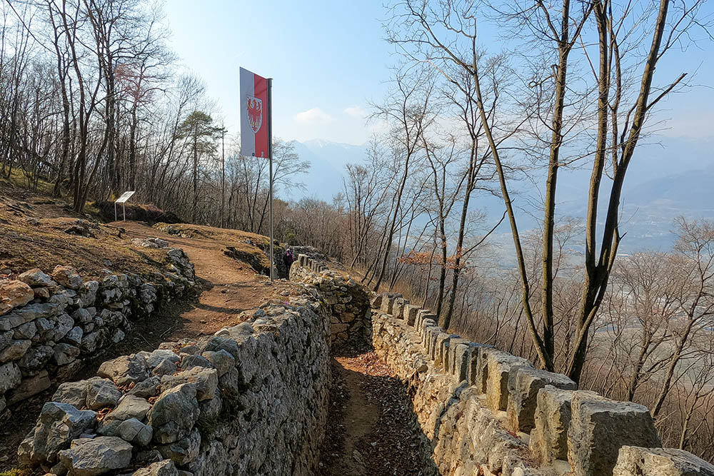
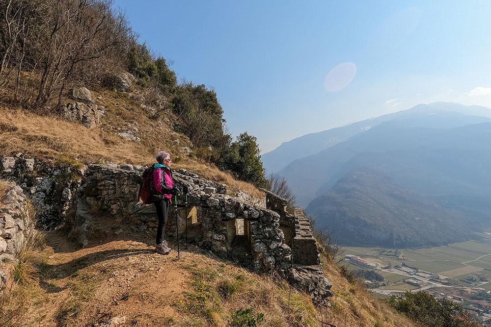
The ring tour that we propose is a historical / naturalistic itinerary departing from the town of Nago. We will retrace the sites of the First World War along the main military fortifications of Monte Corno di Nago, which was part of the first Austro-Hungarian line. The fortifications have recently been restored by groups of volunteers. We will also pass through woods and chestnut groves, being able to enjoy magnificent panoramic points of the Upper Garda.
ITINERARY
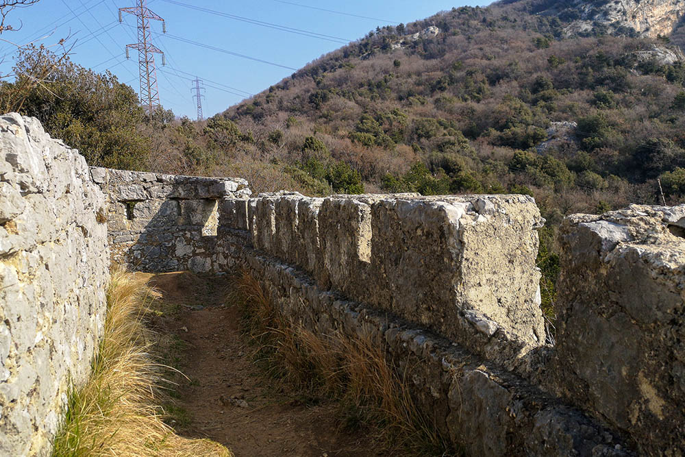
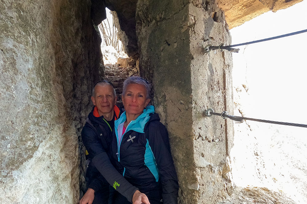
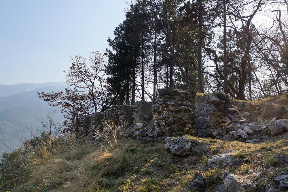
From the roundabout in Nago (221 m) take the signpost indicating Monte Corno - Anello del Perlone. After about 400 m you arrive at the first fortification: the Fuciliera (370 m). Continue always following the Monte Corno - Perlone ring trail to reach Castagneto di Nago (400 m) and then to Busa dei capitani (480 m). Now go towards Tre Croci path n. 637. You pass the remains of the quarter and arrive at the Tre Croci (579 m). Now follow the Monte Corno Anello di Predabusa signpost and arrive at the Caposaldo A.U. Preda Busa (750 m) - we are at the highest point of the excursion. Go back and pass through the Trench towards Arco. Continue to descend and then take the detour to the Trincea della Salina (490 m). Return to the main path and at the first crossroads go right to the Perlone artillery post, where there is an iron cross in memory of the Tyrolean soldiers who died in the war. Return to path 637 and descend towards Nago meeting the last fortification: the fortified post AGO (350 m). The last stretch is on an asphalted road.
EXCURSION DATE
March 19, 2022
STARTING POINT
Nago
REFRESHMENT POINT
Nobody
AUTHOR’S SUGGESTIONS
The excursion can also be done in half a day and if you go in summer, bring plenty of water.
SAFETY TIPS
The viability of the proposed itinerary, like all mountain morphology, is subject to environmental changes due to natural events and weather conditions. Therefore, before leaving, consult the competent tourist offices and / or the refuges of reference.
Our GPX tracks are only indicative, that is, the route was carried out at best with the conditions of the trails and weather of that day. So always consider what to do on site.
Also remember to evaluate the route based on your physical abilities, training and the equipment you have.
You should leave someone the route you intend to do told.
Remember that the emergency number is 112.
EQUIPMENT
It is recommended to have the appropriate equipment for the route, weather conditions and season: windproof and / or rain jacket, map and / or GPS device, goggles, sunscreen, boots, first aid kit, specific clothing, gloves, backpack with food and drink.
RECOMMENDED MAPS
Tabacco 061. ALTO GARDA - LEDRO - MONTE BALDO NORD
INTERESTING LINKS
http://www.trentinograndeguerra.it/
HOW TO ARRIVE
A22 Rovereto Sud exit: go towards Riva del Garda on the SS240. Pass the Loppio Lake and the San Giovanni Pass and continue to Nago.
PARKING AREA
In Nago near the roundabout
GPS coordinates: 45.878308, 10.888240
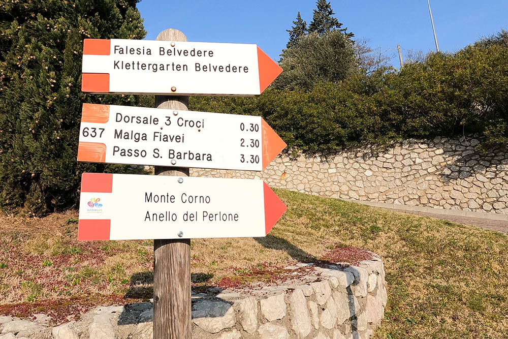
Punto di partenza a Nago
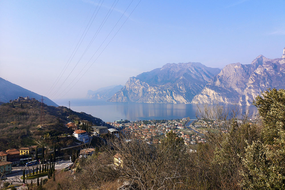
Alzandosi si acquista un bel panorama
Fuciliera
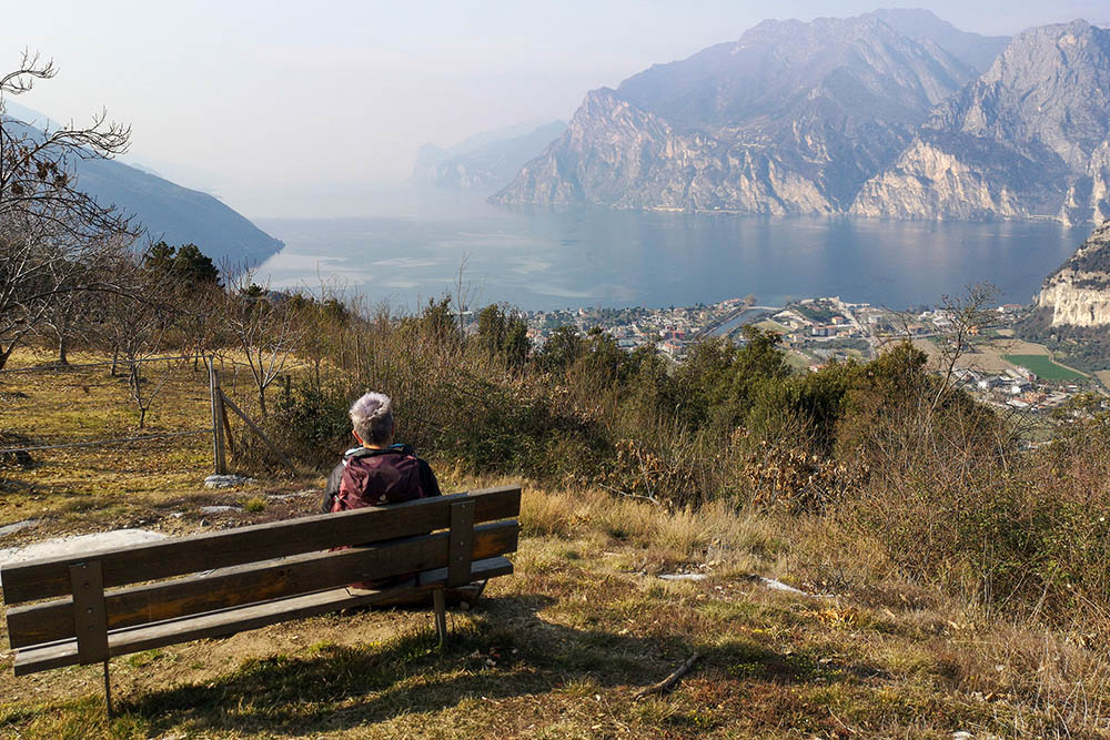
Bel punto panoramico sul Lago di Garda
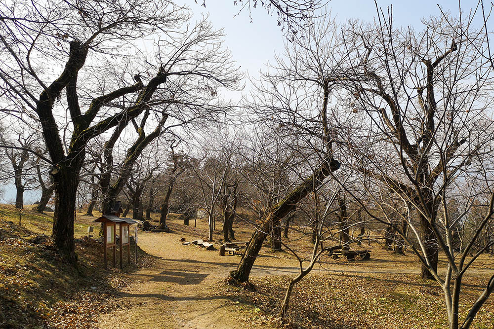
Il Castagneto di Nago
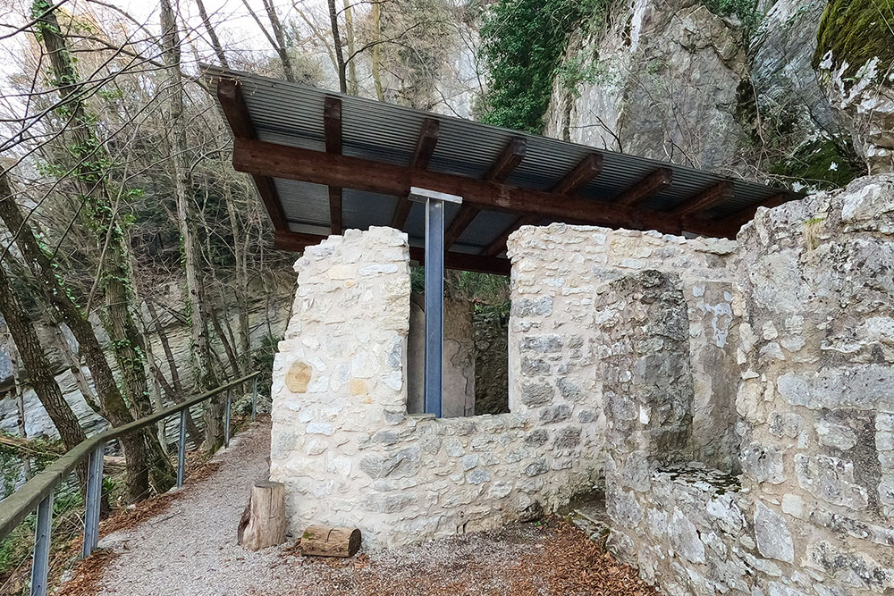
La Busa dei capitani
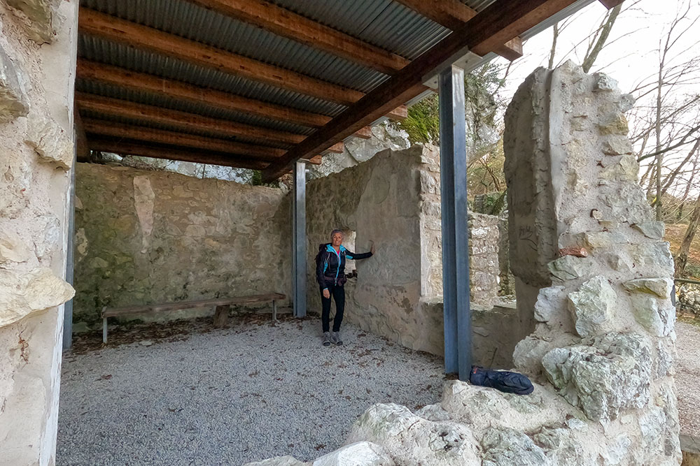
La Busa dei capitani - L'interno del principale edificio
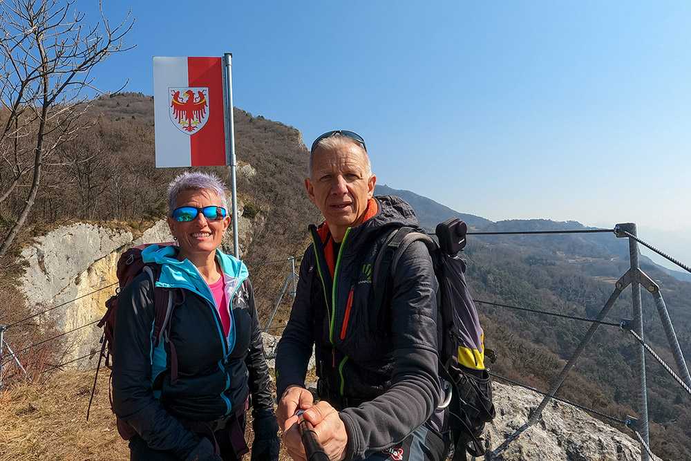
Stützpunkt Preda Busa
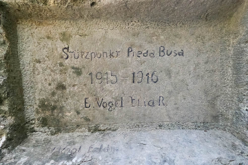
Stützpunkt Preda Busa
Stützpunkt Preda Busa
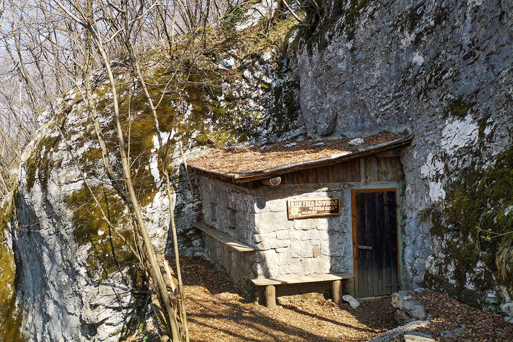
Feld Kommando Preda Busa
Trincea verso il paese di Arco
Trincea della Salina
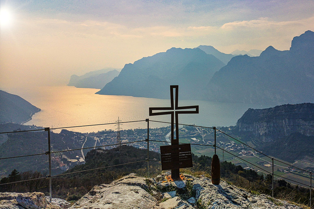
Croce in memoria dei soldati tirolesi caduti in guerra
Postazione fortificata AGO


