


![]()


Durata
 4:00 h
Distanza
 12,7 km
 Ascesa
 797 m
797 mDiscesa
 797 m
797 mH Max
 2281 m
H Min
 1484 m
Resciesa toboggan run
DESCRIPTION
The Rasciesa toboggan run, or Resciesa, is an exciting and spectacular slope located in one of the most beautiful valleys in South Tyrol, Val Gardena.
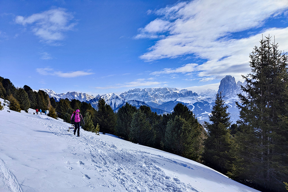
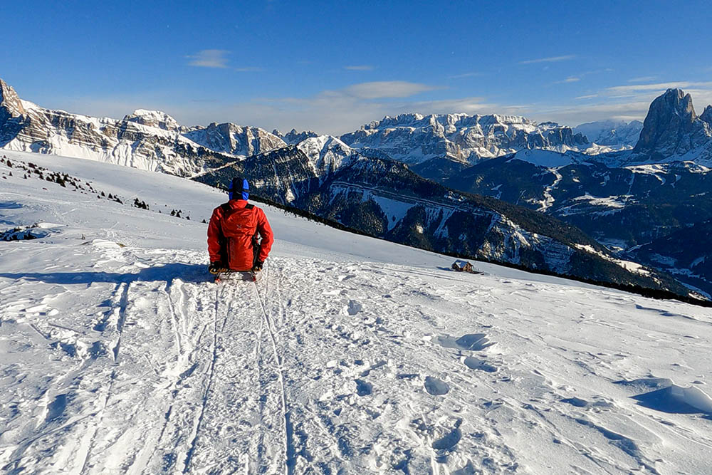
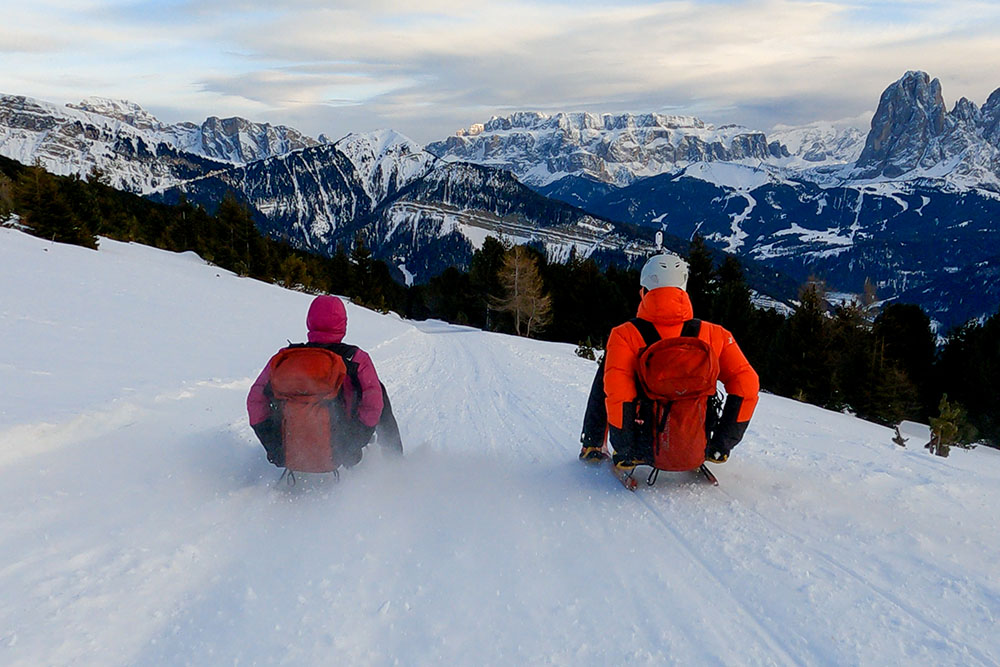
With a length of approximately 5 km, the track has been designed to satisfy all levels of ability, from beginners to the most expert, and offers breathtaking curves and exciting descents that will give all hikers unforgettable moments. For those who don't have their own gear, no need to worry. There are sled rentals on site to make the experience even easier. You can go up either on foot or with the ski lifts. Upstream of the slope you will also find some refreshment points where you can taste the local specialties and enjoy the magnificent view of the Odle, the Sella, the Sassolungo and Sassopiatto, the Catinaccio and the Sciliar.
In summary, if you are looking for an exciting and adrenaline-pumping toboggan experience, the Resciesa toboggan run in Val Gardena is the right place for you!
ITINERARY
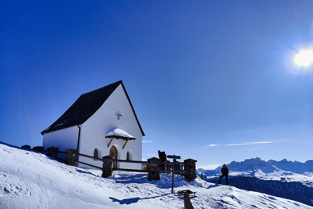
From the small parking lot in Ortisei (1484 m) go up following trail no. 9. The first section coincides with the track, then, where pedestrians are forbidden, turn right and always follow trail no. 9 you reach Baita Cason (2115 m). Here you take path 35 arriving first at the Rifugio Resciesa (2170 m) and then at the Chapel of Santa Croce (2200 m). Now you go up to the n. 10 arriving at the Crocefisso at the top of the Rasciesa di Fuori peak (2281 m). Descend by sled or on foot to the Rifugio Resciesa. From the hut you go down to the valley on the toboggan run back to the starting point.
EXCURSION DATE
January 28, 2023
STARTING POINT
Str. Cuca, Ortisei
REFRESHMENT POINT
Baita Cason (2115 m) and Rifugio Resciesa (2170 m)
AUTHOR’S SUGGESTIONS
Go to the two viewpoints near the Rifugio Resciesa: the Chapel of Santa Croce and the Crucifix on the summit of the Rasciesa di Fuori.
SAFETY TIPS
The stability of the snow cover is subject to sudden and unpredictable changes. For your safety, always consult the avalanche bulletin because the snow cover is subject to rapid changes, ask for information from the competent offices of the place. Our GPX tracks are only indicative, that is, the route was carried out as best as possible with the snow and weather conditions of that day. So always evaluate locally what needs to be done.
In addition, remember to evaluate the route based on your physical abilities, training, and equipment that you have.
It is advisable to tell someone the itinerary that you intend to do.
Remember that the emergency number is 112.
EQUIPMENT
It is recommended to have the appropriate equipment for the trail, weather conditions and season: sled, windbreaker and/or rain jacket, map and/or GPS device, sunglasses, sunscreen, hiking boots, first aid kit, specific winter clothing, crampons, gloves, backpack with food and hot drinks.
RECOMMENDED MAPS
05. Val Gardena - Alpe di Siusi/Gröden - Seiseralm
INTERESTING LINKS
https://www.rifugioresciesa.com/it/
HOW TO ARRIVE
SS242 of Val Gardena. In Ortisei, at the roundabout, go up to the left towards Rasciesa, or Resciesa, and then continue along Via Cuca.
PARKING AREA
Small 8-space car park in Ortisei.
GPS coordinates: 46.583574, 11.687460
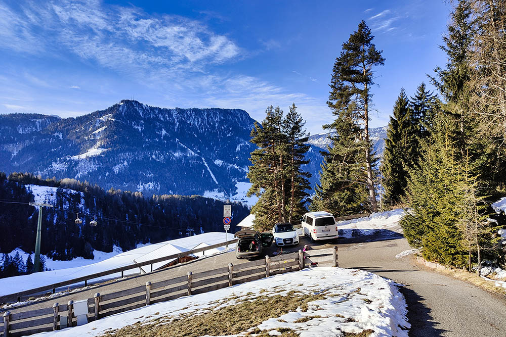
Il piccolo parcheggio a Ortisei
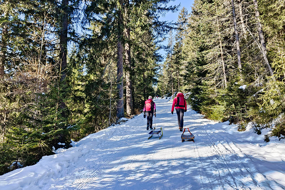
Sul primo tratto
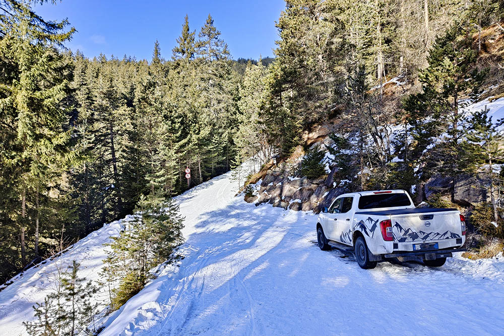
Si lascia la pista e si sale seguendo il segnavia 6
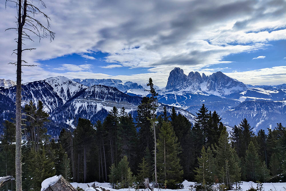
Vista sul Sella e Sassolungo
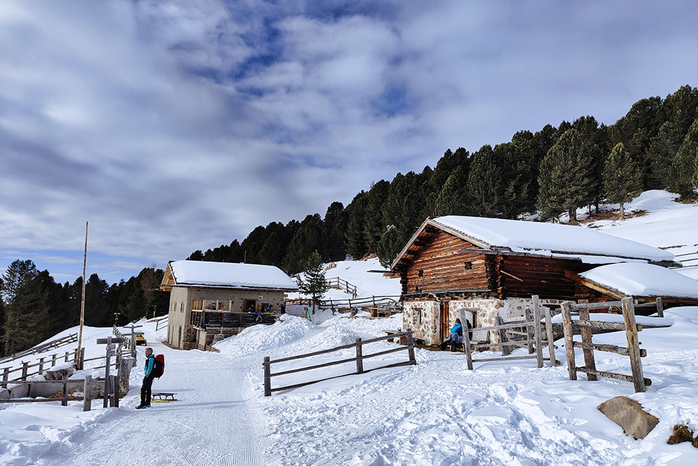
Arrivati alla Baita Cason
Tratto in pianura
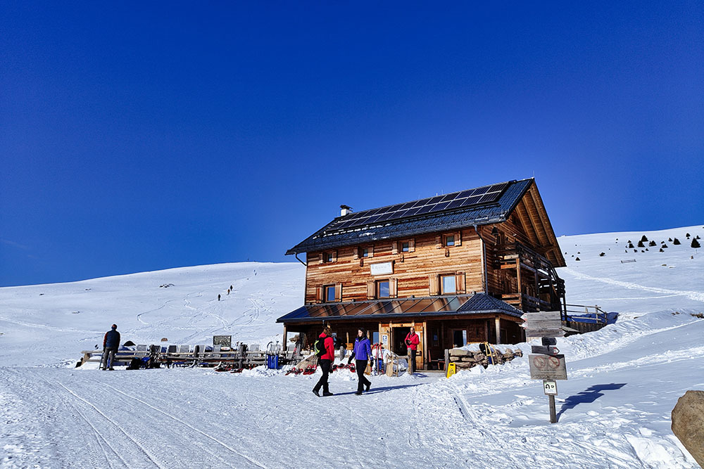
Il Rifugio Resciesa
Cappella di Santa Croce
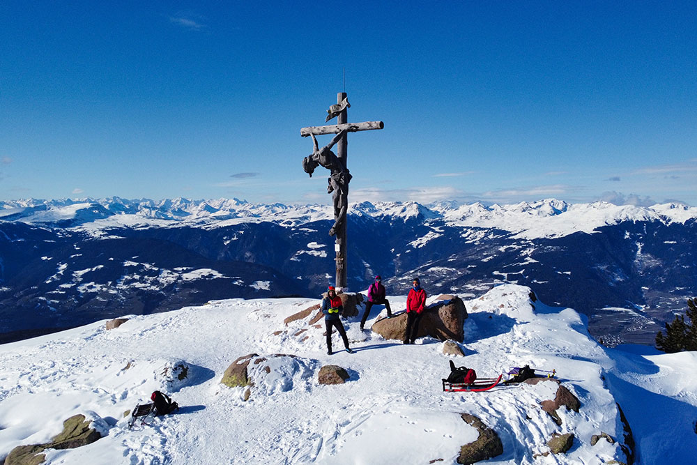
Cima della Rasciesa di Fuori
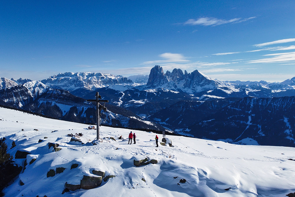
Spettacolare vista dalla vetta
Si ritorna al Rifugio Resciesa
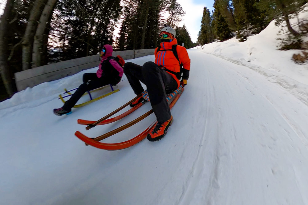
Si inizia la pista da slittino
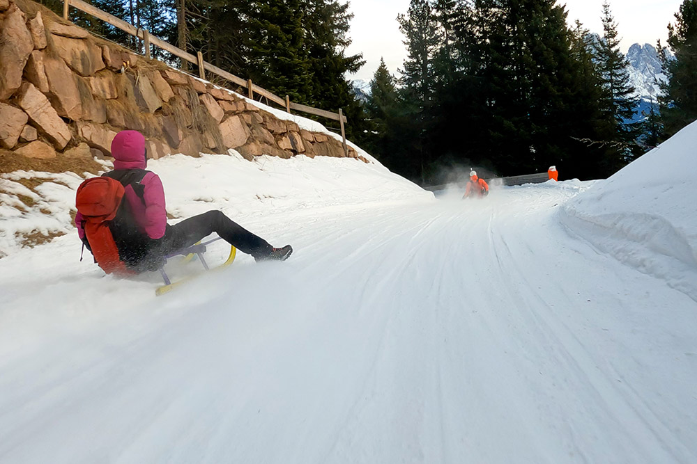
Si prende molta velocità
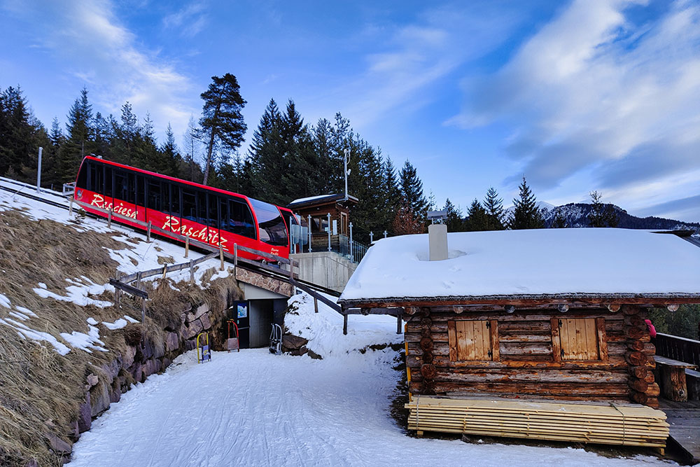
Punto di risalita intermedia della Funicolare Resciesa
Ultimo tratto di pista


