


![]()


Durata
 2:00 h
Distanza
 1,2 km
 Ascesa
 230 m
230 mDiscesa
 230 m
230 mH Max
 812 m
812 mH Min
 610 m
610 mFerrata di Preore or Sentiero Artpinistico delle Niere
DESCRIPTION
Low-altitude via ferrata that is also interesting from an artistic point of view.
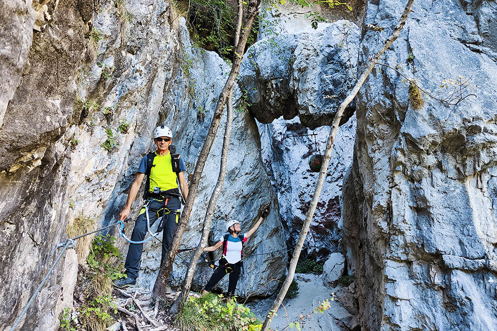
The via ferrata is not very long and is interspersed with frequent wooded points. It's easy? Not really. Some points, the first 30-meter stretch and others after, require some physical effort. Beginners and children must be supported by experienced people. Along the way, you will encounter artistic works accompanied by mottos or aphorisms, which make the hiker reflect on social, cultural and even philosophical issues. The route is well marked.
ITINERARY
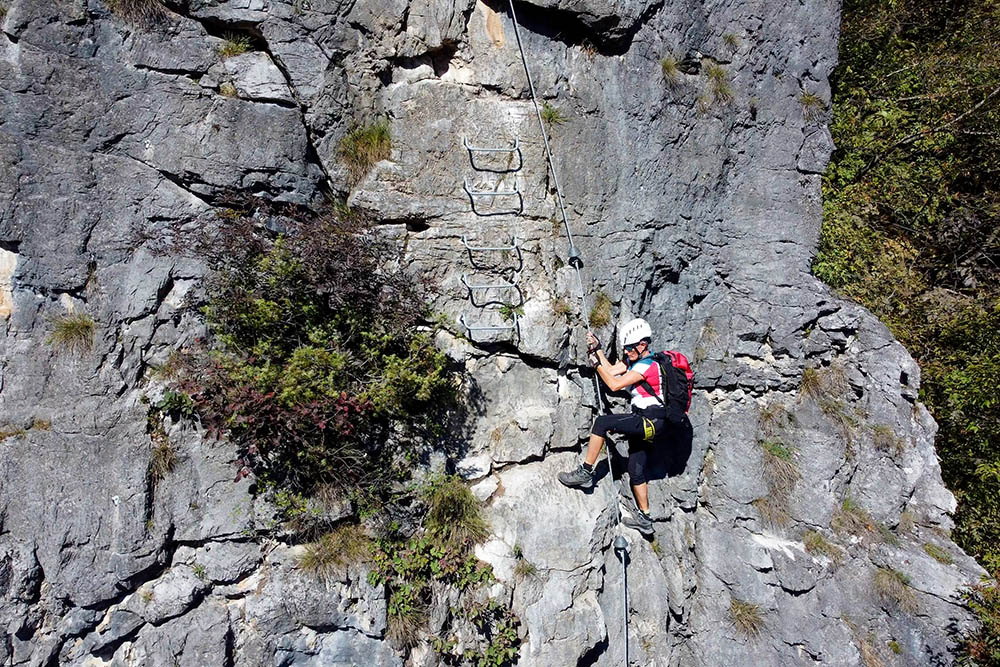
From the car park (633 m), follow the signs for Palestra di Roccia. Arriving at the climbing wall (610 m), go up to the right and in a very short time you will arrive at the start of the via ferrata (620 m). Going up, you cross a steel cord bridge, you reach the summit book and the highest point (812 m), and then descend for some aided sections and along the path, returning to the starting point.
EXCURSION DATE
2 October 2020
STARTING POINT
Parking at the Rock Gym
REFRESHMENT POINT
Nobody
AUTHOR’S SUGGESTIONS
Obviously it is not recommended for people suffering from vertigo.
SAFETY TIPS
The viability of the proposed itinerary, like all mountain morphology, is subject to environmental changes due to natural events and weather conditions. So, before leaving, consult the competent tourist offices and / or the refuges of reference.
Our GPX tracks are only indicative, that is, the route was carried out at best with the conditions of the trails and weather of that day. So always evaluate what to do on site.
Also remember to evaluate the route based on your physical abilities, training and the equipment you have.
You should leave someone the route you intend to do told.
Remember that the emergency number is 112.
EQUIPMENT
It is recommended to have the appropriate equipment: technical mountain clothing, boots with vibram sole or similar, via ferrata set, harness, helmet, via ferrata gloves, goggles, sunscreen, backpack with drinks.
RECOMMENDED MAPS
077 ADAMELLO SUD - VAL RENDENA - VAL DAONE
INTERESTING LINKS
https://www.trentino.com/it/trentino/valli-giudicarie/tre-ville/preore/
HOW TO ARRIVE
From Trento follow the SS237 to Ponte Arche and then continue towards Tione. After the tunnels, turn right at the first intersection, following the signs for Ragoli - Preore. After the center of Preore, turn right uphill towards Montagne - Passo Daone, SP53. A little after the first bend, on the left, there is the climbing gym and the parking lot.
PARKING AREA
Near the Preore rock gym.
GPS coordinates: 46.045502, 10.749528
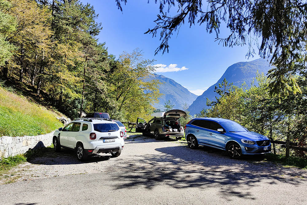
Parcheggio
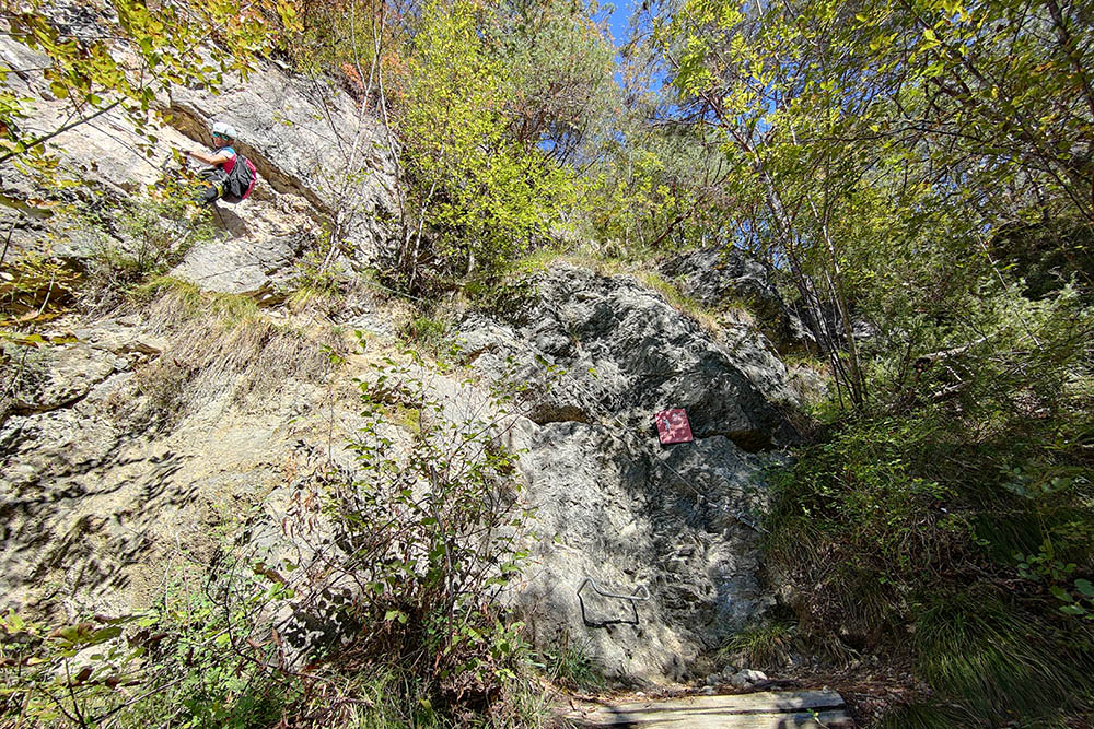
Attacco della ferrata
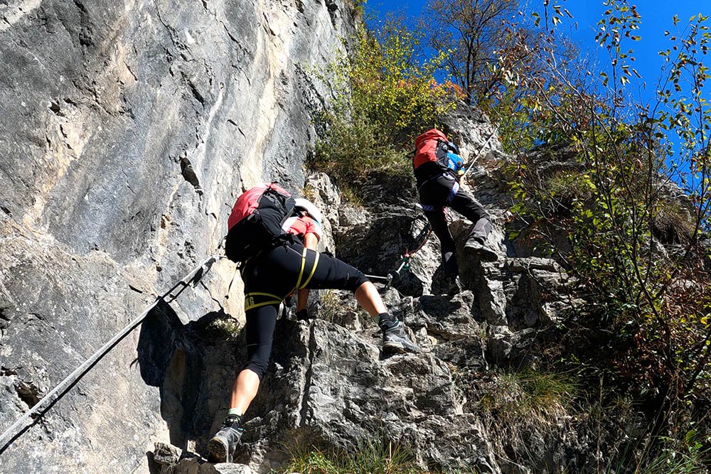
Si sale in verticale
Si sale in verticale
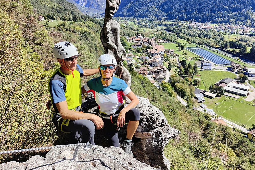
Incontriamo Lo Smilzo
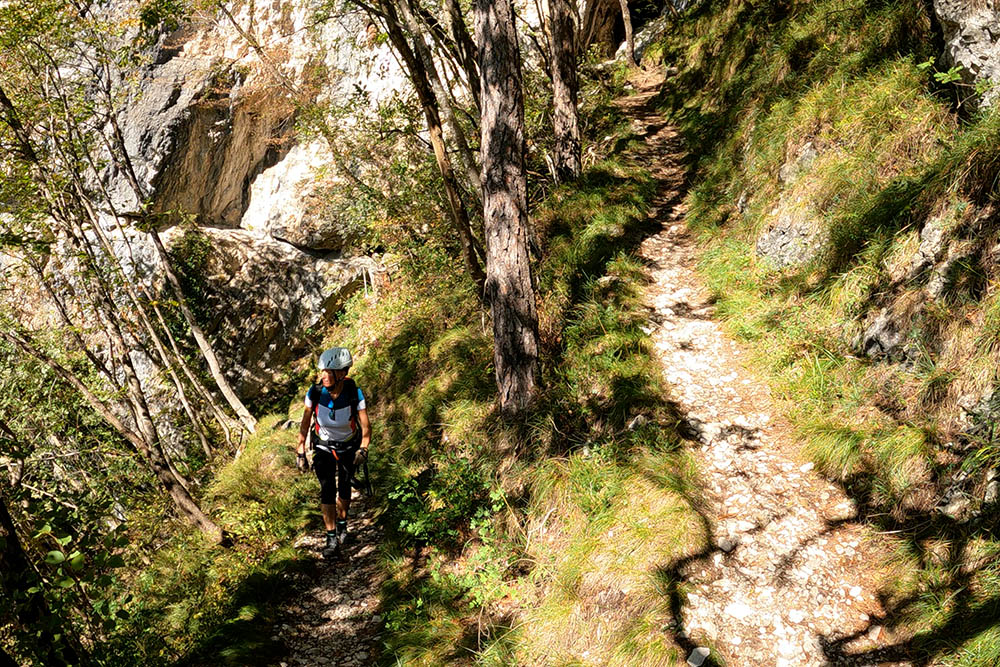
Tratto di sentiero
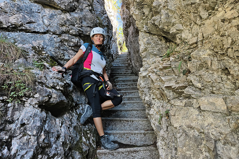
Scalinata
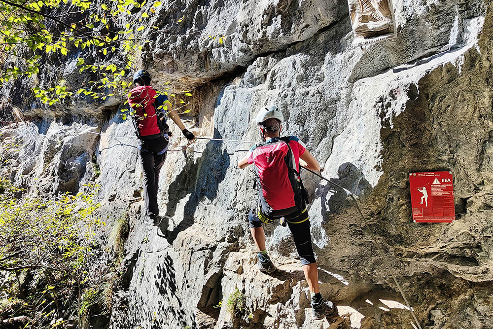
Un traverso
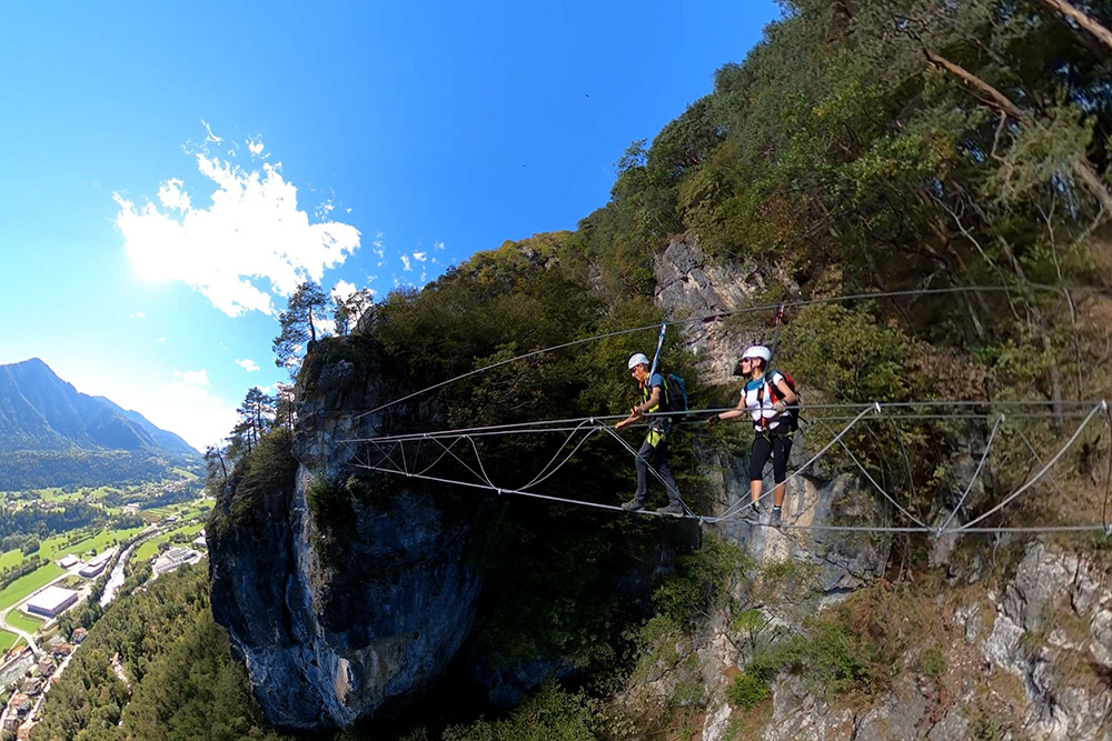
Il ponte
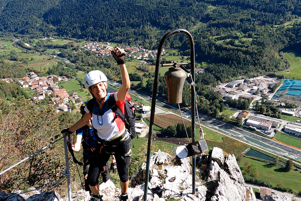
Siamo arrivati alla campanella
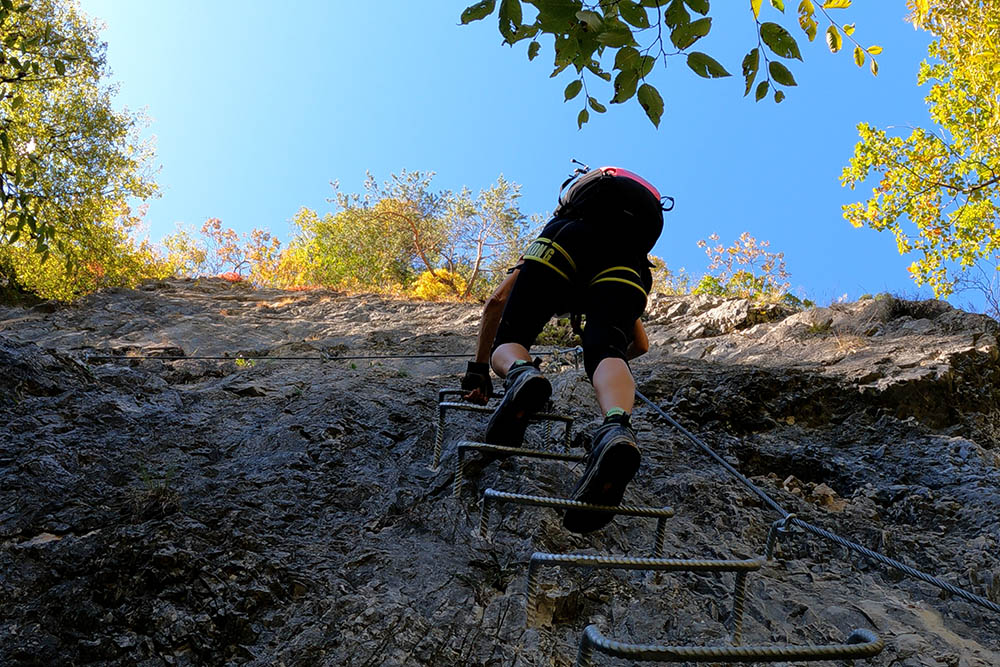
Si sale ancora su staffe
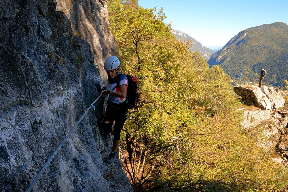
Un altro traverso
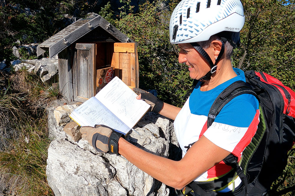
Il libro di vetta
Si scende
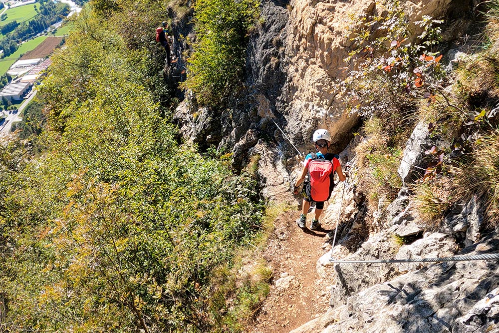
Si scende


