


![]()


Durata
 5:15 h
Distanza
 13,3 km
 Ascesa
 1050 m
Discesa
 1050 m
H Max
 2752 m
H Min
 1720 m
From Capanna Alpina to the Lake and to the Rifugio Lagazuoi
DESCRIPTION
Magnificent excursion between fabulous views of the Dolomites and painful historical memories.
The Capanna Alpina Restaurant is located at the beginning of the Fanes-Senes-Braies Natural Park.
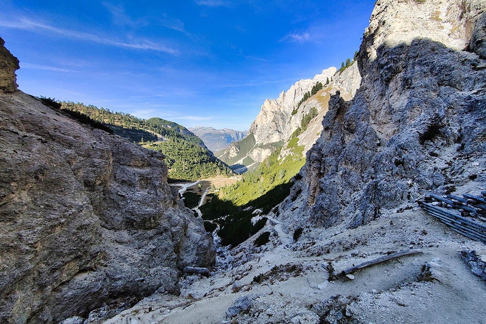
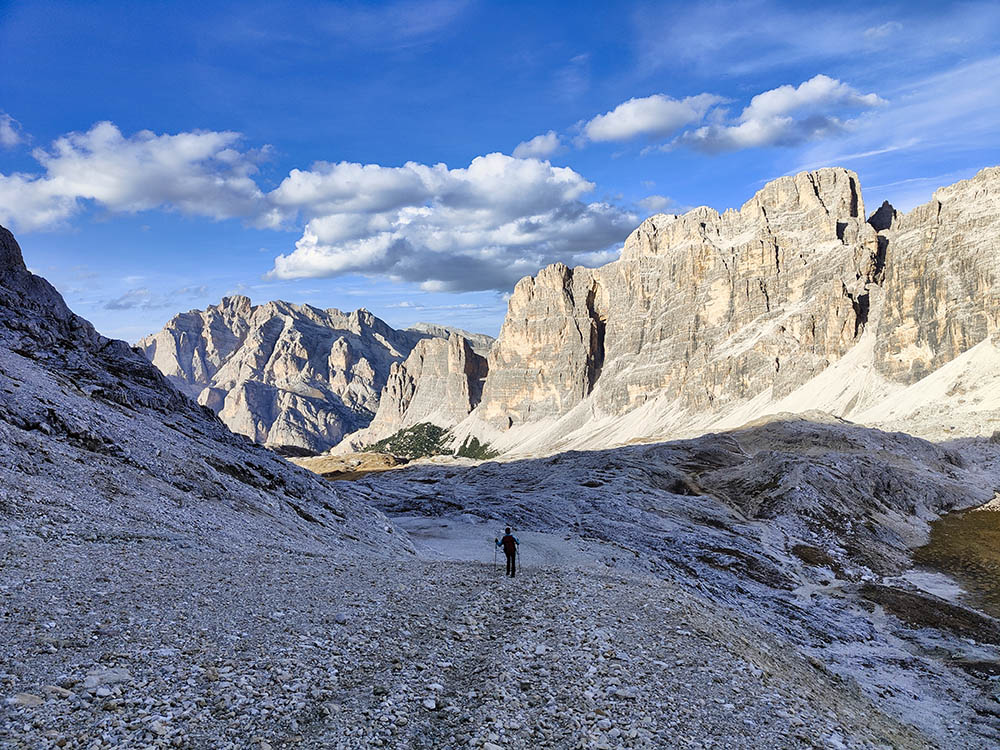
From the starting point you always go up in a magnificent Dolomite environment until you reach a wonderful refuge, the Rifugio Scotoni, a lovely alpine lake, Lake Lagazuoi, and a panoramic refuge, the Rifugio Lagazuoi. The itinerary is almost entirely circular and you walk at the foot of the rocky walls of the Fanis Group or the Fanes/Fanesgruppe Group. Near the Rifugio Lagazuoi you can visit the remains of fortifications dating back to the First World War.
ITINERARY
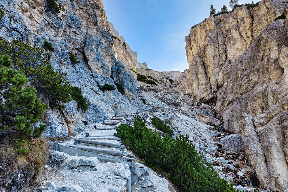
From Capanna Alpina (1720 m) take path no. 20 and in about 50 minutes you arrive at the Rifugio Scotoni (2040 m). Continue to climb along the same path and arrive at Lake Lagazuoi (2182 m). Now always ahead on the 20 reaching the Forcella Lagazuoi (2573 m). A little longer and you will arrive at the Rifugio Lagazuoi (2752 m). Return along path 20A and then 18B to the Rifugio Scotoni and then go down the same road to the starting point.
EXCURSION DATE
October 30, 2022
STARTING POINT
Capanna Alpina
REFRESHMENT POINT
Rifugio Lagazuoi
AUTHOR’S SUGGESTIONS
Bring a torch to visit the galleries of the First World War.
SAFETY TIPS
The viability of the proposed itinerary, like all mountain morphology, is subject to environmental changes due to natural events and weather conditions. Therefore, before leaving, consult the competent tourist offices and / or the refuges of reference.
Our GPX tracks are only indicative, that is, the route was carried out at best with the conditions of the trails and weather of that day. So always consider what to do on site.
Also remember to evaluate the route based on your physical abilities, training and the equipment you have.
You should leave someone the route you intend to do told.
Remember that the emergency number is 112.
EQUIPMENT
It is recommended to have the appropriate equipment for the route, weather conditions and season: windproof and / or rain jacket, map and / or GPS device, goggles, sunscreen, boots, first aid kit, specific clothing, gloves, backpack with food and drink.
RECOMMENDED MAPS
Tabacco 07 ALTA BADIA - ARABBA - MARMOLADA
INTERESTING LINKS
http://www.rifugiolagazuoi.com
HOW TO ARRIVE
SP24 from Val Badia, SR48 from Cortina d'Ampezzo
PARKING AREA
At Capanna Alpina
GPS coordinates: 46.559790, 11.981019
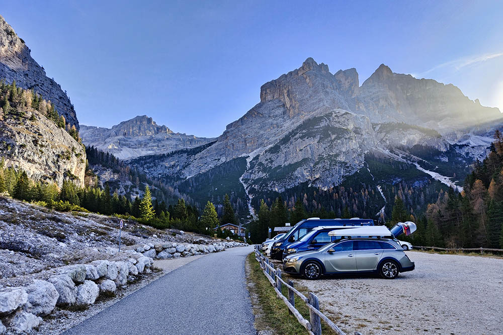
Parcheggio a Capanna Alpini
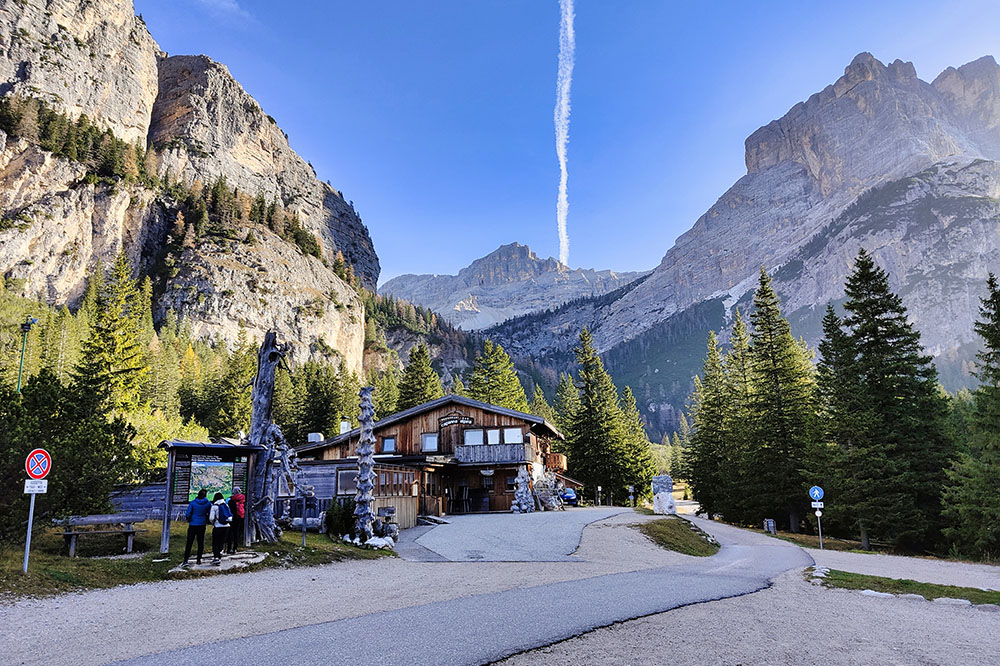
Ristorante Capanna Alpini
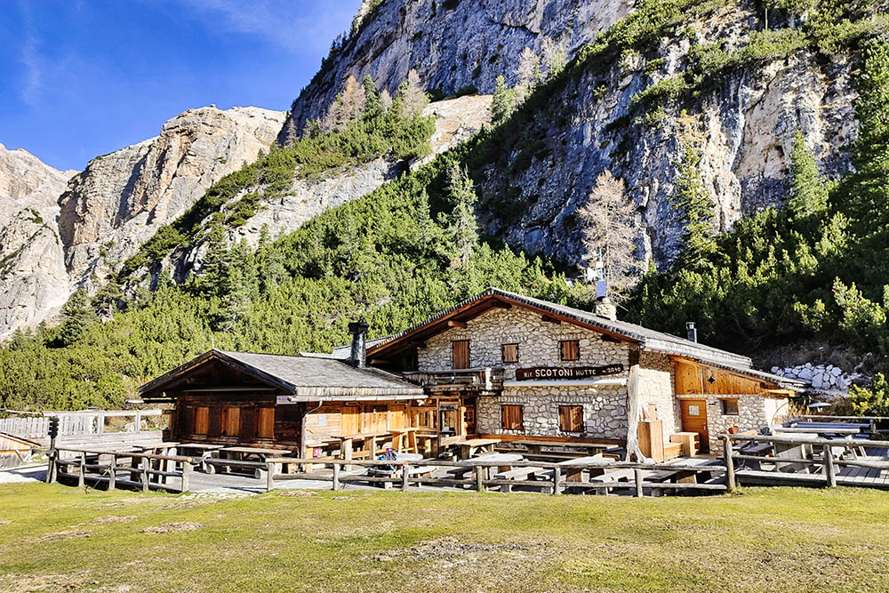
Rifugio Scotoni
Si sale per il sentiero n. 20
In lontananza il Rifugio Scotoni
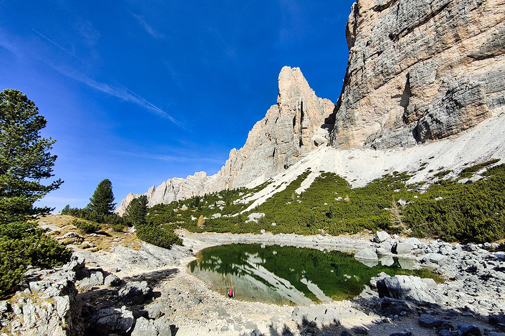
Il Lago Lagazuoi
Il Lago Lagazuoi
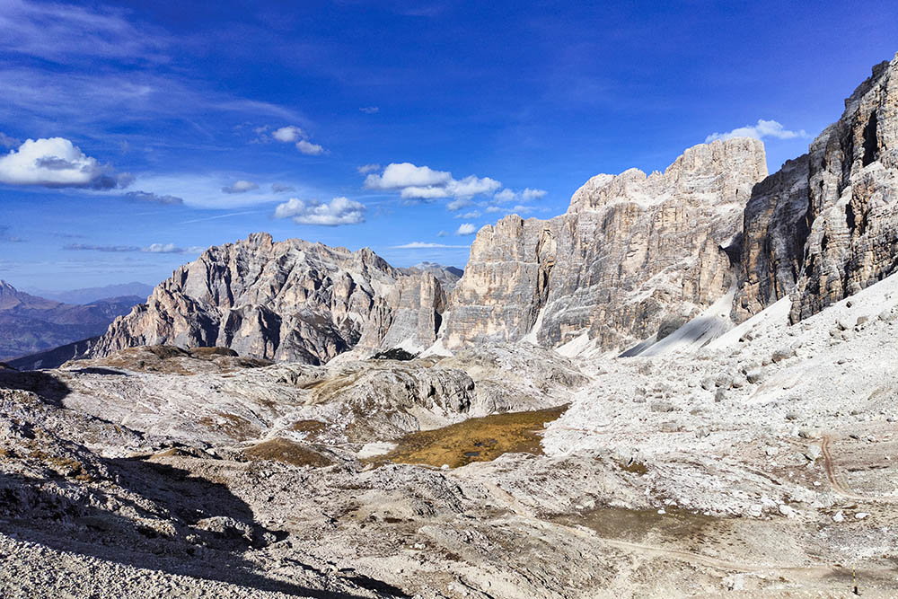
Gruppo di Fanes
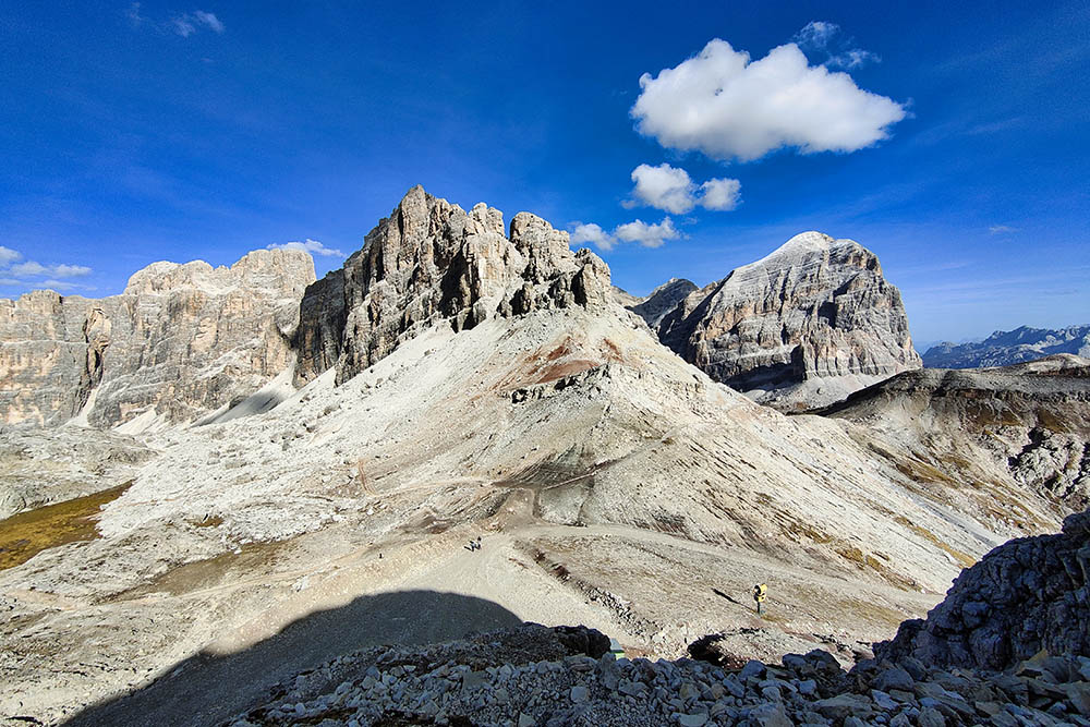
La Forcella Lagazuoi
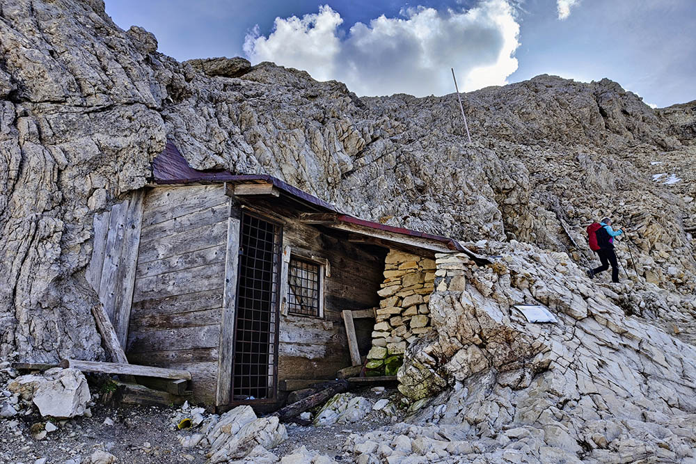
Baracca ufficiali austriaci
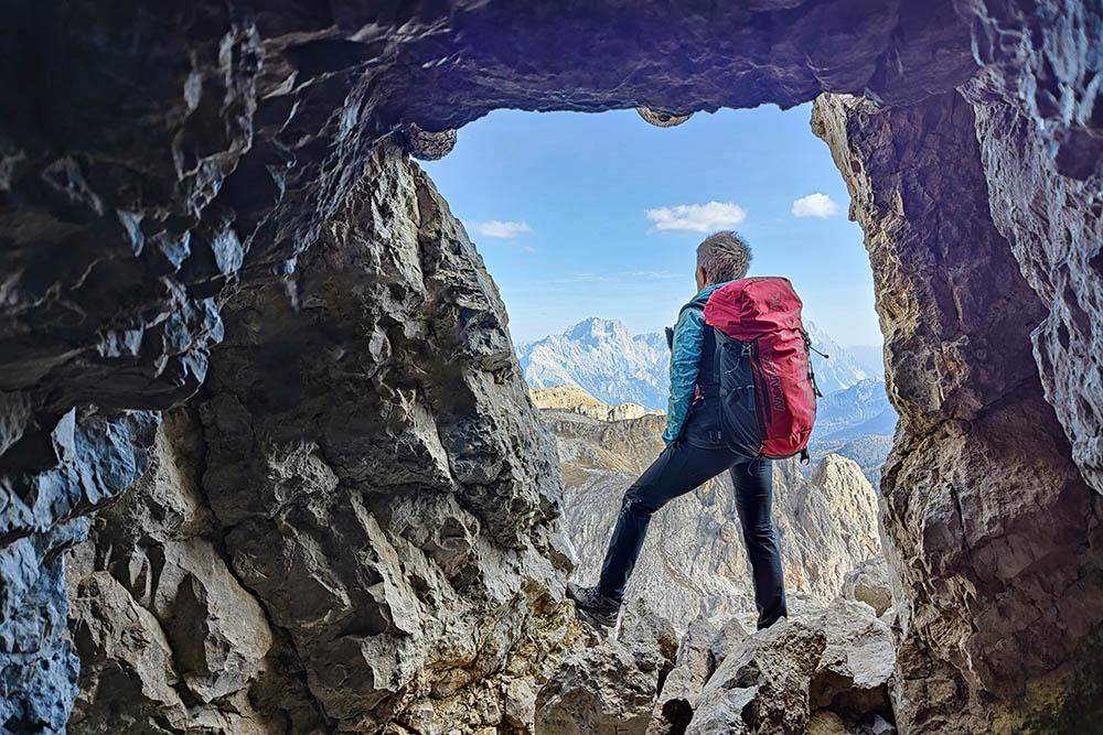
All'interno delle gallerie
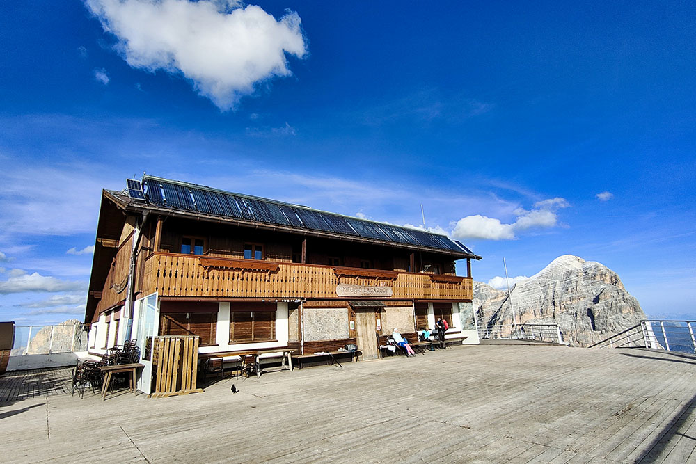
Rifugio Lagazuoi
Si scende sul sentiero 20A
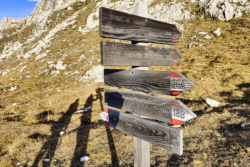
Si lascia il 20A e si prende il 18B
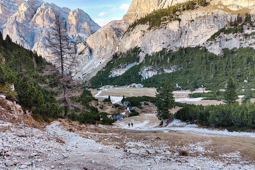
Ritorno al Rifugio Scotoni


