


![]()


Durata
 4:50 h
Distanza
 11,7 km
 Ascesa
 682 m
682 mDiscesa
 682 m
682 mH Max
 2213 m
H Min
 1572 m
Malga Durra and Alta Via di Riva
DESCRIPTION
Fabulous walk on the Alta Via di Riva.
Val di Riva is one of the most fascinating hiking areas in South Tyrol, where there is the highest concentration of mountains that exceed 3000 meters above sea level.
Our itinerary runs from 1600 to 2200 meters and partly retraces the Alta Via di Riva, passing through numerous huts, beautiful pastures and barns, always accompanied by a wonderful view of the valley and the surrounding peaks. It is a walk with a drop of just over 600 meters and is also suitable for families.
ITINERARY
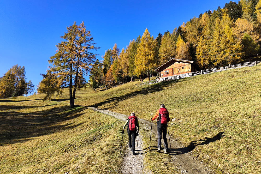
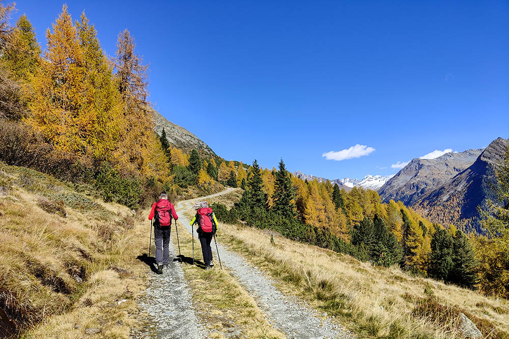
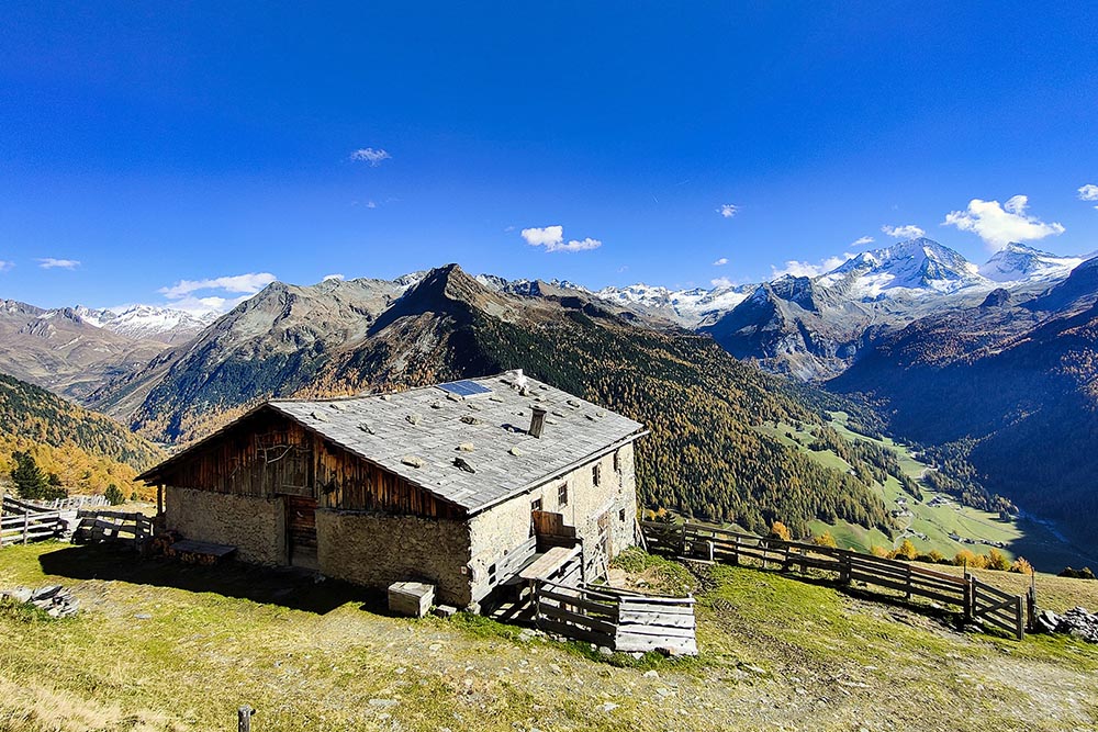
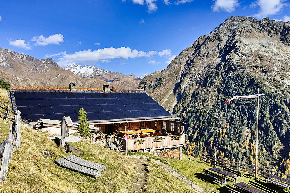
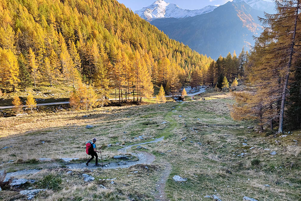
From the car park near the Church of San Volfango (1600 m) take path 10 to the pastures with barns known as Lobisa Schupfn (1950 m). Turn right onto the Alta Via di Riva - trail marker 1 A, passing the Unterrieser (1990 m) and Hirber (2090 m) huts, and a simple shepherd's hut (2214 m - highest point of the excursion). arrives at Malga Durra (2096 m). Now take path 1, which goes down to the parking lot for the Dossi hut (1690 m). At the end of the car park, take the road on the left with signpost n. 9 and descend to Riva di Tures (1572 - lowest point of the excursion). Now you return to the parking area on the paved road.
EXCURSION DATE
October 17, 2022
STARTING POINT
Riva di Tures
REFRESHMENT POINT
Malga Unterrieser (1990 m) and Malga Durra (2096 m)
AUTHOR’S SUGGESTIONS
Enjoy the delicious dishes of the mountain huts.
SAFETY TIPS
The viability of the proposed itinerary, like all mountain morphology, is subject to environmental changes due to natural events and weather conditions. Therefore, before leaving, consult the competent tourist offices and / or the refuges of reference.
Our GPX tracks are only indicative, that is, the route was carried out at best with the conditions of the trails and weather of that day. So always consider what to do on site.
Also remember to evaluate the route based on your physical abilities, training and the equipment you have.
You should leave someone the route you intend to do told.
Remember that the emergency number is 112.
EQUIPMENT
It is recommended to have the appropriate equipment for the route, weather conditions and season: windproof and / or rain jacket, map and / or GPS device, goggles, sunscreen, boots, first aid kit, specific clothing, gloves, backpack with food and drink.
RECOMMENDED MAPS
035 VALLE AURINA - VEDRETTE DI RIES / AHRNTAL - RIESERFERNER GRUPPE
INTERESTING LINKS
https://www.campo-tures.net/escursioni/
HOW TO ARRIVE
From Brunico head towards the Valle Aurina SS621. Once in Campo Tures, turn right onto the SP48 for Riva di Tures.
PARKING AREA
At the Church of San Volfango in Riva di Tures
GPS coordinates: 46.947847, 12.061140
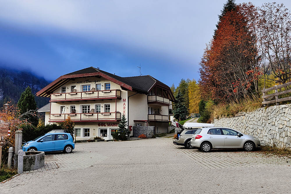
Parcheggio a Riva di Tures
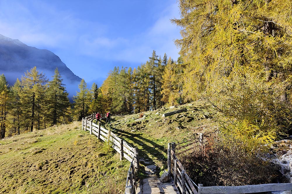
Si sale per sentiero n. 10
Si incontrano delle belle baite
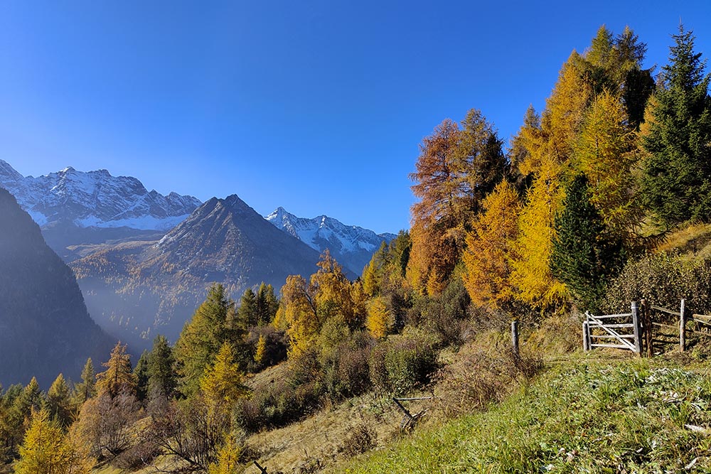
Larici colorati con alle spalle le cime innevate
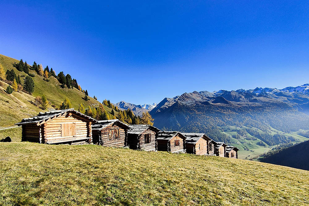
Fienili Lobisa Schupfn
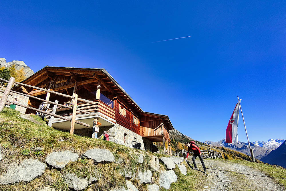
Malga Unterrieser
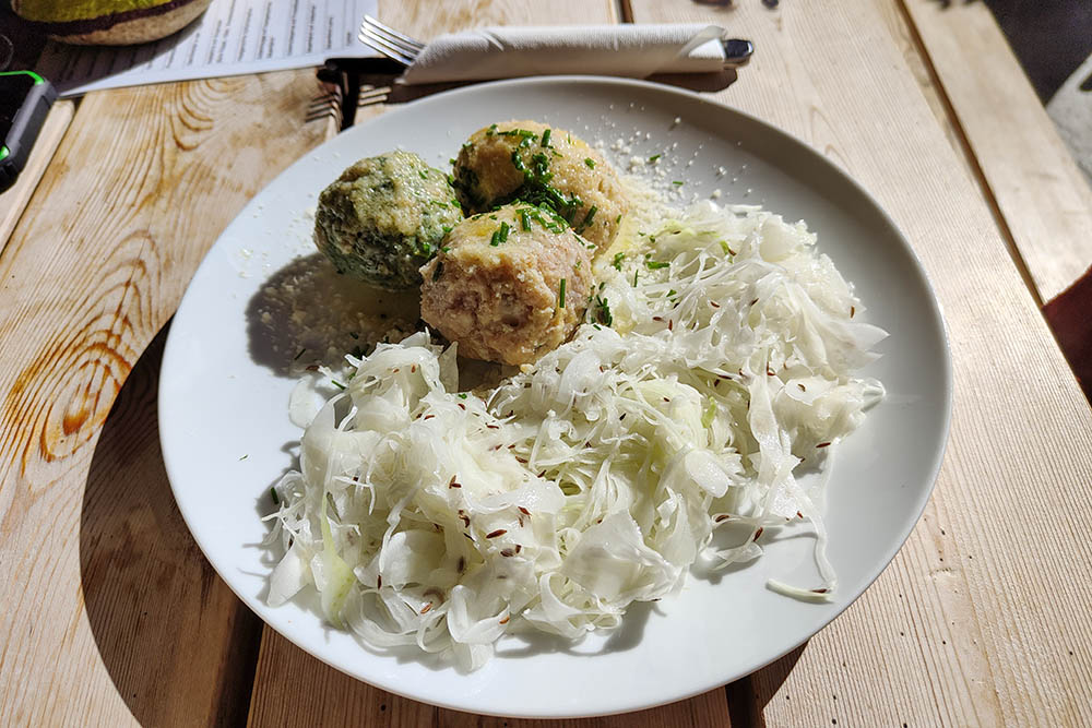
Tris di canederli
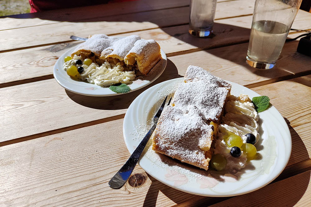
Strudel
Si cammina sull'Alta Via di Riva
Malga Hirber
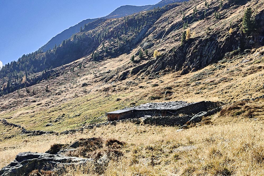
Baita di pastori
Malga Durra
Si scende sul sentiero n.1
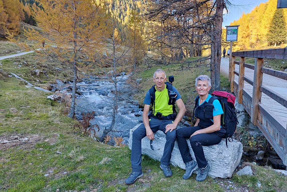
Riposiamo un po'
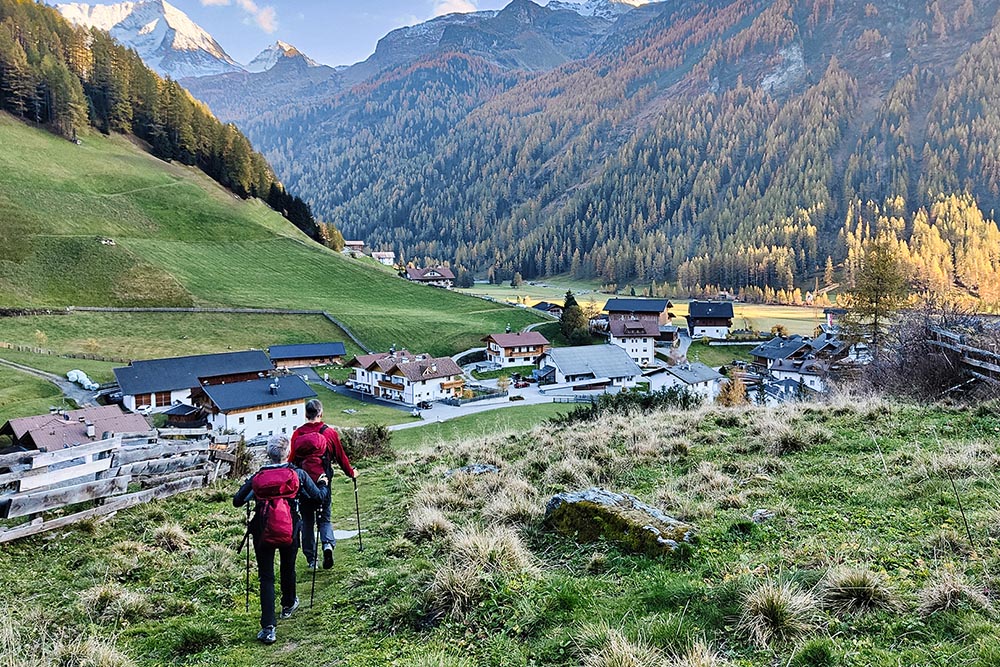
Si ritorna a Riva di Tures


