


![]()


Durata
 4:30 h
Distanza
 12,7 km
 Ascesa
 405 m
405 mDiscesa
 1408 m
H Max
 1588 m
H Min
 538 m
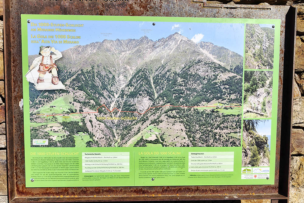
538 mGorge of 1,000 steps - Alta Via di Merano / Meraner Höhenweg
DESCRIPTION
Beautiful autumn walk in the Texel Group.
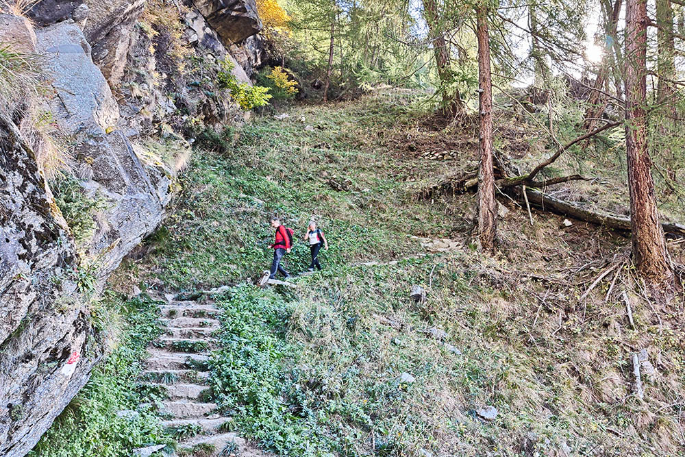
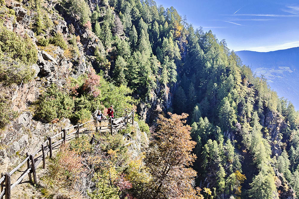
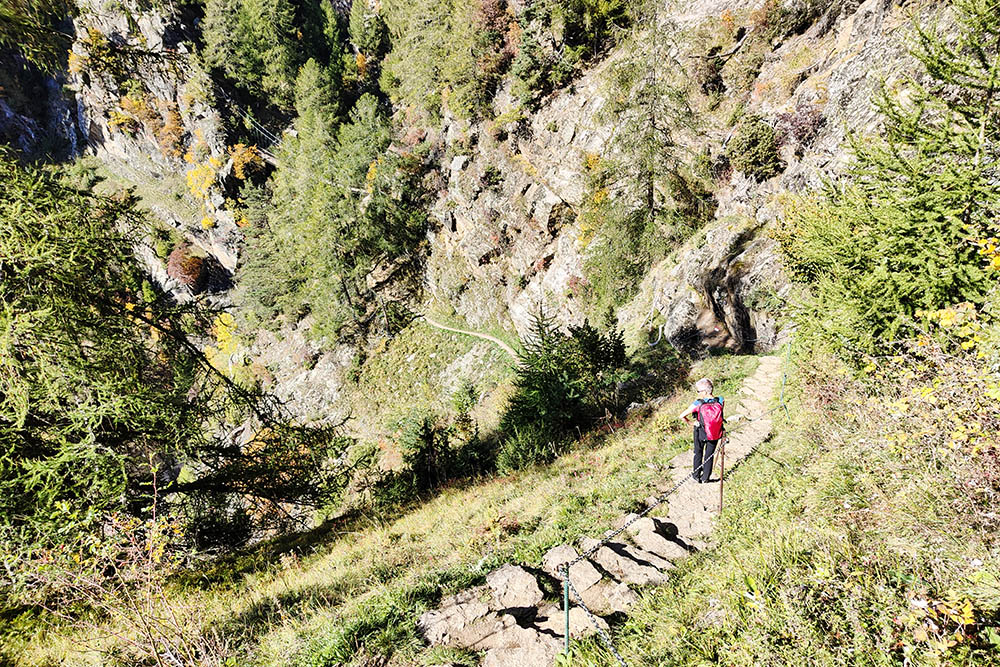
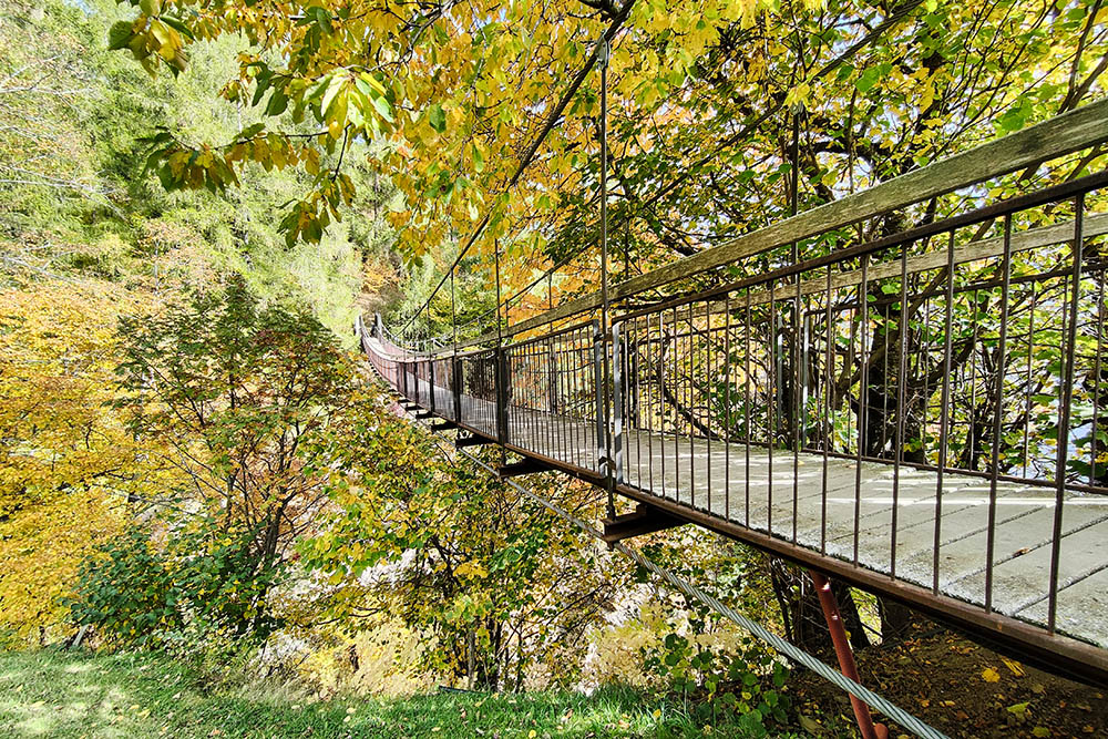
The 1000 Steps Gorge is located between the Gasthaus Giggelberg and the Unterstell farms, about halfway through, where the Rio Lana / Lahnbach has carved a deep gorge. Here you go down, cross a suspension bridge and go up on the other side of the gorge: in all there are 987 steps on a stretch of 1.5 km. It is one of the most beautiful and characteristic points of the Alta Via di Merano / Meraner Höhenweg.
ITINERARY
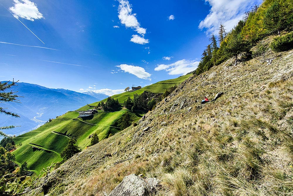
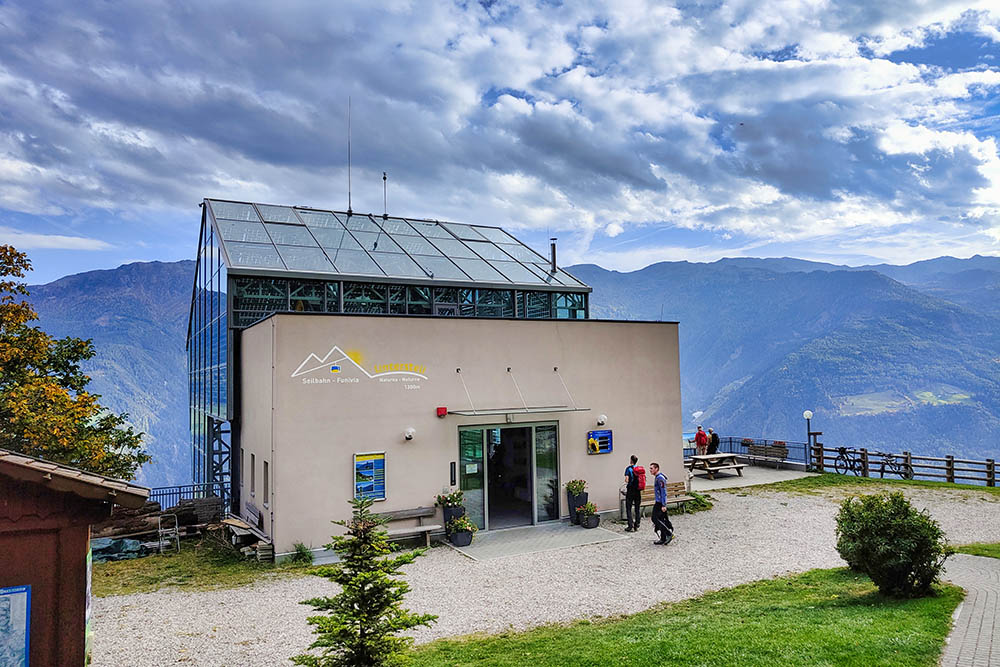
From the mountain station of the Texel cable car (1540 m) you can reach the Gasthaus Giggelberg (1565 m) in a few minutes. Here you take the Alta Via di Merano / Meraner Höhenweg, path 24. Arriving at the Hochforch farm (1550 m), you will find the beginning of the path of the 1000 steps gorge. Cross the Rio Lana / Lahnbach gorge on a beautiful suspension bridge, pass the farms Pirch (1440 m), Grub (1370 m), Galmein (1395 m) and Innerforch (1465 m), take path 24B and arrives at the mountain station of the Unterstell cable car (1300 m), passing through a splendid panoramic point with a suspended terrace (1340 m). Now either take the cable car down to Naturno, a less demanding choice, or take the 10A signpost and walk down to the valley station of the Unterstell / Seilbahn Unterstell cable car (539 m).
EXCURSION DATE
8 October 2022
STARTING POINT
Mountain station of the Texel / Texelbahn cable car
REFRESHMENT POINT
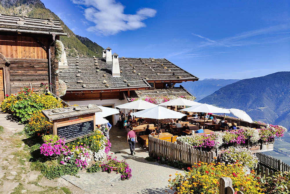
Giggelberg (1565m), Hochforch (1550m), Pirchhof (1440m), Galmein (1395m), Innerforch (1465m) and Gasthaus Unterstell (1300m)
AUTHOR’S SUGGESTIONS
It is advisable to take the excursion counterclockwise. To return to the parking area of the Texel / Texelbahn cable car, take bus no. 266.
SAFETY TIPS
The viability of the proposed itinerary, like all mountain morphology, is subject to environmental changes due to natural events and weather conditions. Therefore, before leaving, consult the competent tourist offices and / or the refuges of reference.
Our GPX tracks are only indicative, that is, the route was carried out at best with the conditions of the trails and weather of that day. So always consider what to do on site.
Also remember to evaluate the route based on your physical abilities, training and the equipment you have.
You should leave someone the route you intend to do told.
Remember that the emergency number is 112.
EQUIPMENT
It is recommended to have the appropriate equipment for the route, weather conditions and season: windproof and / or rain jacket, map and / or GPS device, goggles, sunscreen, boots, first aid kit, specific clothing, gloves, backpack with food and drink.
RECOMMENDED MAPS
Tabacco 011 MERANO E DINTORNI
INTERESTING LINKS
http://www.texelbahn.com/it/
HOW TO ARRIVE
From Merano take the SS38 towards Passo di Resia. In Rablà / Rabland, turn right and go up for about 1.4 km to the Texel / Texelbahn cable car.
PARKING AREA
Free at the valley station of the Texel / Texelbahn cable car
GPS coordinates: 46.679466, 11.064524
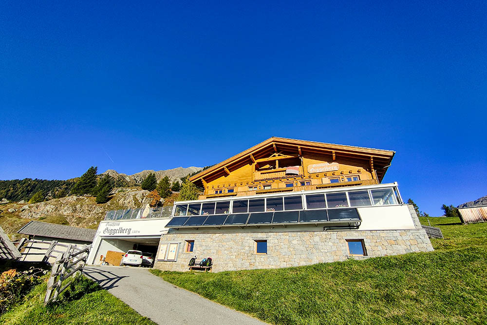
Gasthaus Giggelberg
Inizio della Gola dei 1.000 scalini
Si va verso la gola
Si va verso la gola
Si vede il ponte
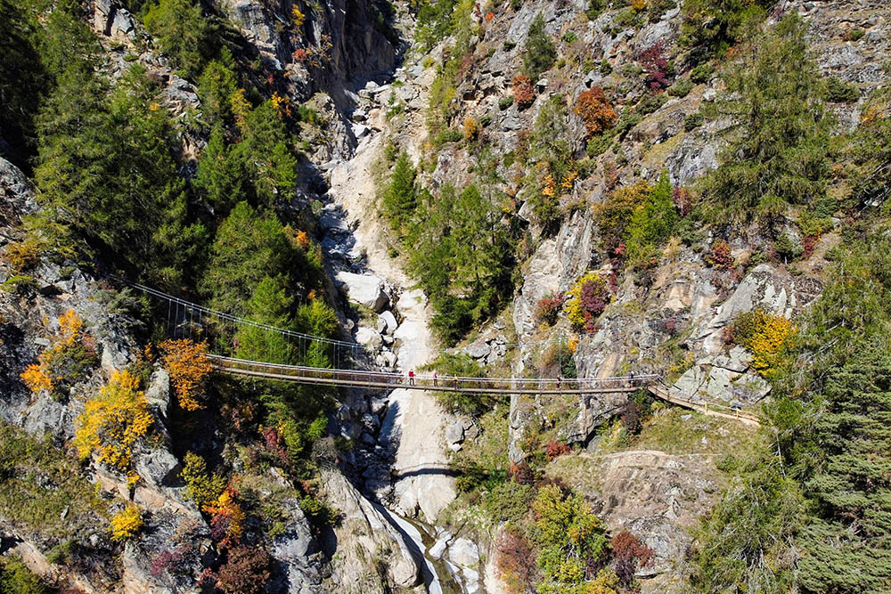
Il ponte sul Rio Lana
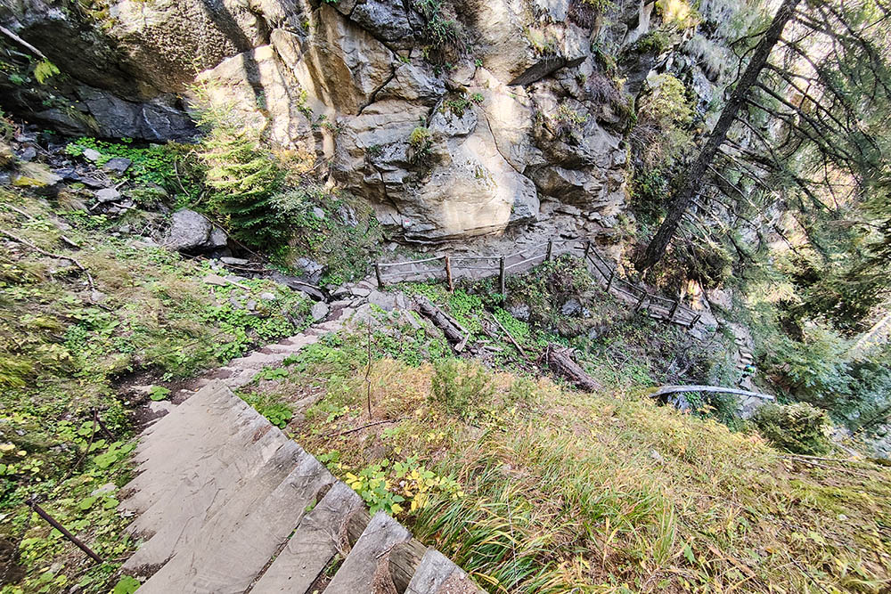
Si risale la gola
Si va verso il Maso Pirch
Il Maso Pirch
Il secondo ponte
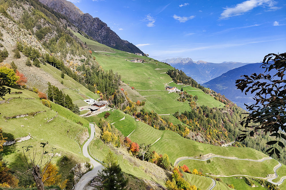
Vista sui masi
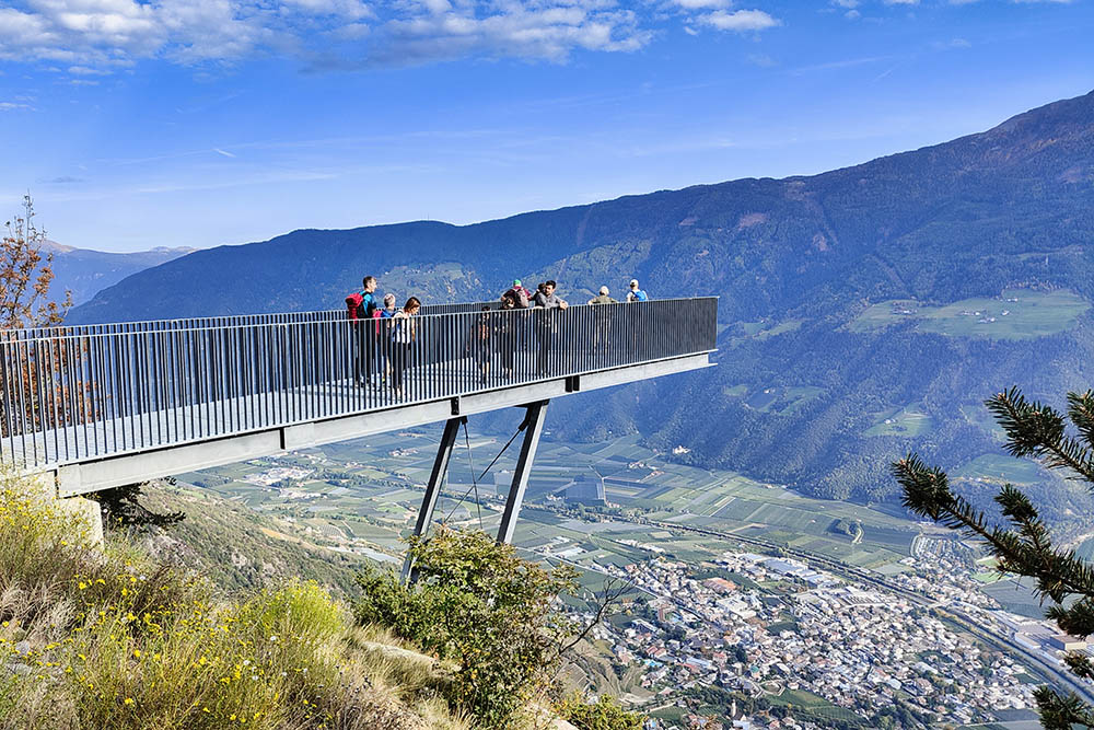
Punto panoramico
Stazione a monte della funivia Unterstell
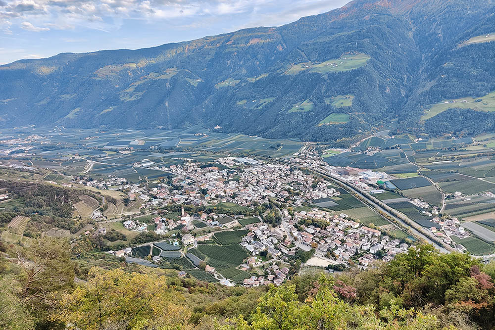
Vista su Naturno
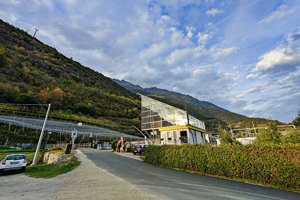
Stazione a valle della funivia Unterstell


