


![]()


Durata
 5:50 h
Distanza
 31 km
31 km Ascesa
 1370 m
Discesa
 1370 m
H Max
 2369 m
H Min
 1640 m
MTB Rifugio Santa Croce di Lazfons - Schutzhaus Latzfonser Kreuz
DESCRIPTION
A nice round trip with MTBs in the Sarentine Alps.
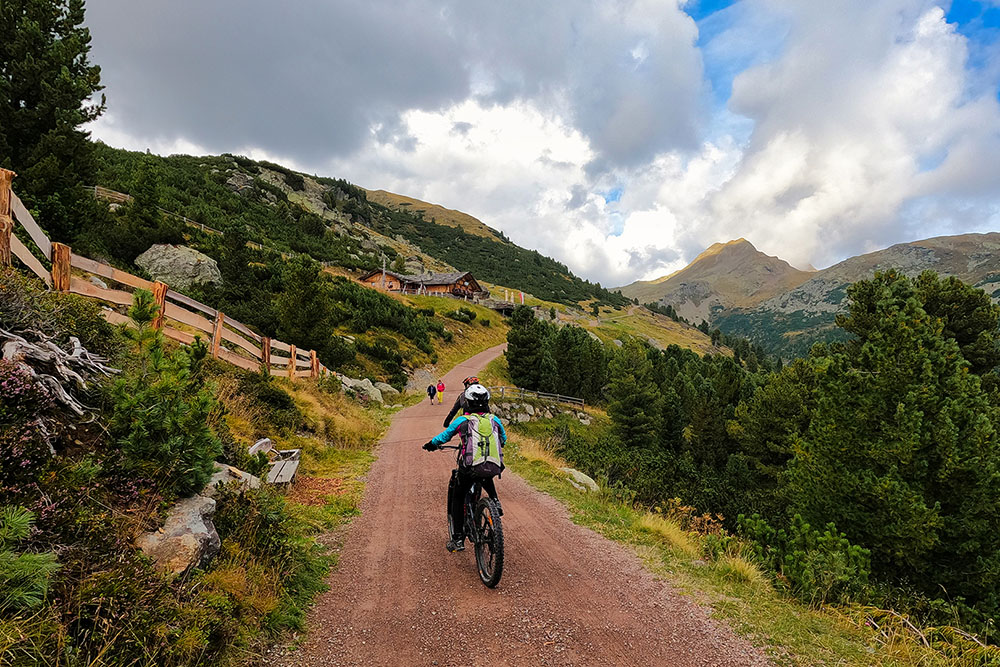
The tour starts from the Kasereck / Kaseregg car park, will take you through some splendid huts, will make you visit the characteristic Totenkirchl, will drop you off near San Martino in Val Sarentino and finally will take you up to the beautiful Schutzhaus Latzfonser Kreuz with the homonymous refuge nearby. The excursion is not technically difficult, but in the stretch that goes from the Getrum Alm to the sanctuary there are sections where you have to get off and push the bike. Being a route that develops over 31 km, with 1370 meters of ascent, it is not for everyone; you have to be trained.
ITINERARY
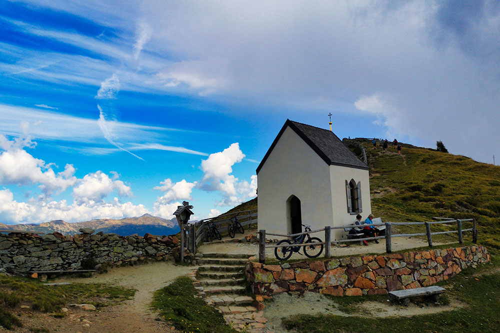
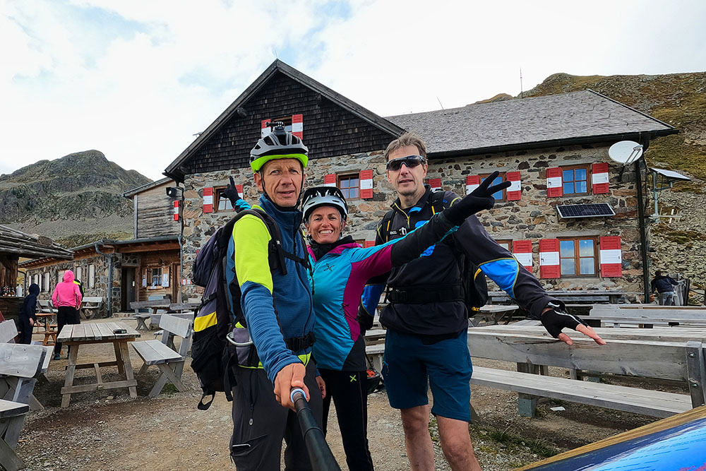
From the Kasereck / Kaseregg car park (1961 m) take the dirt road and in a few minutes you will arrive at Jochalm (1968 m). Continue and pass Stöffl Hütte (2057m) and Marzuner Schupfe (1940m). Now take the Totenweg dirt road and passing through Pfroder Alm (2146 m) you will reach Totenkirchl / Chiesetta del Morto (2186 m). Here you go down towards the Val Sarentino and before reaching San Martino, turn right and go up to the Getrum Alm (2094 m). Climbing further, trail signs 8A and 7, you arrive at Lückl Scharte / Passo del Lucolo (2369 m highest point of the excursion) and then descend to the Refuge and Sanctuary of Santa Croce di Lazfons - Schutzhaus Latzfonser Kreuz (2311 m). Return to the starting point following the signpost n. 15.
EXCURSION DATE
September 4, 2021
STARTING POINT
Kasereck / Kaseregg car park
REFRESHMENT POINT
Jochalm (1968 m), Stöffl Hütte (2057 m), Marzuner Schupfe (1940 m), Pfroder Alm (2146 m), Getrum Alm (2094 m) e Rifugio and al Santuario Santa Croce di Lazfons - Schutzhaus Latzfonser Kreuz (2311 m).
AUTHOR’S SUGGESTIONS
Attention in some places you have to push the MTB.
SAFETY TIPS
The viability of the proposed itinerary, like all mountain morphology, is subject to environmental changes due to natural events and weather conditions. Therefore, before leaving, consult the competent tourist offices and / or the refuges of reference.
Our GPX tracks are only indicative, that is, the route was carried out at best with the conditions of the trails and weather of that day. So always evaluate what to do on site.
Also remember to evaluate the route based on your physical abilities, the training and the equipment you have.
For e-bike owners: evaluate the kilometers and the altitude difference in relation to the battery power and the weight of the cyclist well.
You should leave someone the route you intend to do told.
Remember that the emergency number is 112.
EQUIPMENT
It is recommended to have the appropriate equipment for the route, weather conditions and season: helmet, windproof and / or rain jacket, map and / or GPS device, goggles, helmet and / or handlebar torch (an unexpected event may lengthen the travel times), sunscreen, MTB shoes, first aid kit, bike repair kit, specific clothing, whistle or signal bell, reflective bike wheels, gloves, backpack with food and drinks.
RECOMMENDED MAPS
Tabacco 040 MONTI SARENTINI / SARNTALER ALPEN
INTERESTING LINKS
https://www.klausen.it/it/piaceri-cultura/cultura-luoghi-interesse/croce-lazfons/
HOW TO ARRIVE
A22 closed exit. Take the SP74 road for Velturno. Once in the town, take the SP142 towards Lazfons. After Lazfons follow the signs for the Jochalm-Kasereck Parking.
PARKING AREA
Kasereck / Kaseregg car park, free of charge
GPS coordinates: 46.675786, 11.499711
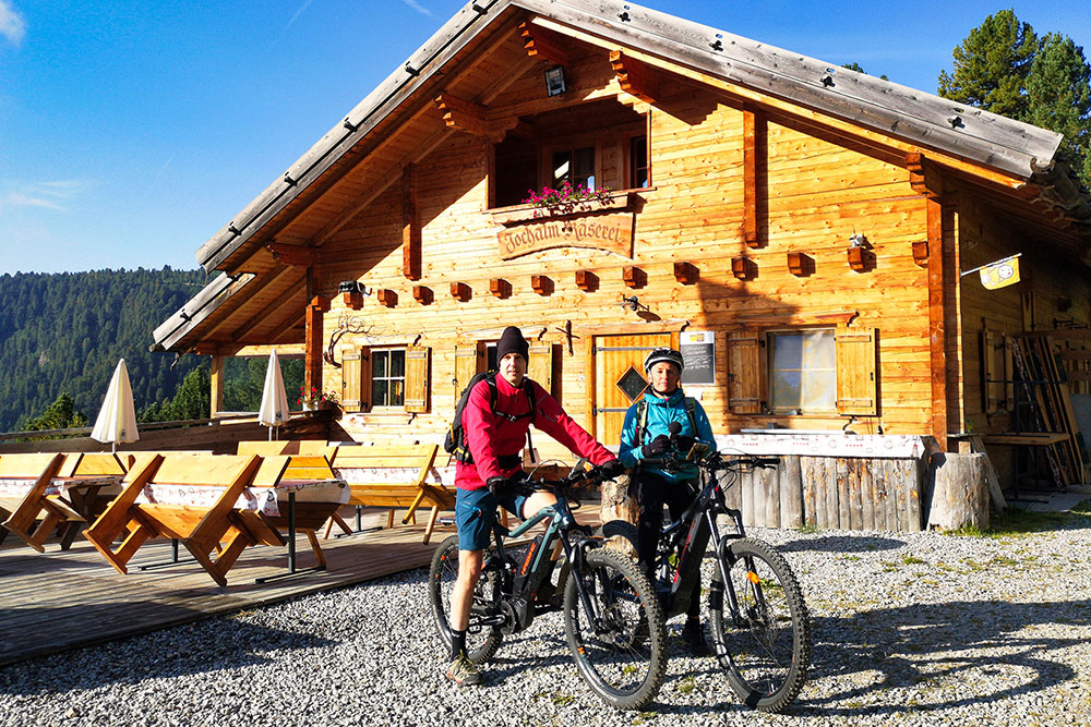
Jochalm
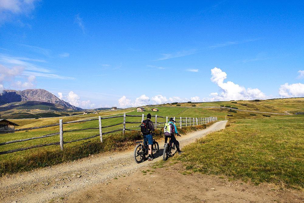
Si percorre una comoda strada sterrata in discesa
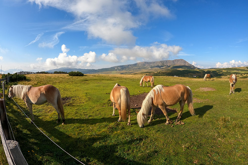
L'altopiano con alcuni cavalli
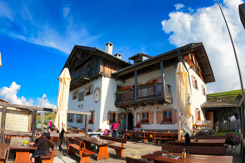
Stöffl Hütte
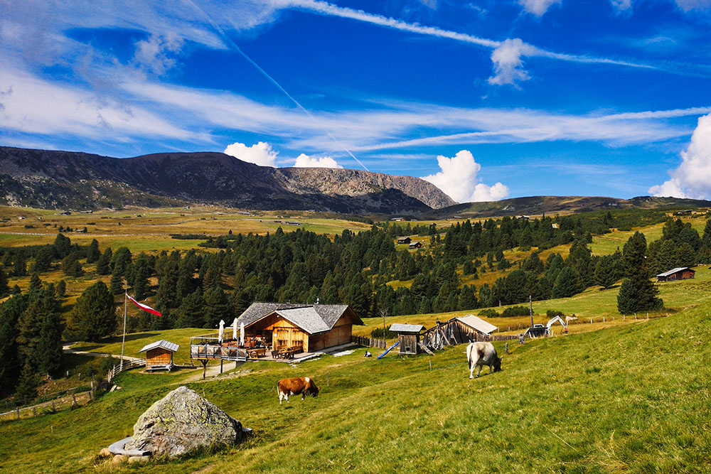
Marzuner Schupfe
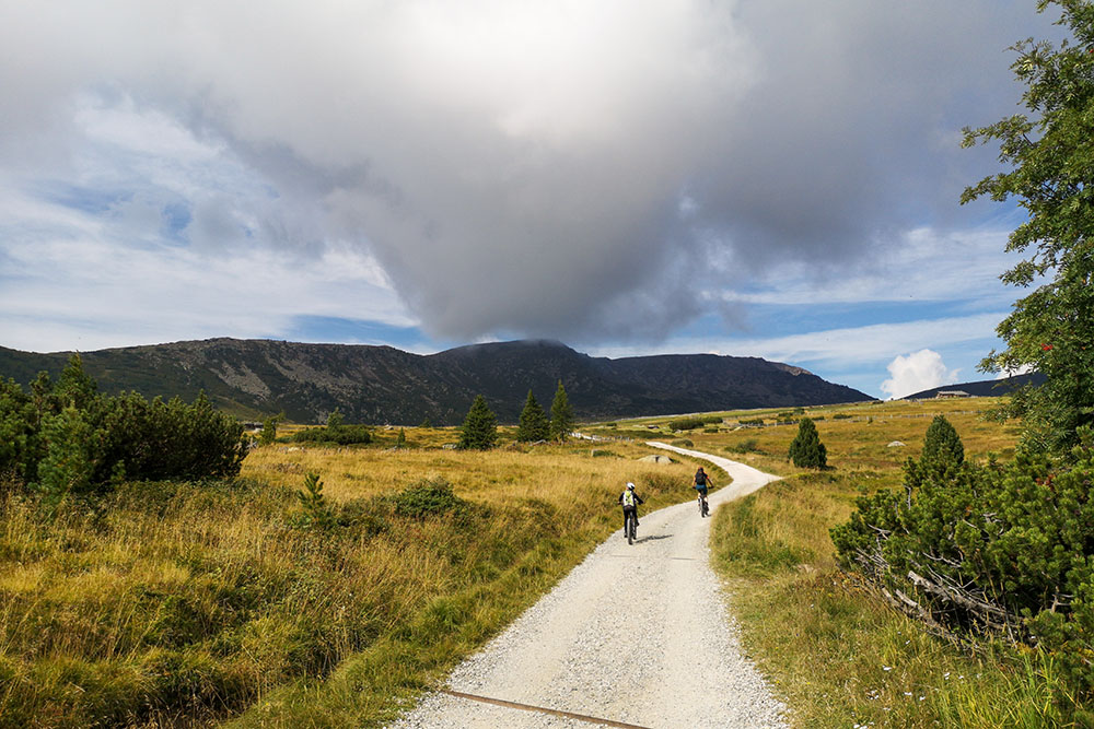
Si prosegue sull'altopiano
Pfroder Alm
Totenkirchl
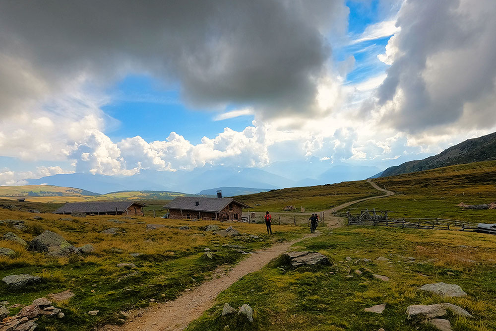
Getrum Alm
Rifugio Santa Croce - Latzfonser Kreuz


