


![]()


Durata
 2:25 h
Distanza
 2,9 km
 Ascesa
 334 m
334 mDiscesa
 334 m
334 mH Max
 537 m
537 mH Min
 203 m
203 mVia Ferrata Ottorino Marangoni
DESCRIPTION
Historic via ferrata that still gives an adrenaline rush.
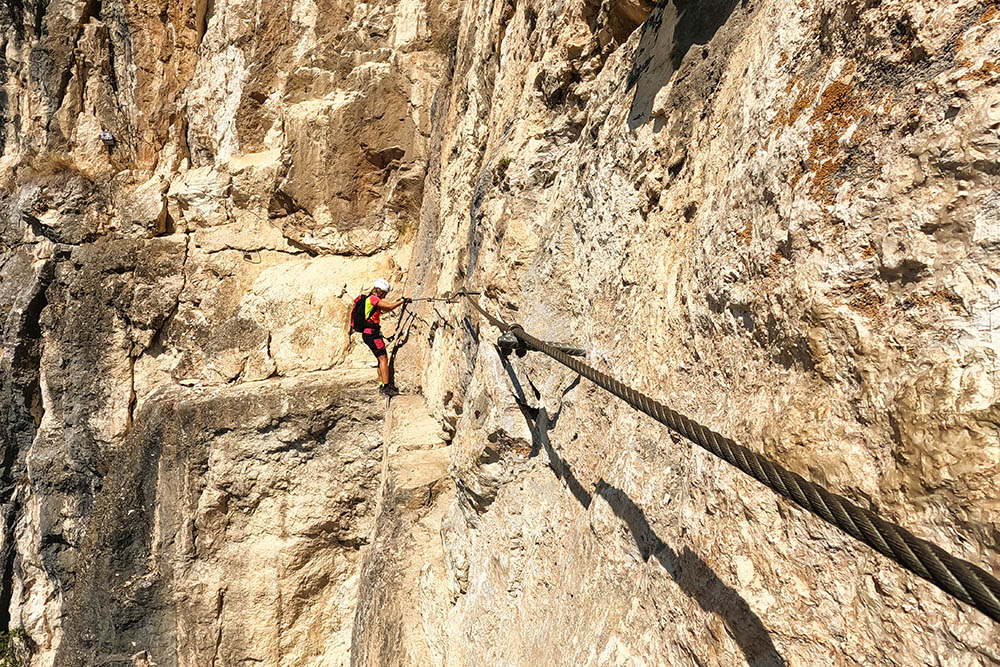
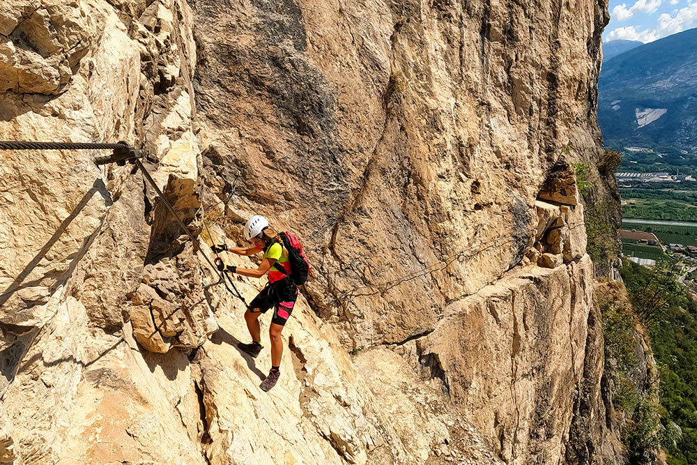
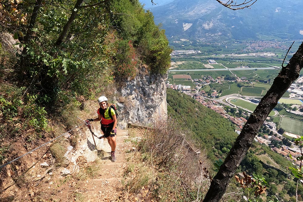
The Mori via ferrata dates back to the 1970s and was inaugurated in 1976. At that time it was considered extreme. Recently, in 2014, it has been modified and made easier. It is currently considered difficult or moderately difficult. The numerous interventions, especially brackets, have facilitated its usability, but the grips for greasy and slippery hands and feet, with the addition of the high exposure, still make it an adrenaline-filled via ferrata.
The ferrata is called in many ways: Via Ferrata O. Marangoni, Ferrata di Monte Albano, Ferrata di Mori.
The via ferrata is exposed to the south and therefore be careful in hot periods.
ITINERARY
From Piazza Cesare Battisti di Mori (203 m), go up the path 670 to the Sanctuary of Monte Albano (302 m). Here you continue until you reach a crossroads (354 m) where you take path 675 and in a few minutes you will arrive at the start of the via ferrata (430 m). Arriving at the end of the ferrata (537 m), go down the special path to the sanctuary and the town of Mori.
Timing: approach 0:25, ferrata 1:45, return 40, total 2:50.
EXCURSION DATE
August 26, 2022
STARTING POINT
Piazza Cesare Battisti, Mori
REFRESHMENT POINT
Nobody
AUTHOR’S SUGGESTIONS
Obviously it is highly discouraged for people suffering from vertigo. It is not suitable for those who want to approach the world of via ferratas for the first time.
SAFETY TIPS
The viability of the proposed itinerary, like all mountain morphology, is subject to environmental changes due to natural events and weather conditions. So, before leaving, consult the competent tourist offices and / or the refuges of reference.
Our GPX tracks are only indicative, that is, the route was carried out at best with the conditions of the trails and weather of that day. So always evaluate what to do on site.
Also remember to evaluate the route based on your physical abilities, training and the equipment you have.
You should leave someone the route you intend to do told.
Remember that the emergency number is 112.
EQUIPMENT
It is recommended to have the appropriate equipment: technical mountain clothing, boots with vibram sole or similar, via ferrata set, harness, helmet, via ferrata gloves, goggles, sunscreen, backpack with drinks.
RECOMMENDED MAPS
Tabacco 061 ALTO GARDA - LEDRO - MONTE BALDO NORD
INTERESTING LINKS
https://www.morimontalbano.it/storia/chiese/
HOW TO ARRIVE
A22 exit Rovereto Sud and go towards Lake Garda. After a while, take the SP90 road to Mori, go straight on until Via G. Marconi.
PARKING AREA
Free of charge in Mori in Via G. Marconi
GPS coordinates: 45.851625, 10.979283
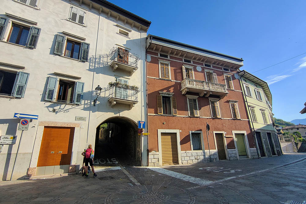
Punto di partenza
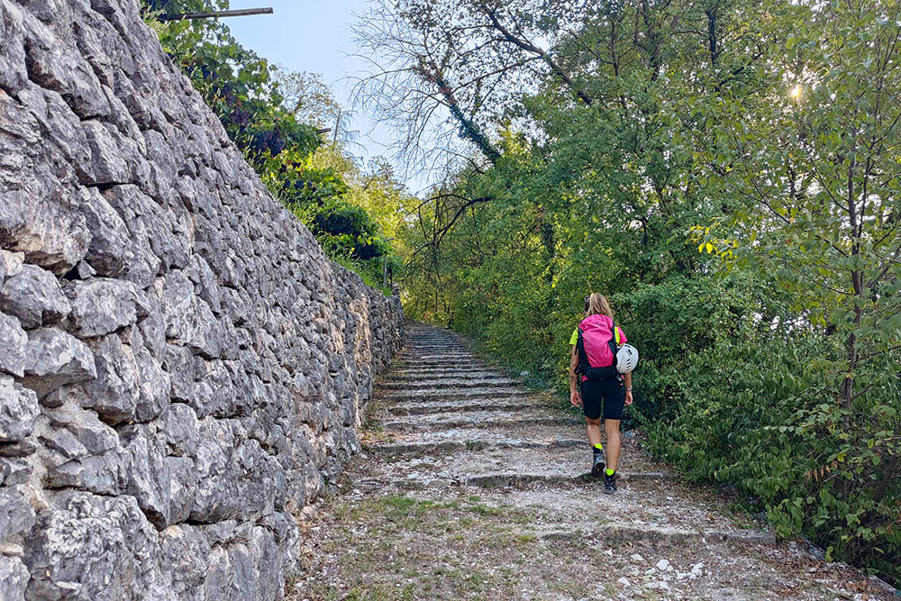
Si sale per una strada lastricata
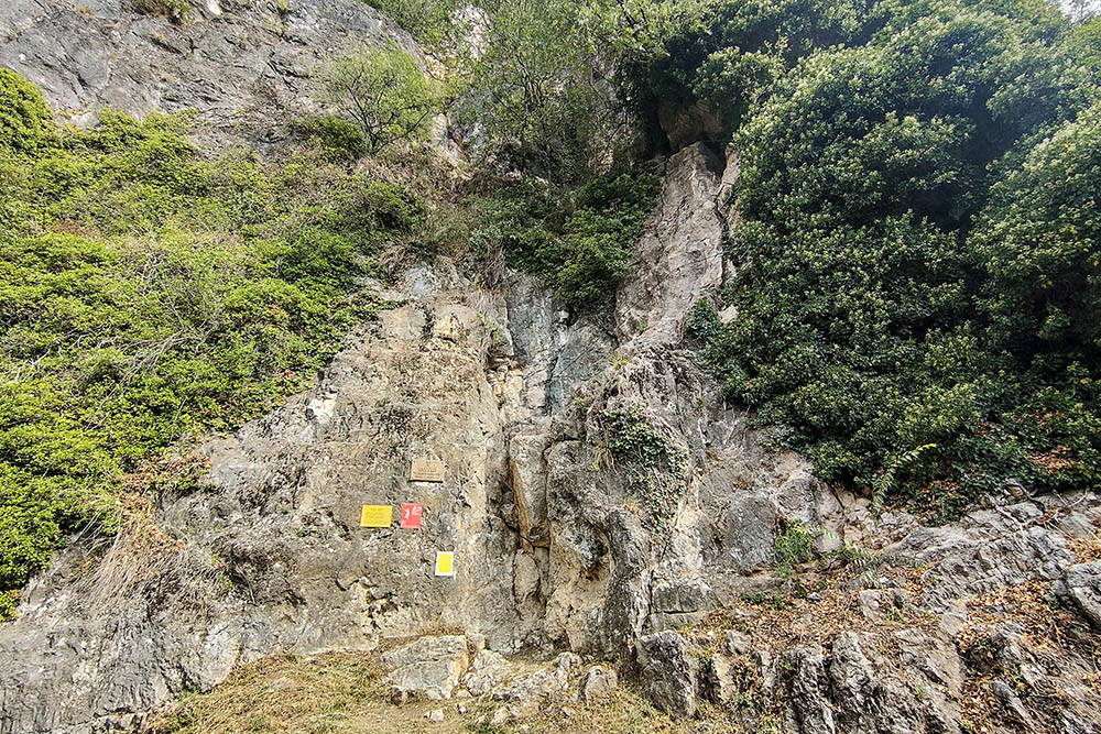
Attacco della ferrata
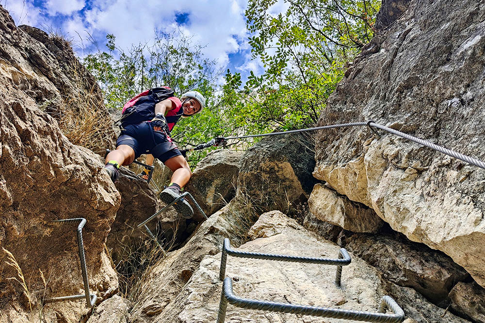
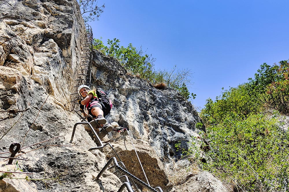
Si sale utilizzando le numerose staffe
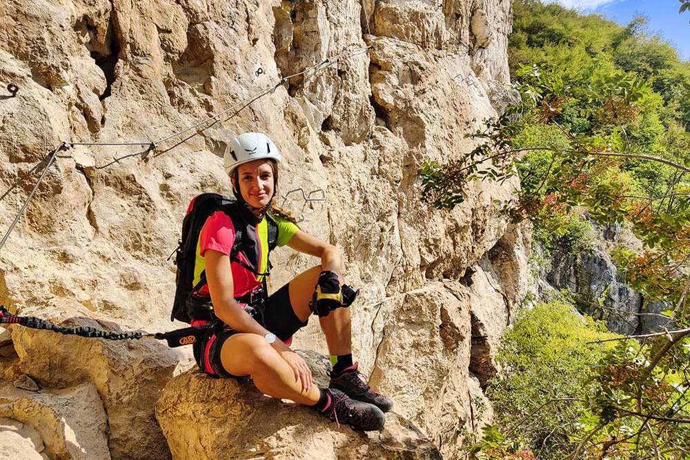
Momento di riposo
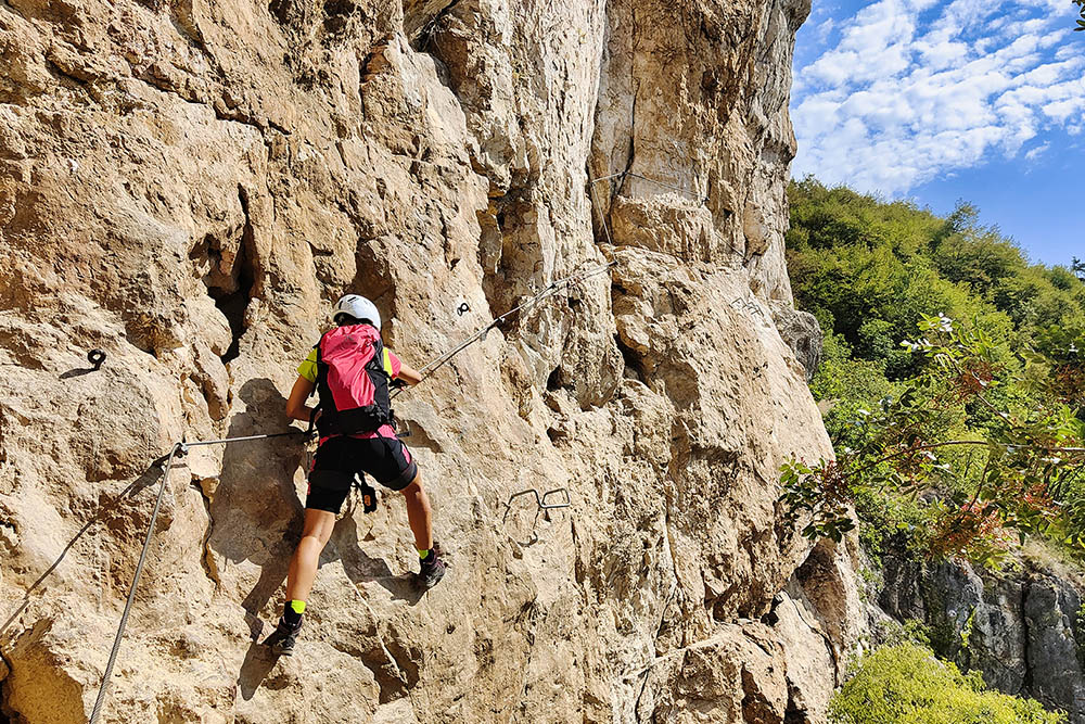
La roccia è molto levigata e scivolosa
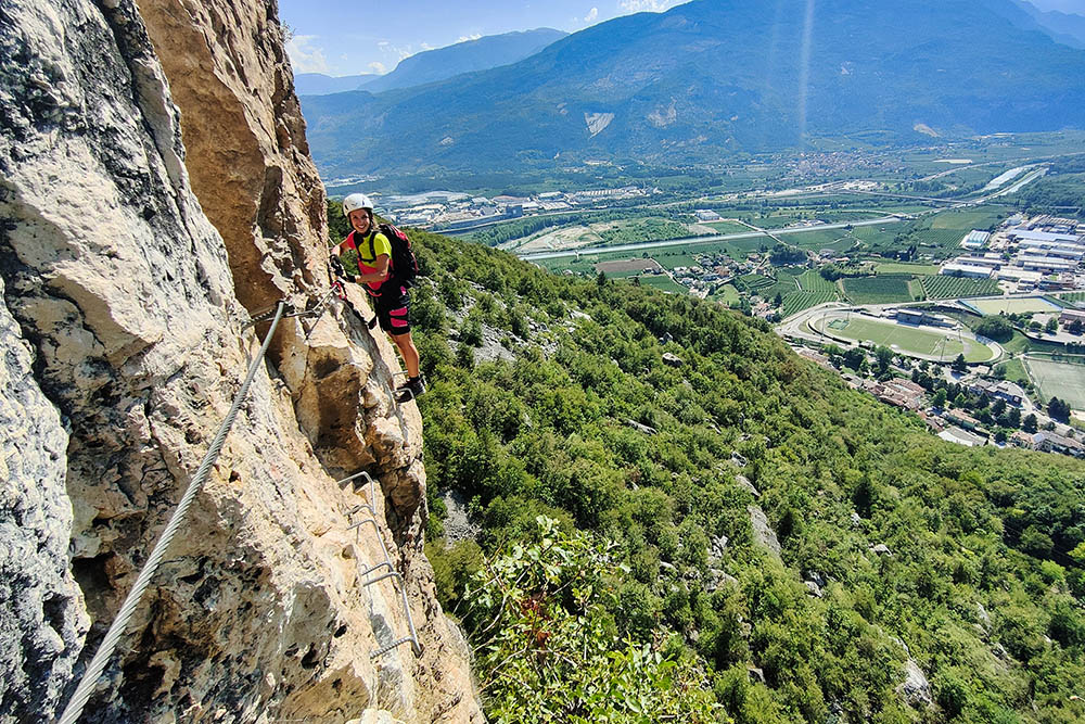
Punto più esposto
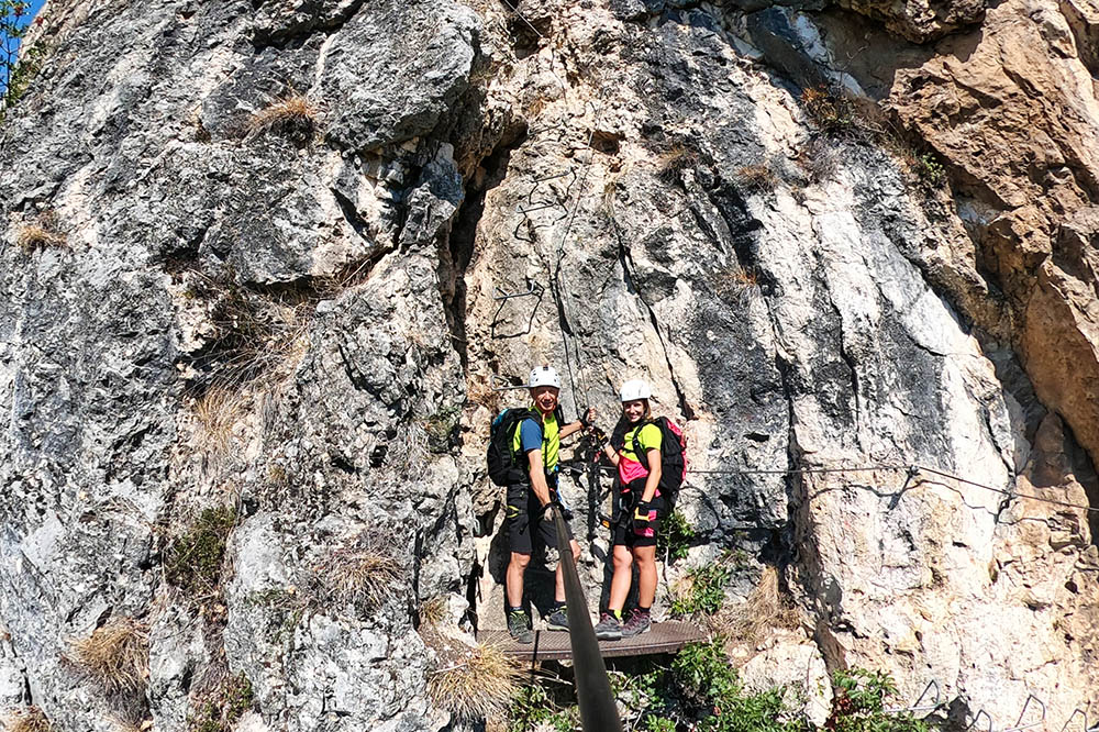
Siamo arrivati alla pedana di sosta
Un bel traverso
Un bel traverso
Ultimo tratto
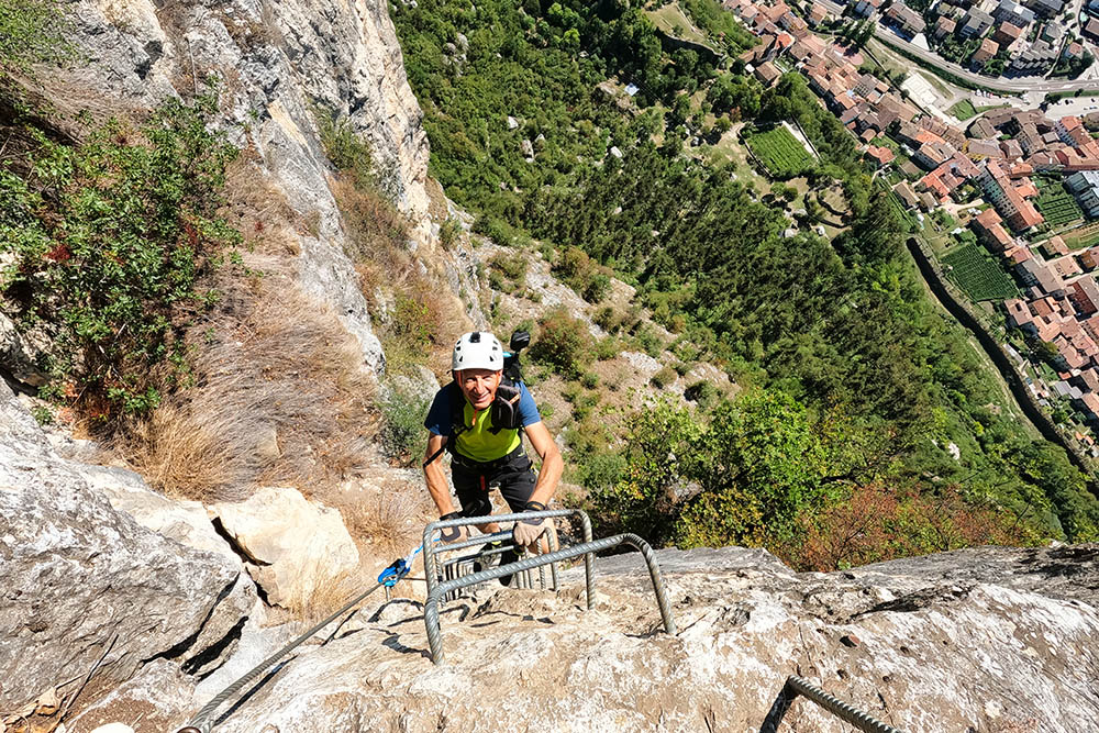
Ultimo tratto
Fine della ferrata
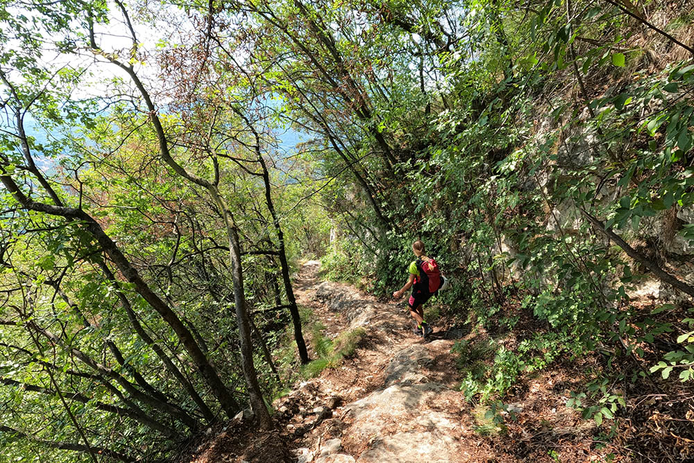
Si ritorna al santuario
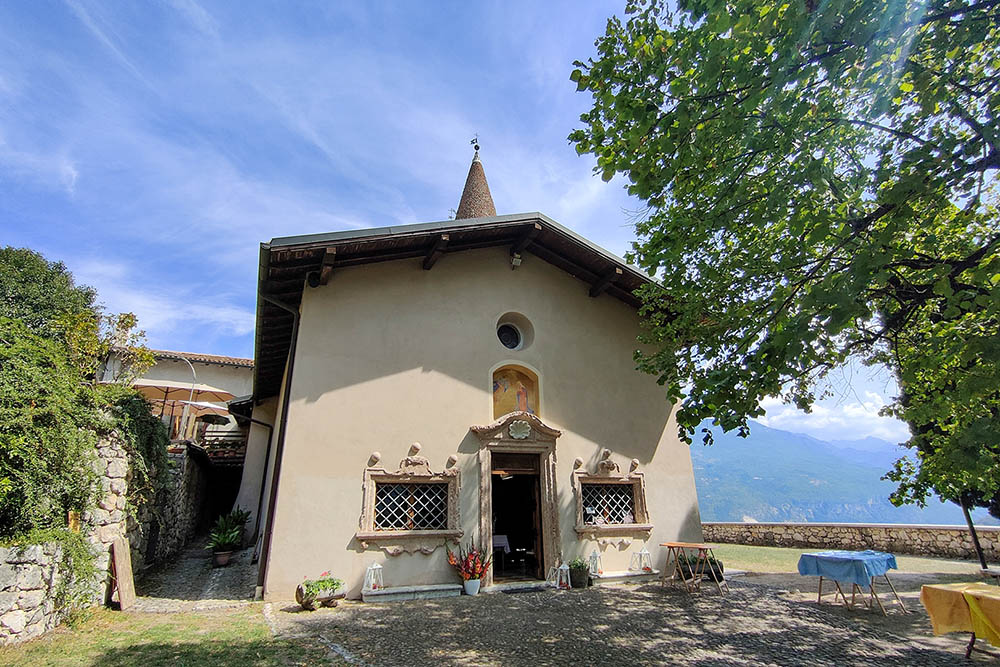
Santuario di Monte Albano


