


![]()


Durata
 5:53 h
Distanza
 10,7 km
 Ascesa
 1201 m
Discesa
 1203 m
H Max
 3225 m
H Min
 2040 m
Tofana di Rozes - Normal route
DESCRIPTION
A beautiful 3000 with a fantastic panorama.
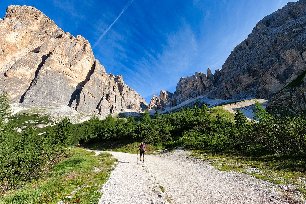
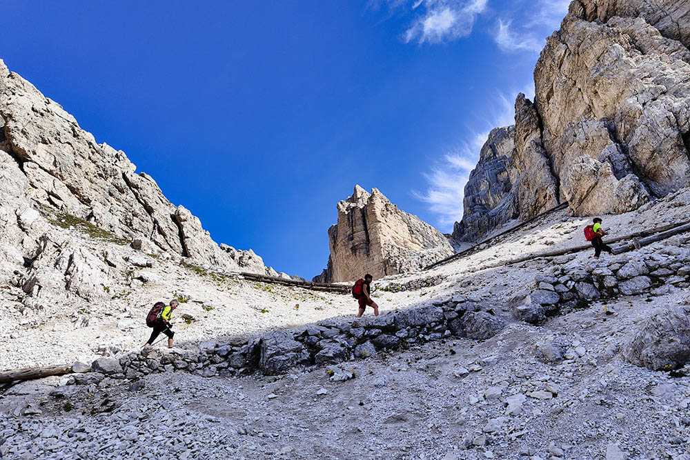
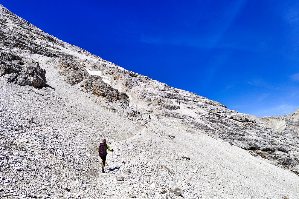
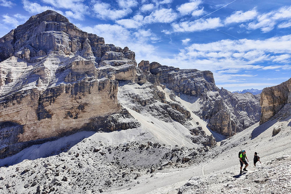
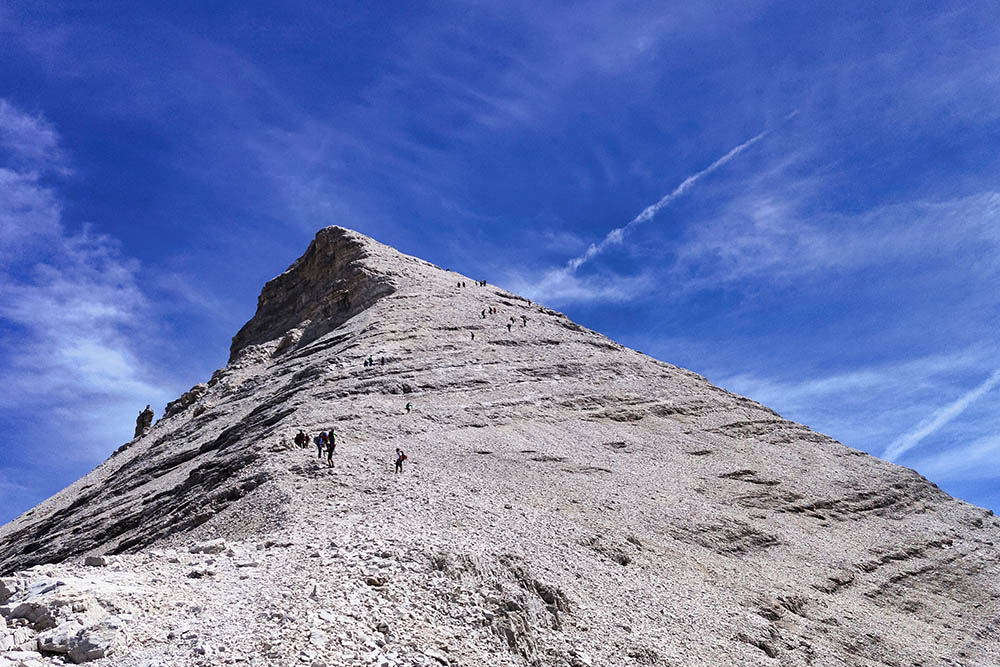
Surely the excursion to the Tofana di Rozes is one of the most beautiful and most scenic excursions in the Cortina d'Ampezzo area. Once at the top, the view sweeps 360 degrees on the splendid peaks of three provinces: Belluno, Trento and Bolzano. The route does not present particular difficulties except in the stretch from the Giussani Refuge to Cima Tofana di Rozes, because you walk on rocks or scree and because the signposting is somewhat deficient. You should follow the path marked with a blue dot, but it is often not seen or not there and therefore you follow the stone men. In case of low clouds this can be a problem.
In conclusion: simple / tourist route (T) to the Giussani refuge, then for expert hikers (EE).
ITINERARY
From the Rifugio Dibona (2083 m) take path no. 403 and you arrive at the Forcella Fontananegra and then the Rifugio Camillo Giussani (2600 m). Here, continue following the signs for Tofana di Rozes. Arrived at the summit (3225 m) you return along the same path.
EXCURSION DATE
July 9, 2022
STARTING POINT
Rifugio Dibona
REFRESHMENT POINT
Rifugio Giussani (2600 m)
AUTHOR’S SUGGESTIONS
Be careful when signage is lacking.
SAFETY TIPS
The viability of the proposed itinerary, like all mountain morphology, is subject to environmental changes due to natural events and weather conditions. Therefore, before leaving, consult the competent tourist offices and / or the refuges of reference.
Our GPX tracks are only indicative, that is, the route was carried out at best with the conditions of the trails and weather of that day. So always consider what to do on site.
Also remember to evaluate the route based on your physical abilities, training and the equipment you have.
You should leave someone the route you intend to do told.
Remember that the emergency number is 112.
EQUIPMENT
It is recommended to have the appropriate equipment for the route, weather conditions and season: windproof and / or rain jacket, map and / or GPS device, goggles, sunscreen, boots, first aid kit, specific clothing, gloves, backpack with food and drink.
RECOMMENDED MAPS
Tabacco 03 Cortina d'Ampezzo - Dolomiti Ampezzane
INTERESTING LINKS
https://www.rifugiogiussani.com/
HOW TO ARRIVE
From Cortina d'Ampezzo SR48 towards Passo Falzarego. After the Chiesetta degli Alpini, take a small road - first asphalted and then dirt road - which leads to the Rifugio Dibona.
PARKING AREA
Free at the Rifugio Dibona.
GPS coordinates: 46.532773, 12.069863
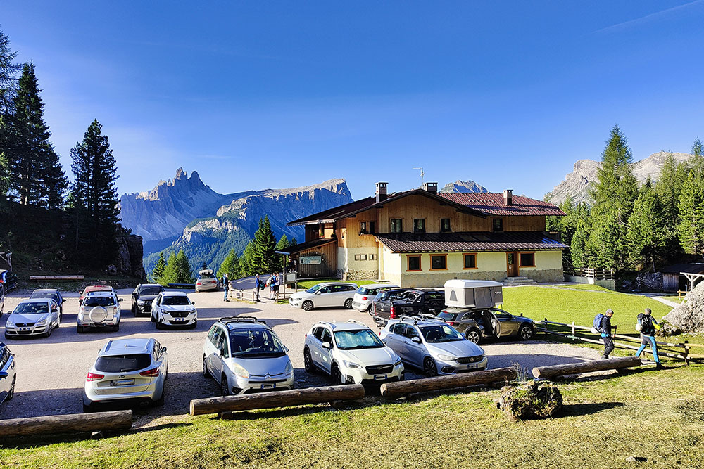
Rifugio Dibona
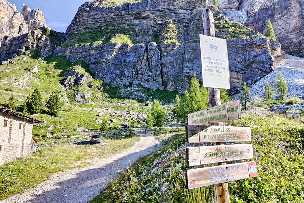
Inizio del sentiero n. 403
Si percorre una strada sterrata
Manca poco al Rifugio Giussani
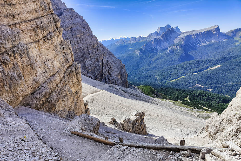
Vista sul sentiero che abbiamo fatto
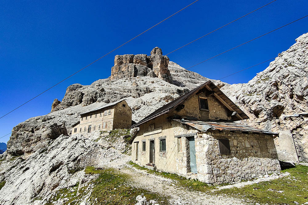
Ex Rifugio Cantore
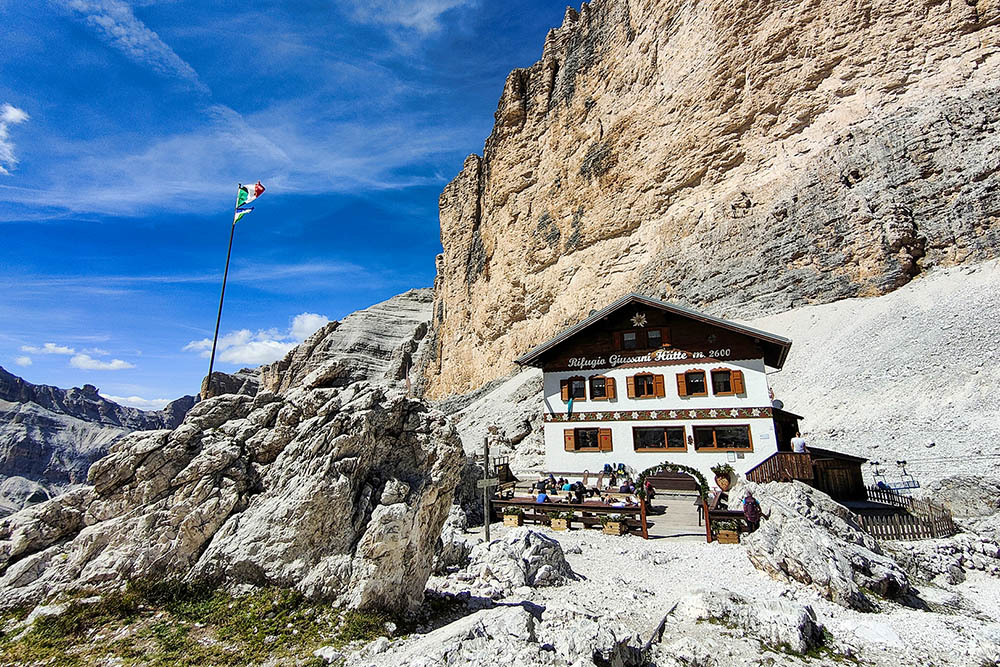
Rifugio Camillo Giussani
Si continua verso la vetta
In lontananza il Rifugio Giussani
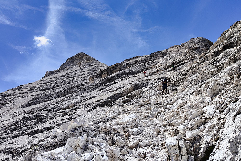
Si sale su ghiaioni e roccette
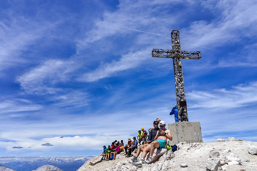
Croce di vetta della Tofana di Rozes
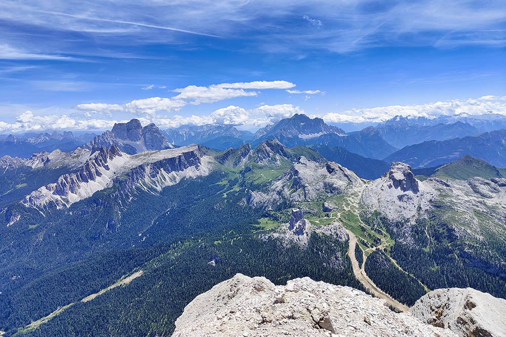
Vista verso il Pelmo, il Nuvolau e l'Averau
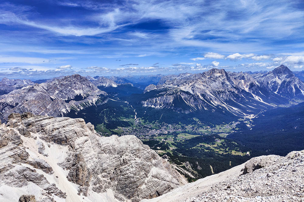
Vista su Cortina d'Ampezzo
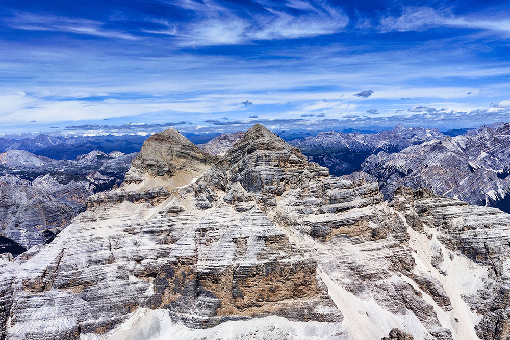
Vista sulle Tofane di Mezzo e di Dentro
Si ritorna per il sentiero dell'andata


