


![]()


Durata
 7:44 h
Distanza
 19,1 km
 Ascesa
 1546 m
Discesa
 1546 m
H Max
 2888 m
H Min
 1440 m
Rifugio Ponte di Ghiaccio and Cima Cadini
DESCRIPTION
At the bottom of the Val di Fundres a nice excursion starts to the Rifugio Ponte di Ghiaccio.
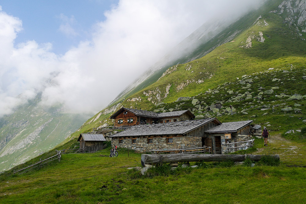
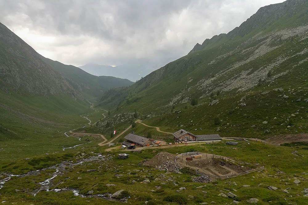
The excursion is challenging both for the difference in height and for the length, but does not present particular difficulties, except in the stretch from the Rifugio Ponte di Ghiaccio to the Cima Cadini, where the path climbs steeply over stones with a certain exposure. As you climb to the top, the panorama widens and in the distance you can also see a piece of Lake Neves. The Ponte di Ghiaccio Lake is quite large and is a great place to catch your breath, take some photos and maybe even a nap. The Rifugio Ponte di Ghiaccio is located on the saddle that separates Lappago from the Fundres Valley.
ITINERARY
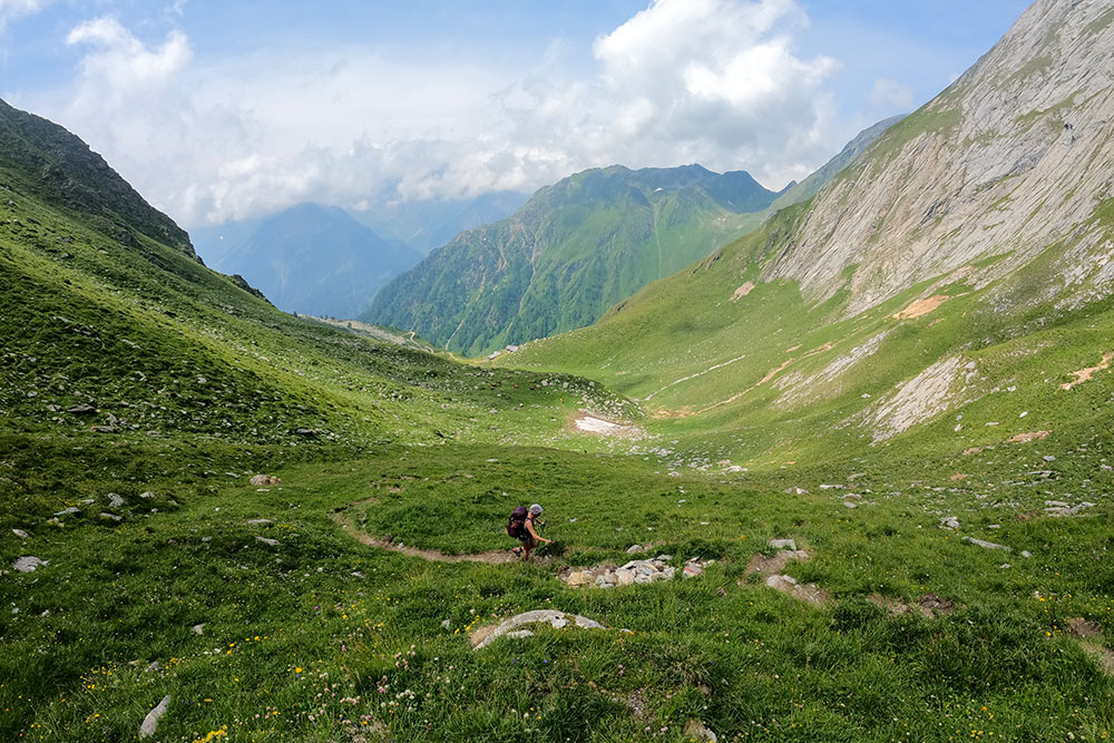
From the car park (1440 m) go up the asphalted road for 1 km following the signpost number 18 to the Luzerhof farm. Near Malga Boden continue on 18 until you reach Malga Vals (2180 m) - up to here a dirt road. From the hut the path begins, always signposted 18, which leads first to Forcella Vals (2410 m) and then to Lago Ponte di Ghiaccio (2351 m). Here you take the 13 and arrive at the Rifugio Ponte di Ghiaccio / Edelrauthütte (2545 m). From the refuge, go up to Cima Cadini / Napfspitze (2888 m) along path 6. For the return, take the same road to the lake and then take trail 13 which, passing through the Malga Ponte di Ghiaccio (2154 m) and Malga Boden (1690 m), leads to the car park.
EXCURSION DATE
July 24, 2021
STARTING POINT
Dun location
REFRESHMENT POINT
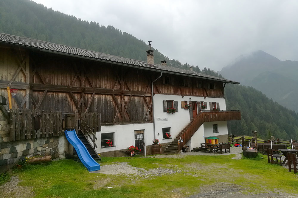
Malga Vals (2180 m), Rifugio Ponte di Ghiaccio/Edelrauthütte (2545 m), Malga Ponte di Ghiaccio (2154 m) and Malga Boden (1690 m)
AUTHOR’S SUGGESTIONS
We advise you to go up to Cima Cadini to enjoy the magnificent panorama.
SAFETY TIPS
The viability of the proposed itinerary, like all mountain morphology, is subject to environmental changes due to natural events and weather conditions. Therefore, before leaving, consult the competent tourist offices and / or the refuges of reference.
Our GPX tracks are only indicative, that is, the route was carried out at best with the conditions of the trails and weather of that day. So always consider what to do on site.
Also remember to evaluate the route based on your physical abilities, training and the equipment you have.
You should leave someone the route you intend to do told.
Remember that the emergency number is 112.
EQUIPMENT
It is recommended to have the appropriate equipment for the route, weather conditions and season: windproof and / or rain jacket, map and / or GPS device, goggles, sunscreen, boots, first aid kit, specific clothing, gloves, backpack with food and drink.
RECOMMENDED MAPS
Tabacco 037 MONTI DI FUNDRES - GRAN PILASTRO / PFUNDERER BERGE - HOCHFEILER
INTERESTING LINKS
https://www.edelrauthuette.it/
HOW TO ARRIVE
A22 exit Bressanone Nord. Take the Strada della Pusteria SS49. At Vandoies you enter the village and follow the signs for Fundres. After the village of Fundres, continue to the parking lot in Località Dun.
PARKING AREA
Free in Dun
GPS coordinates: 46.914714, 11.686937
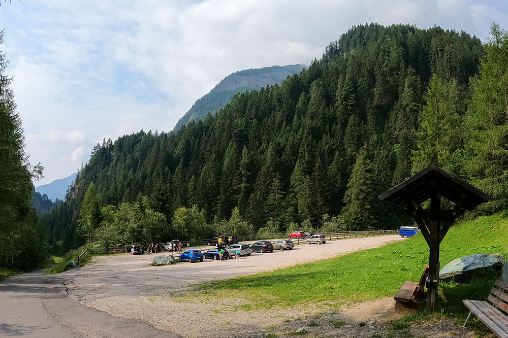
Parcheggio in località Dun
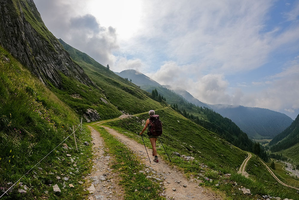
Si sale per strada sterrata
Malga Vals
Ora si sale alla Forcella Vals per sentiero
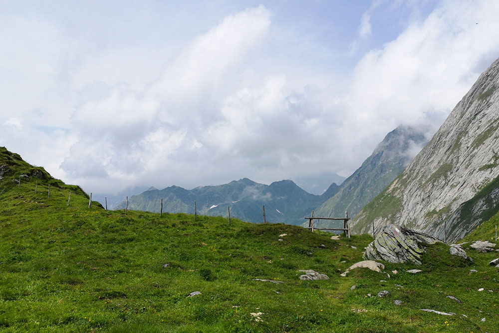
Forcella Vals

Siamo quasi arrivati al lago
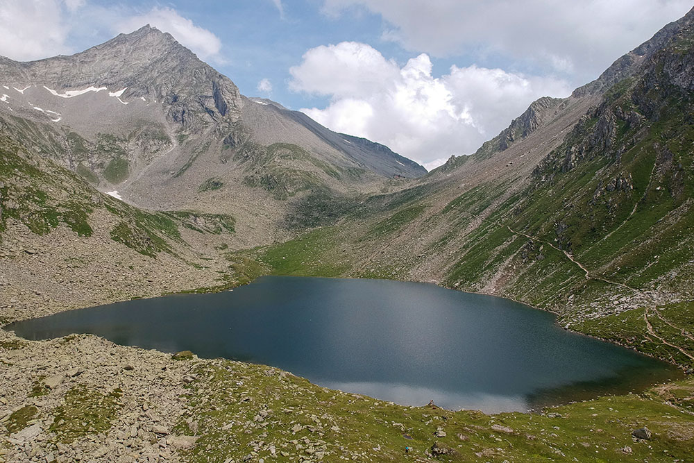
Il Lago Ponte di Ghiaccio
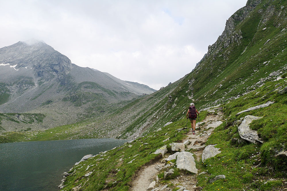
Si sale costeggiando il lago
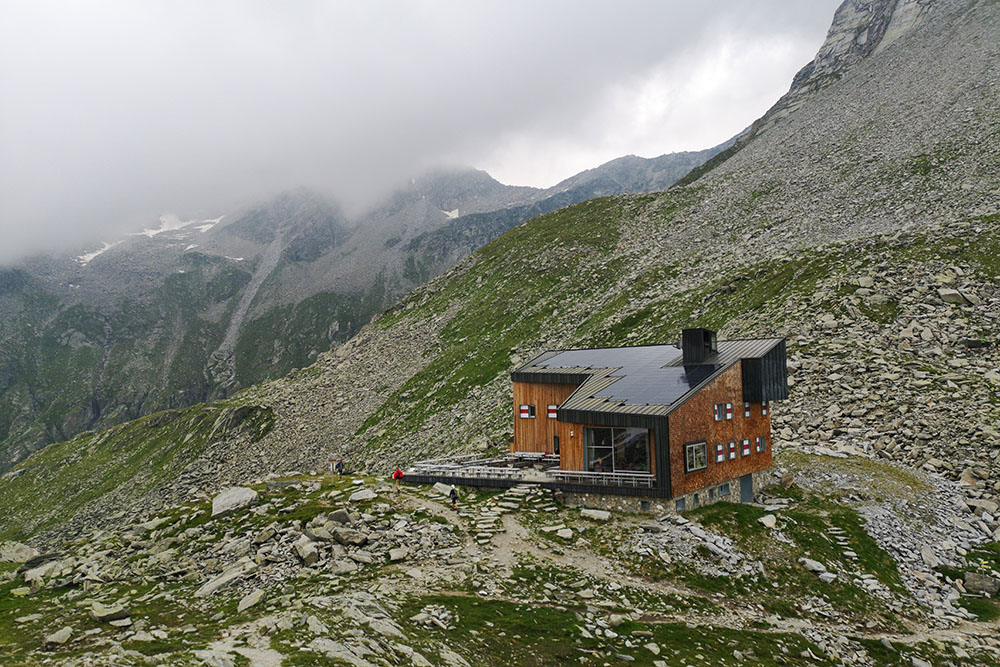
Il Rifugio Ponte di Ghiaccio
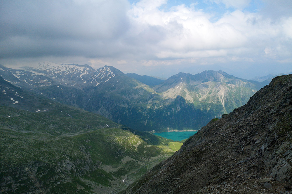
Salendo alla cima si vede un lembo del Lago di Neves
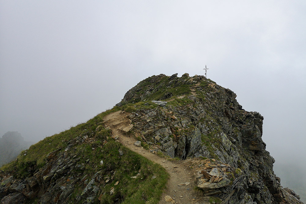
Quasi arrivati in vetta
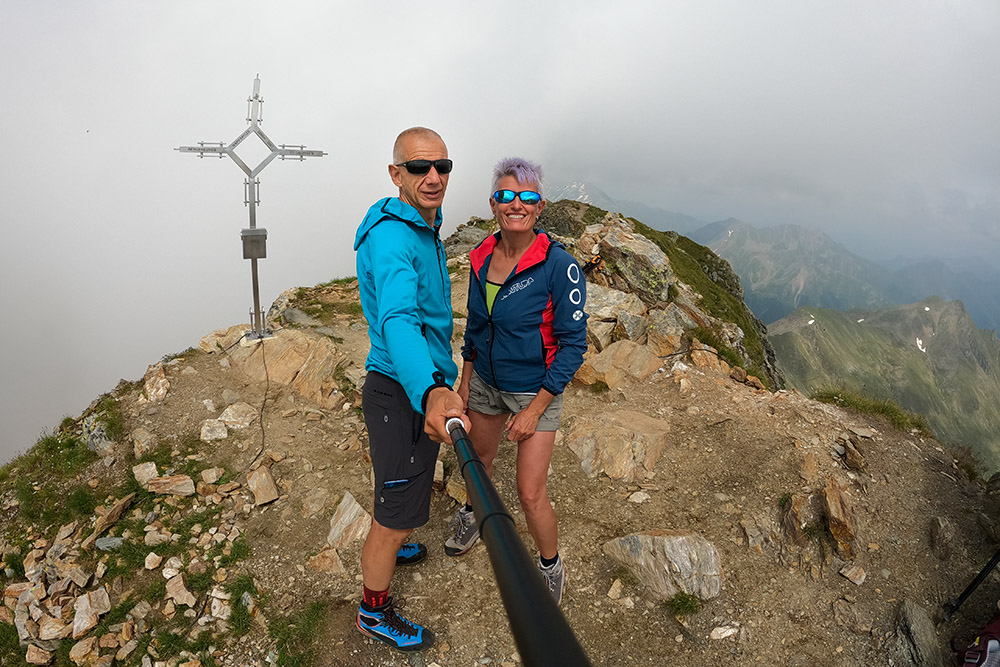
Cima Napf - Cadini
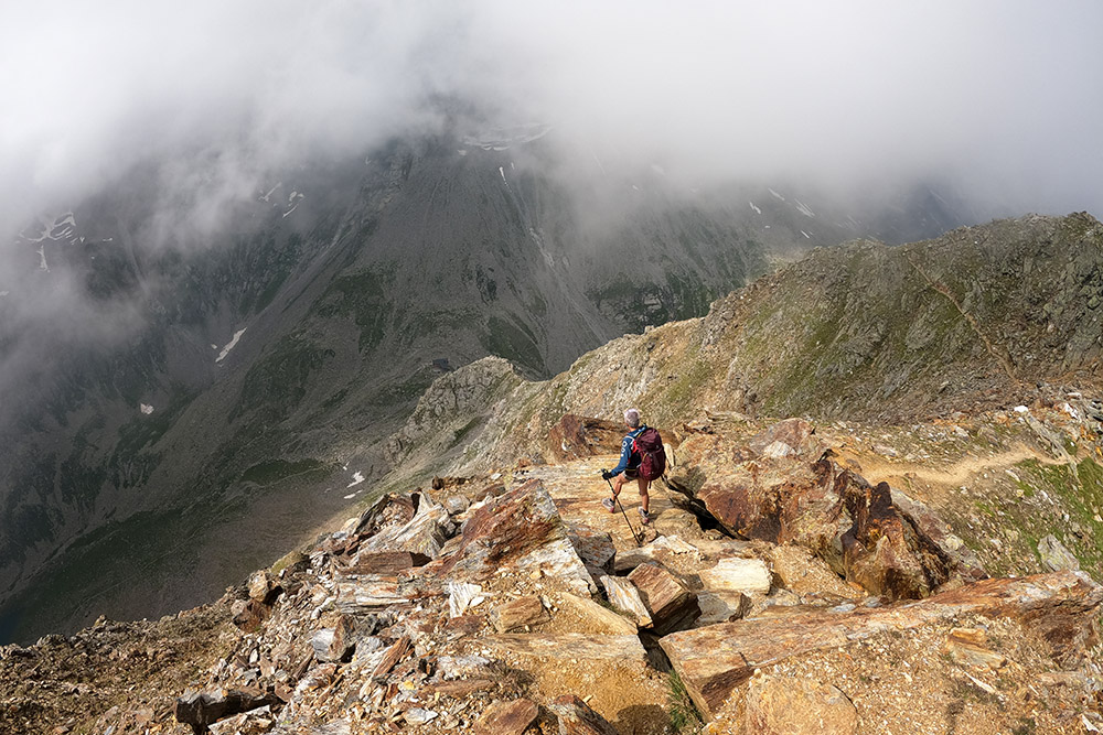
Scendiamo al rifugio
Malga Ponte di Ghiaccio
Malga Boden


