


![]()


Durata
 5:50 h
Distanza
 10,3 km
 Ascesa
 1090 m
Discesa
 1090 m
H Max
 2791 m
H Min
 1748 m
Cima Latemar
DESCRIPTION
Wonderful panoramic excursion on the Latemar Group.
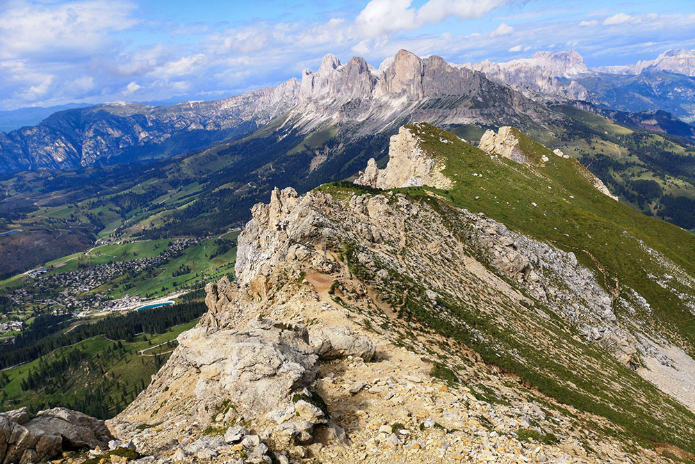
Cima Latemar is also known by the name of Schenon, and with its 2791 meters of altitude it is the second peak of the Latemar Group.
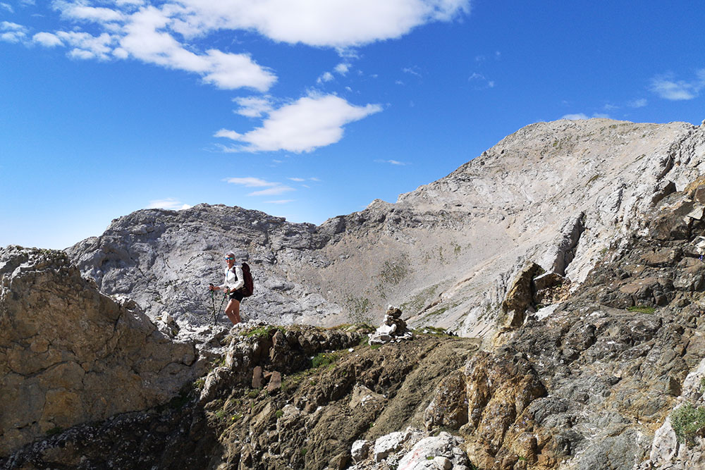
The excursion that we propose is not for everyone, because it has some points that are not very easy and require certain requirements: firm foot, absence of dizziness and a minimum of familiarity with the alpine environment. In particular: in a channel of dark rocks - 1st grade with slightly exposed passage -, on some 1st grade ups and downs - slightly friable rock - and two other short exposed sections.
But those who reach the top will not be able to say that: wow, wonderful! From the top you can enjoy a splendid 360 degree panorama with the Catinaccio and Lake Carezza in the foreground.
ITINERARY
From the car park at Passo Costalunga (1748 m) take trail 17 to Prato Latemar where you follow 18A. Shortly after, you leave 18A and climb onto 18, a very steep and gravel path for expert hikers, up to the Forcella Latemar Piccola (2520 m). Here you continue on the 18 up to the Cima Latemar / Latemarspitze (2791 m). You return along the same path to the Forcella Latemar Piccola. Now go down towards the pass for the path 517bis. Once in Pian de Valacia (1983 m), take path 517 which leads comfortably to Passo Costalunga.
Costalunga Pass - Forcella Latemar Piccola = 2:50
Forcella Latemar Piccola - Cima Latemar / Latemarspitze = 0:50
Cima Latemar / Latemarspitze - Forcella Latemar Piccola = 0:40
Forcella Latemar Piccola - Passo Costalunga = 1:30
Total 5:50
EXCURSION DATE
August 26, 2021
STARTING POINT
Costalunga Pass
REFRESHMENT POINT
Nobody
AUTHOR’S SUGGESTIONS
There are no refreshment points along the itinerary, so bring plenty of water.
SAFETY TIPS
The viability of the proposed itinerary, like all mountain morphology, is subject to environmental changes due to natural events and weather conditions. Therefore, before leaving, consult the competent tourist offices and / or the refuges of reference.
Our GPX tracks are only indicative, that is, the route was carried out at best with the conditions of the trails and weather of that day. So always consider what to do on site.
Also remember to evaluate the route based on your physical abilities, training and the equipment you have.
You should leave someone the route you intend to do told.
Remember that the emergency number is 112.
EQUIPMENT
It is recommended to have the appropriate equipment for the route, weather conditions and season: windproof and / or rain jacket, map and / or GPS device, goggles, sunscreen, boots, first aid kit, specific clothing, gloves, backpack with food and drink.
RECOMMENDED MAPS
Tabacco 029 SCHLERN - ROSENGARTEN / SCILIAR - CATINACCIO – LATEMAR
INTERESTING LINKS
https://www.latemar.it/
HOW TO ARRIVE
A22 exit Bolzano Nord. Take the SP241 Val D’Ega up to the Costalunga Pass.
PARKING AREA
Free at Passo Costalunga
GPS coordinates: 46.404787, 11.607740
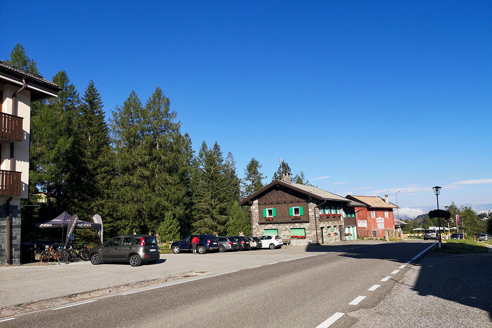
Passo Costalunga
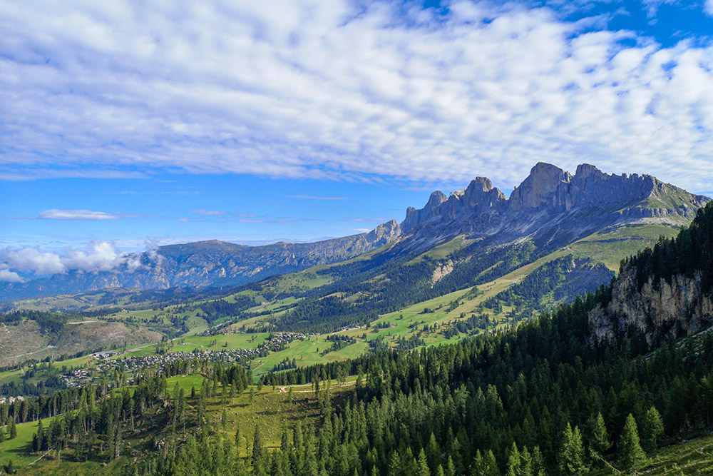
Vista sul Catinaccio mentre si sale
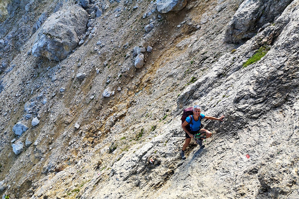
Si sale su roccia
Forcella Latemar Piccola
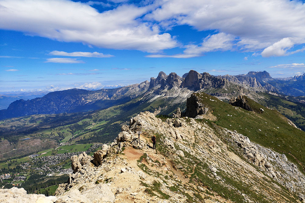
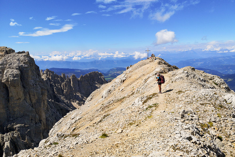
In cresta verso la vetta
Ultimo tratto
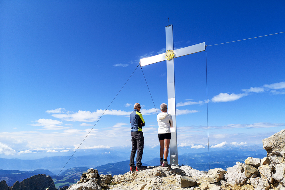
Cima Latemar
Si ritorna
Forcella Latemar Piccola
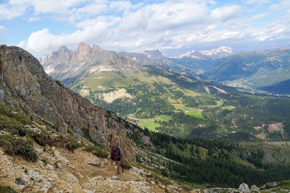
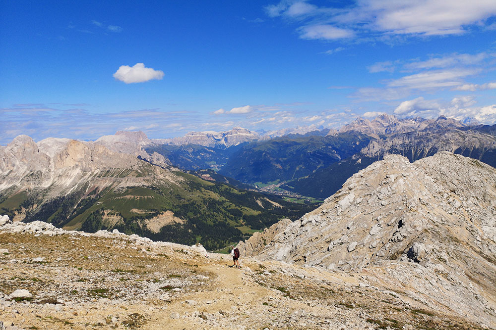
Panorama dal sentiero 517bis
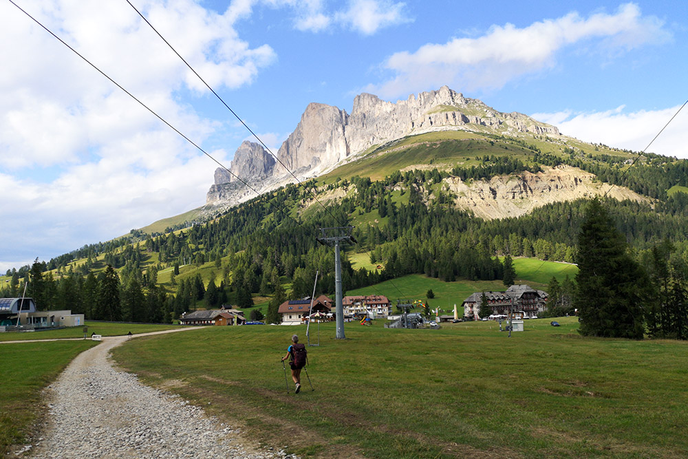
Ritornati a Passo Costalunga


