


![]()


Durata
 3:56 h
Distanza
 9,5 km
 Ascesa
 750 m
750 mDiscesa
 750 m
750 mH Max
 779 m
779 mH Min
 67 m
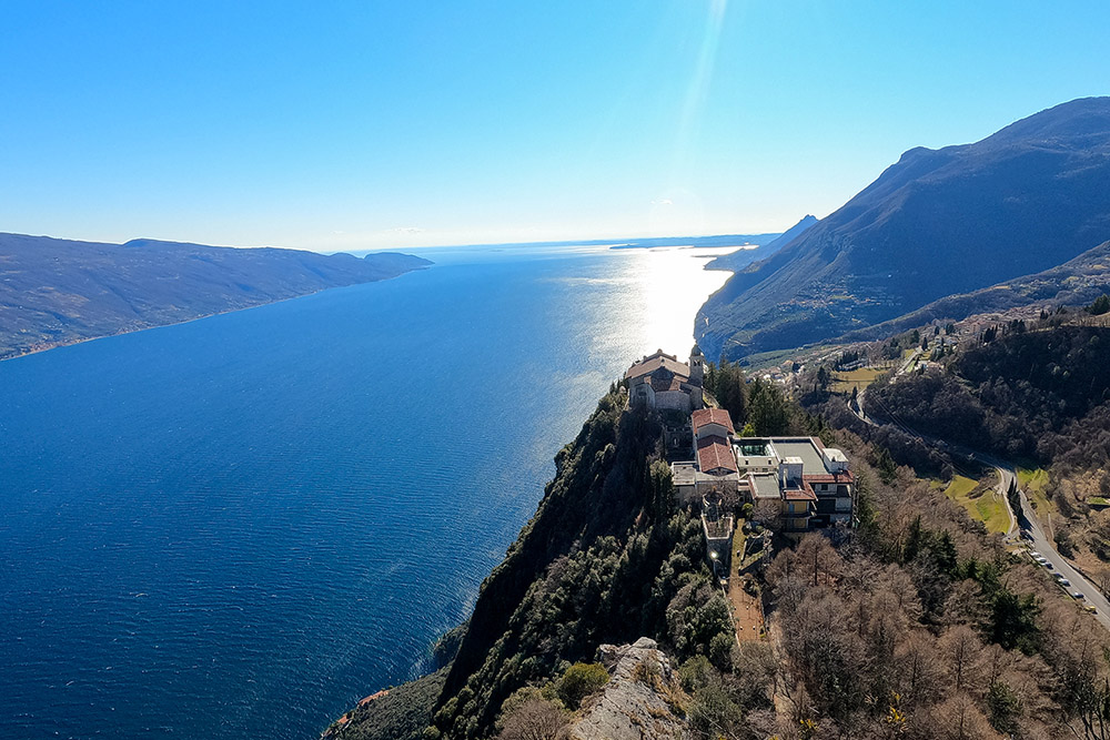
67 mThe Forra di San Michele, Mount Cas and the Sanctuary of Montecastello
DESCRIPTION
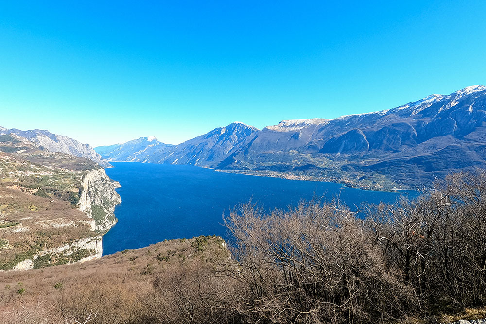
Itinerary that offers great views of Lake Garda and Monte Baldo.
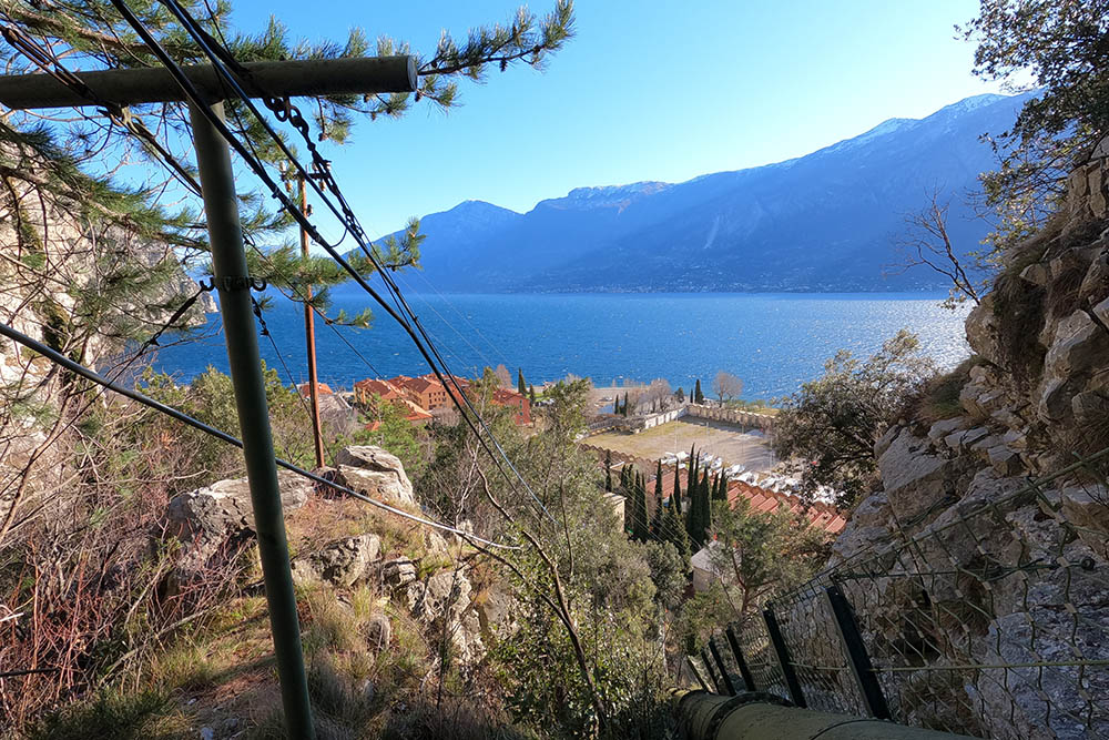
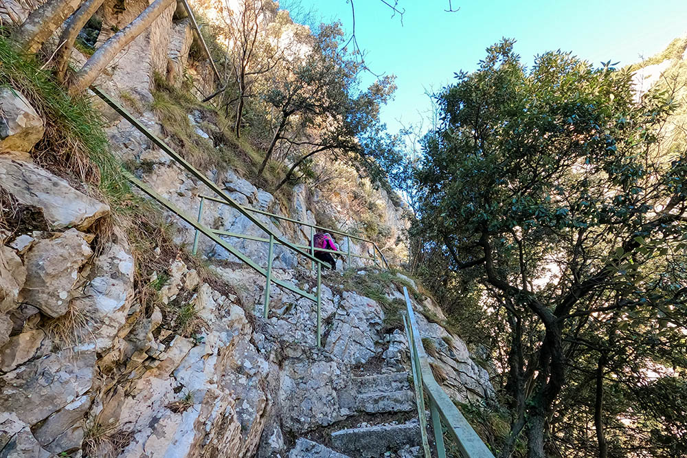
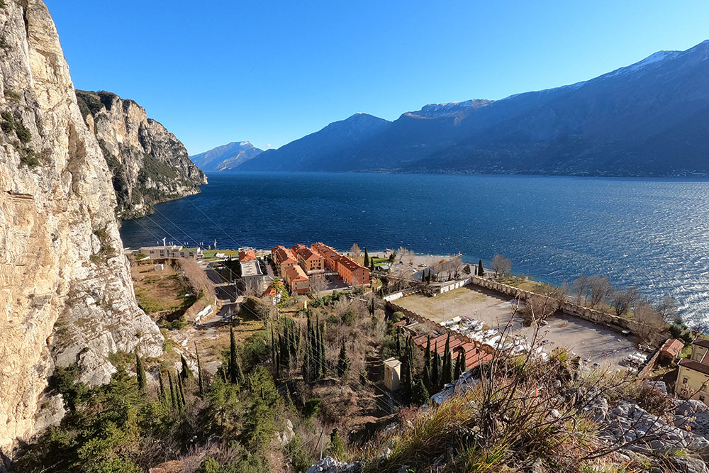
The excursion starts from the level of Lake Garda, exactly from Campione del Garda, and then goes up to the ravine of the San Michele stream: the San Michele gorge. Here the path runs alongside the hydraulic structures that were used in the past by the cotton mill. Already in this section there are some beautiful views of Campione and the lake.
The panorama gives its best in the stretch that goes from the ridge, to the top of Monte Cas, up to the Sanctuary of Montecastello.
ITINERARY
From Campione del Garda (77 m) take path no. 266/110 and go up crossing the Forra di San Michele. At the first crossroads (310 m) continue left on the 266 towards Monte Cas. Arrived at the top of Monte Cas (779 m), where there is an iron cross, you go down to the Sanctuary of Montecastello (650 m), always for 266. From the Sanctuary you go down for 100 m from the asphalted road and then turn right a path following the direction of Prabione. Take path 266 again and return to the starting point.
EXCURSION DATE
February 26, 2022
STARTING POINT
Campione del Garda
REFRESHMENT POINT
Nobody
AUTHOR’S SUGGESTIONS
Be careful on the path of the Forra di San Michele.
SAFETY TIPS
The viability of the proposed itinerary, like all mountain morphology, is subject to environmental changes due to natural events and weather conditions. Therefore, before leaving, consult the competent tourist offices and / or the refuges of reference.
Our GPX tracks are only indicative, that is, the route was carried out at best with the conditions of the trails and weather of that day. So always consider what to do on site.
Also remember to evaluate the route based on your physical abilities, training and the equipment you have.
You should leave someone the route you intend to do told.
Remember that the emergency number is 112.
EQUIPMENT
It is recommended to have the appropriate equipment for the route, weather conditions and season: windproof and / or rain jacket, map and / or GPS device, goggles, sunscreen, boots, first aid kit, specific clothing, gloves, backpack with food and drink.
RECOMMENDED MAPS
Tabacco 071 PREALPI GARDESANE - TREMALZO - VALLE DI LEDRO - L.D’IDRO
INTERESTING LINKS
https://www.visitgarda.com
HOW TO ARRIVE
From Riva del Garda or from Salò: SS45bis.
PARKING AREA
For a fee (except in winter)
GPS coordinates: 45.753336, 10.749873
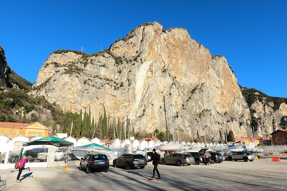
Parcheggio a Campione del Garda
Si sale lungo gli impianti idrici
Si sale lungo gli impianti idrici
Il panorama inizia ad essere interessante
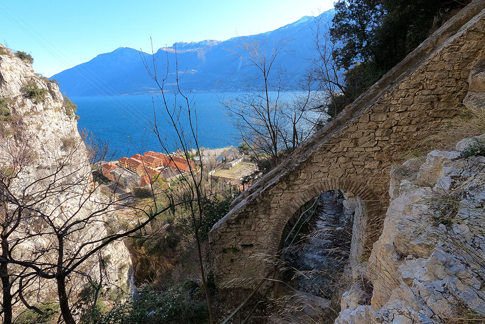
Si sale lungo gli impianti idrici
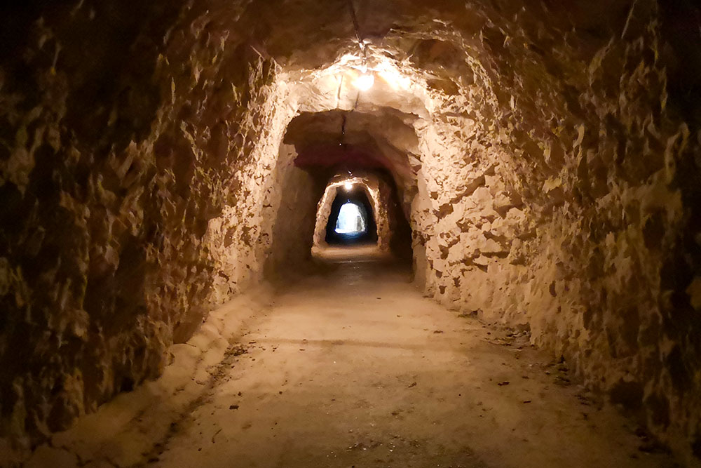
Galleria
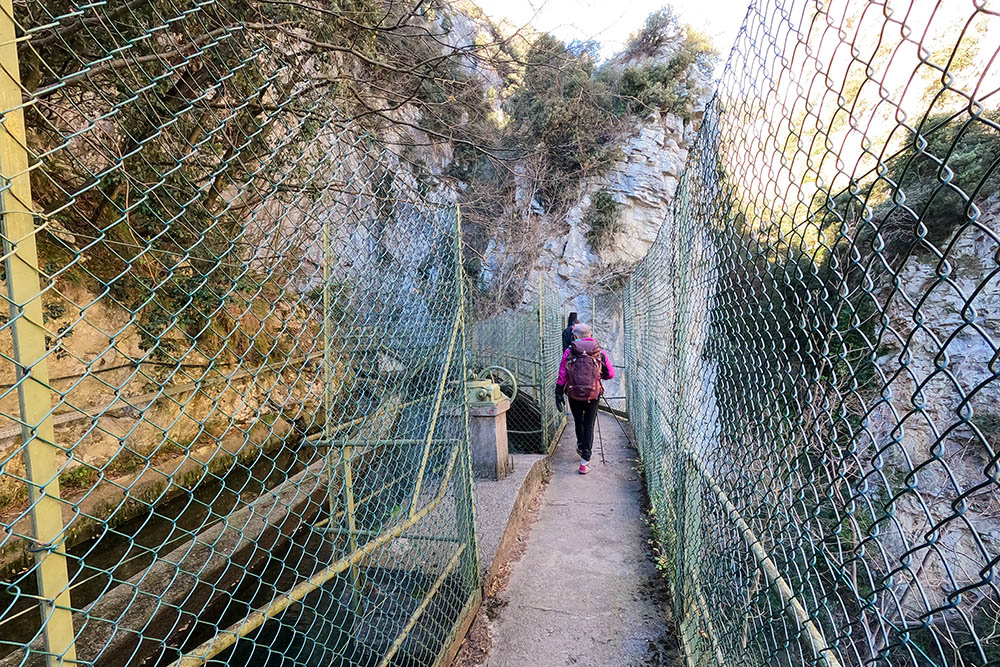
Il sentiero passa accanto a delle vasche
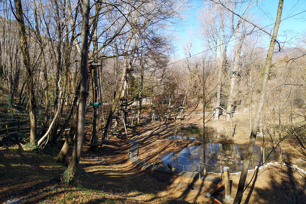
Parco avventura vicino a Prabione
Siamo quasi in cima
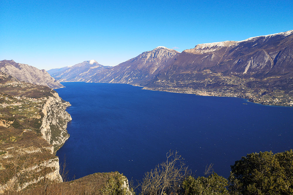
Il lago visto dal primo belvedere
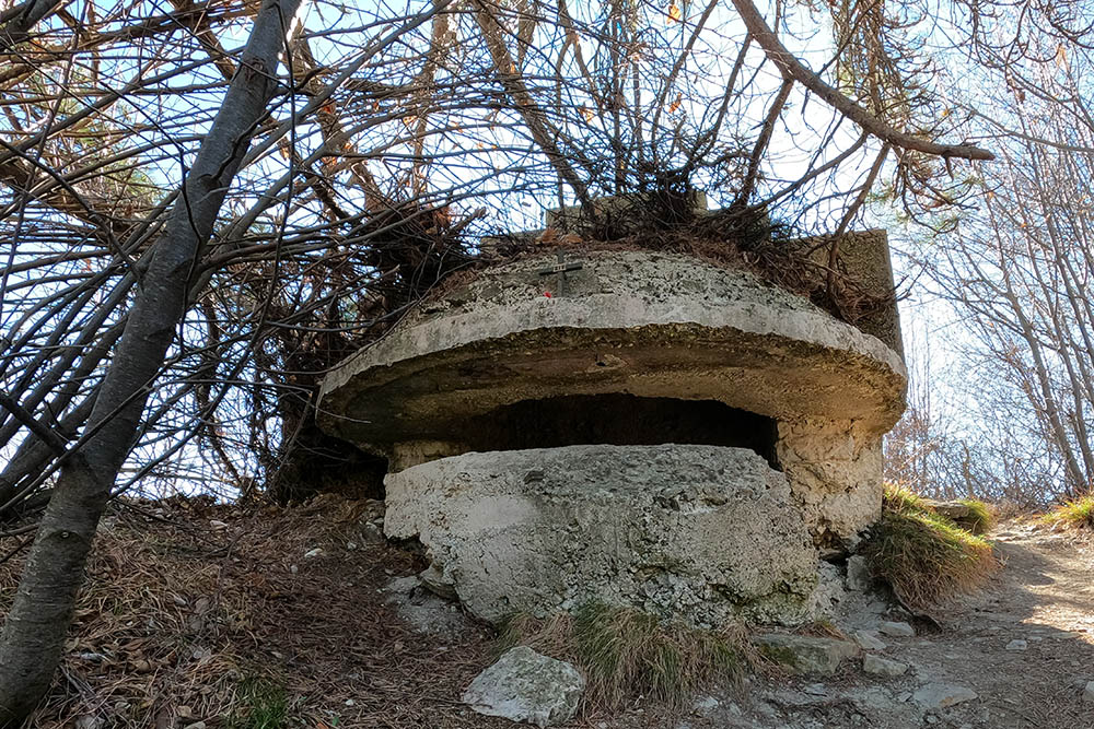
Resti di fortificazioni della Prima Guerra Mondiale
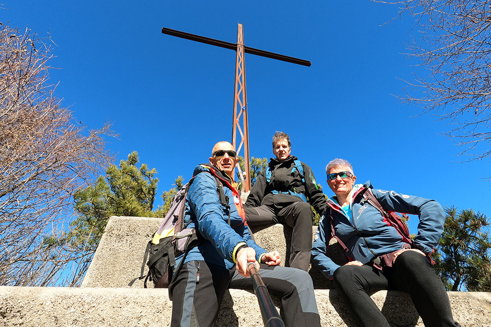
La croce di vetta del Monte Cas
Veduta verso sud
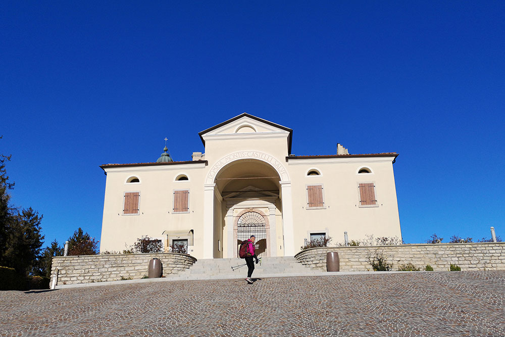
Il Santuario di Montecastello


