


![]()


Durata
 4:30 h
Distanza
 12,8 km
 Ascesa
 350 m
350 mDiscesa
 350 m
350 mH Max
 255 m
255 mH Min
 65 m
65 mExcursion to the villages of Brenzone
DESCRIPTION
Beautiful walk with a wonderful view of Lake Garda.
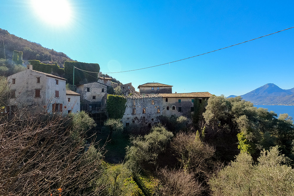
Splendid circular itinerary passing through the villages of the Municipality of Brenzone starting from Sommavilla. The first half of the route is an ups and downs through the numerous villages walking along mule tracks, paths and stretches of paved road. Each town you pass is a small architectural jewel, as are all the agricultural terracing works. From the top, up to 255 meters, you can enjoy a beautiful view of Lake Garda.
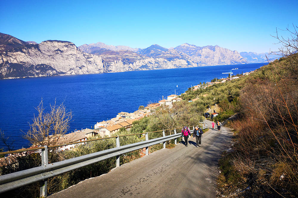
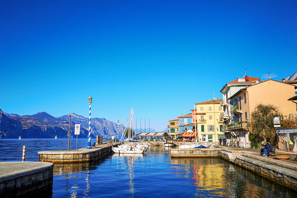
Once in Castelletto the return is all by the lake. The itinerary is within everyone's reach, obviously if they have a bit of training. For those wishing to shorten the tour, they can do it in two ways: 1) at any point go down towards the lake or 2) when you arrive in Castelletto, return by public transport.
ITINERARY
From the parking lot (130 m) go south along Via Benedetto Croce, then go up Via Monteccio and, passing under a small arch, follow path 31 to Zignago. Here you go down to the right to Castello (140 m) and then to Cà Romana (97 m). Go up a very steep asphalted road following the signs for Campo Borgo Medievale. Arriving at the beautiful Campo Borgo (255 m), the highest point of the route, you go down to Castelletto (63 m). Now we return to Sommavilla following the beautiful lakeside path. At the Sommavilla / Assenza roundabout, go up to the right on the paved road that leads back to the parking lot.
EXCURSION DATE
February 12, 2022
STARTING POINT
Sommavilla di Brenzone
REFRESHMENT POINT
In the numerous villages that meet
AUTHOR’S SUGGESTIONS
It is recommended to go around clockwise and in the spring or autumn months.
SAFETY TIPS
The viability of the proposed itinerary, like all mountain morphology, is subject to environmental changes due to natural events and weather conditions. Therefore, before leaving, consult the competent tourist offices and / or the refuges of reference.
Our GPX tracks are only indicative, that is, the route was carried out at best with the conditions of the trails and weather of that day. So always consider what to do on site.
Also remember to evaluate the route based on your physical abilities, training and the equipment you have.
You should leave someone the route you intend to do told.
Remember that the emergency number is 112.
EQUIPMENT
It is recommended to have the appropriate equipment for the route, weather conditions and season: windproof and / or rain jacket, map and / or GPS device, goggles, sunscreen, boots, first aid kit, specific clothing, gloves, backpack with food and drink.
RECOMMENDED MAPS
Tabacco 063 MONTE BALDO - MALCESINE - GARDA
INTERESTING LINKS
https://www.livelagodigarda.it/cosa-vedere-a-brenzone/
HOW TO ARRIVE
A22 Affi exit. Follow the SP9 with the indication Lago di Garda. Once in Varesche, take the SP8 towards Torri del Benaco. At Garda take the SR249 on the right and continue until Sommavilla di Brenzone. In Sommavilla di Brenzone, at the roundabout, go up to the right towards Pozzo for 600 m.
A22 exit Rovereto Sud. Follow the signs for Lake Garda and go through the Tierno Tunnel. Take the SS240 up to Torbole. Here you take the SS249 towards Malcesine. Once in Sommavilla di Brenzone, at the first roundabout, go up to the left towards Pozzo for 600 m.
PARKING AREA
For a fee in Sommavilla di Brenzone
GPS coordinates: 45.726990, 10.785709
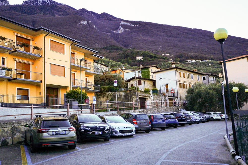
Parcheggio
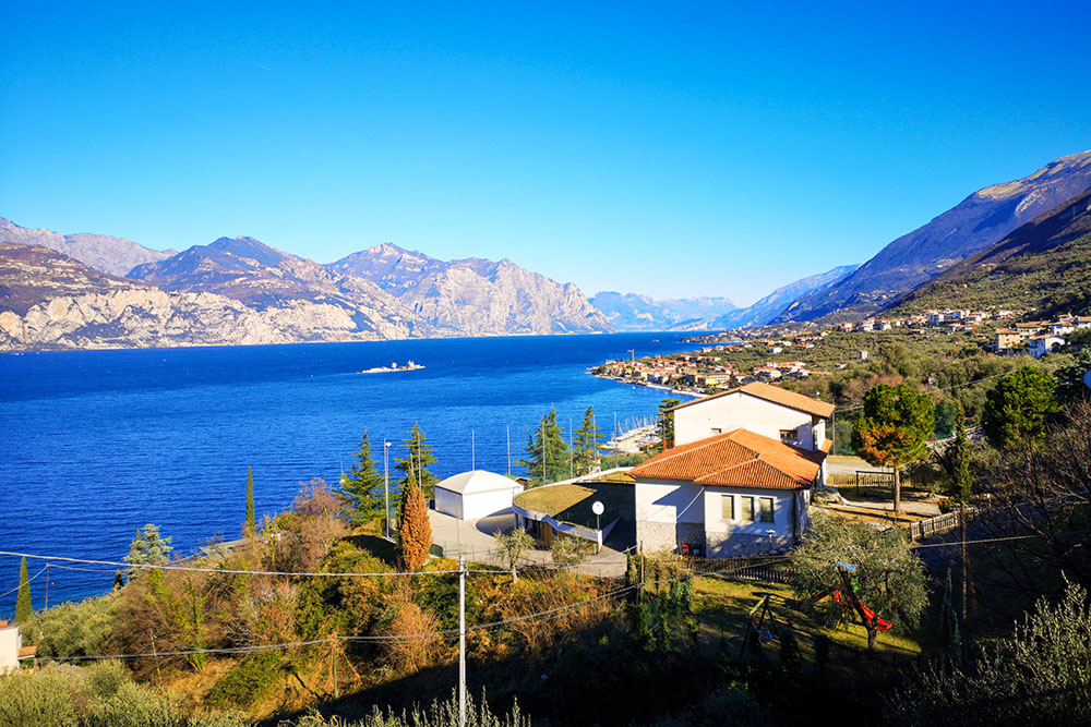
Appena si prende quota il panorama diventa splendido
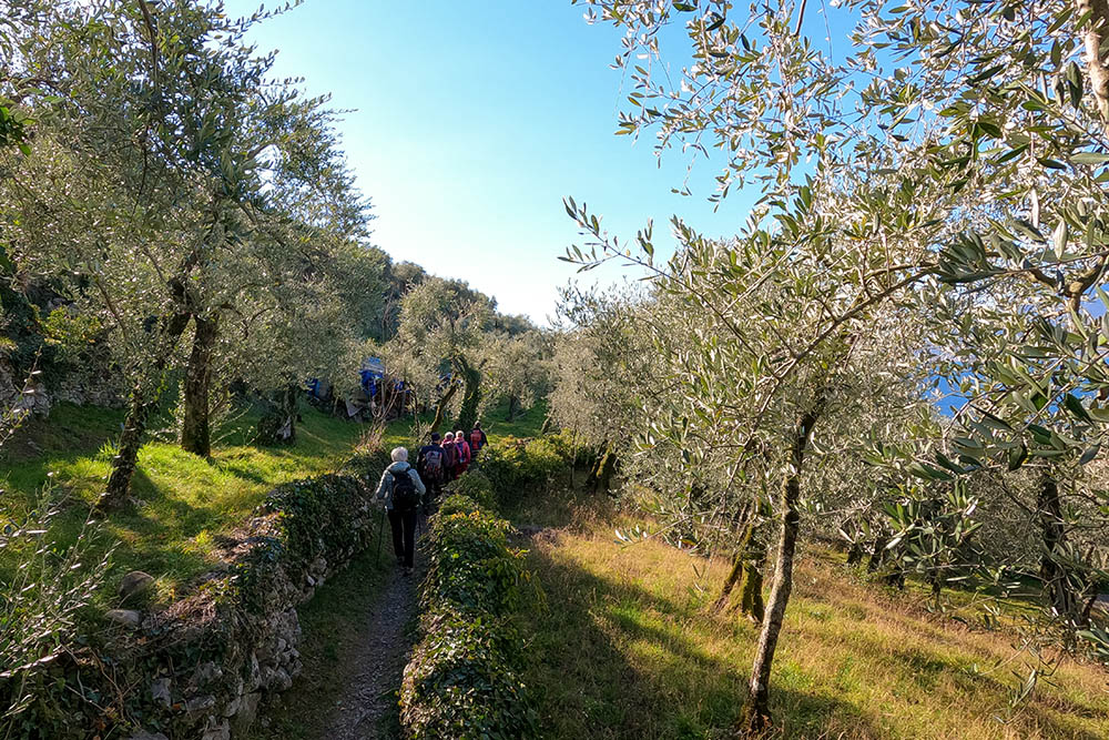
Si passa per bellissimi uliveti
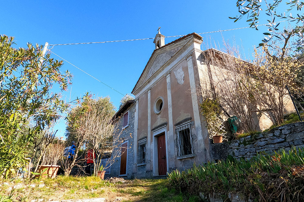
Chiesa Madonna della Pace - Boccino
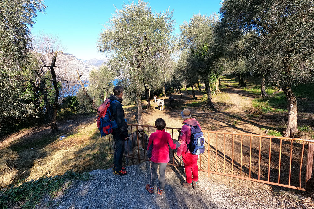
Si incontrano anche dei simpatici asinelli
Si sale su strada molto ripida
Siamo arrivati a Campo di Brenzone
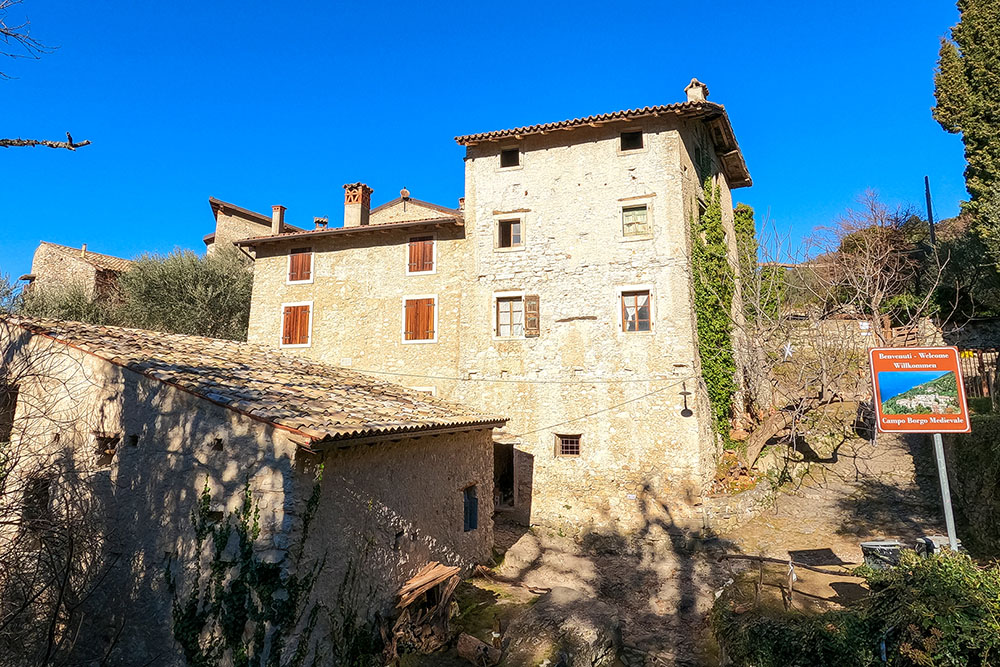
Campo di Brenzone
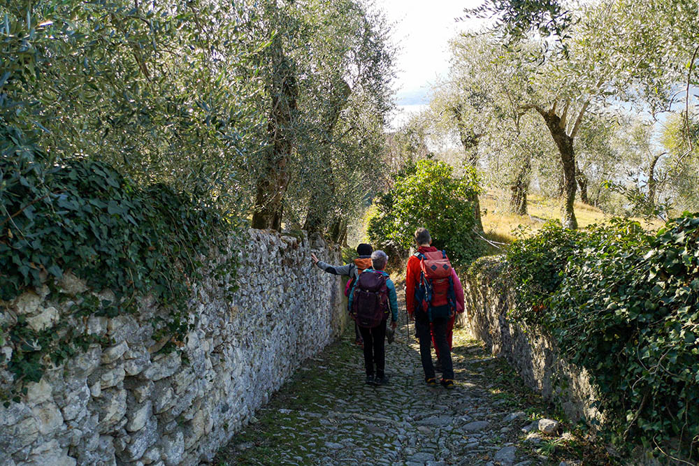
Siamo sempre attorniati dagli ulivi
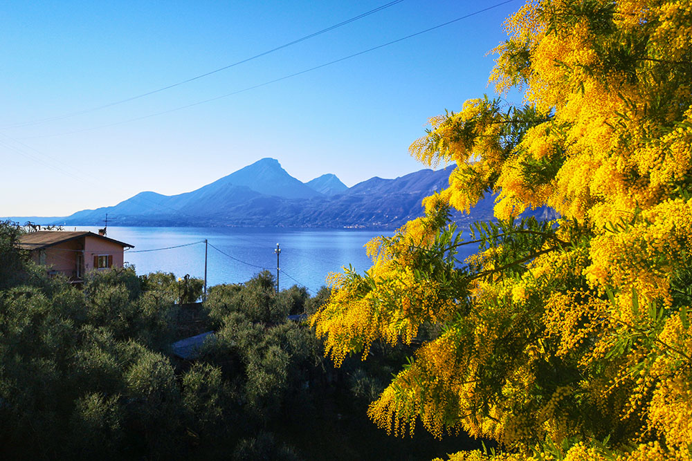
Le mimose sono già in fiore
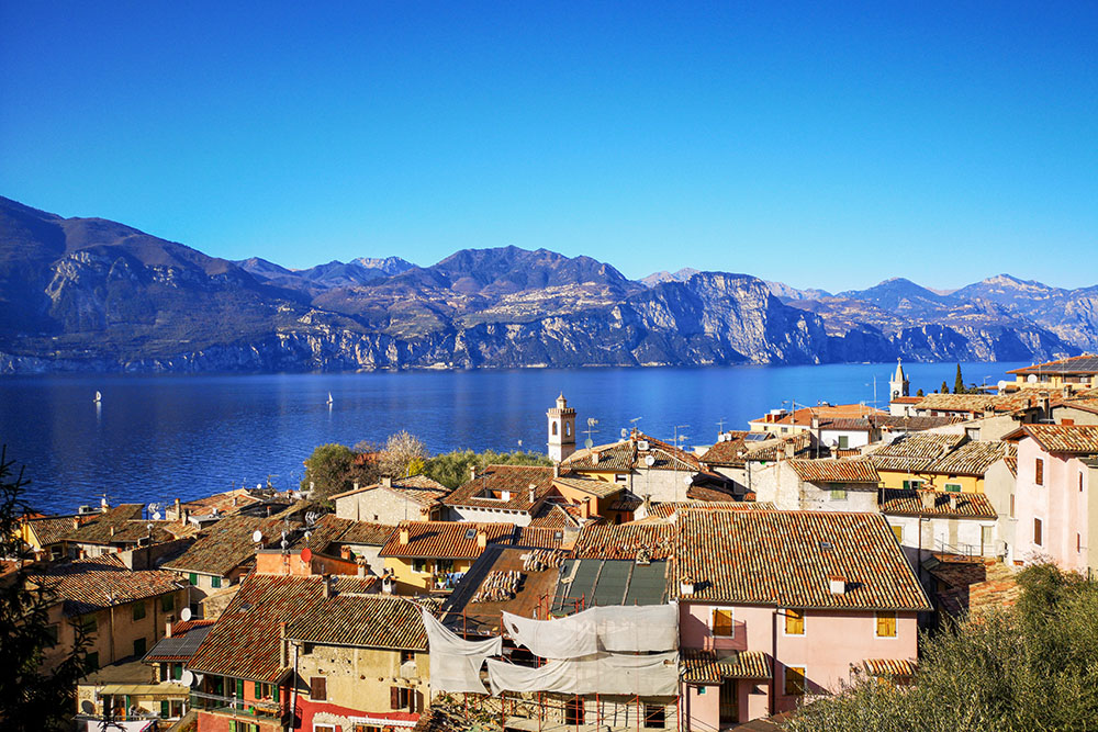
Castelletto dall'alto
Castelletto di Brenzone
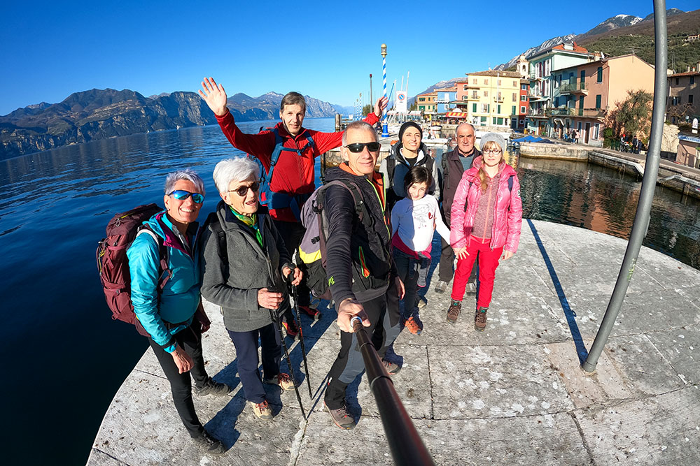
Foto ricordo dell'allegra compagnia
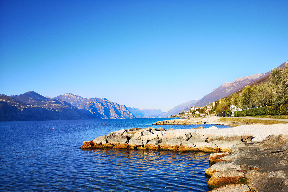
Panorama della costa
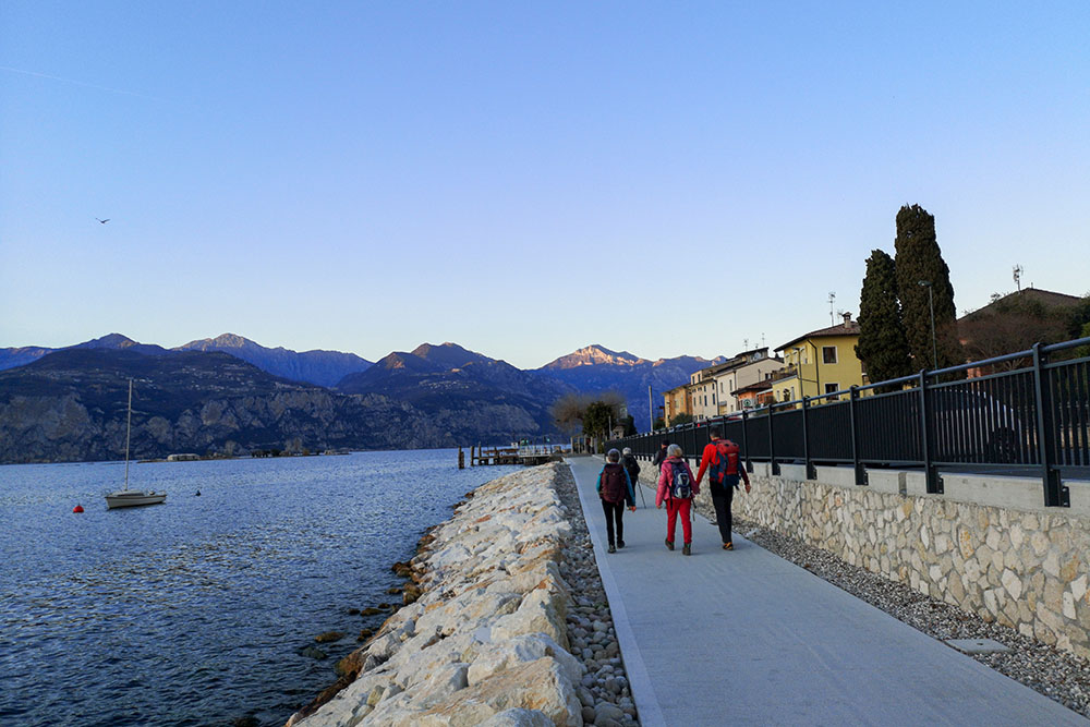
Si ritorna all'imbrunire


