


![]()


Durata
 4:50 h
Distanza
 9,8 km
 Ascesa
 913 m
913 mDiscesa
 913 m
913 mH Max
 2694 m
H Min
 1910 m
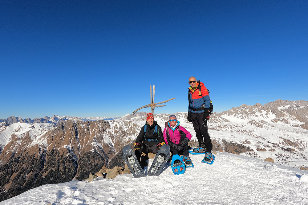
Cima Juribrutto / Gereburt
DESCRIPTION
Magnificent snowshoe hike in the Bocche Group.
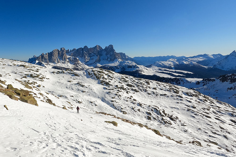
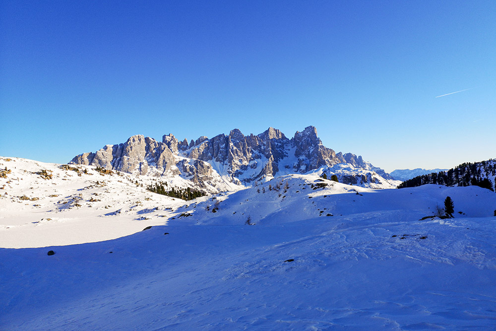
Cima Juribrutto is a classic destination for ski mountaineering and excursions with cisapole. The outward leg does not present particular technical difficulties, while in the return - particularly in Val Juribrutto - some sections have steep slopes. So be careful and take a good look at the snow conditions. The excursion is very scenic from the very beginning: the Pale di San Martino will accompany you all the way. From the top the view is exceptional: Sella Group, Sassolungo and Sassopiatto, Catinaccio, Cima Bocche, Lagorai Group, Pale di San Martino, Pelmo, Civetta, Marmolada and Costabella ridges.
ITINERARY
From Malga Valazza (1940 m) take the 631 - direction Lago Juribrutto. Arrived at an altitude of 2335 m, leave the 631 and follow the tracks - path without signpost - which lead directly to Cima Juribrutto / Gereburt (2694 m). Go back a little on the same path and then take the path that leads to Passo Juribrutto (2381 m). Now go down the path 628 to Lake Juribrutto (2220 m) and then take the path 631 back to the starting point.
EXCURSION DATE
January 23, 2022
STARTING POINT
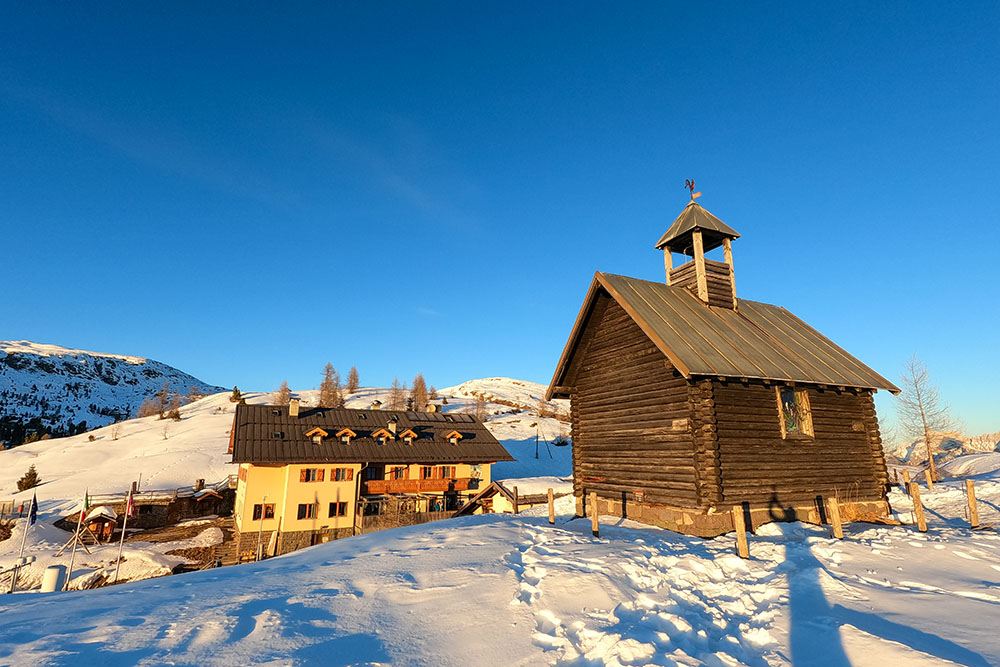
Valazza mountain hut
REFRESHMENT POINT
Nobody
AUTHOR’S SUGGESTIONS
In the event of abundant or unsettled snow, it is advisable to return along the same path as the outward journey.
SAFETY TIPS
Snowpack stability is subject to sudden and unpredictable changes. For your safety, always consult the avalanche bulletin, because the snowpack is subject to rapid changes, ask the competent local offices for information. Our GPX tracks are indicative only, that is, the route was best done with the snow and weather conditions of that day. So always evaluate what to do on site. Also remember to evaluate the route based on your physical abilities, training and the equipment you have. It is appropriate to let someone know the itinerary you intend to take. Remember that the emergency number is 112.
EQUIPMENT
It is recommended to have the appropriate equipment: kit for self-rescue in avalanches (consisting of Artva, shovel and probe), snowshoes, sticks, crampons, glasses, sunscreen, hiking boots, winter clothing, gloves, cap, backpack hot drinks.
RECOMMENDED MAPS
Tabacco 06 Val di Fassa e Dolomiti fassane
INTERESTING LINKS
https://www.fassa.com/
HOW TO ARRIVE
SS48 up to Predazzo, SS50 towards Passo Rolle - Passo Valles, SP81 and 1 km before Passo Valles, on the left, is the Malga Valazza.
PARKING AREA
Free at Malga Valazza
GPS coordinates: 46.341177, 11.791059
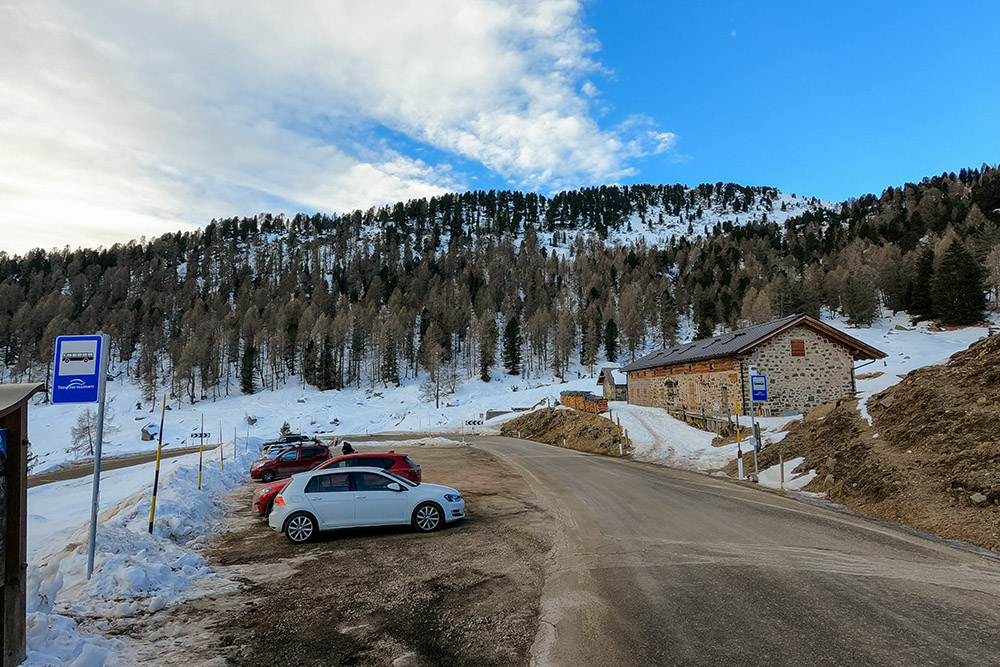
Parcheggio presso la Malga Valazza
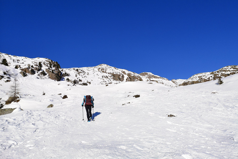
Si sale sul sentiero n. 631
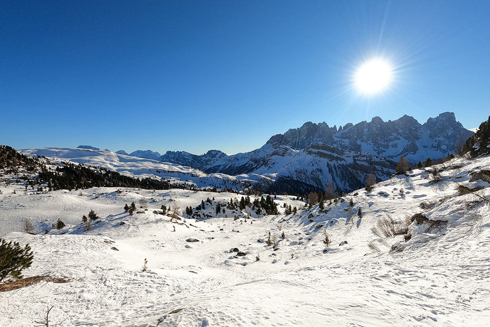
Le Pale di San Martino il lontananza
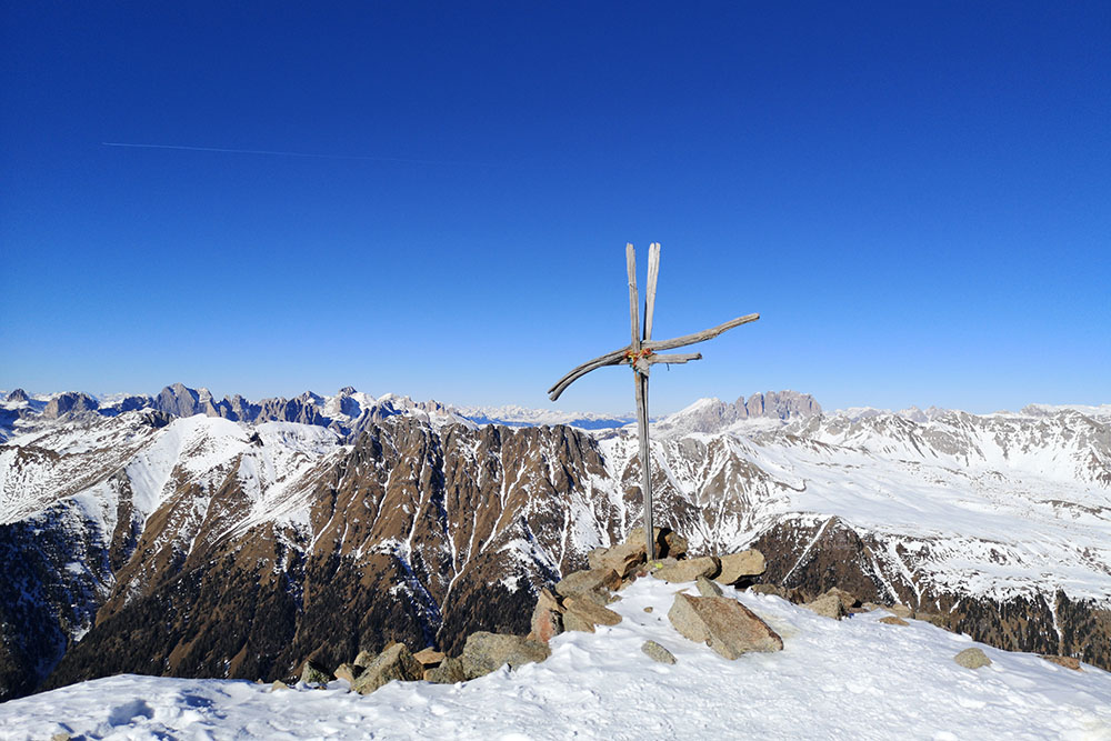
La Cima Juribrutto
La Cima Juribrutto
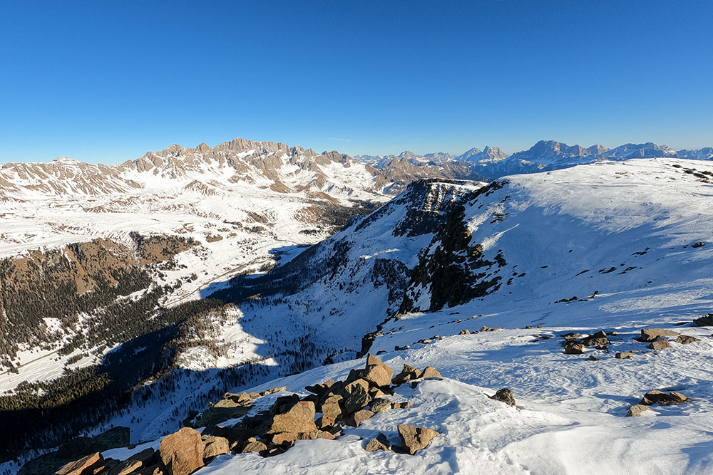
Vista sul Passo San Pellegrino
Si ritorna sulle proprie tracce
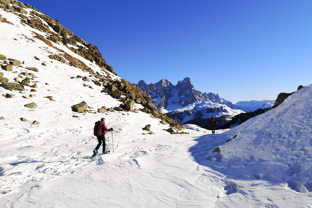
Si percorre la Val Juribrutto
Le Pale di San Martino dal Lago Juribrutto
Passo Valles


