


![]()


Durata
 5:00 h
Distanza
 12,9 km
 Ascesa
 898 m
898 mDiscesa
 898 m
898 mH Max
 2010 m
H Min
 1135 m
Snowshoe hike to Haniger Schwaige
DESCRIPTION
Fantastic snowshoe hike in the kingdom of King Laurin.
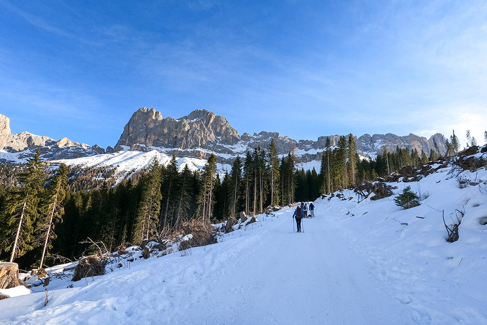
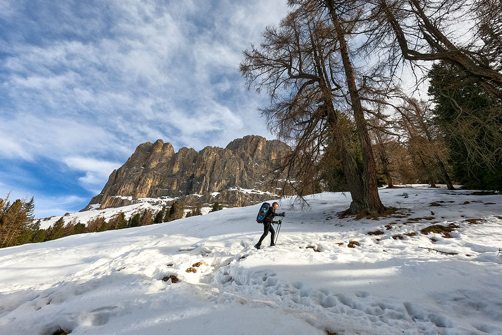
Very scenic loop hike at the foot of the Catinaccio Group. The first stretch - from the car park at Passo Nigra - is almost always in the woods, but since taking path no. 1 and then n. 7 the view expands. The gaze is captivated by a beautiful panorama that reaches its peak when you reach the Angelwiesen: the Latemar, the Corno Nero, the Corno Bianco, the Valle di Tires, the Schiliar and the Catinaccio Group.
ITINERARY
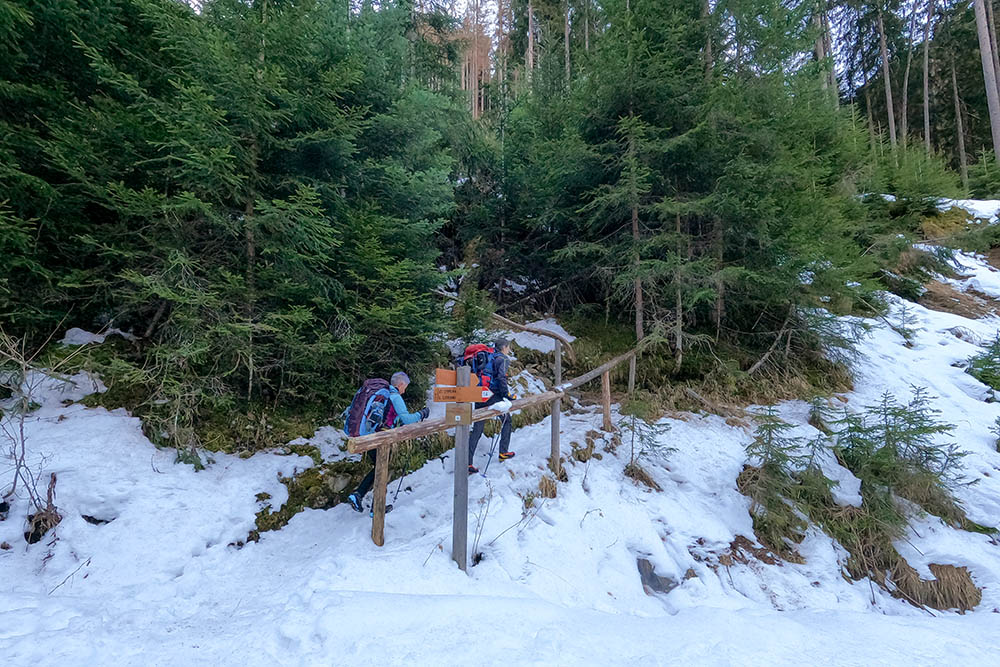
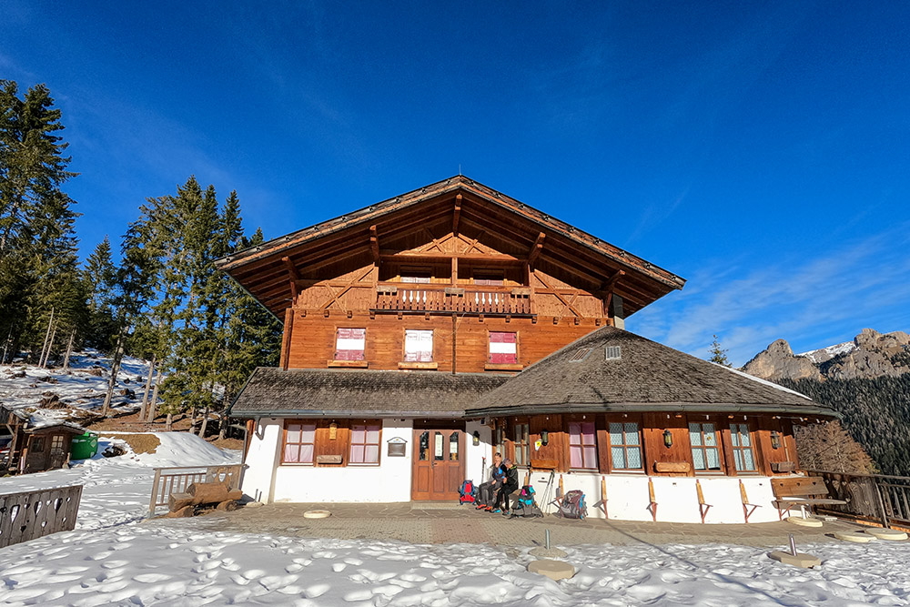
From the car park 1135 m, take the A1 path and arrive at Passo Nigra - Rifugio Nigra 1690 m. Cross the road and take a dirt road, signpost no. 1. After a while you leave path 1 and take path 7 which first passes over Angelwiesen and then leads to Malga Costa / Haniger Schwaige 1937 m. You return to the starting point for path 7 and 10 passing through the Plafotsch hut (1570 m).
Parking - Passo Nigra 2 hours
Passo Nigra - Malga Costa 1:30 hours
Malga Costa - Parking 1:30 hours
EXCURSION DATE
January 2, 2022
STARTING POINT
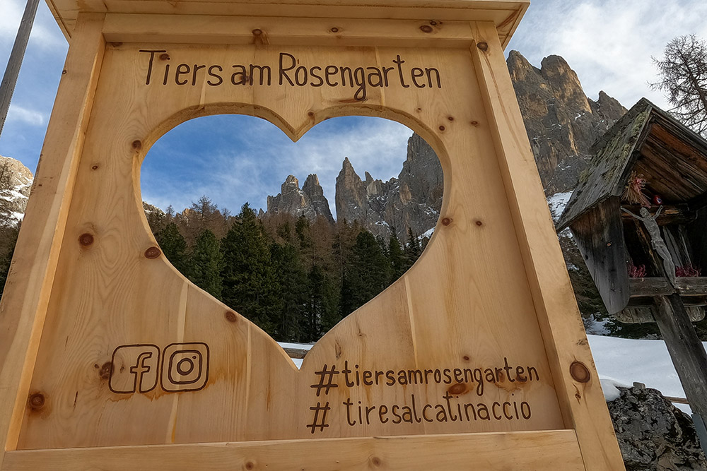
San Cipriano
REFRESHMENT POINT
Malga Costa/Haniger Schwaige 1937 m
AUTHOR’S SUGGESTIONS
At Malga Costa / Haniger Schwaige there are excellent dishes waiting for you: we recommend eggs, potatoes and speck.
SAFETY TIPS
Snowpack stability is subject to sudden and unpredictable changes. For your safety, always consult the avalanche bulletin, because the snowpack is subject to rapid changes, ask the competent local offices for information. Our GPX tracks are indicative only, that is, the route was best done with the snow and weather conditions of that day. So always evaluate what to do on site. Also remember to evaluate the route based on your physical abilities, training and the equipment you have. It is appropriate to let someone know the itinerary you intend to take. Remember that the emergency number is 112.
EQUIPMENT
It is recommended to have the appropriate equipment: kit for self-rescue in avalanches (consisting of Artva, shovel and probe), snowshoes, sticks, crampons, glasses, sunscreen, hiking boots, winter clothing, gloves, cap, backpack hot drinks.
RECOMMENDED MAPS
Tabacco 029 SCHLERN - ROSENGARTEN / SCILIAR - CATINACCIO - LATEMAR
INTERESTING LINKS
https://www.hanigerschwaige.com/
HOW TO ARRIVE
A22 exit Bolzano Nord take SS12 towards Brennero. In Prato Isarco take the road to Tires and once you arrive in Tires continue towards San Cipriano. In San Cipriano you pass the Dolomit Resort for about 700 m. There is a car park on the right.
PARKING AREA
Free, immediately after the town of San Cipriano.
GPS coordinates: 46.470940, 11.568567
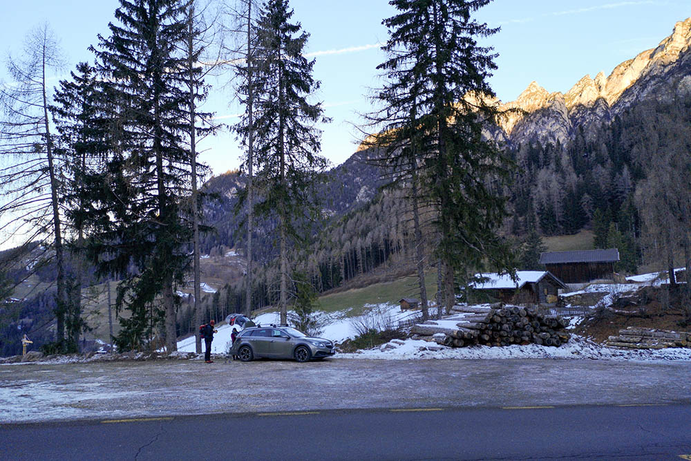
Parcheggio
Si sale per il sentiero A1
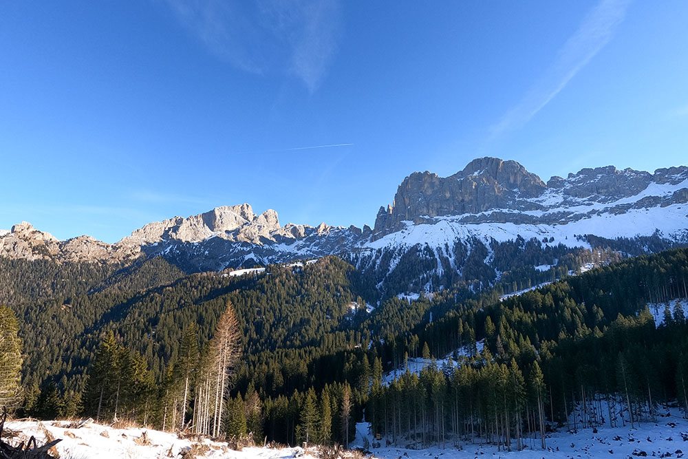
Si inizia a vedere un bel panorama sul Gruppo del Catinaccio
Passo Nigra
Si sale seguendo il segnavia n 1
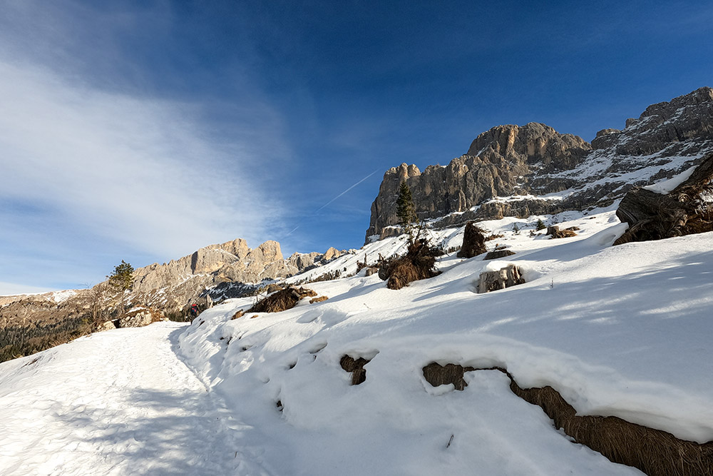
Si cambia segnavia, ora è il 7
Il panorama diventa sempre più interessante
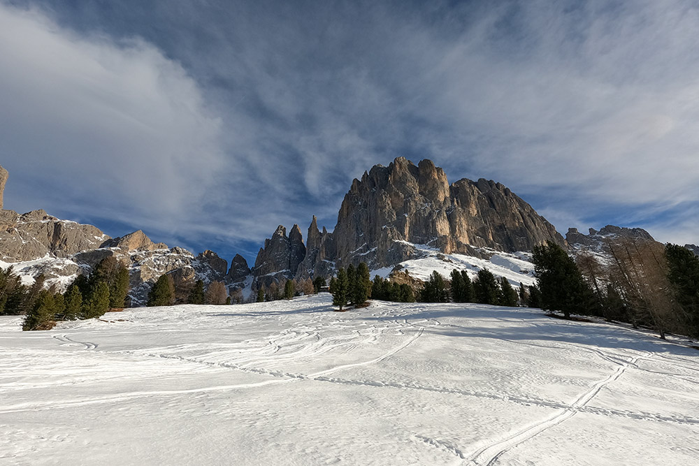
Il Gruppo del Catinaccio dagli Angelwiesen
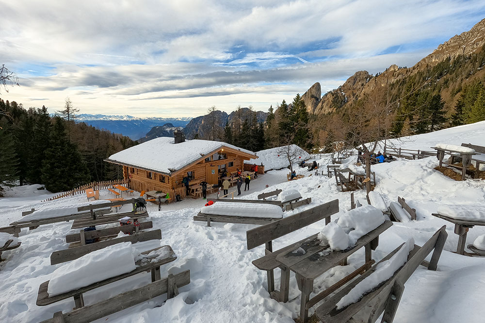
Siamo arrivati a Malga Costa - Haniger
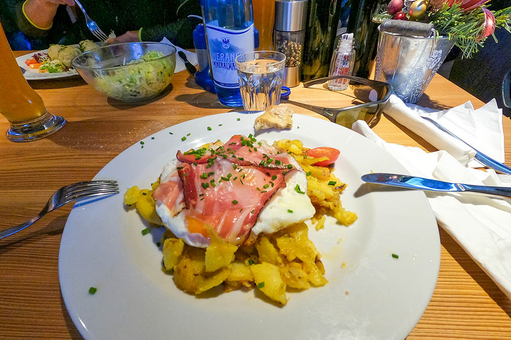
Uova, patate e speck
Le Torri del Vajolet
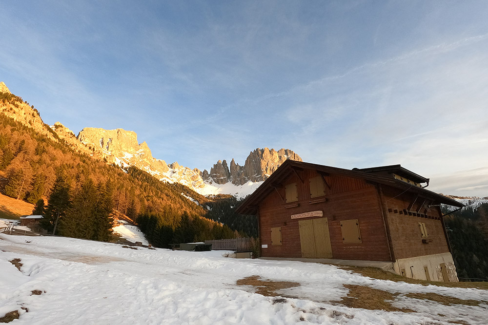
Malga Plafotsch

Si ritorna al parcheggio


