


![]()


Durata
 3:45 h
Distanza
 10,6 km
 Ascesa
 418 m
418 mDiscesa
 418 m
418 mH Max
 2194 m
H Min
 1803 m
Astjoch from the Tulper Gampis car park
DESCRIPTION
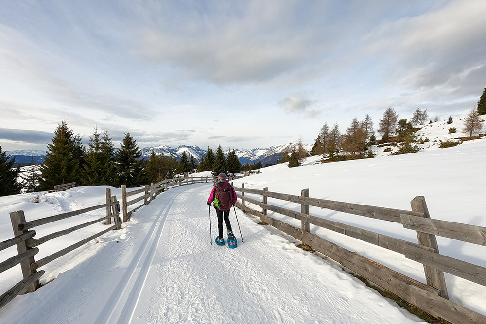
Easy excursions with snowshoes on the Alpe di Luson.
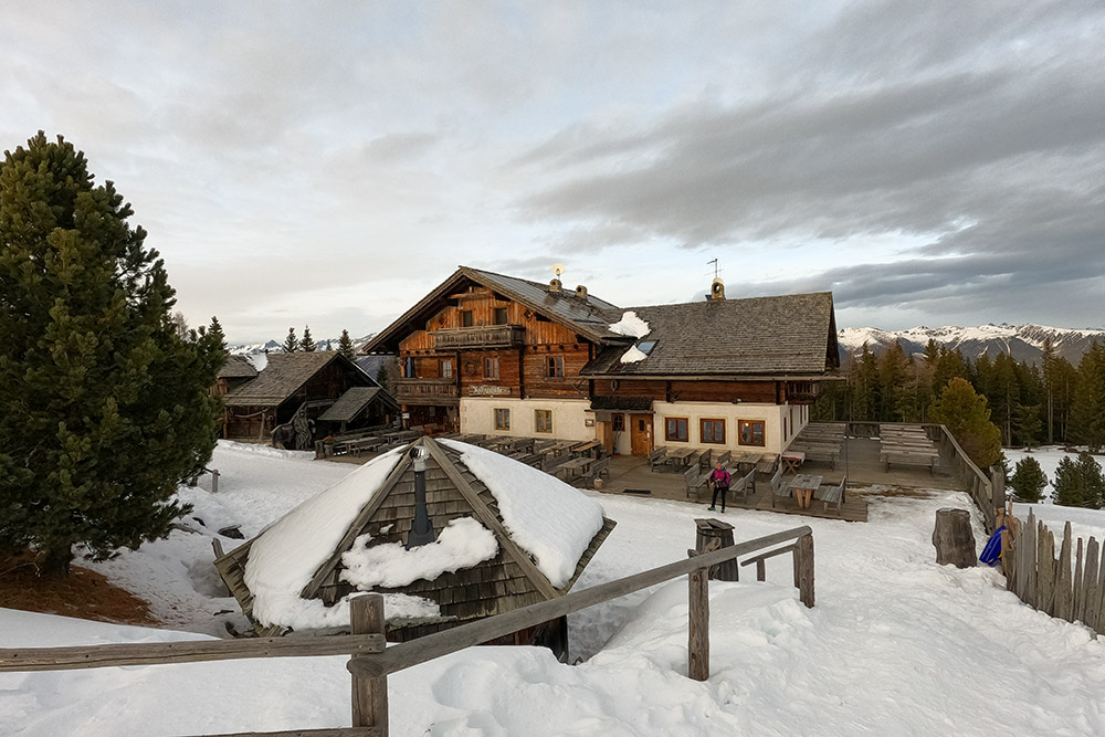
The Lüsner Alm is a spacious hut with a fantastic view of the surrounding mountains. It is a very popular tourist destination as it offers numerous excursions in all seasons.
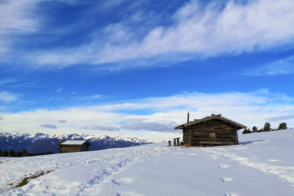
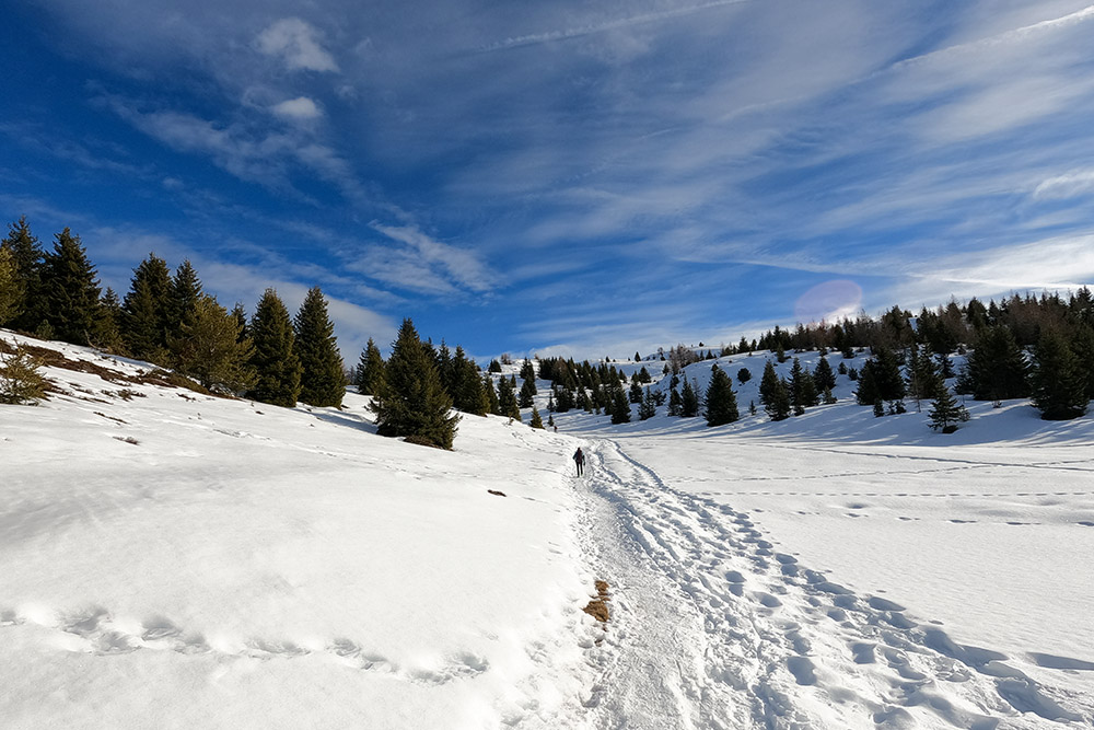
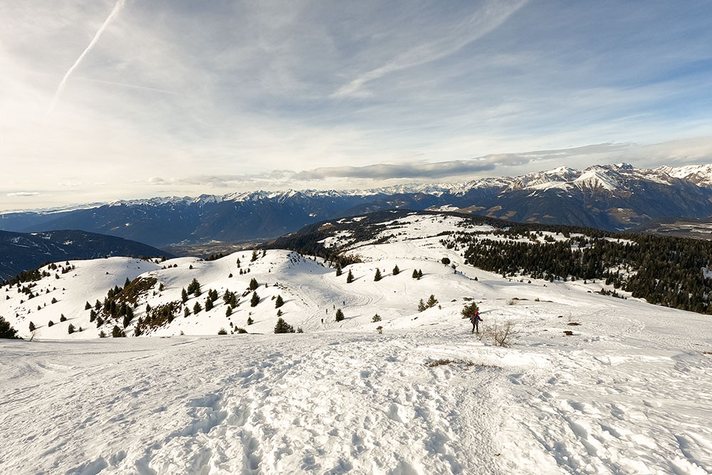
The excursion with snowshoes that we offer is very simple: there are no particular technical difficulties and not even places that are extremely dangerous for avalanches. The panorama from the summit of Astjoch is also splendid: the Vedrette di Ries, the High Tauern, the Dolomites, the Isarco and Pusteria valleys.
ITINERARY
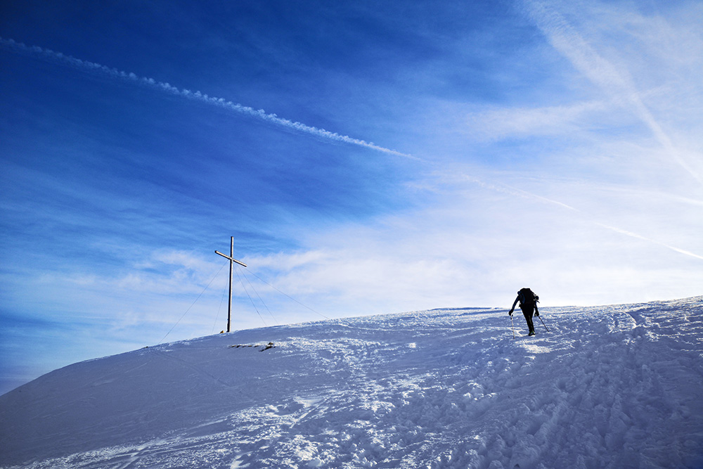
From the car park (1809 m) in the direction of the Starkenfeldhütte, path n. 3. Once you reach Starkenfeldhütte (1936 m), continue on the same path. After a while, take path 67 and climb to the top of the Astjoch (2194 m). You go back on the same road. Shortly after the Starkenfeldhütte (1936 m), turn right and reach the Rastnerhütte (1930 m). Go back to the intersection, follow the 3 to the starting point.
EXCURSION DATE
January 3, 2022
STARTING POINT
Tulper Gampis car park
REFRESHMENT POINT
Starkenfeldhütte (1936 m) and Rastnerhütte (1930 m)
AUTHOR’S SUGGESTIONS
Try the ricotta strudel from the Rastnerhütte.
SAFETY TIPS
Snowpack stability is subject to sudden and unpredictable changes. For your safety, always consult the avalanche bulletin, because the snowpack is subject to rapid changes, ask the competent local offices for information. Our GPX tracks are indicative only, that is, the route was best done with the snow and weather conditions of that day. So always evaluate what to do on site. Also remember to evaluate the route based on your physical abilities, training and the equipment you have. It is appropriate to let someone know the itinerary you intend to take. Remember that the emergency number is 112.
EQUIPMENT
It is recommended to have the appropriate equipment: kit for self-rescue in avalanches (consisting of Artva, shovel and probe), snowshoes, sticks, crampons, glasses, sunscreen, hiking boots, winter clothing, gloves, cap, backpack hot drinks.
RECOMMENDED MAPS
Tabacco 030 Bressanone / Val di Funes
INTERESTING LINKS
https://www.starkenfeld.com/
HOW TO ARRIVE
From Bressanone SP30 to Luson. Here you take the road to Rodengo and after about 6 km you go up to the right - sign for parking. You pass the Herol car park and drive to the Tulper Gampis car park (open only in winter).
PARKING AREA
Free parking at Tulper Gampis (open only in winter).
GPS coordinates: 46.768551, 11.763564
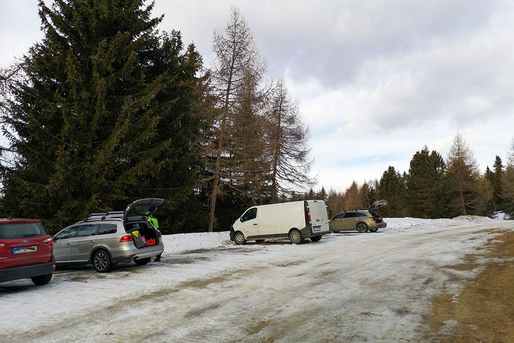
Parcheggio Tulper Gampis
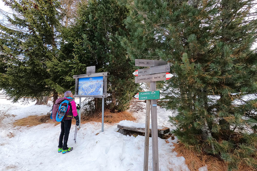
Inizio del sentiero n 3
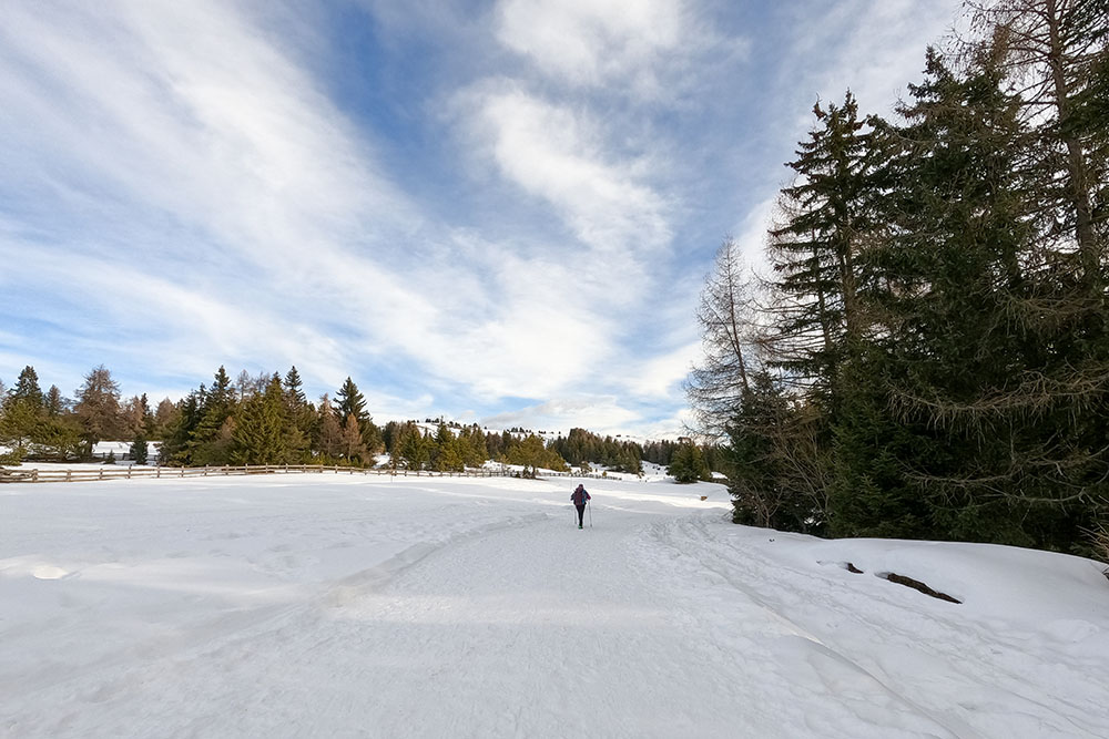
Il sentiero ha poca pendenza
Interessanti scorci dell'Alpe
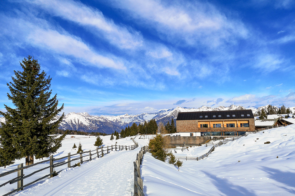
Rifugio Campoforte - Starkenfeldhütte

Si inizia a vedere la croce di vetta
Saliamo per il sentiero n 67
Arrivati a Cima Lasta - Astjoch
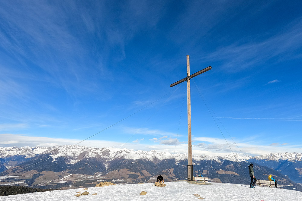
La grande croce lignea di Cima Lasta - Astjoch
Si ritorna per lo stesso sentiero
Nei pressi del Rifugio Campoforte - Starkenfeldhütte
Il Rifugio Rastner

Lo squisito strudel alla ricotta


