


![]()


Durata
 6:00 h
Distanza
 16,4 km
 Ascesa
 836 m
836 mDiscesa
 836 m
836 mH Max
 2458 m
H Min
 1858 m
Tour of the Three Peaks of Lavaredo
DESCRIPTION
The beautiful excursion to the Tre Cime di Lavaredo is one of the most famous and popular in the Dolomites area.
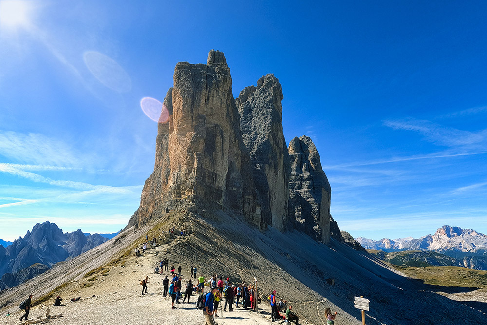
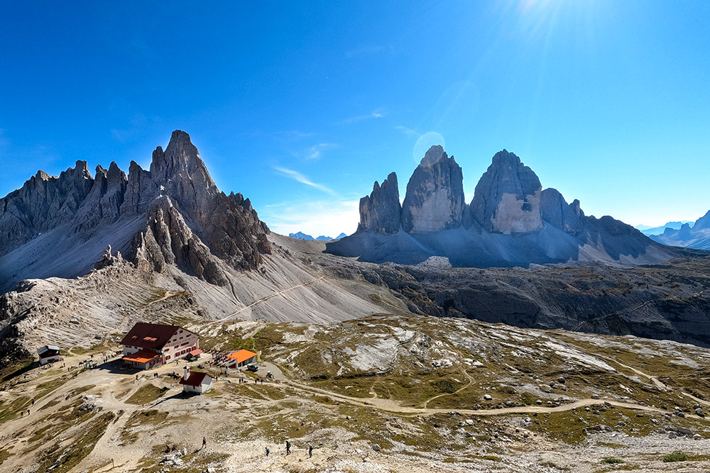
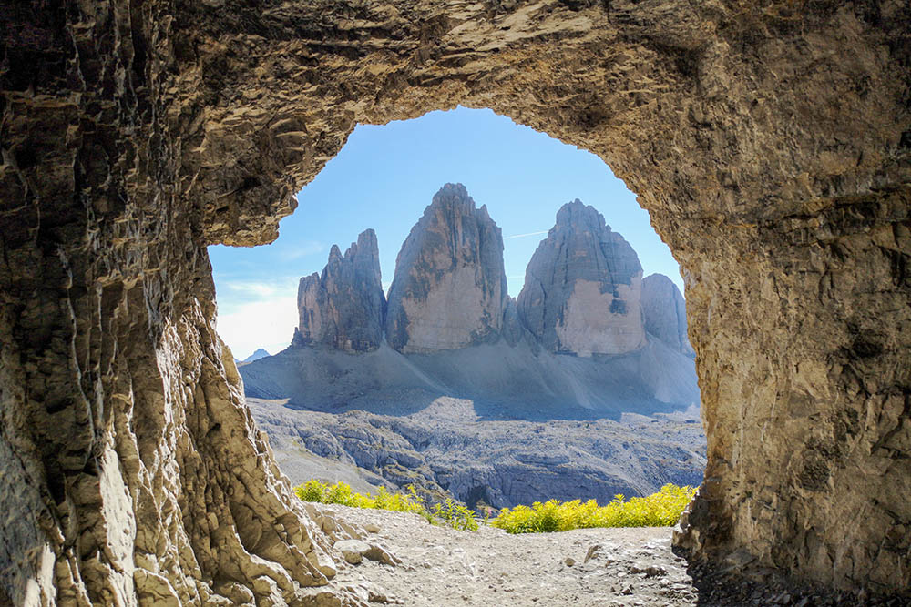
The Three Peaks are made up of: Cima Piccola (2857 m), Cima Grande (2998 m) and Cima Ovest (2973 m) and are located in the Tre Cime Natural Park and, together with other Dolomite peaks, in 2009 they were declared World Heritage 'Humanity by UNESCO. They are an icon of our mountains and are known all over the world. The place is very popular especially in summer.
Toll information: in 2021 it costs € 30 for cars, € 20 for motorcycles and € 45 for campers. Parking at the Rifugio Auronzo is included in the price.
ITINERARY
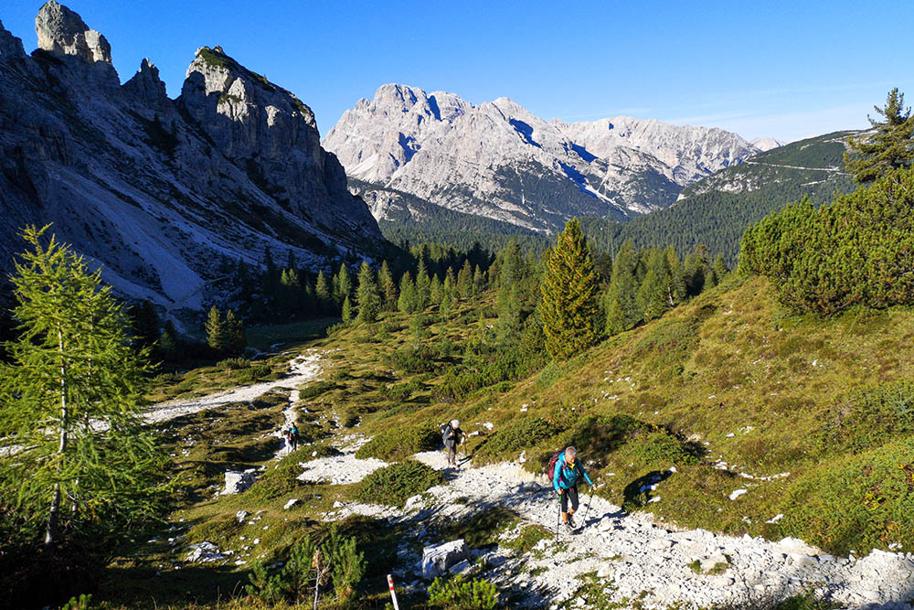
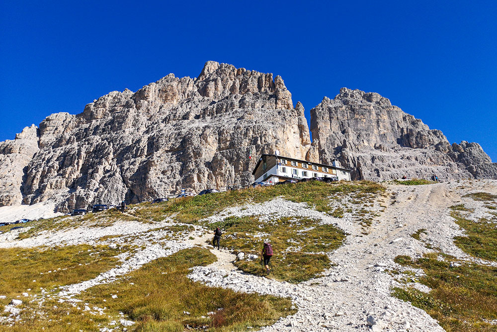
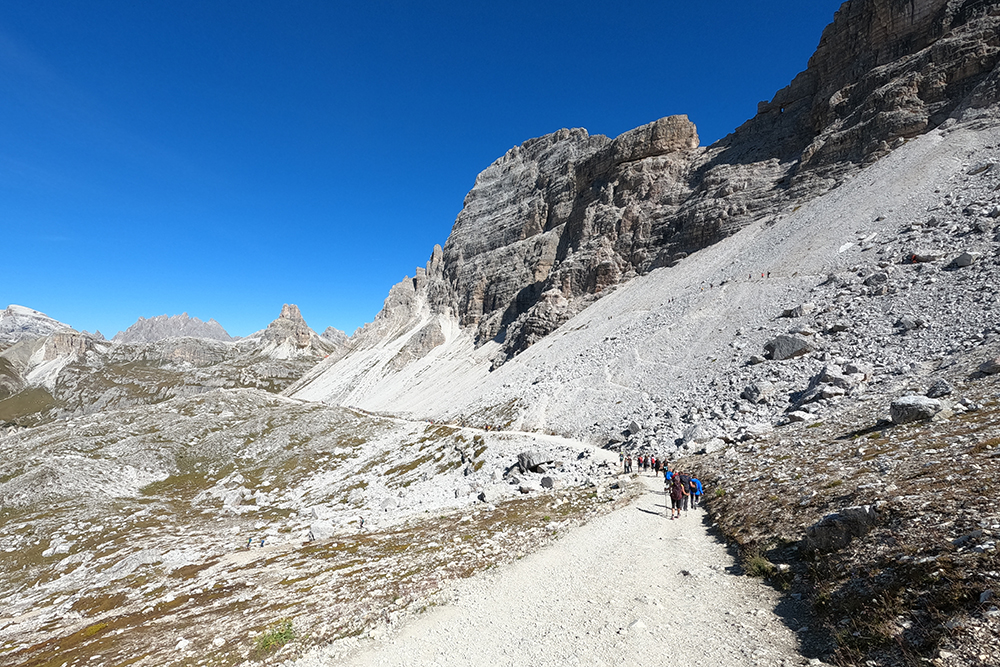
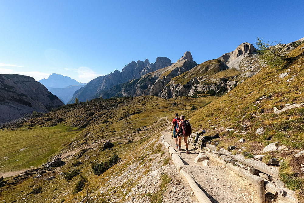
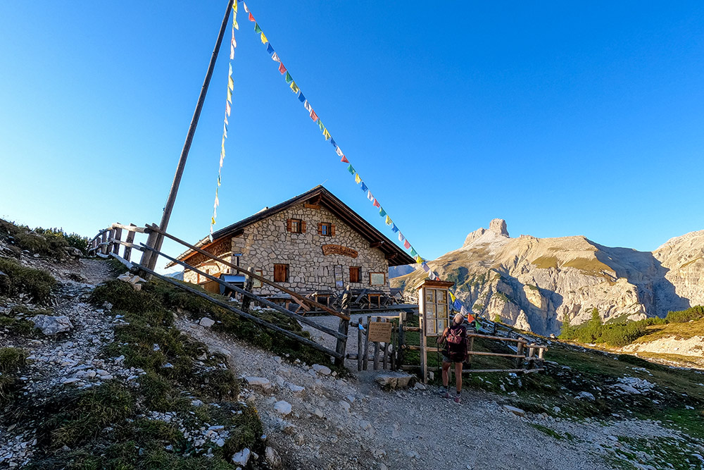
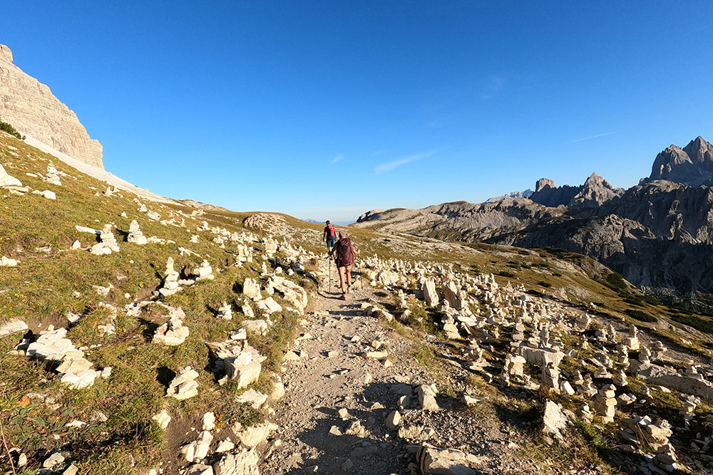
From the toll booth car park (1858 m) take path 101 and arrive at the Rifugio Auronzo (2333 m). Continue on the 101 and arrive at the Rifugio Lavaredo (2344 m). Here you go up to the Forcella Lavaredo (2454 m) and continue until you reach the Rifugio Locatelli (2405 m). Now you return to the Rifugio Auronzo in a ring by following the path 105 passing the Col Forcellina (2232 m) and the Forcella di Mezzo (2315 m). Returning to the Rifugio Auronzo, go down to the starting point on the same path as the outward journey.
EXCURSION DATE
September 25, 2021
STARTING POINT
Parking at the toll booth
REFRESHMENT POINT
Rifugio Auronzo (2333 m), Rifugio Lavaredo (2344 m) and Rifugio Locatelli (2405 m)
AUTHOR’S SUGGESTIONS
For those wishing to shorten the route, it is sufficient to go up to the Rifugio Auronzo by car.
For photography lovers: from the Rifugio Locatelli, in the late afternoon, you can take the most beautiful photos of the Three Peaks.
SAFETY TIPS
The viability of the proposed itinerary, like all mountain morphology, is subject to environmental changes due to natural events and weather conditions. Therefore, before leaving, consult the competent tourist offices and / or the refuges of reference.
Our GPX tracks are only indicative, that is, the route was carried out at best with the conditions of the trails and weather of that day. So always consider what to do on site.
Also remember to evaluate the route based on your physical abilities, training and the equipment you have.
You should leave someone the route you intend to do told.
Remember that the emergency number is 112.
EQUIPMENT
It is recommended to have the appropriate equipment for the route, weather conditions and season: windproof and / or rain jacket, map and / or GPS device, goggles, sunscreen, boots, first aid kit, specific clothing, gloves, backpack with food and drink.
RECOMMENDED MAPS
Tabacco 010 DOLOMITI DI SESTO/ SEXTENER DOLOMITEN
INTERESTING LINKS
https://www.dolomitireview.com/strada-per-le-tre-cime-di-lavaredo-pedaggio-orari-informazioni-pratiche/
HOW TO ARRIVE
From Dobbiaco SS51 to Carbonin, then take the SP49. Near Lake Misurina, exactly at the Hotel Dolomiti Des Alpes, turn left towards Rifugio Auronzo. The car park is on the right before the toll booth. For those who want to get in by car paying the toll, the car park is located at the Rifugio Auronzo.
PARKING AREA
At the toll booth: GPS coordinates 46.599382, 12.270014
To the Rifugio Auronzo: GPS coordinates 46.612186, 12.295076
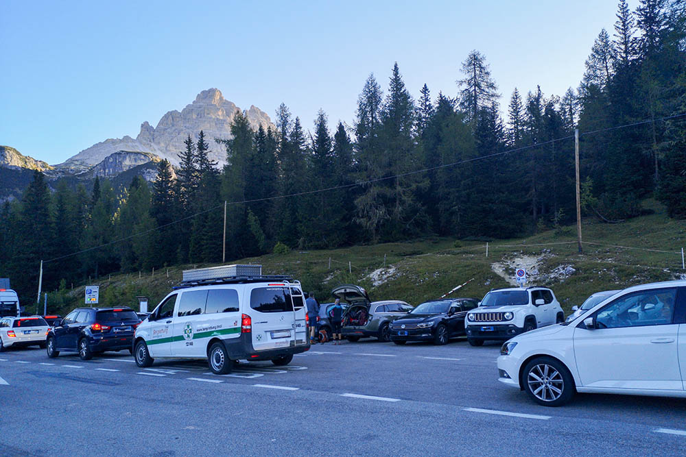
Piccolo parcheggio al punto pedaggio
Si sale verso il Rifugio Auronzo
Manca poco al Rifugio Auronzo

Il Rifugio Auronzo
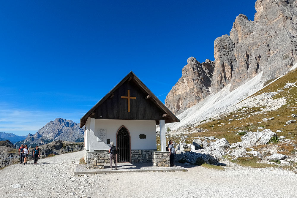
La Cappella degli Alpini
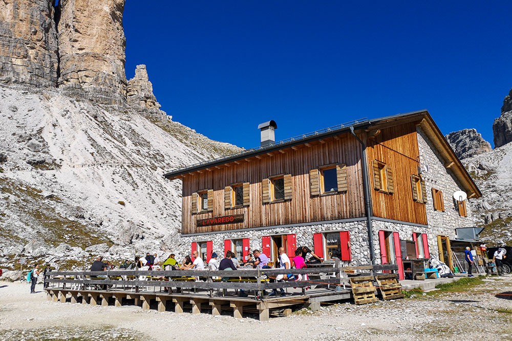
Il Rifugio Lavaredo
La Forcella Lavaredo
Si va verso il Rifugio Locatelli
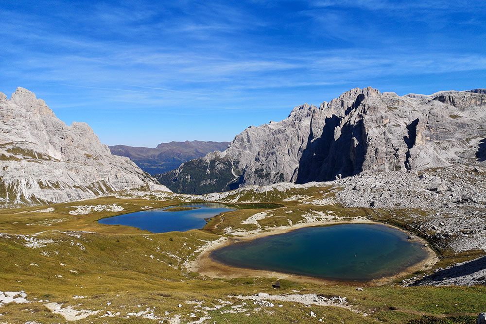
Vista sui Laghi dei Piani
Il Rifugio Locatelli
Le Tre Cime di Lavaredo
Si percorre il sentiero n. 105
Malga Lang
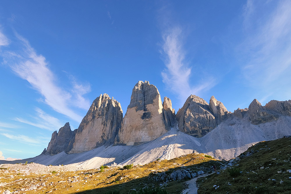
Le Tre Cime di Lavaredo
Si ritorna al Rifugio Auronzo


