


![]()


Durata
 4:25 h
Distanza
 10,3 km
 Ascesa
 853 m
853 mDiscesa
 853 m
853 mH Max
 2146 m
H Min
 1320 m
Sas de Pere da Fech
DESCRIPTION
From the top you can enjoy a spectacular view over the Fassa Valley and the Fassa Dolomites.
Sas de Père da Fech is a wooded peak overlooking Pera di Fassa and the middle Val di Fassa. You go up to the beautiful Val Jumela and the ascent does not present any technical difficulties. Along the way there are alpine huts including the Jumela mountain hut. Once you reach the ridge and the top you can admire a splendid view of: Sassolungo - Sassopiatto, Catinaccio, Monzoni and Marmolada.
ITINERARY
From the car park (1320 m), cross the bridge over the Avisio stream and go right. Then take the dirt road that goes up through the woods - trail marker n. 644 Malga Jumela. Once you reach Malga Jumela (1882 m), continue for a while along the dirt road and then take a path without signs to the left and go up to some pretty huts. Now follow the signs To the Cross - beware they are not very visible. Once in La Bassa (2070 m) follow the signs for Sas de Pere da Fech h. 0.20. Now go up slightly in the woods until you reach the ridge. Continue on the flat along the wooded ridge along an easy path and then, having made a slight descent, you will reach the huge iron cross. Arrived: we are at an altitude of 2125 m. On the small plateau we find a table with benches.
Return:
1. by the same road (recommended option)
2. Back in La Bassa, take the Path from Cene and descend to Pera di Fassa. We do not recommend this option, because the path is not well marked, in winter it is dangerous and there are many trees on the ground.
EXCURSION DATE
November 6, 2021
STARTING POINT
Pera di Fassa
REFRESHMENT POINT
Jumela mountain hut (1882 m)
AUTHOR’S SUGGESTIONS
Return by the same route as the outward journey.
SAFETY TIPS
The viability of the proposed itinerary, like all mountain morphology, is subject to environmental changes due to natural events and weather conditions. Therefore, before leaving, consult the competent tourist offices and / or the refuges of reference.
Our GPX tracks are only indicative, that is, the route was carried out at best with the conditions of the trails and weather of that day. So always consider what to do on site.
Also remember to evaluate the route based on your physical abilities, training and the equipment you have.
You should leave someone the route you intend to do told.
Remember that the emergency number is 112.
EQUIPMENT
It is recommended to have the appropriate equipment for the route, weather conditions and season: windproof and / or rain jacket, map and / or GPS device, goggles, sunscreen, boots, first aid kit, specific clothing, gloves, backpack with food and drink.
RECOMMENDED MAPS
Tabacco 06 VAL DI FASSA E DOLOMITI FASSANE
INTERESTING LINKS
https://www.fassa.com/
HOW TO ARRIVE
A22 motorway, Egna / Ora exit. Follow the SS48 of Dolomites state road to Pera di Fassa.
PARKING AREA
In Pera di Fassa
GPS coordinates: 46.440790, 11.696665
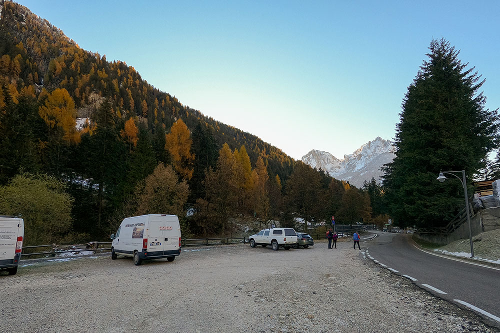
Parcheggio a Pera di Fassa
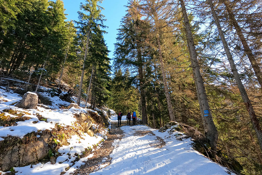
Si sale per la Val Jumela
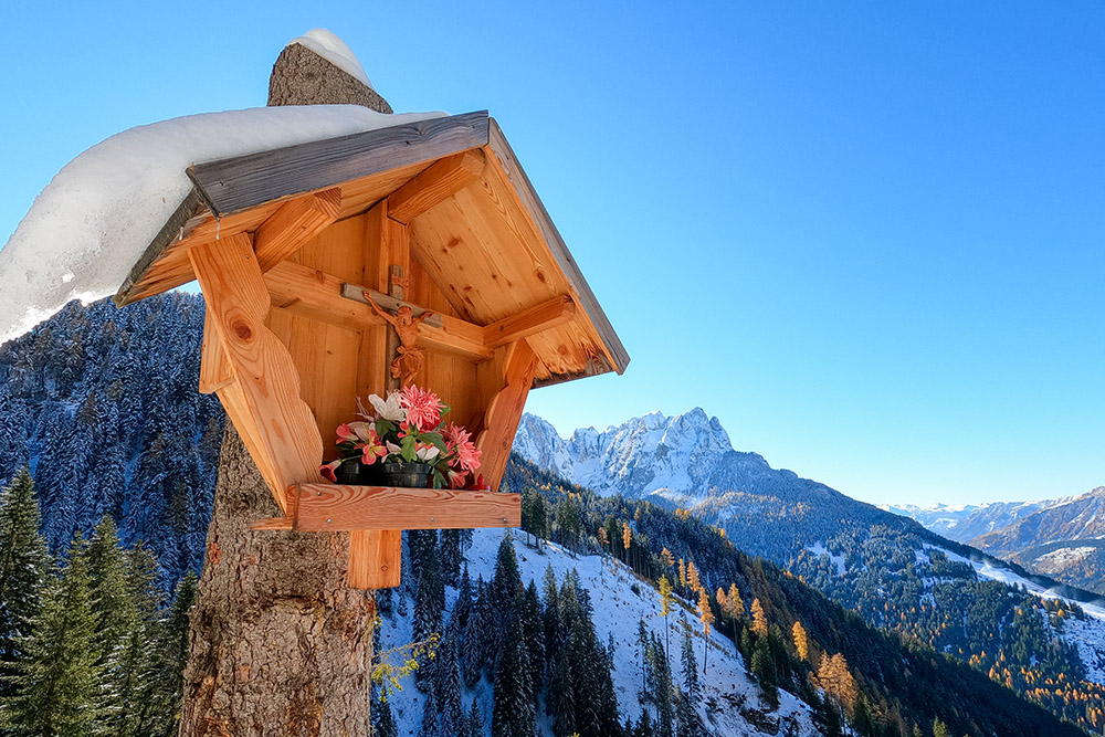
Grazioso crocifisso
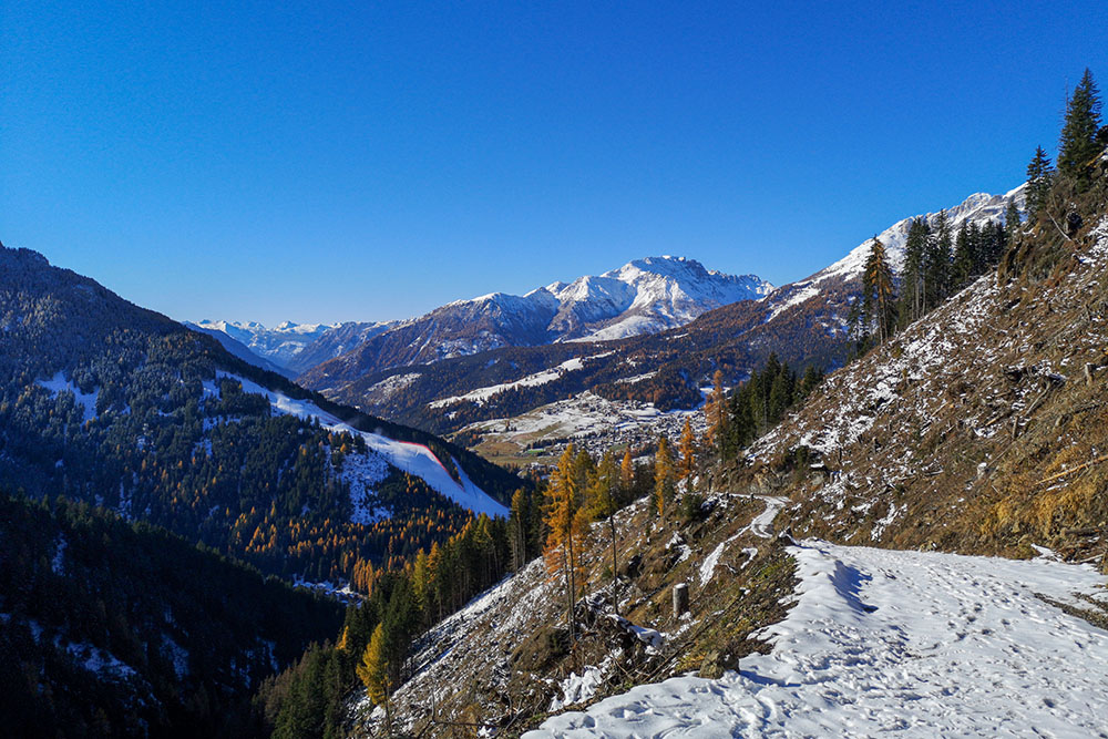
In lontananza il Latemar
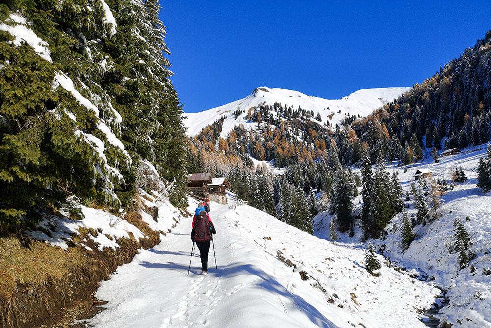
Si sale su una strada sterrata
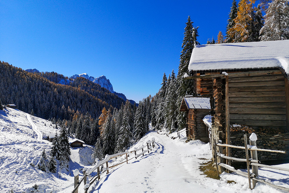
Lungo il percorso si incontrano delle simpatiche baite
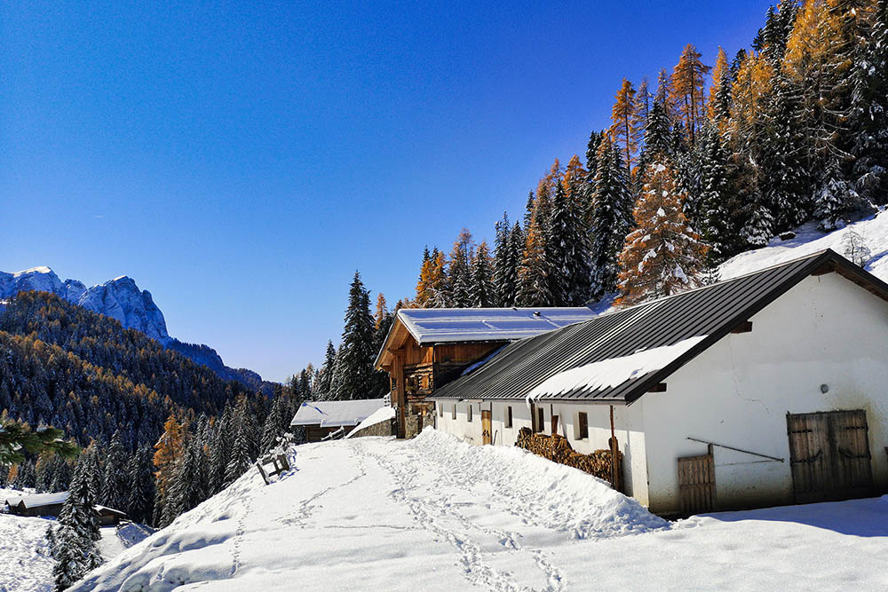
La Malga Jumela Bassa
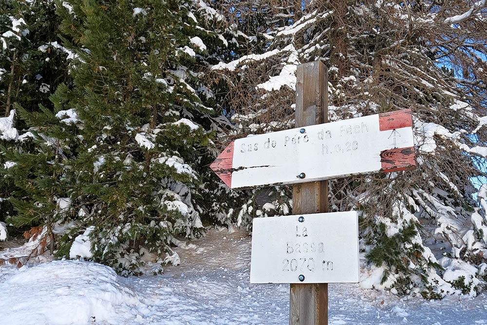
Arrivati in Località La Bassa
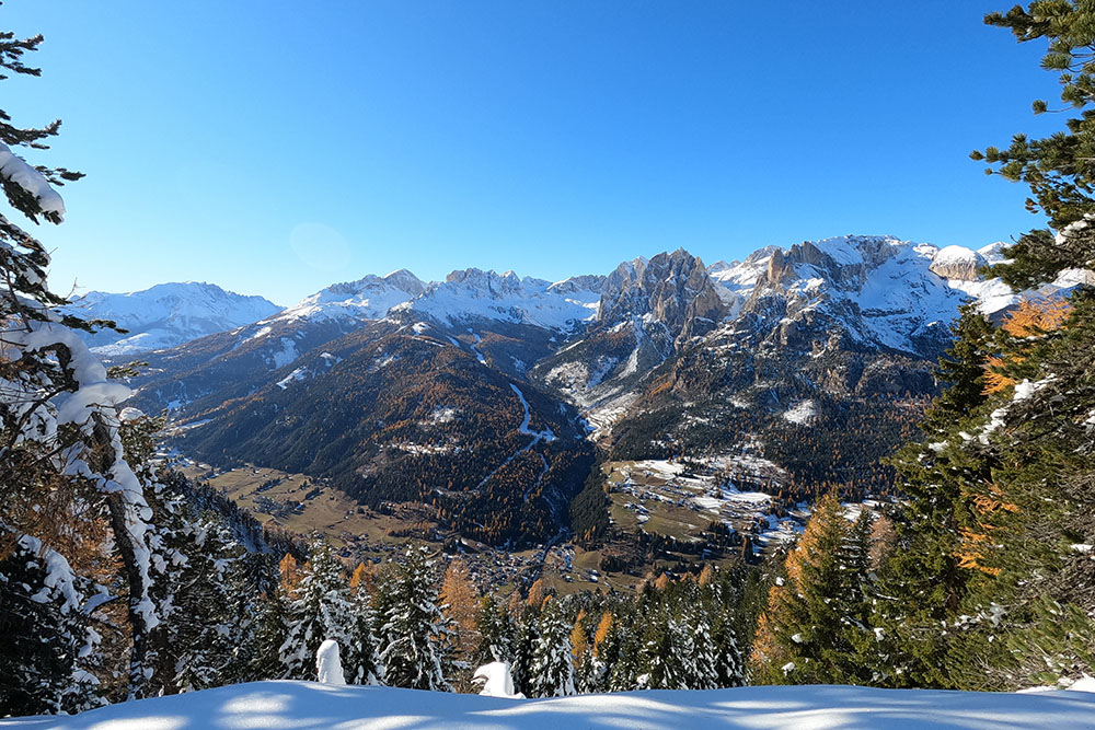
Panorama sul Catinaccio
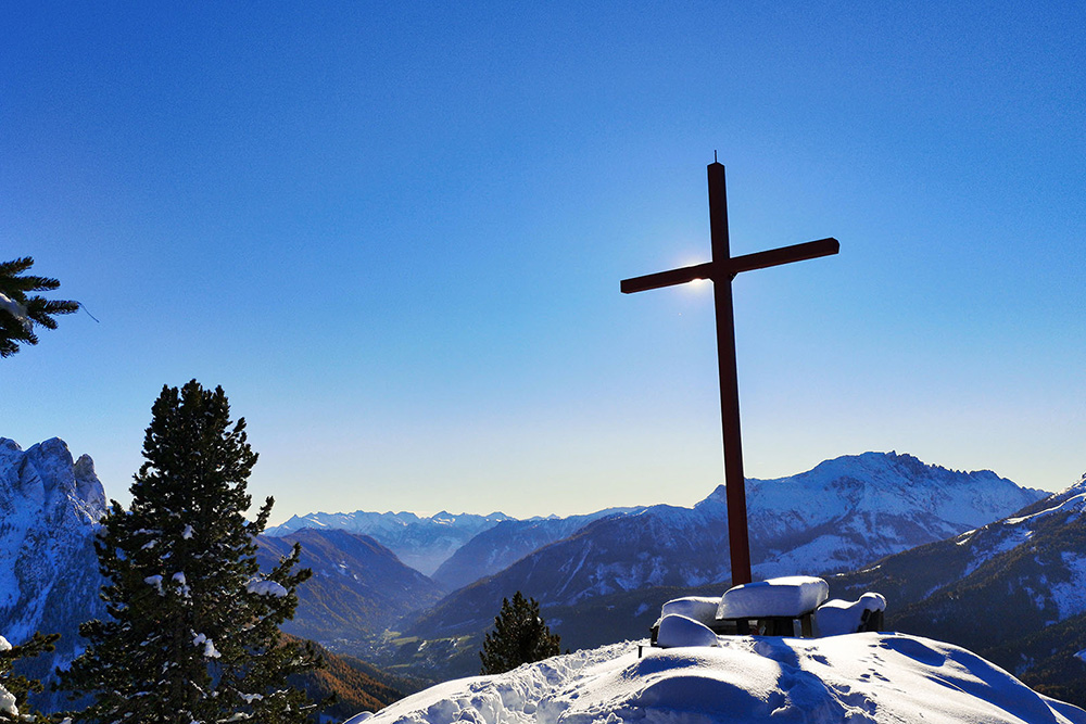
Sas de Pere da Fech con la grande croce metallica


