


![]()


Durata
 2:30 h
Distanza
 6,6 km
 Ascesa
 137 m
137 mDiscesa
 137 m
137 mH Max
 1590 m
H Min
 1490 m
Pragser Wildsee and the Foresta / Grünwald Alm mountain hut
DESCRIPTION
Fantastic excursion in one of the most beautiful areas of Val Pusteria to do even with children.
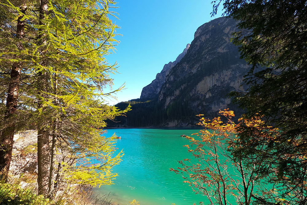
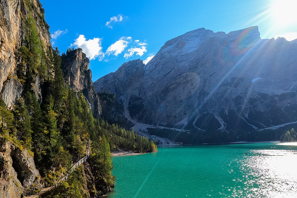
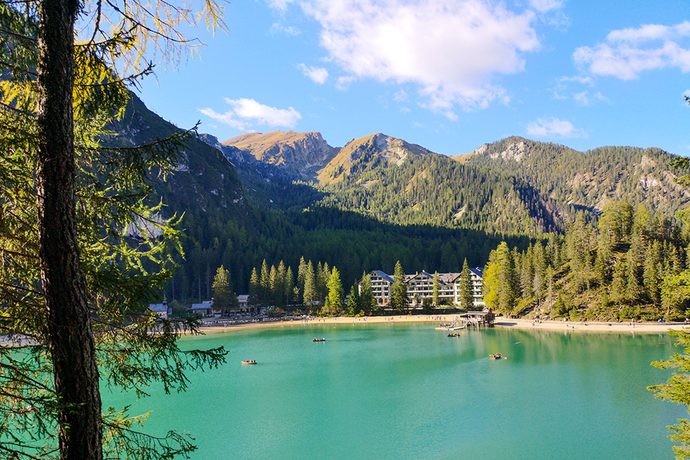
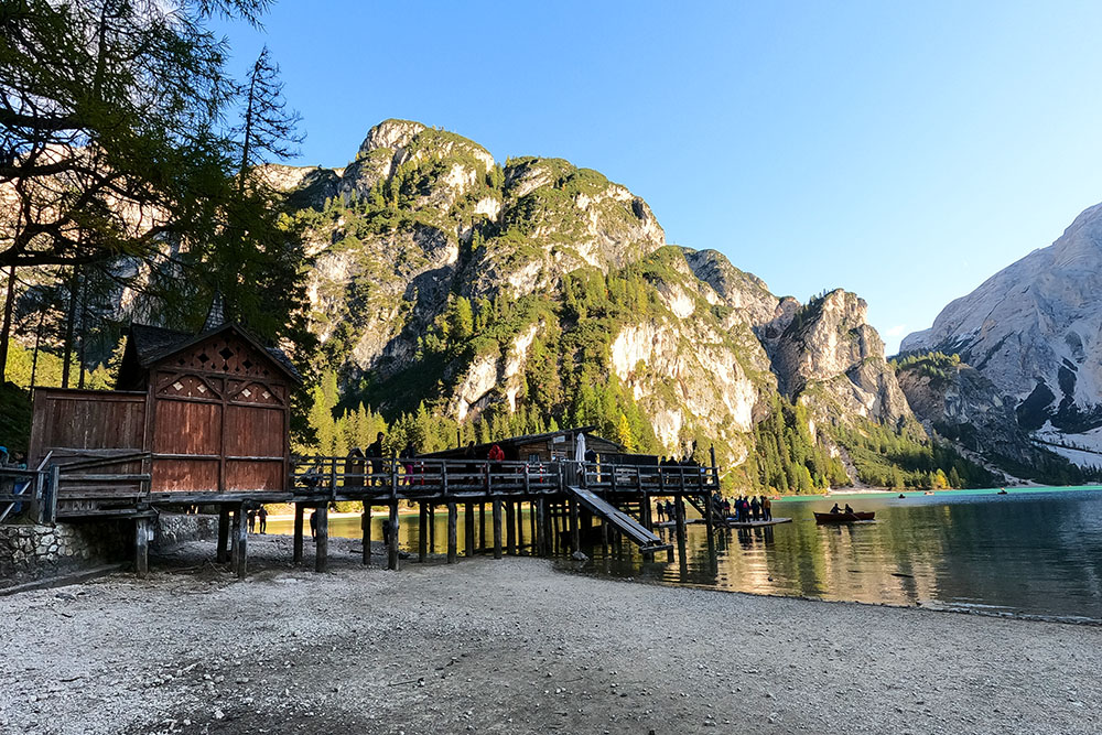
Lake Braies needs no introduction, because it is the best known lake in South Tyrol thanks to the television series A step from heaven. It is located within the Fanes-Senes-Braies Natural Park, its waters are of a beautiful emerald green color and is surrounded by high mountains including the best known and the Croda del Becco.
Malga Foresta is located at 1,590 m between the Senes Group and the Hochalpe mountain range, on a beautiful plateau crossed by the Rio Fosco. It is a wonderful place to stop and relax. For children there is a small play area available.
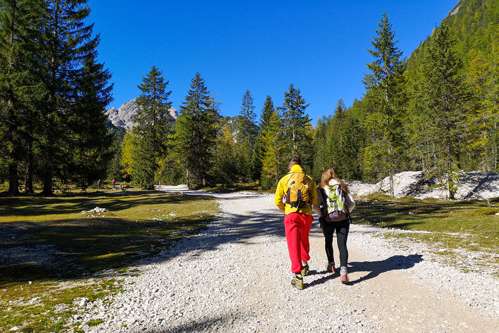
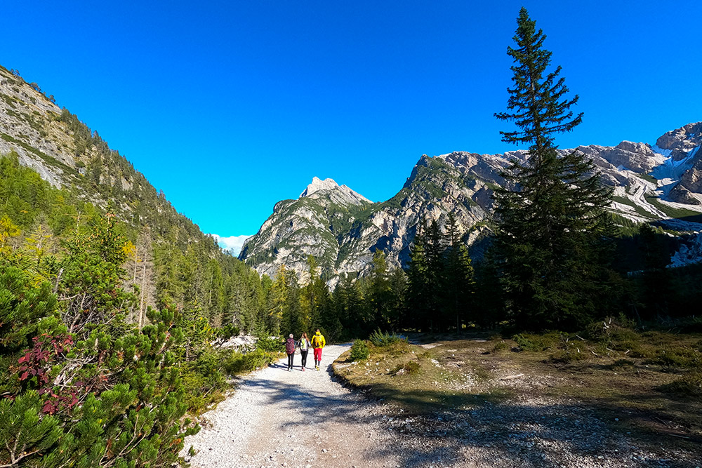
The route is absolutely not demanding, it is within reach of children. You walk mainly on a dirt road and the ascent is only 137 m spread over 6.6 km.
For those with strollers, it is not recommended to take the path on the east coast of the lake.
ITINERARY
From the car park of Lake Braies (1490 m), take path no. 1 which, along the western side of the lake, takes you to the bottom of the lake. Here you take path no. 19 which quickly leads to the Foresta hut (1590 m). You return to the lake by the same path. Arrived at the lake, turn right and take the dirt road, which then becomes a path. Now go along the opposite shore of the lake to the one made in the outward journey, arriving at the starting point.
EXCURSION DATE
October 10, 2021
STARTING POINT
Braies Lake
REFRESHMENT POINT
Braies Lake Restaurant - Pragser Wildsee (1496 m), Emmas Bistro (1496 m) and Malga Foresta (1590 m).
AUTHOR’S SUGGESTIONS
If you have strollers, return to the starting point on the same side of the lake.
SAFETY TIPS
The viability of the proposed itinerary, like all mountain morphology, is subject to environmental changes due to natural events and weather conditions. Therefore, before leaving, consult the competent tourist offices and / or the refuges of reference.
Our GPX tracks are only indicative, that is, the route was carried out at best with the conditions of the trails and weather of that day. So always consider what to do on site.
Also remember to evaluate the route based on your physical abilities, training and the equipment you have.
You should leave someone the route you intend to do told.
Remember that the emergency number is 112.
EQUIPMENT
It is recommended to have the appropriate equipment for the route, weather conditions and season: windproof and / or rain jacket, map and / or GPS device, goggles, sunscreen, boots, first aid kit, specific clothing, gloves, backpack with food and drink.
RECOMMENDED MAPS
Tabacco 031 DOLOMITI DI BRAIES - MAREBBE / PRAGSER DOLOMITEN
INTERESTING LINKS
www.braies.org
HOW TO ARRIVE
Autostrada del Brennero A22 - exit Bressanone / Val Pusteria, SS 49 of Val Pusteria, after Monguelfo turn towards Lake Braies
PARKING AREA
For a fee at Lake Braies.
GPS coordinates: 46.700047, 12.084711

Punto di partenza
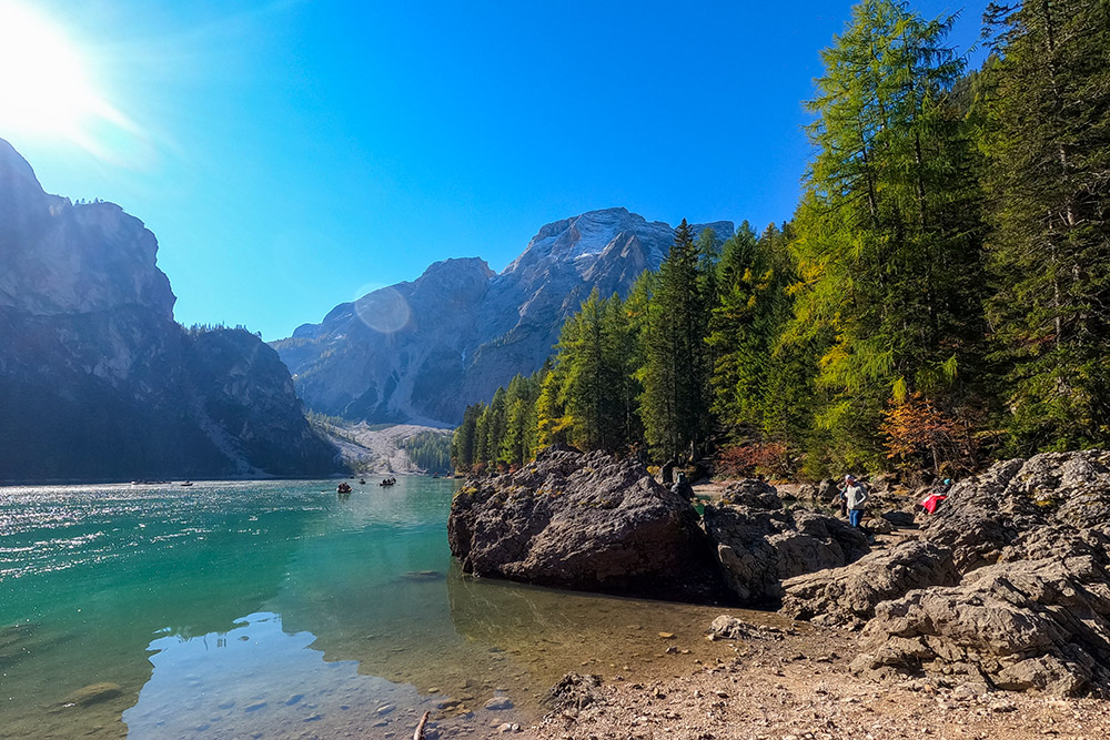
Lago di Braies con la Croda del Becco
Lago di Braies
Si sale verso la Malga Foresta
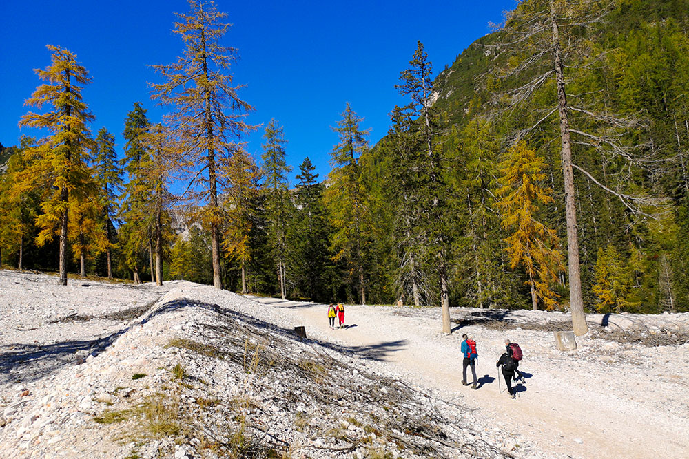
Si sale verso la Malga Foresta
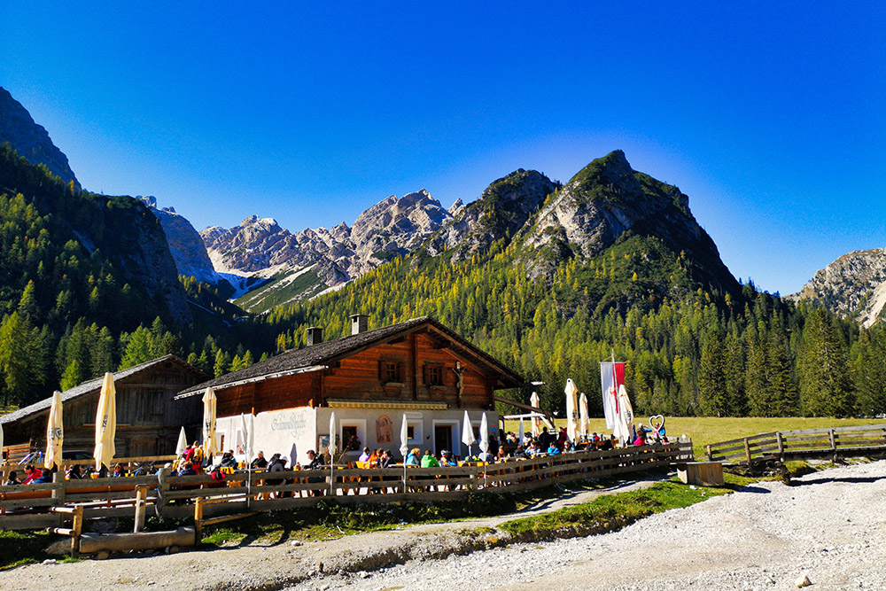
La Malga Foresta
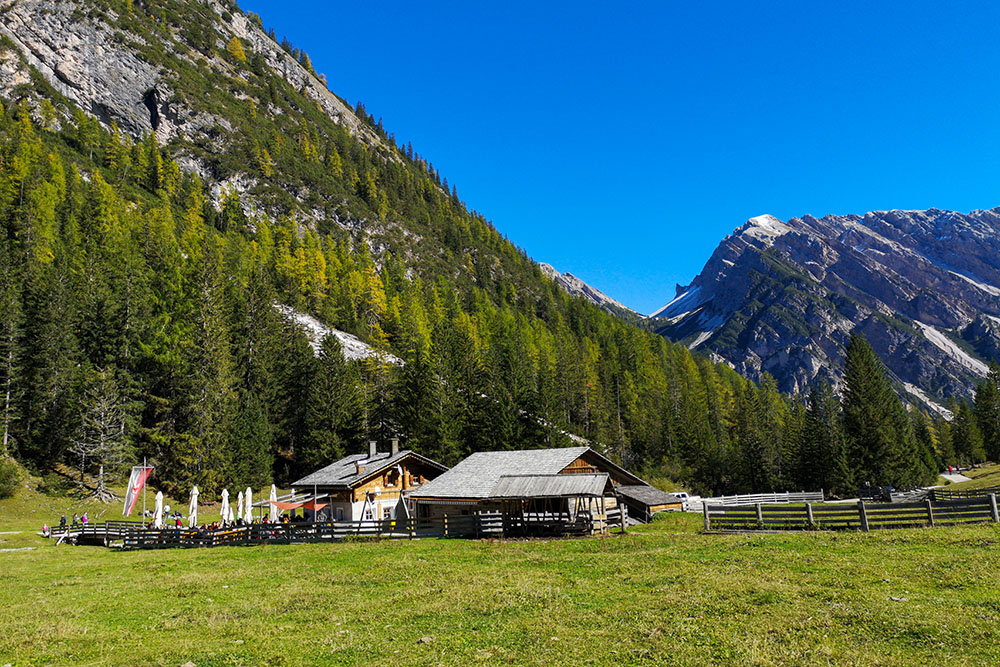
La Malga Foresta
Si ritorna al lago
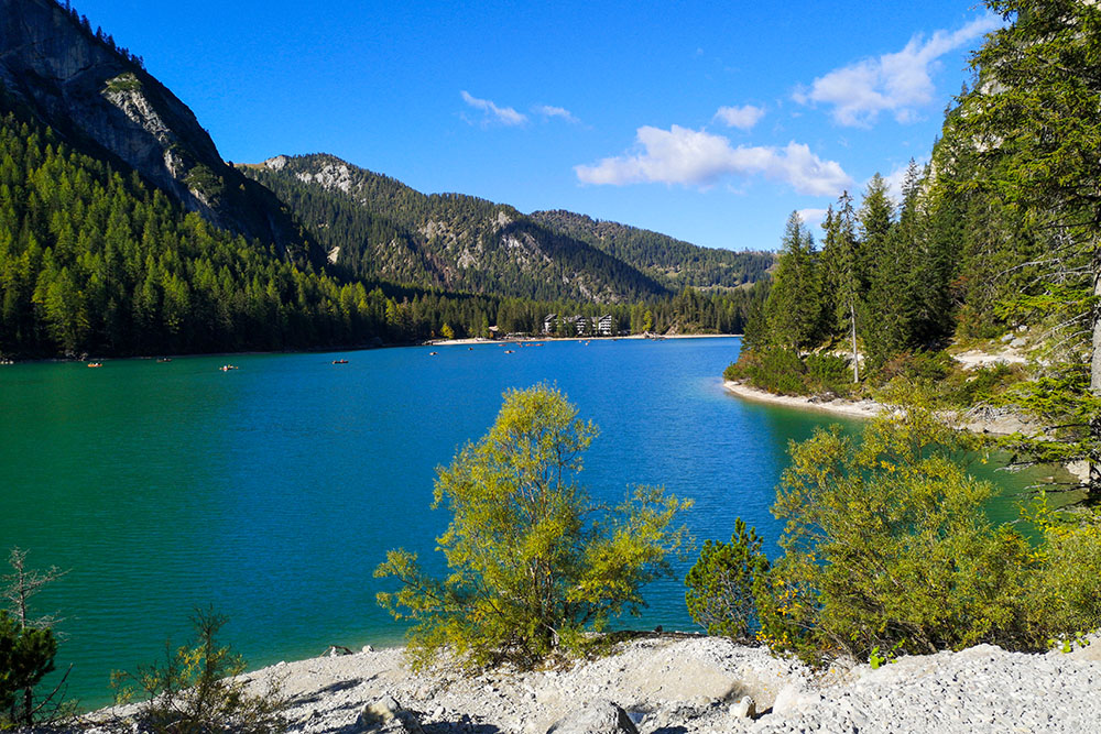
Veduta del Lago di Braies
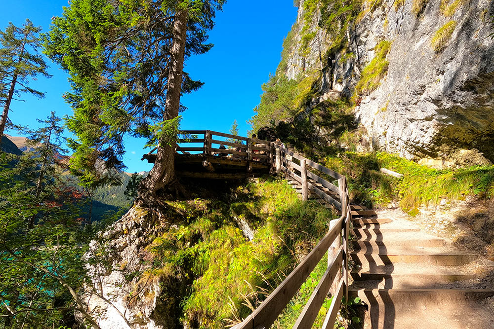
Sentiero orientale del lago
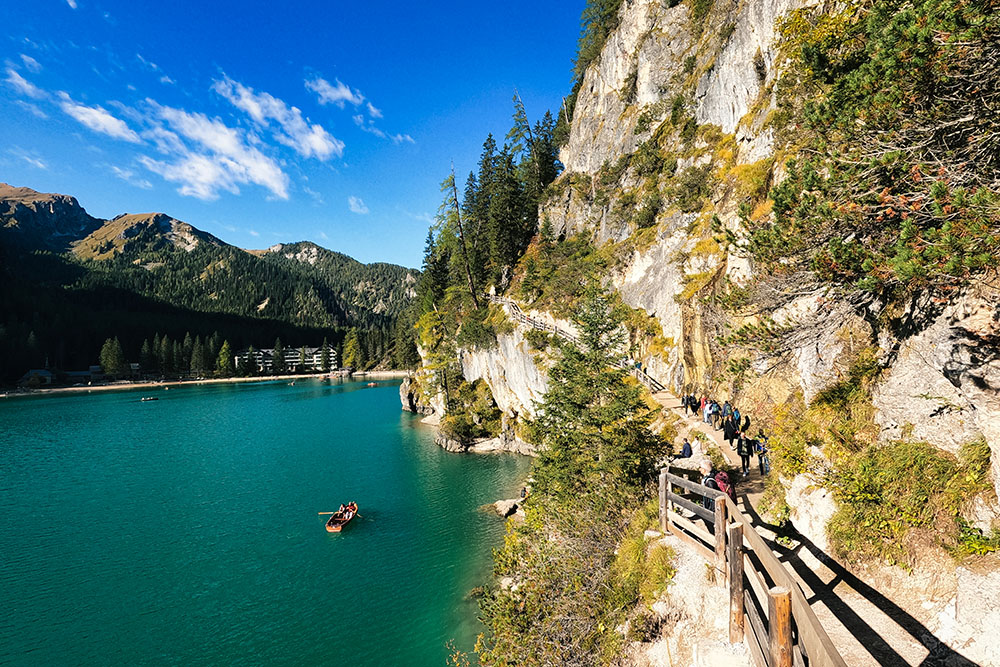
Sentiero orientale del lago
Sentiero orientale del lago
Siamo quasi ritornati al punto di partenza
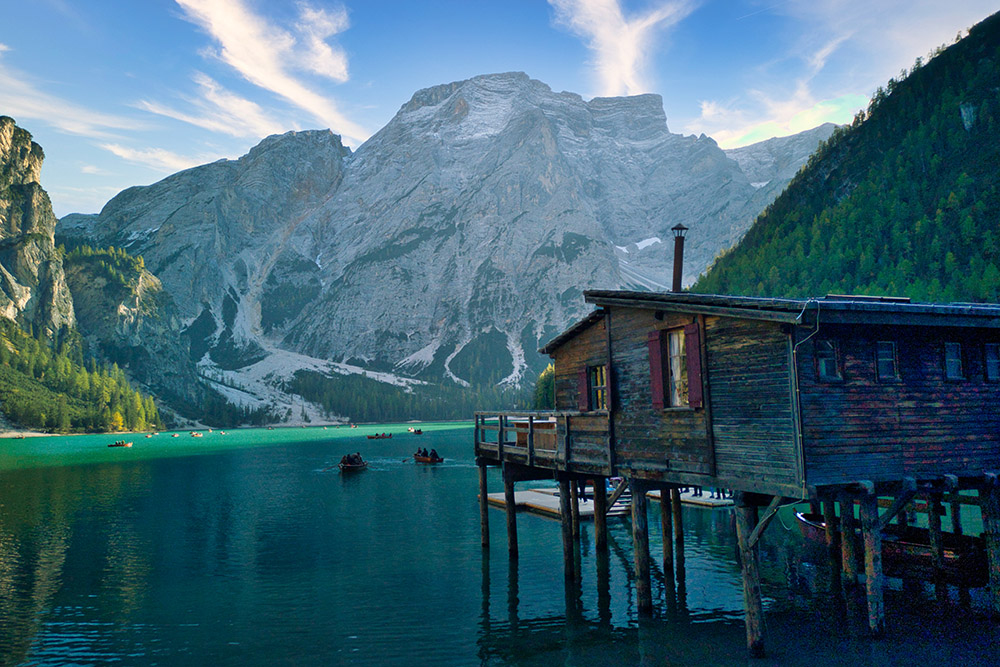
Palafitta
Palafitta


