


![]()


Durata
 4:30 h
Distanza
 10,8 km
 Ascesa
 690 m
690 mDiscesa
 690 m
690 mH Max
 2705 m
H Min
 2197 m
Corno Bianco di Sarentino from Passo di Pennes
INSTA360 GO 2
https://www.insta360.com/sal/go_2?insrc=INR7BM5
https://store.insta360.com/accessory?insrc=INR7BM5
DESCRIPTION
Excursion to the Cervino della Val Sarentino.
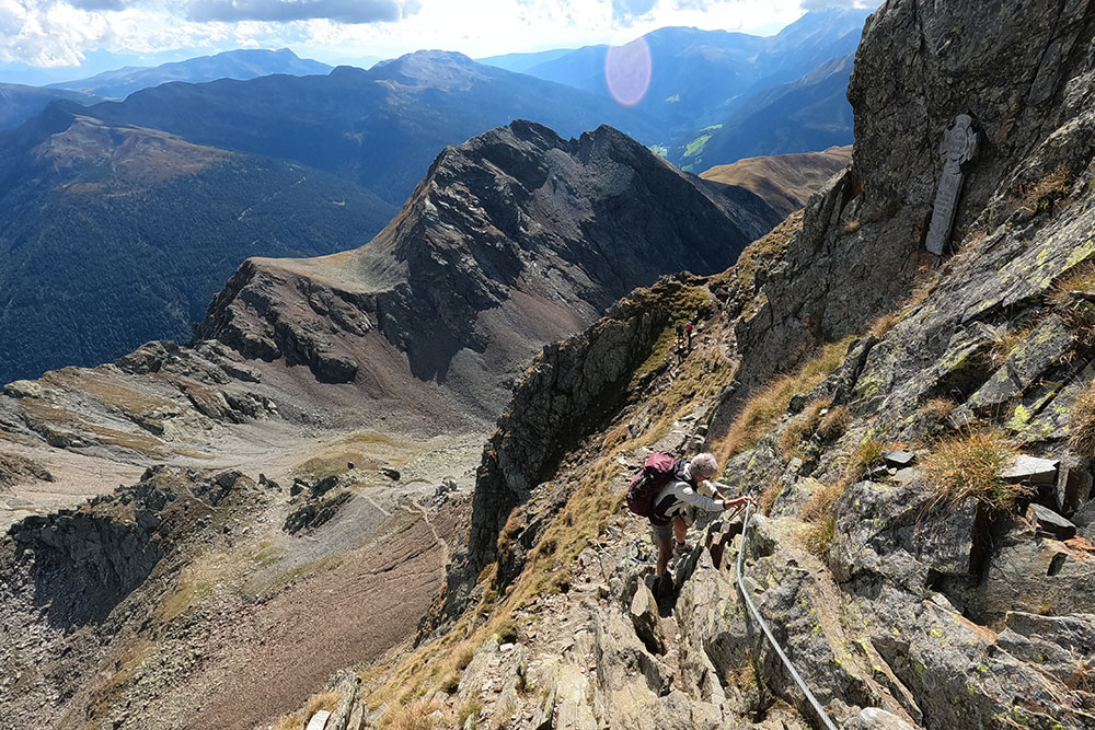
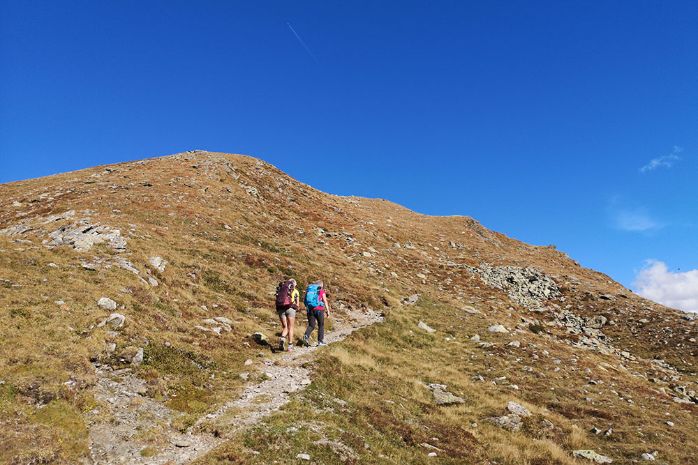
The Weisshorn, or Corno Bianco della Val Sarentino, is a mountain that offers a beautiful view of the surrounding peaks. The itinerary does not have an important difference in altitude despite the summit being at an altitude of 2705, because it starts already from 2211 m of the Passo di Pennes. Up to Gröllejoch the path climbs gradually then the last stretch becomes much steeper and more demanding, as you are following an aided path. This section is not technically difficult, but it should not be taken lightly, especially if the surface is wet. For those who are not experts, we recommend that you bring via ferrata equipment.
ITINERARY
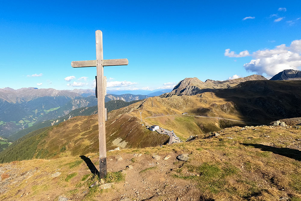
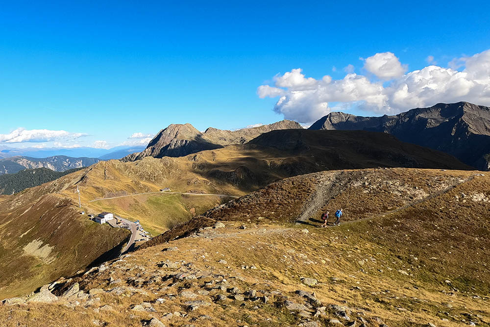
From Passo di Pennes (2211 m) take path 12A. You pass some small lakes, climb to Gröllejoch (2557 m) and then with the last stretch - aided path - you reach the summit of Corno Bianco di Sarentino (2705 m). You return by the same road to the small lake near the Passo di Pennes. Here you take an unmarked path and climb to Punta di Campo / Gänsekragenspitze (2322 m). Now go down to Passo di Pennes.
EXCURSION DATE
September 18, 2021
STARTING POINT
Pass of Pennes
REFRESHMENT POINT
Nobody
AUTHOR’S SUGGESTIONS
On the way back, go up to Punta di Campo / Gänsekragenspitze to have a beautiful view of the Passo di Pennes.
SAFETY TIPS
The viability of the proposed itinerary, like all mountain morphology, is subject to environmental changes due to natural events and weather conditions. Therefore, before leaving, consult the competent tourist offices and / or the refuges of reference.
Our GPX tracks are only indicative, that is, the route was carried out at best with the conditions of the trails and weather of that day. So always consider what to do on site.
Also remember to evaluate the route based on your physical abilities, training and the equipment you have.
You should leave someone the route you intend to do told.
Remember that the emergency number is 112.
EQUIPMENT
It is recommended to have the appropriate equipment for the route, weather conditions and season: windproof and / or rain jacket, map and / or GPS device, goggles, sunscreen, boots, first aid kit, specific clothing, gloves, backpack with food and drink.
RECOMMENDED MAPS
Tabacco 040 MONTI SARENTINI / SARNTALER ALPEN
INTERESTING LINKS
https://www.sarntal.com/it/
HOW TO ARRIVE
From Bolzano SS508. It runs through the entire Val Sarentino and arrives at Passo di Pennes.
From Vipiteno exit A22. SS44 for a short stretch and then take the SS508 up to Passo di Pennes.
PARKING AREA
Free at Passo di Pennes
GPS coordinates: 46.818816, 11.440378
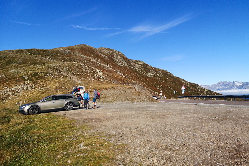
Passo di Pennes

Ci lasciamo Passo di Pennes alle spalle
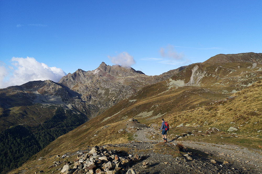
In lontananza si vede il Corno Bianco di Sarentino
Vista dal Giogo delle Frane verso Passo di Pennes
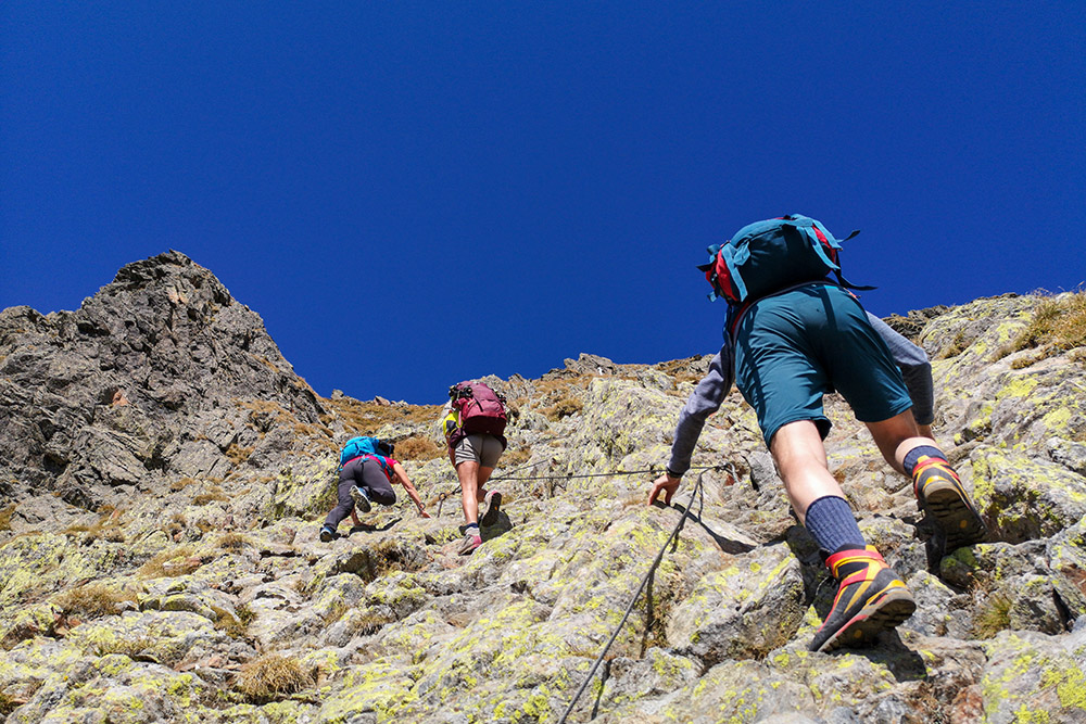
Si sale per il sentiero attrezzato
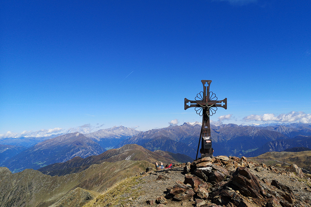
La croce di vetta al Corno Bianco di Sarentino
Si ritorna
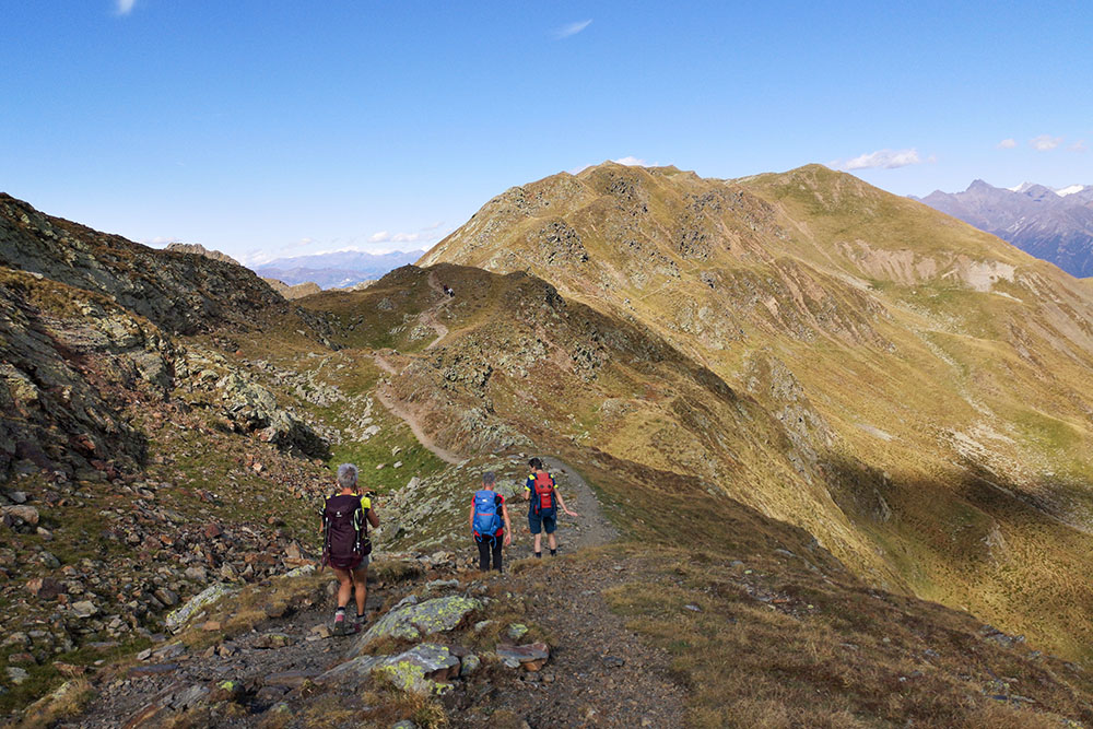
Si ritorna
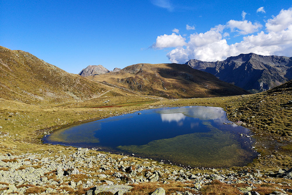
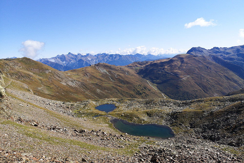
Piccolo laghetto nei pressi del passo
Saliamo alla Cima di Campo
Cima di Campo
Ritorniamo a Passo di Pennes


