


![]()


Durata
 4:05 h
Distanza
 10,5 km
 Ascesa
 827 m
827 mDiscesa
 827 m
827 mH Max
 2581 m
H Min
 1961 m
Rifugio Santa Croce of Lazfons and the 3 peaks: Ritzlar, San Cassiano and Samspitze
DESCRIPTION
Beautiful hike in the eastern Sarntal Alps starting from the Kasareck car park.
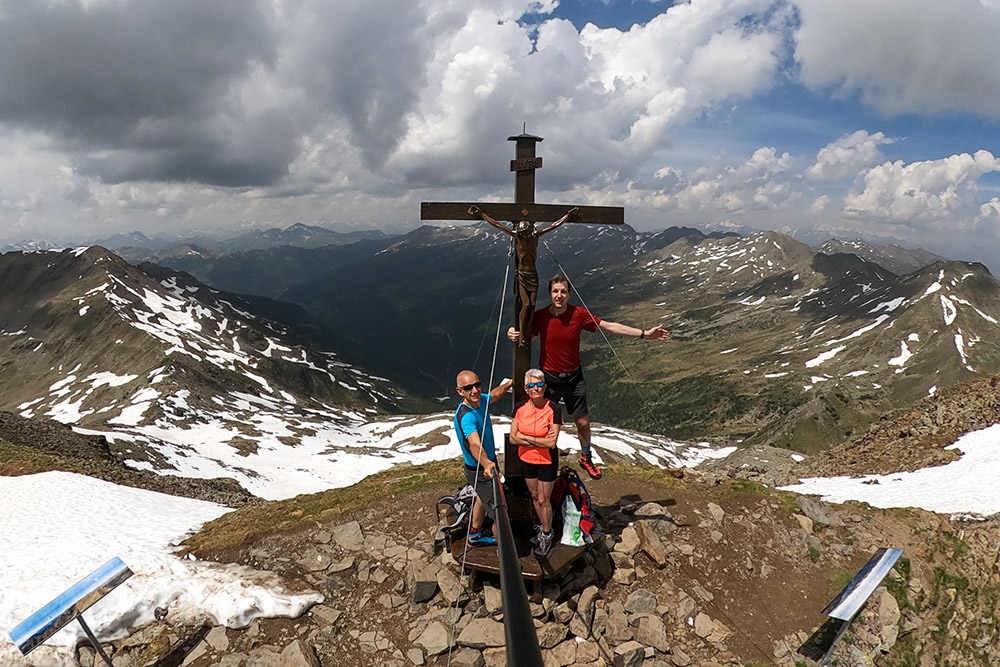
This excursion is very interesting, because it allows us to: conquer three peaks and visit the highest pilgrimage site in South Tyrol. The three peaks are: Cima Ritzlar, Cima San Cassiano - Kassianspitz and Cima Samspitze. All three are above 2500 meters of altitude. The church, which is the highest in South Tyrol, was built in 1743 and then enlarged in 1860 in the Gothic style. Inside we find the crucifix called Schwarzer Herrgott, that is Black Jesus, which protects pilgrims and hikers. Another curiosity: the Rifugio Santa Croce di Latzfons before 1743 served only as a shelter for cattle drivers in the mountain pastures. With the influx of pilgrims it was enlarged. The current layout of the refuge is due to the work of the parish of Lazfonds which acquired it and inaugurated it in 1952.
From the Croce di Lazfons there is a beautiful panorama and the view extends to Sassolungo, Punta Grohmann and the Catinaccio group.
ITINERARY
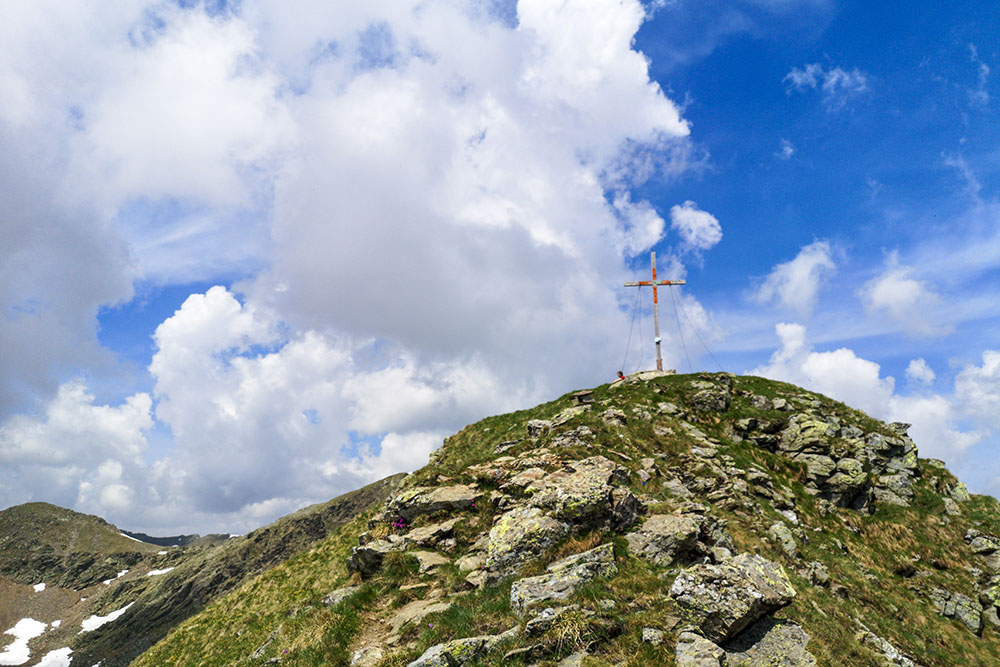
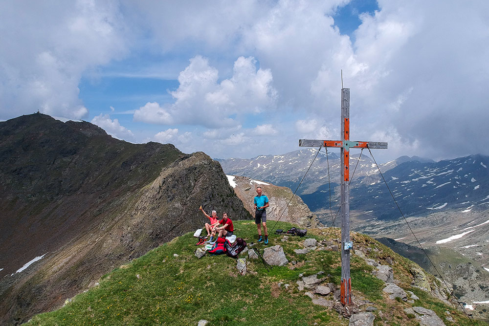
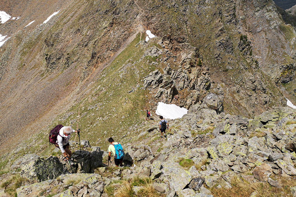
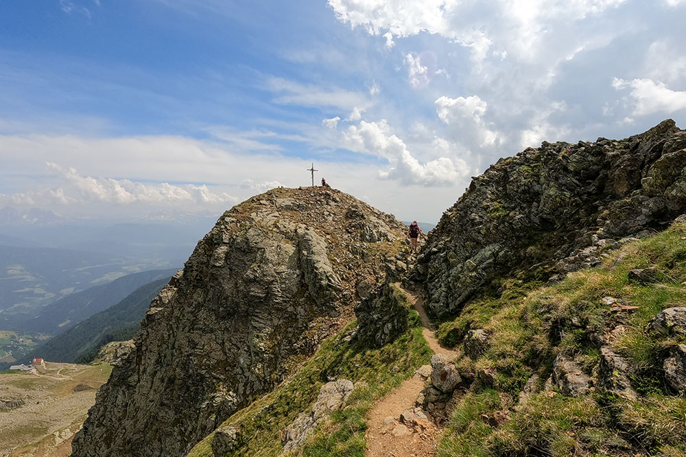
From the Kasereck car park (1961 m) go up first along path 15 and then along path 1 to the Rifugio and the Santa Croce di Lazfons Sanctuary - Schutzhaus Latzfonser Kreuz (2311 m). Now take an unnumbered path and go up to Cima Ritzlar (2528 m): in this section, sometimes, we have the presence of a metal cord. Continue descending, and then going up again, to Cima San Cassiano - Kassianspitz (2581 m). Go down path 9 and once you reach a saddle, take an unnumbered path and go up to Cima Samspitze (2563 m). You return by the same path to the saddle. Here you take path 9, pass near Lake San Cassiano - Kassiansee (2475 m) and return to the Rifugio Santa Croce di Lazfons (2311 m). Now we just have to go back to the Kasereck car park along the paths of the first leg.
EXCURSION DATE
June 19, 2021
STARTING POINT
Kasereck parking
REFRESHMENT POINT
Rifugio Santa Croce di Lazfons - Schutzhaus Latzfonser Kreuz (2311 m)
AUTHOR’S SUGGESTIONS
The hike to the Rifugio Santa Croce di Lazfons and Sanctuary - Schutzhaus Latzfonser Kreuz (2311 m) is for everyone, but the tour of the three peaks must be trained and not suffer from vertigo.
SAFETY TIPS
The viability of the proposed itinerary, like all mountain morphology, is subject to environmental changes due to natural events and weather conditions. Therefore, before leaving, consult the competent tourist offices and / or the refuges of reference.
Our GPX tracks are only indicative, that is, the route was carried out at best with the conditions of the trails and weather of that day. So always consider what to do on site.
Also remember to evaluate the route based on your physical abilities, training and the equipment you have.
You should leave someone the route you intend to do told.
Remember that the emergency number is 112.
EQUIPMENT
It is recommended to have the appropriate equipment for the route, weather conditions and season: windproof and / or rain jacket, map and / or GPS device, goggles, sunscreen, boots, first aid kit, specific clothing, gloves, backpack with food and drink.
RECOMMENDED MAPS
Tabacco 040 MONTI SARENTINI / SARNTALER ALPEN
INTERESTING LINKS
https://www.klausen.it/it/piaceri-cultura/cultura-luoghi-interesse/croce-lazfons/
HOW TO ARRIVE
A22 closed exit. Take the SP74 road for Velturno. Once in the town, take the SP142 towards Lazfons. After Lazfons follow the signs for the Jochalm-Kasereck Parking.
PARKING AREA
Kasereck / Kaseregg car park, free of charge
GPS coordinates: 46.675546, 11.500066
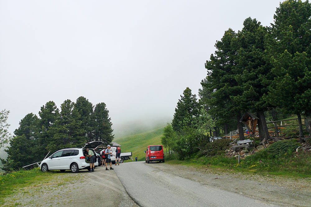
Parcheggio Kasareck
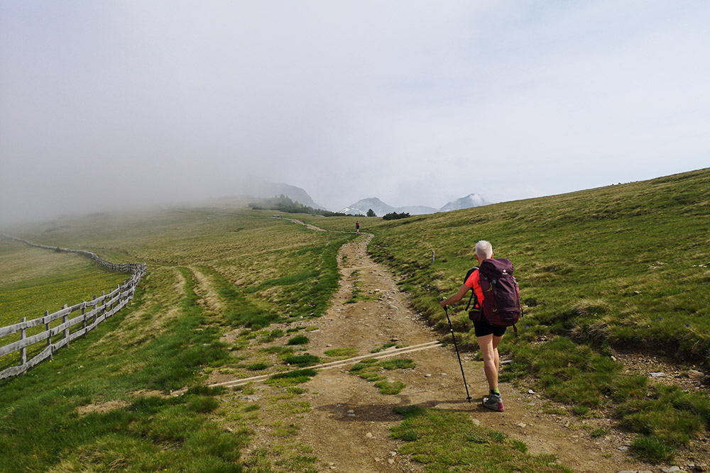
Si sale con le nuvole molto basse
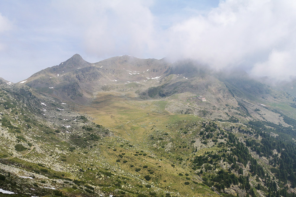
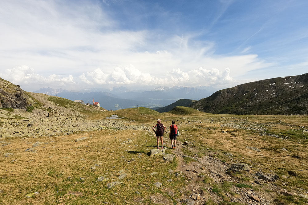
Si vede in lontananza il Rifugio S. Croce di Lazfons
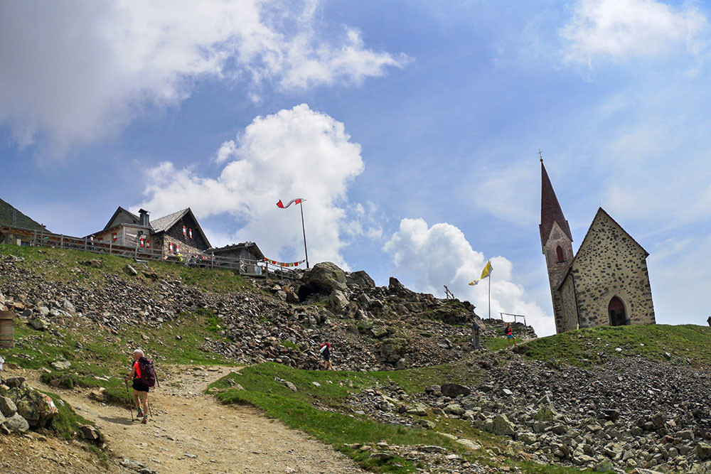
Ancora pochi metri e siamo al rifugio
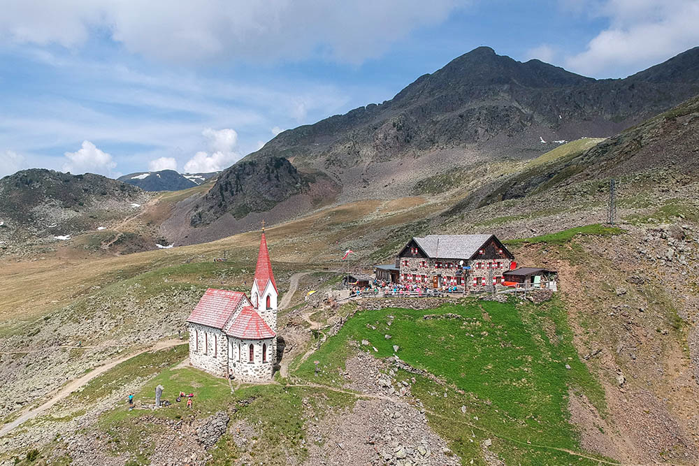
Il Rifugio S. Croce di Lazfons e la sua Chiesa
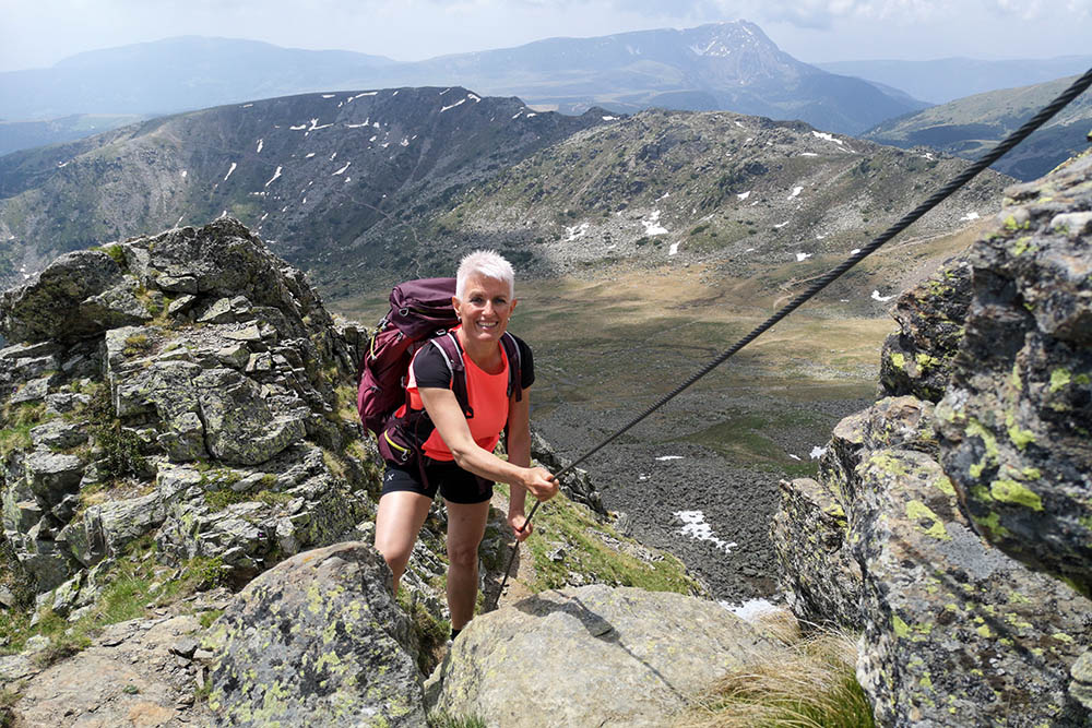
Tratto attrezzato per salire a Cima Ritzlar
Pochi passi e siamo in vetta
Cima Ritzlar
Scendiamo un po' di quota
Cima S. Cassiano
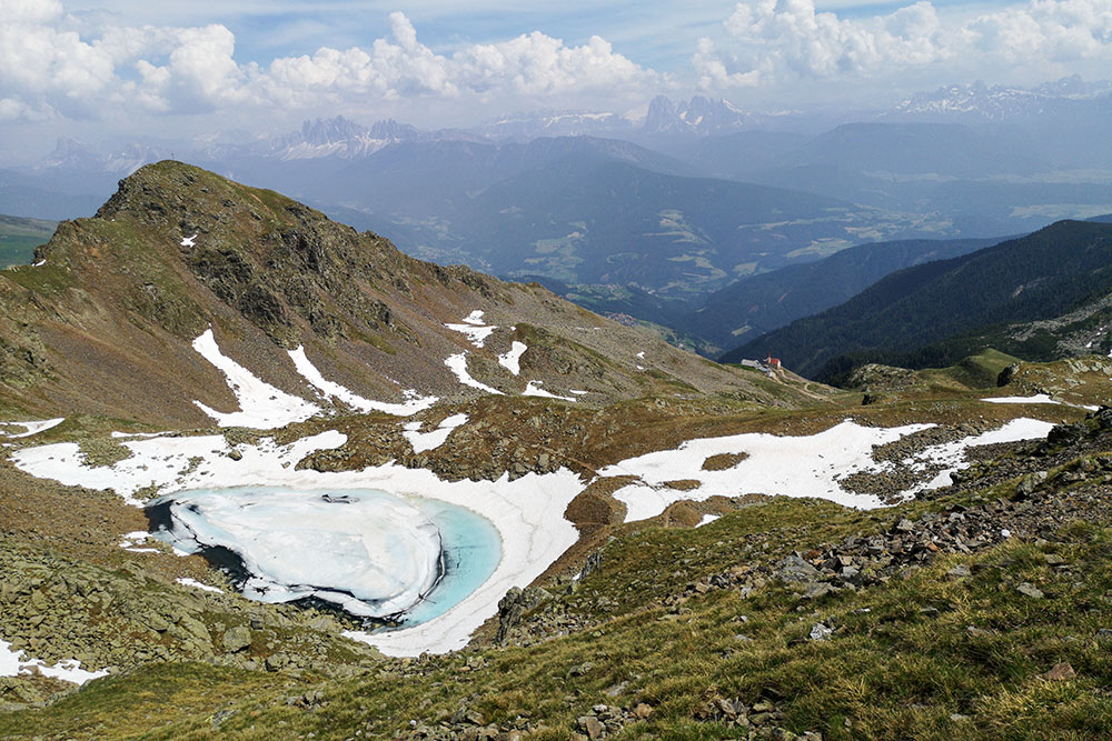
Lago S. Cassiano
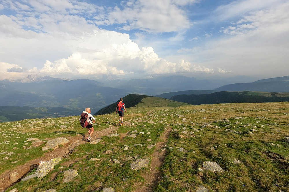
Si va verso la terza e ultima vetta
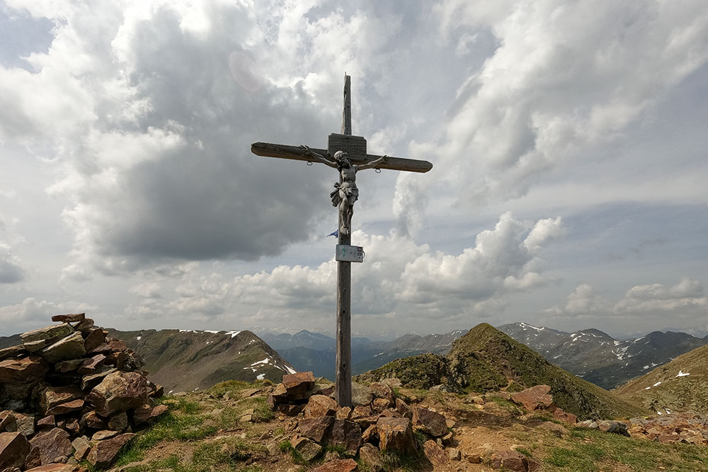
Samspitze
Si ritorna al rifugio
Ritorniamo al parcheggio


