


![]()


Durata
 3:15 h
Distanza
 7,5 km
 Ascesa
 550 m
550 mDiscesa
 550 m
550 mH Max
 2370 m
H Min
 1840 m
Rifugio Fratelli Fonda Savio
DESCRIPTION
Ring hike to the Rifugio Fratelli Fonda Savio starting near Lake Antorno.
The refuge is located on the ridge of the Passo dei Toci in the heart of the Cadini Group. It is named after the three sons of the partisan Antonio Fonda Savio: Piero, Paolo and Sergio who died during the Second World War. The itinerary has a short aided section, in the first part of the Bonacossa Path. For those who do not feel like doing this stretch, they can return by the same route. The trek is very beautiful and scenic.
ITINERARY
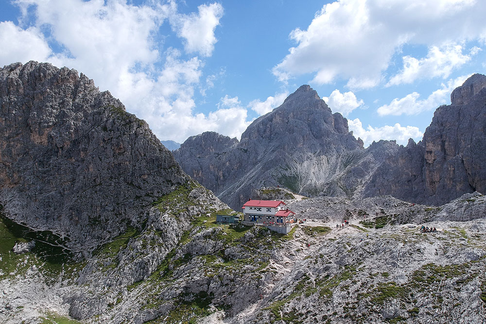
From the car park (1840 m) take path 115 and climb up to the Rifugio Fratelli Fonda Savio (2367 m). Now go down the 117 - aided path Alberto Bonacossa - towards Forcella de Rin Bianco. Arriving at the saddle (2176 m), follow the 119 which leads to Lake Antorno. From the lake you return to the starting point following the paved road.
STARTING POINT
Cadini car park
REFRESHMENT POINT
Rifugio Fratelli Fonda Savio (2367 m)
AUTHOR’S SUGGESTIONS
Go above the refuge, where there is a flagpole with a flag, because it is an extremely panoramic point from which it is possible to see the south face of the Tre Cime di Lavaredo.
SAFETY TIPS
The viability of the proposed itinerary, like all mountain morphology, is subject to environmental changes due to natural events and weather conditions. Therefore, before leaving, consult the competent tourist offices and / or the refuges of reference.
Our GPX tracks are only indicative, that is, the route was carried out at best with the conditions of the trails and weather of that day. So always consider what to do on site.
Also remember to evaluate the route based on your physical abilities, training and the equipment you have.
You should leave someone the route you intend to do told.
Remember that the emergency number is 112.
EQUIPMENT
It is recommended to have the appropriate equipment for the route, weather conditions and season: windproof and / or rain jacket, map and / or GPS device, goggles, sunscreen, boots, first aid kit, specific clothing, gloves, backpack with food and drink.
RECOMMENDED MAPS
Tabacco 010 Dolomiti di Sesto
INTERESTING LINKS
https://www.fonda-savio.it/
HOW TO ARRIVE
From Cortina d’Ampezzo SR48 and SP49. After the Misurina lake, take the road to go to the Auronzo Refuge. A little before reaching Lake Antorno you will find the parking lot on the right.
PARKING AREA
Cadini free parking
GPS coordinates: 46.591230, 12.26287
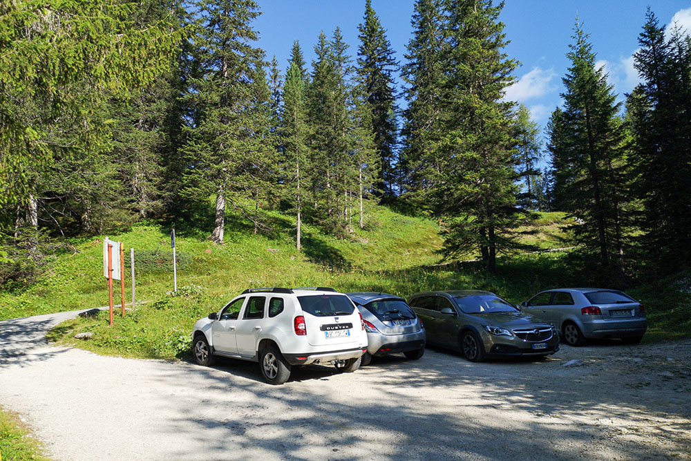
Parcheggio Cadini
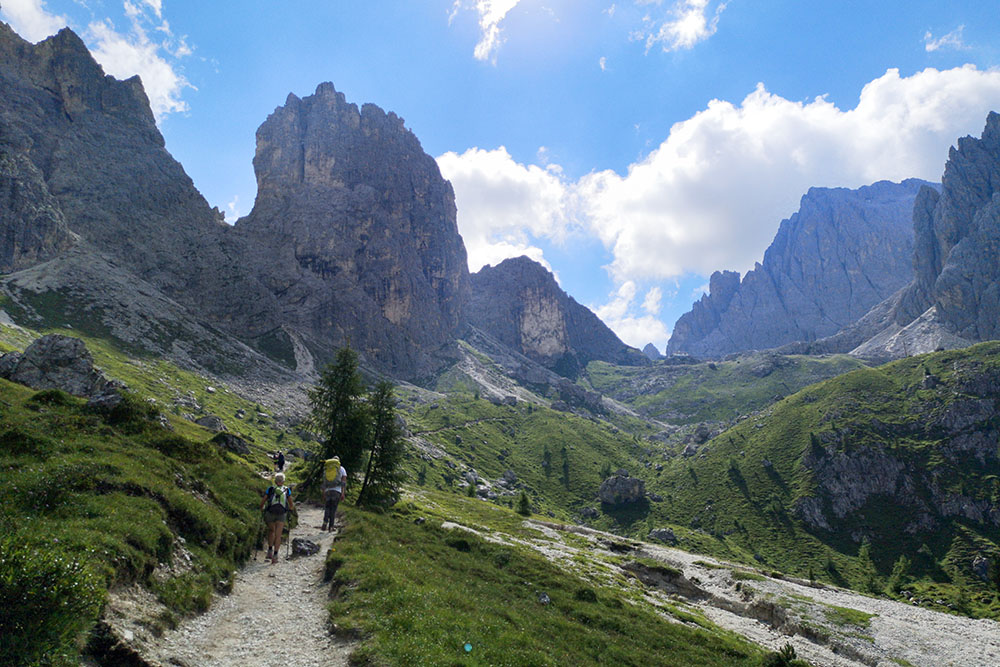
Si sale lungo il sentiero 115
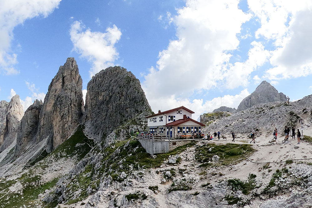
Arrivati al Rifugio Fratelli Fonda Savio
Il Rifugio Fratelli Fonda Savio
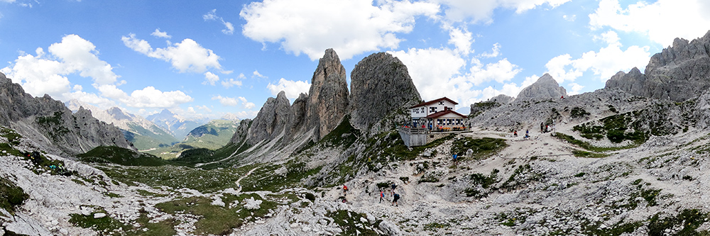
Panoramica 270 gradi
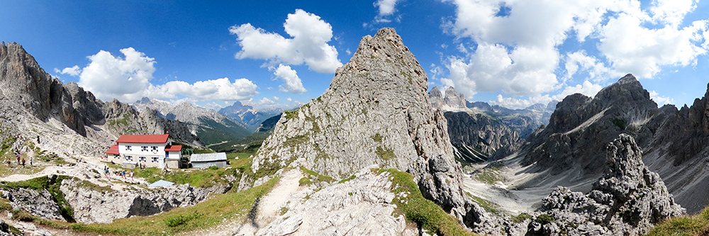
Da sopra il rifugio si possono vedere le Tre Cime di Lavaredo
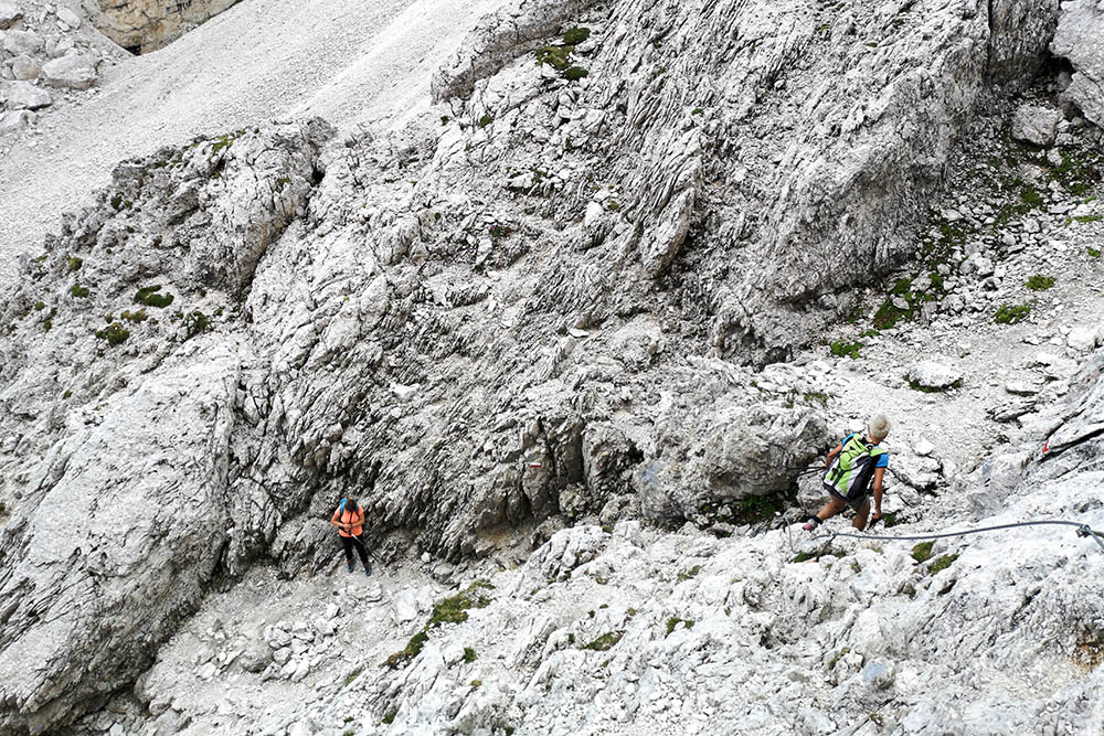
Si scende per il sentiero attrezzato Alberto Bonacossa
Bellissimo panorama sulle Tre Cime di Lavaredo
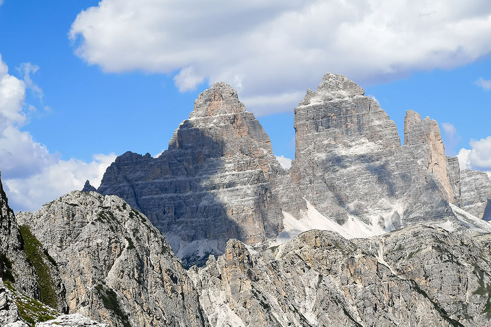
Le Tre Cime di Lavaredo
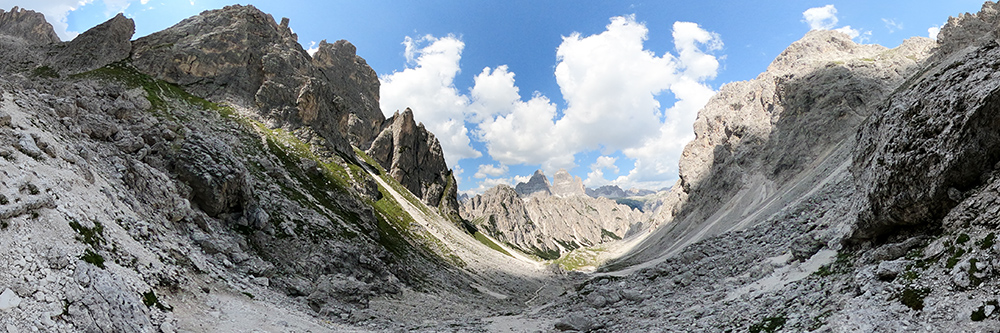
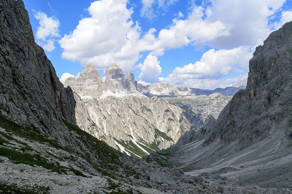
La vallata con le Tre Cime di Lavaredo
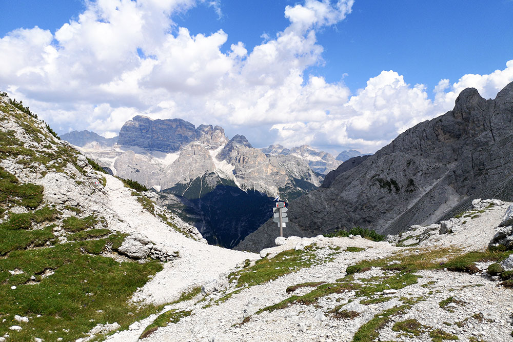
La Forcella de Rin Bianco
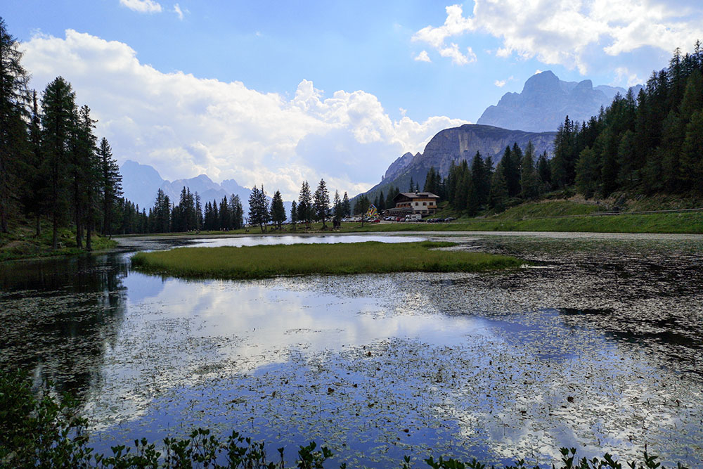
Il Lago d'Antorno
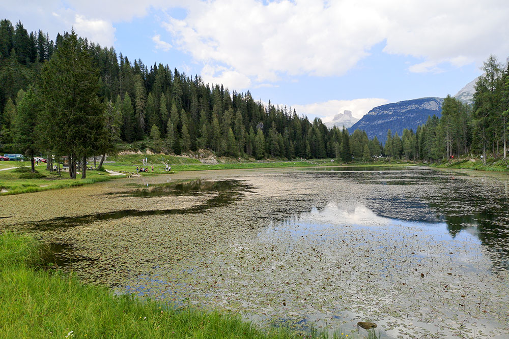
Il Lago d'Antorno


