


![]()


Durata
 6:00 h
Distanza
 52,5 km
 Ascesa
 1857 m
Discesa
 1857 m
H Max
 1762 m
H Min
 215 m
215 mMTB Tour: Ora - Malghette - Malga Corno - Kanzel - Ora
DESCRIPTION
Challenging circular route in the Monte Corno Natural Park.
The route starting from the Castelfer car park - between Egna and Ora - follows the route of the “Vecia ferovia” cycle path up to the S. Lugano Pass. This section is well maintained and well signposted. Instead, the less signposted part is the one that starts from Malga Corno up to the Adige Valley: we recommend that you download the GPS track. The two huts, Krabes Alm / Malghette and Malga Corno, are very nice and, if open, offer tasty dishes. The entire itinerary does not present particular technical difficulties.
The road surface is divided into:
- 26.5 km dirt road
- 11.7 km mule track
- 12 km asphalt
- 2.3 km trail
ITINERARY
From the Castelfeder car park (221 m) take the Vecia ferovia cycle path that climbs towards the village of Montagna (450 m). Here you continue until you reach Passo S. Lugano (1097 m). After the pass, turn right, on a paved road, towards Solaiolo. Here you take trail 9A which then becomes 9 and follow it until you reach the Malghette / Krabes Alm (1540 m). Now go down, passing Malga Pausa (1472 m) and Passo Cisa (1448 m). Now, still on a dirt road, go up to Malga Corno / Horn Alm (1709 m) and if you want you can go up to Monte Corno (1762 m). From the hut you return to Passo Cisa and at the third bend you take a dirt road on the left, which then becomes a path for some sections and leads to the Hakelboden hut (1427 m). Now we have gone down to Egna (214 m) on a dirt road passing through Kanzel (947 m). Once in Egna we took the cycle path along the Adige river and returned to the parking lot.
EXCURSION DATE
June 23, 2020
STARTING POINT
Castelfeder Parking - Ora
REFRESHMENT POINT
Krabes Alm / Malghette (1540 m) and Malga Corno (1709 m)
AUTHOR’S SUGGESTIONS
Use battery energy sparingly because the ascent is significant, 1857 m. We did it with a 500 W battery.
SAFETY TIPS
The viability of the proposed itinerary, like all mountain morphology, is subject to environmental changes due to natural events and weather conditions. Therefore, before leaving, consult the competent tourist offices and / or the refuges of reference.
Our GPX tracks are only indicative, that is, the route was carried out at best with the conditions of the trails and weather of that day. So always evaluate what to do on site.
Also remember to evaluate the route based on your physical abilities, the training and the equipment you have.
For e-bike owners: evaluate the kilometers and the altitude difference in relation to the battery power and the weight of the cyclist well.
You should leave someone the route you intend to do told.
Remember that the emergency number is 112.
EQUIPMENT
It is recommended to have the appropriate equipment for the route, weather conditions and season: helmet, windproof and / or rain jacket, map and / or GPS device, goggles, helmet and / or handlebar torch (an unexpected event may lengthen the travel times), sunscreen, MTB shoes, first aid kit, bike repair kit, specific clothing, whistle or signal bell, reflective bike wheels, gloves, backpack with food and drinks.
RECOMMENDED MAPS
Tabacco 049 STRADA DEL VINO / SÜDTIROLER WEINSTRASSE
INTERESTING LINKS
https://parchi-naturali.provincia.bz.it/parco-naturale-monte-corno.asp
HOW TO ARRIVE
A22 Egna-Ora exit. Take the SS12 road towards Ora - from the toll booth 1.4 km. The car park is visible on the left.
PARKING AREA
Free at the Castelfeder car park
GPS coordinates: 46.333551, 11.281774
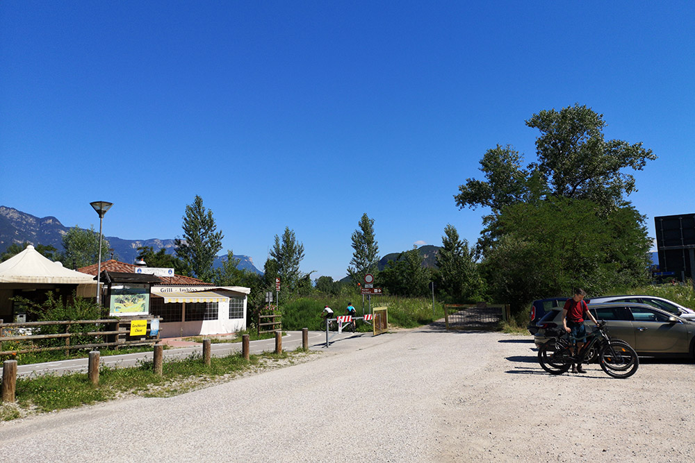
Parcheggio Castelfeder
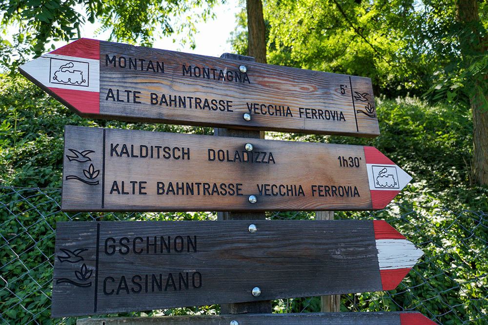
Indicazioni a Montagna
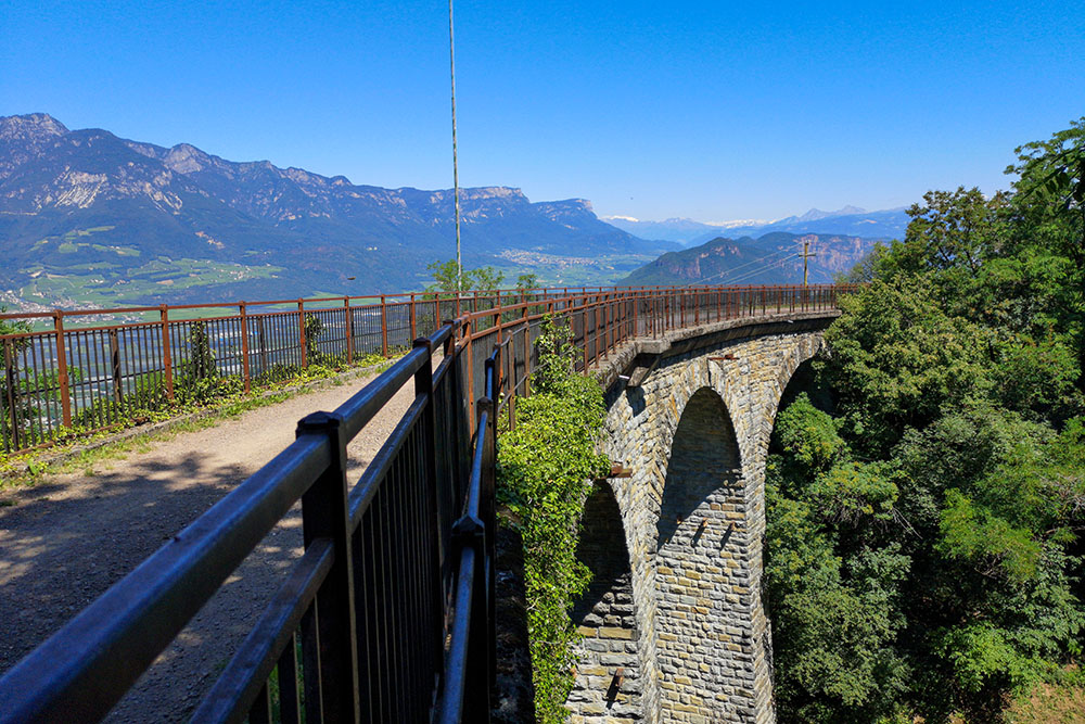
Si percorre la cilabile della Vecchia Ferrovia
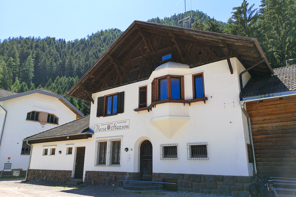
Siamo arrivati alla Vecchia Stazione presso Passo S. Lugano
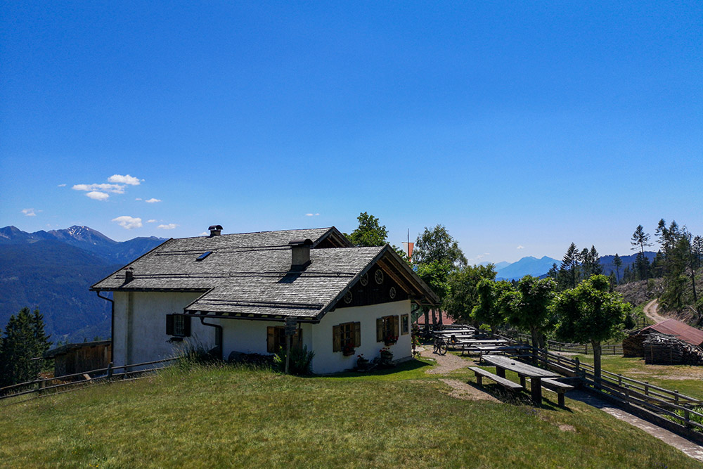
Krabes Alm-Malghette
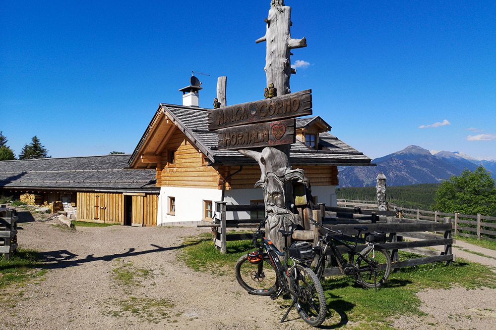
Malga Corno-Hornalm
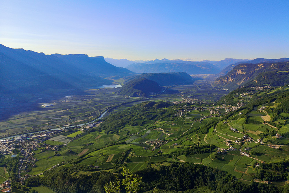
Si scende verso la Valle dell'Adige


