


![]()


Durata
 5:15 h
Distanza
 13,2 km
 Ascesa
 980 m
980 mDiscesa
 980 m
980 mH Max
 2490 m
H Min
 1547 m
Rifugio Lusia and Cima Lusia
DESCRIPTION
Fantastic cisapolata on the Alpe di Lusia.
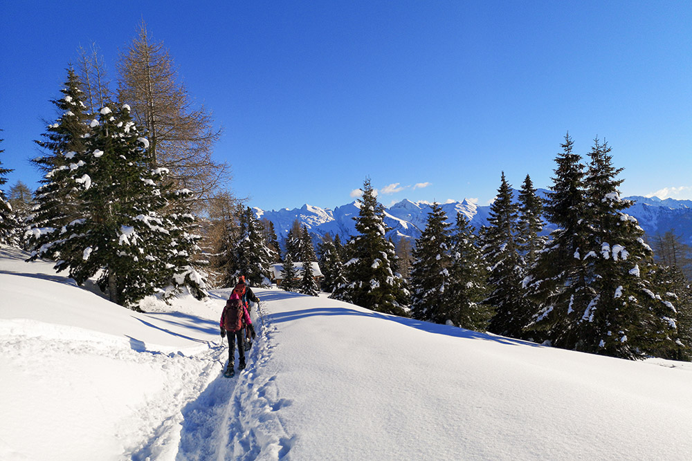
We are located in the center of the Alpe Lusia / Bellamonte Ski Area, usually very popular with skiers and hikers. We made the itinerary when the lifts were closed. However, it is also feasible with open lifts, just be a little careful when crossing the ski slopes. From Cima Lusia you can admire an amazing 360 degree panorama: the Latemar, the Catinaccio Group, the Monzoni Group, the Pale di San Martino and the Lagorai.
ITINERARY
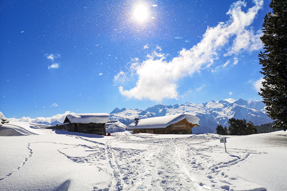
From the car park in Castelir (1547 m) go up the dirt road, which then becomes a path, towards Malga Canvere. Arriving at the hut (1977 m), follow the tracks in the snow - the path is not marked - which lead to Cima Lusia (2490 m). Now go down to Passo Lusia where we find the refuge of the same name (2053 m). Following for a while the trail marker 633, towards Malga Canvere, you will find a crossroads: here you go down to the valley following the sign for Chalet 44. In a few minutes you will reach Chalet 44 (1960 m), then pass the Bucaneve hut ( 1760 m) you return to the starting point.
EXCURSION DATE
February 13, 2021
STARTING POINT
Castelir locality
REFRESHMENT POINT
Rifugio Lusia (2053 m), Chalet 44 (1960 m) and Baita Bucaneve (1760 m)
SAFETY TIPS
Snowpack stability is subject to sudden and unpredictable changes. For your safety, always consult the avalanche bulletin, because the snowpack is subject to rapid changes, ask the competent local offices for information. Our GPX tracks are indicative only, that is, the route was best done with the snow and weather conditions of that day. So always evaluate what to do on site. Also remember to evaluate the route based on your physical abilities, training and the equipment you have. It is appropriate to let someone know the itinerary you intend to take. Remember that the emergency number is 112.
EQUIPMENT
It is recommended to have the appropriate equipment: kit for self-rescue in avalanches (consisting of Artva, shovel and probe), snowshoes, sticks, crampons, glasses, sunscreen, hiking boots, winter clothing, gloves, cap, backpack hot drinks.
RECOMMENDED MAPS
Tabacco 06 Val di Fassa e Dolomiti fassane
INTERESTING LINKS
https://www.rifugiolusia.it
HOW TO ARRIVE
SS48 up to Predazzo, SS50 towards Passo Rolle - Passo Valles. After passing Bellamonte, on the left, go up following the signs for Località Castelir.
PARKING AREA
In Castelir
GPS coordinates: 46.312502, 11.687575
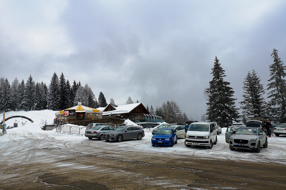
Parcheggio in località Castelir
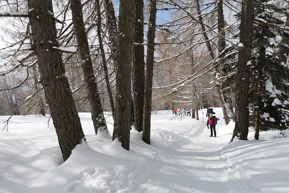
Si sale per una comoda strada forestale
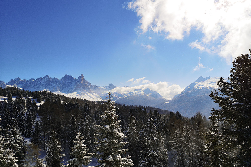
Panorama verso le Pale di San Martino
Arrivati a Malga Canvere
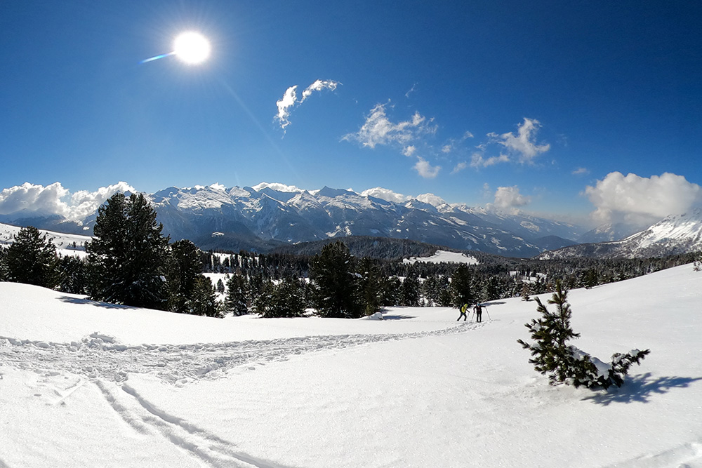
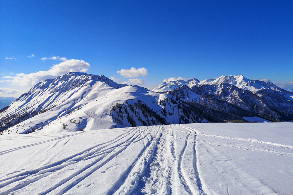
Si sale verso la vetta con un panorama spettacolare
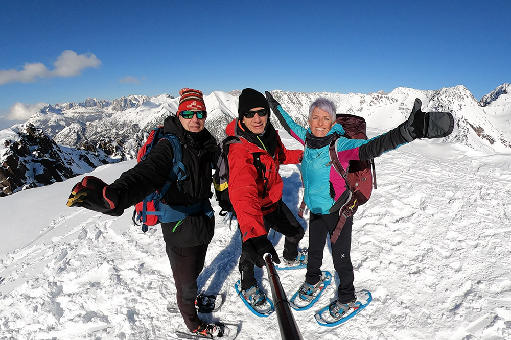
Cima Lusia
Scendiamo verso Passo Lusia
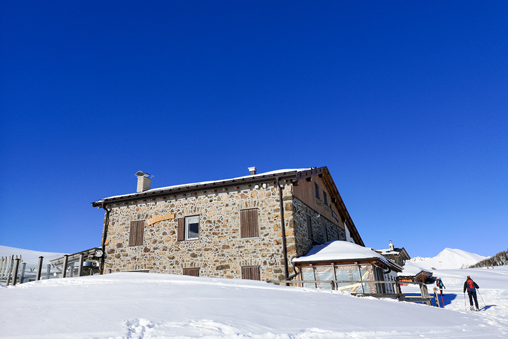
Arrivati al Rifugio Passo Lusia
Seguiamo il segnavia in direzione Malga Canvere
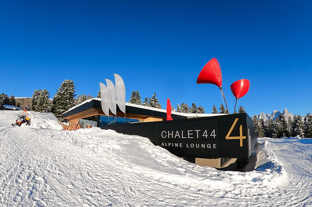
Chalet 44
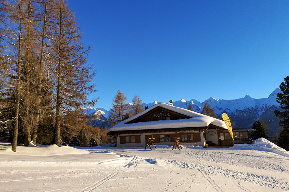
Baita Bucaneve


