


![]()


Durata
 5:00 h
Distanza
 11,8 km
 Ascesa
 936 m
936 mDiscesa
 936 m
936 mH Max
 2397 m
H Min
 1606 m
Tour of the Moregna, Trout and Brutto lakes
DESCRIPTION
Excursion in the Lagorai Group on the side of Val di Fiemme.
The itinerary will take you to beautiful places in the eastern Lagorai that are not very popular with Sunday hikers.
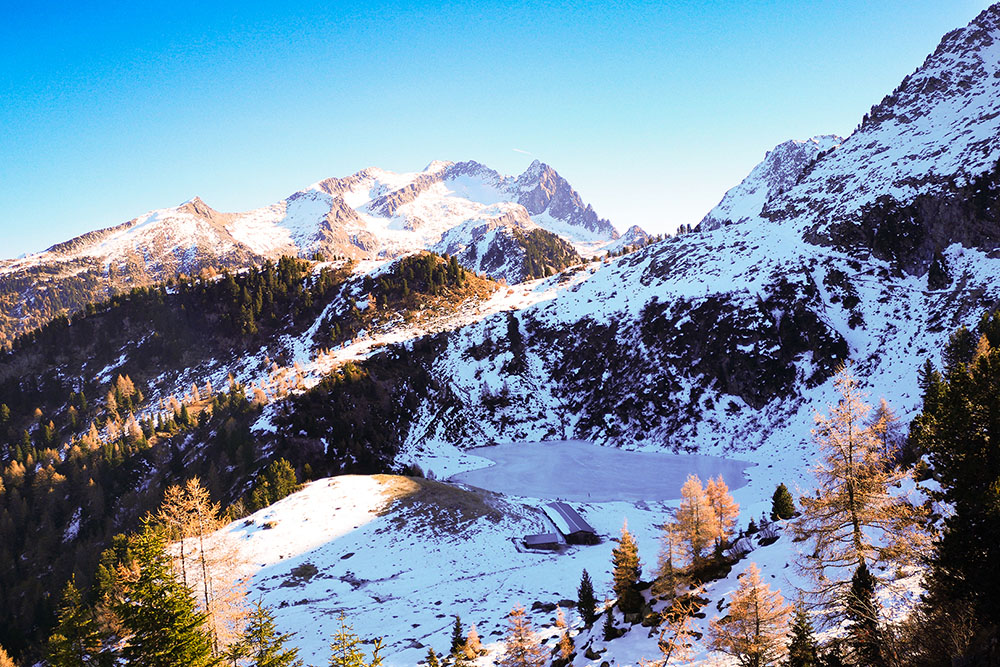
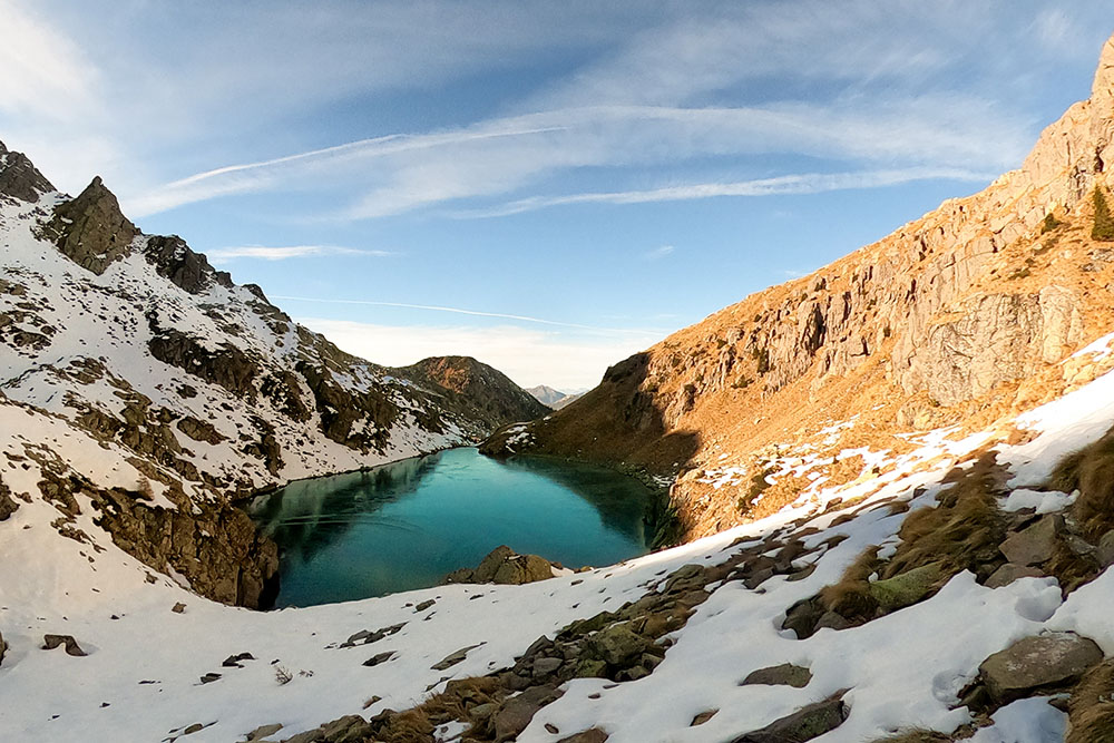
You go up starting from Malga Valmaggiore, where you park, and when you arrive at Malga Moregna you make a loop around Cima Moregna touching three lakes: Lake Moregna, Lake Delle Trote and Lake Brutto. All three lakes are beautiful and nestled in the mountains. The panorama, especially when you arrive at the Forcella Moregna, becomes interesting: on one side you can see the Black Horn, the White Horn, the Adamello in the distance and the Cima Cece Group on the other.
ITINERARY
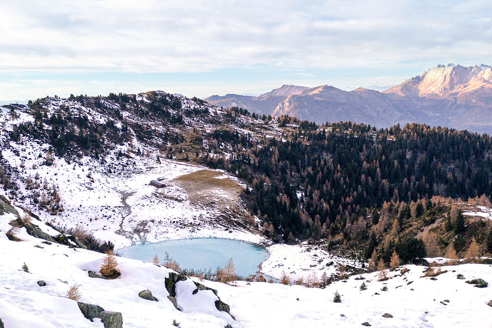
From Malga Valmaggiore (1609 m) take path 339 and go up, first on a dirt road and then on a mule track, to the Malga Moregna (2081 m) and the lake of the same name. Now the 339 is resumed and we head towards the Trout Lake. At the first crossroads, take the path on the right and go down a bit until you reach Lago delle Trote (2110 m). Go back to the crossroads and take path 349 and after 15 minutes you will arrive at Lago Brutto (2208 m). Here you skirt the lake and go up the gully reaching the Forcella Moregna (2397 m). Always go down on 349. At the first crossroads, keep to the left, at the second, always the left. Along the path 349B you return to the path 339 passing near the Malga Moregna. Now we return to the car park for 339.
STARTING POINT
Malga Valmaggiore
REFRESHMENT POINT
Malga Valmaggiore
AUTHOR’S SUGGESTIONS
There are many rhododendron plants in the area. We recommend that you take the excursion in July, when they are in bloom, because they create beautiful splashes of color.
SAFETY TIPS
The viability of the proposed itinerary, like all mountain morphology, is subject to environmental changes due to natural events and weather conditions. Therefore, before leaving, consult the competent tourist offices and / or the refuges of reference.
Our GPX tracks are only indicative, that is, the route was carried out at best with the conditions of the trails and weather of that day. So always consider what to do on site.
Also remember to evaluate the route based on your physical abilities, training and the equipment you have.
You should leave someone the route you intend to do told.
Remember that the emergency number is 112.
EQUIPMENT
It is recommended to have the appropriate equipment for the route, weather conditions and season: windproof and / or rain jacket, map and / or GPS device, goggles, sunscreen, boots, first aid kit, specific clothing, gloves, backpack with food and drink.
RECOMMENDED MAPS
Tabacco 014 VAL DI FIEMME - LAGORAI - LATEMAR
INTERESTING LINKS
https://www.trentino.com/it/cultura-e-territorio/natura-e-paesaggio/montagne-del-trentino/lagorai/
HOW TO ARRIVE
From Predazzo take the road following the direction of Malga di Valmaggiore. The street is Via Coronele.
PARKING AREA
At Malga Valmaggiore
GPS coordinates 46.280470, 11.649377
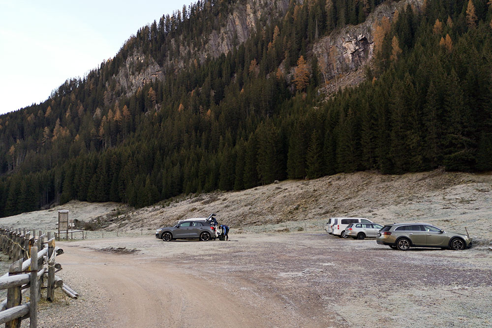
Parcheggio presso la Malga Valmaggiore
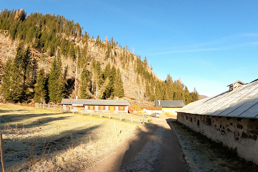
Malga Valmaggiore
Malga Moregna con l'omonimo lago
Lago delle Trote
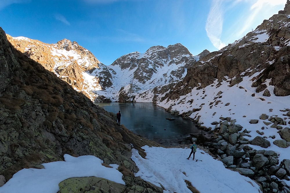
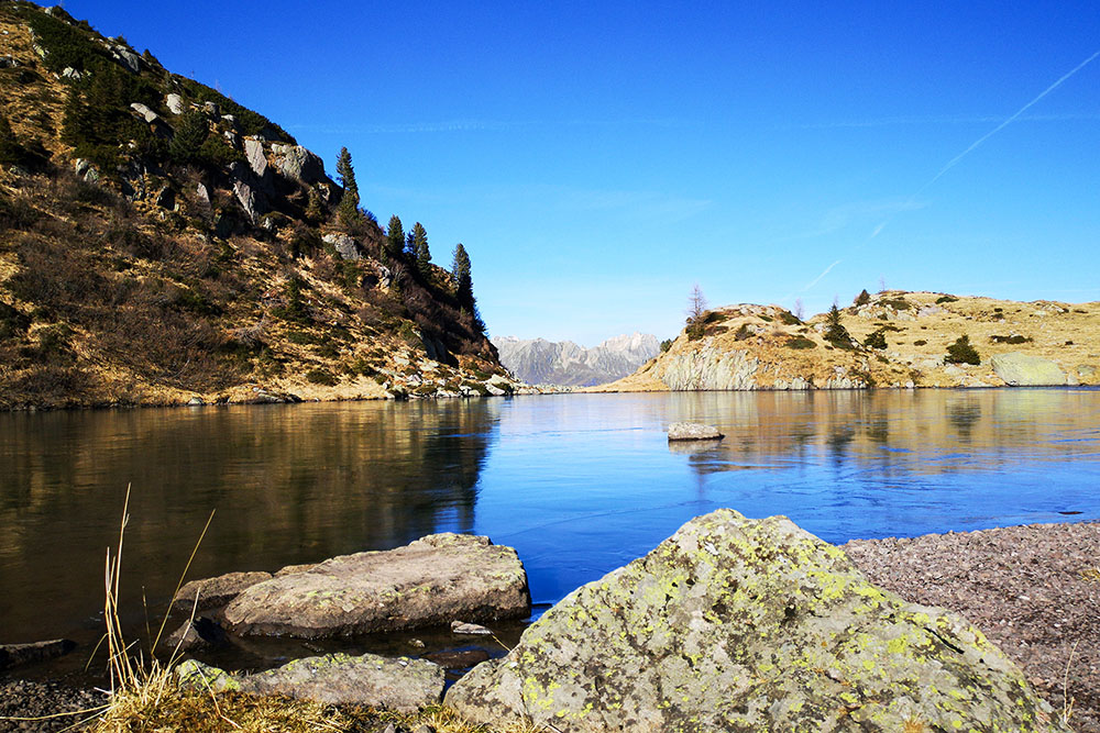
Lago Brutto
Lago Brutto
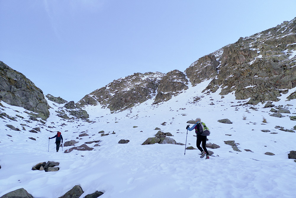
Si sale per il canalone verso la Forcella Moregna
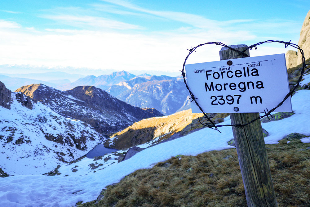
Forcella Moregna
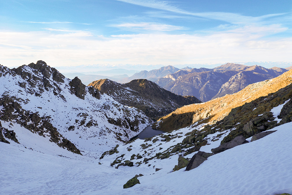
Vista dalla Forcella Moregna
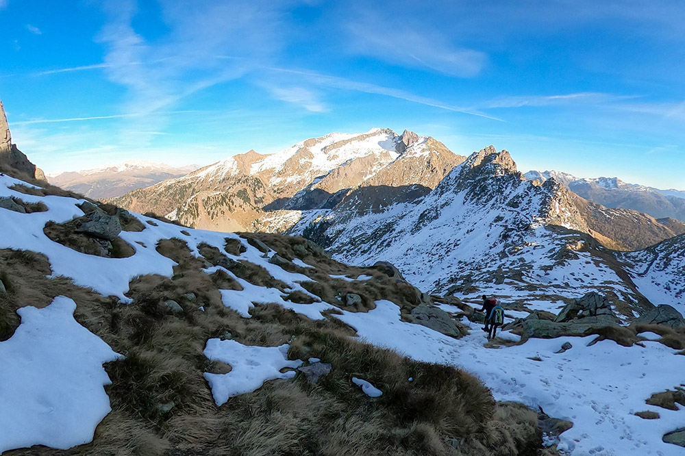
Vista dalla Forcella Moregna
Ritorno al Lago Moregna


