


![]()


Durata
 6:00 h
Distanza
 7,5 km
 Ascesa
 1045 m
Discesa
 1045 m
H Max
 2806 m
H Min
 2125 m
Via Ferrate Masarè and Roda di Vael
DESCRIPTION
Beautiful via ferratas in a spectacular Dolomite scenery.
The two via ferratas are located in one of the most beautiful places in the Dolomites: in the Catinaccio Group. From the start of the Via Ferrata Masarè to the Vaiolon Pass, the view is always amazing.
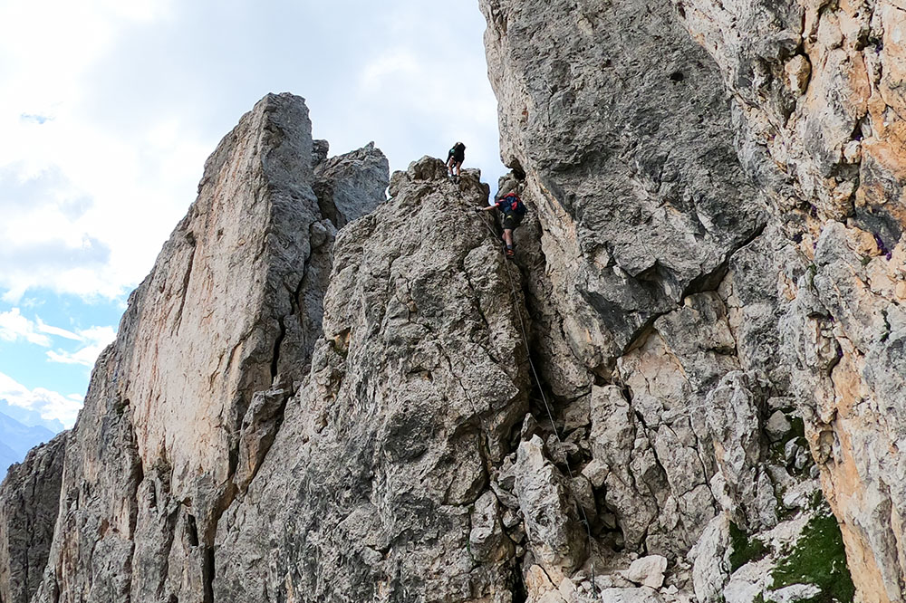
The via ferratas cannot be classified as difficult, but have some points with technical difficulties or with strong exposure. During the month of August they are very popular, so it's better to leave early.
The itinerary can be done both clockwise and counterclockwise and the two via ferratas can also be traveled separately.
ITINERARY
From the Rifugio Paolina (2125 m) take the 539 up to the Christomannos Monument, then along the path 549 you reach the Rifugio Roda di Vael (2283 m). Here we follow the signs Ferrata Masarè: at the first junction we go straight and at the second junction we take the unnumbered path to the left. Please do not follow the indication Ferrata Masarè. You do the whole Masarè via ferrata. At the end - Torre Finestra 2540 m -, you do not go down towards the Rifugio Roda di Vael, but go up to start the Ferrata Roda di Vael al Pian dal Diaol (2625 m). You arrive at the highest point, Cima Roda di Vael (2806 m), and then descend to Passo del Vaiolon (2562 m). Through the paths 9, 549 and 539 you return to the Rifugio Paolina.
STARTING POINT
Rifugio Paolina
REFRESHMENT POINT
Rifugio Paolina (2125 m) and Rifugio Roda di Vael (2283 m)
AUTHOR’S SUGGESTIONS
Obviously it is not recommended for people suffering from vertigo.
SAFETY TIPS
The viability of the proposed itinerary, like all mountain morphology, is subject to environmental changes due to natural events and weather conditions. So, before leaving, consult the competent tourist offices and / or the refuges of reference.
Our GPX tracks are only indicative, that is, the route was carried out at best with the conditions of the trails and weather of that day. So always evaluate what to do on site.
Also remember to evaluate the route based on your physical abilities, training and the equipment you have.
You should leave someone the route you intend to do told.
Remember that the emergency number is 112.
EQUIPMENT
It is recommended to have the appropriate equipment: technical mountain clothing, boots with vibram sole or similar, via ferrata set, harness, helmet, via ferrata gloves, goggles, sunscreen, backpack with drinks.
RECOMMENDED MAPS
Tabacco 06 VAL DI FASSA E DOLOMITI FASSANE
INTERESTING LINKS
http://www.paolina-huette.com/
HOW TO ARRIVE
A22 Bolzano Nord exit. SS12 towards Bolzano and then after 5 km take the SS241 - Val d’Ega on the right.
A little before the Costalunga Pass, on the left, is the parking lot of the valley station of the Paolina chairlift.
PARKING AREA
At the valley station of the Paolina chairlift
GPS coordinates: 46.407333, 11.591138
Abbiamo lasciato il Monumento a Christomannos
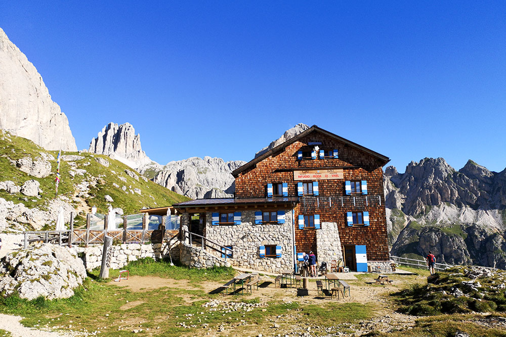
Arrivati al rifugio Roda di Vael
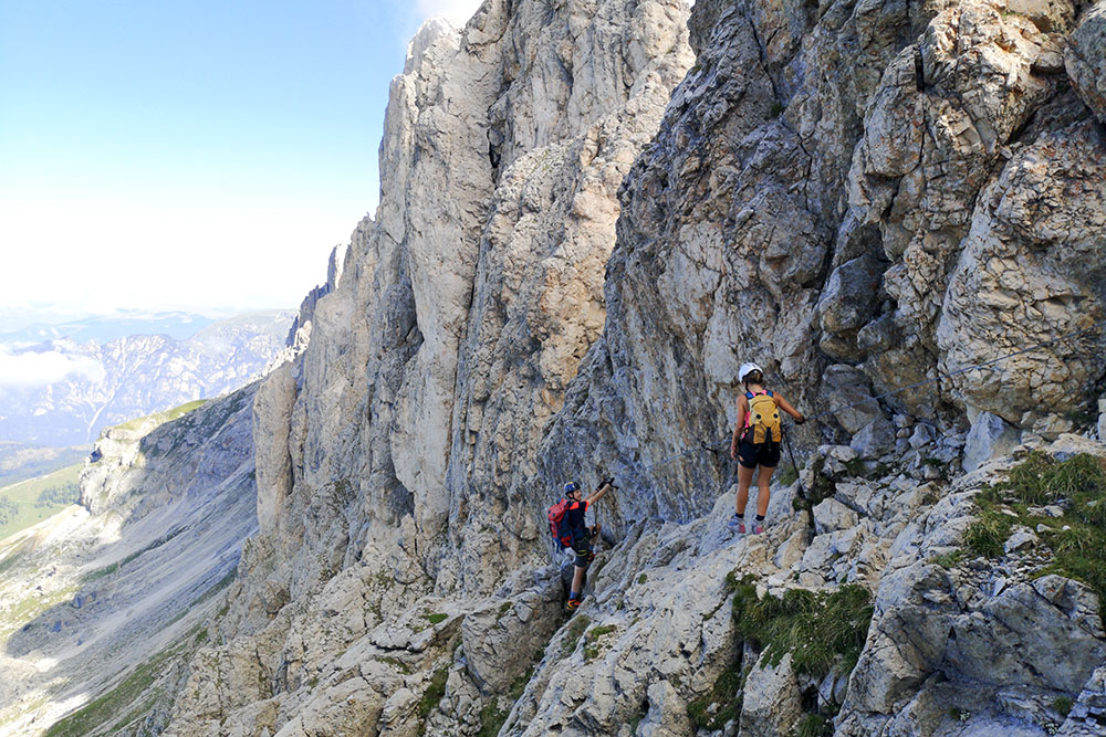
Attacco della Ferrata Masarè
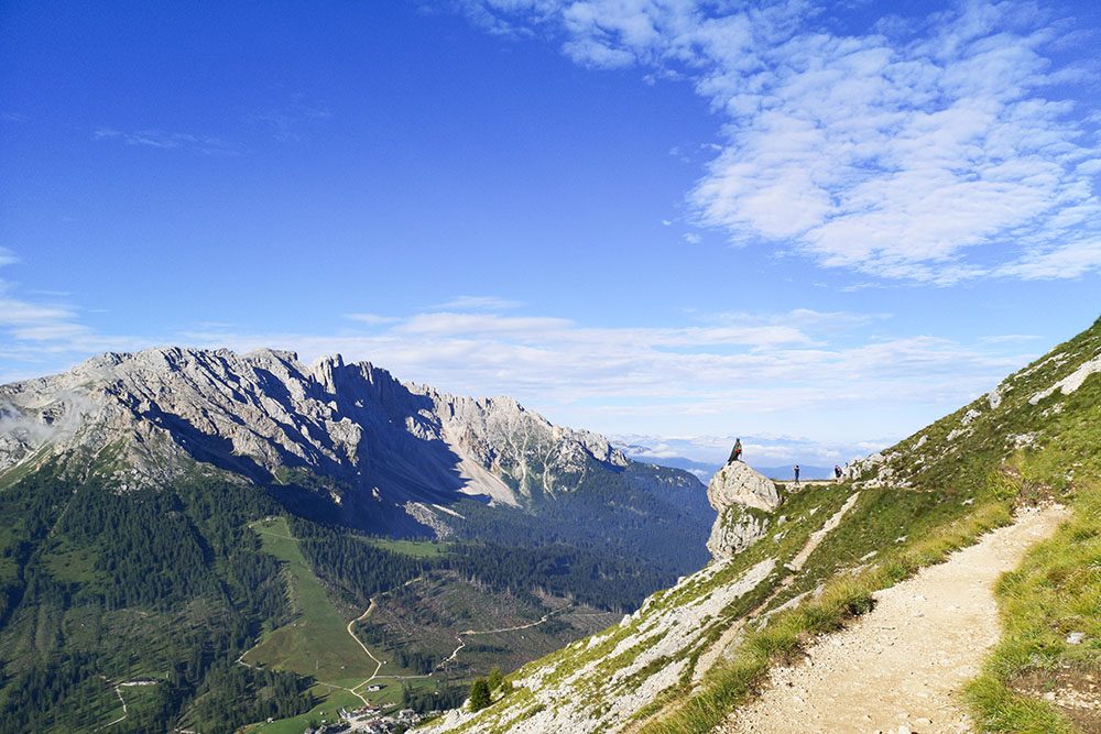
Si continua a salire e in lontananza si vede il rifugio Roda di Vael
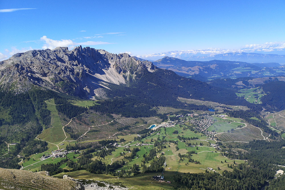
Il panorama verso il Latemar
Ultimo tratto in discesa della ferrata Masarè
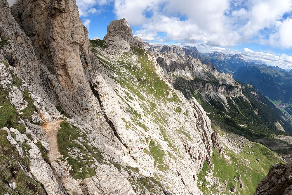
In lontananza si vede il sentiero che sale fino a Pian dal Diaol 2625 m
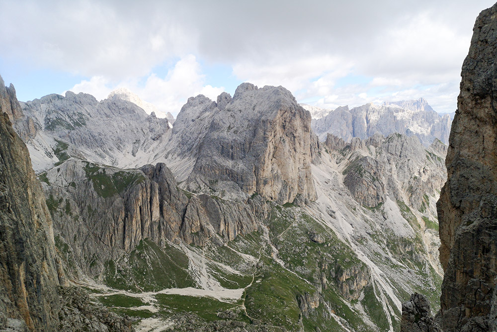
Panorama sul Catinaccio
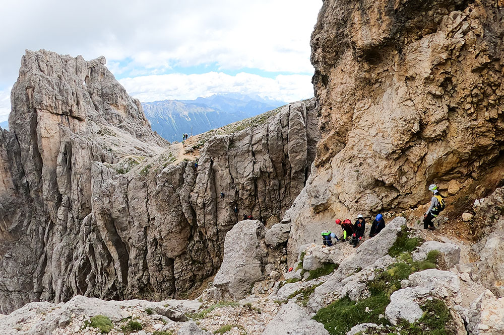
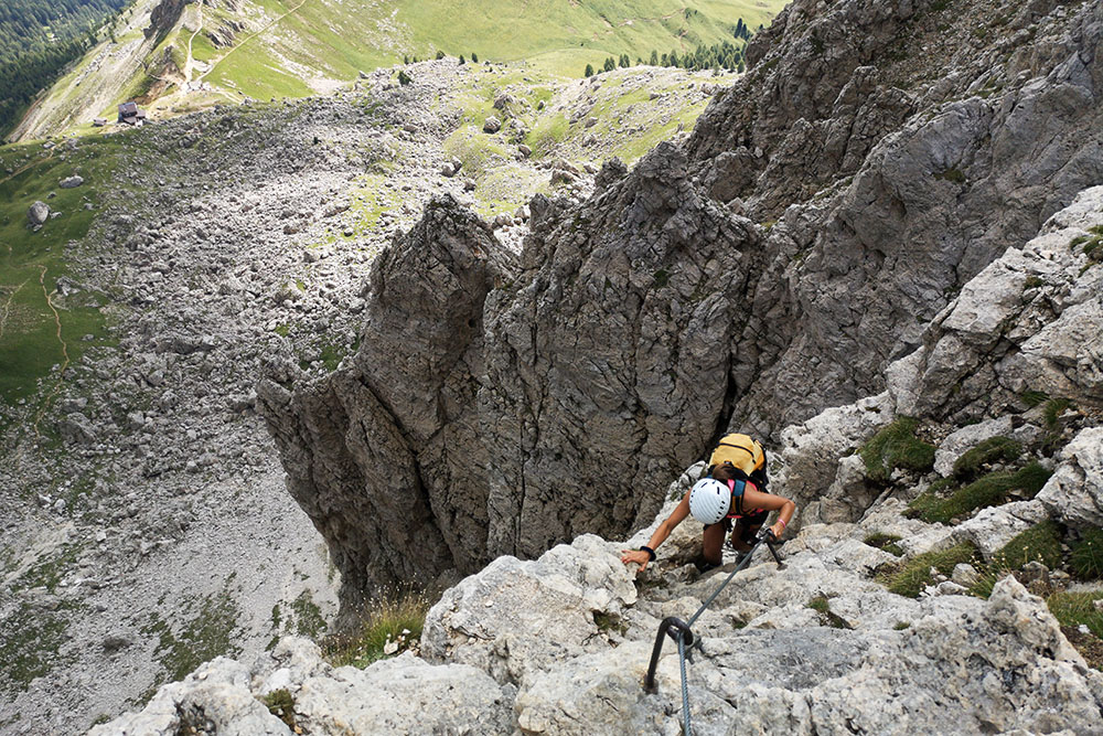
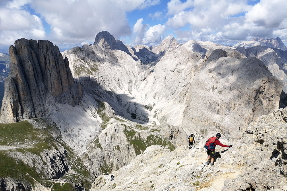
Abbiamo superato Pian dal Diaol
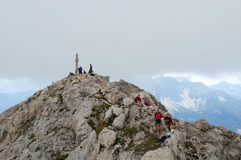
In vetta al Monte Roda di Vael
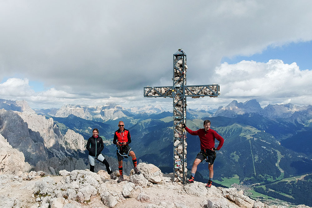
In vetta al Monte Roda di Vael
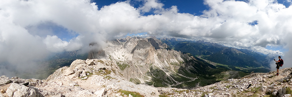
Panorama dal Monte Roda di Vael
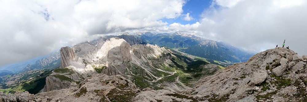
Panorama dal Monte Roda di Vael
Si scende verso il Passo del Vaiolon
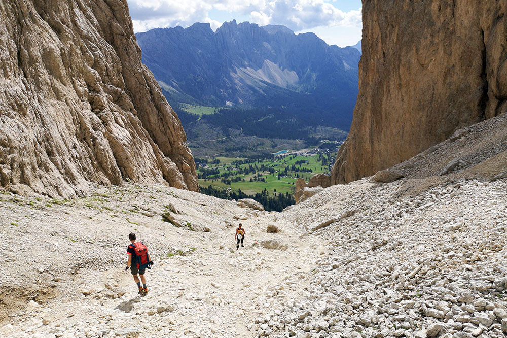
Si rientra al rifugio Paolina


