


![]()


Durata
 3:10 h
Distanza
 8,2 km
 Ascesa
 550 m
550 mDiscesa
 550 m
550 mH Max
 2322 m
H Min
 1874 m
Cima Cavallazza and the Colbricon lakes
DESCRIPTION
Ring excursion to Cima Cavallazza and the Colbricon lakes starting from Passo Rolle.
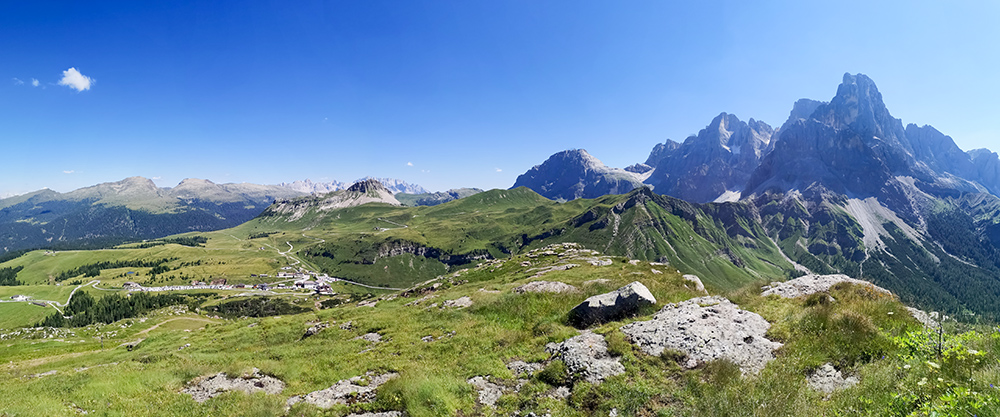
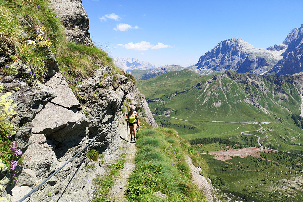
We are located within the Lagorai chain. The itinerary we propose is very scenic: from the peaks and ridges you can admire a beautiful view of the Pale di San Martino and in particular of the Cimon della Pala, nicknamed the Matterhorn of the Dolomites. The remains of the fortifications of the Great War that we find on Monte Cavallazza are also interesting. The two lakes of Colbricon then, are two lake jewels of our mountains. The route has some sections equipped with a metal cord.
ITINERARY
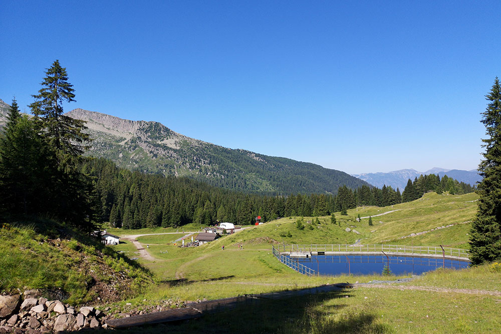
Departure from Malga Rolle (1910 m) on path 348. Shortly after, arriving at Bar La Baita (1878 m), turn left towards Passo Rolle going up the ski slope. Above the pass we find the signs for Cima Cavallazza: path R02. Go up the dirt road which then becomes a path. Go along the ridge and arrive at Cima Tognazza and Cima Cavallazza Piccola (2303 m) - here we find some aided sections. You go down to Forcella Cavallazza (2226 m) and then go up to Cima Cavallazza (2322 m). Now you go down to the Colbricon Lakes and the Rifugio Colbricon (1930 m). Return to Malga Rolle along path 348.
STARTING POINT
Malga Rolle
REFRESHMENT POINT
Malga Rolle (1910 m), Bar La Baita (1878 m) and Rifugio Laghi di Colbricon (1927 m)
AUTHOR’S SUGGESTIONS
The aided section is not suitable for those suffering from vertigo. You need a steady step and balance.
SAFETY TIPS
Attention on the aided sections.
The viability of the proposed itinerary, like all mountain morphology, is subject to environmental changes due to natural events and weather conditions. Therefore, before leaving, consult the competent tourist offices and / or the refuges of reference.
Our GPX tracks are only indicative, that is, the route was carried out at best with the conditions of the trails and weather of that day. So always consider what to do on site.
Also remember to evaluate the route based on your physical abilities, training and the equipment you have.
You should leave someone the route you intend to do told.
Remember that the emergency number is 112.
EQUIPMENT
It is recommended to have the appropriate equipment for the route, weather conditions and season: windproof and / or rain jacket, map and / or GPS device, goggles, sunscreen, boots, first aid kit, specific clothing, gloves, backpack with food and drink.
RECOMMENDED MAPS
Tabacco 06 VAL DI FASSA E DOLOMITI FASSANE
INTERESTING LINKS
https://www.visitfiemme.it/it/more-info/fiemme/mercati/Baita-Laghi-di-Colbricon_isd_122399
HOW TO ARRIVE
From Predazzo SS50 to Malga Rolle (1.2 km before Passo Rolle)
PARKING AREA
Free at Malga Rolle
GPS coordinates: 46.295944, 11.775858

Parcheggio a Passo Rolle
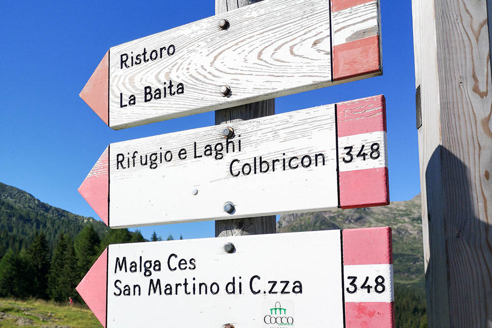
Segnavia alla partenza
Dal Bar La Baita parte la seggiovia Paradiso che porta alla cima Tognazza
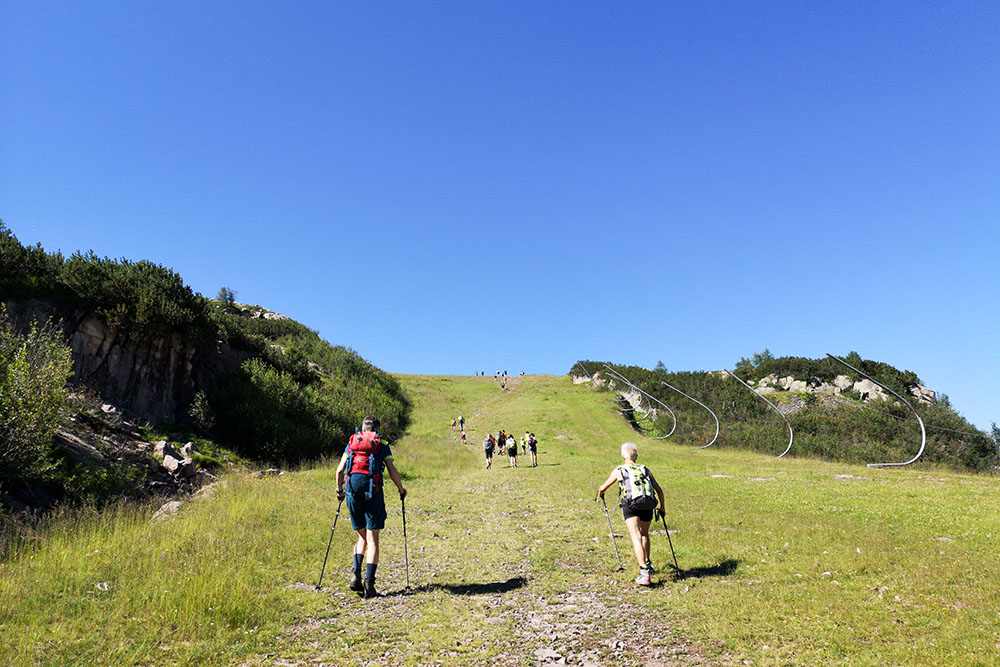
Si sale verso Cima Tognazza
Panorama dalla Cima Tognazza
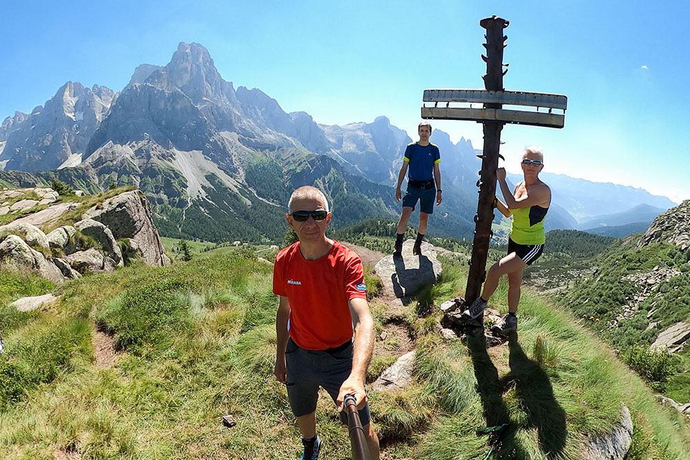
Croce in ferro presso la stazione a monte della seggiovia Paradiso
Tratto attrezzato dove si trovano i camminamenti della Prima Guerra Mondiale
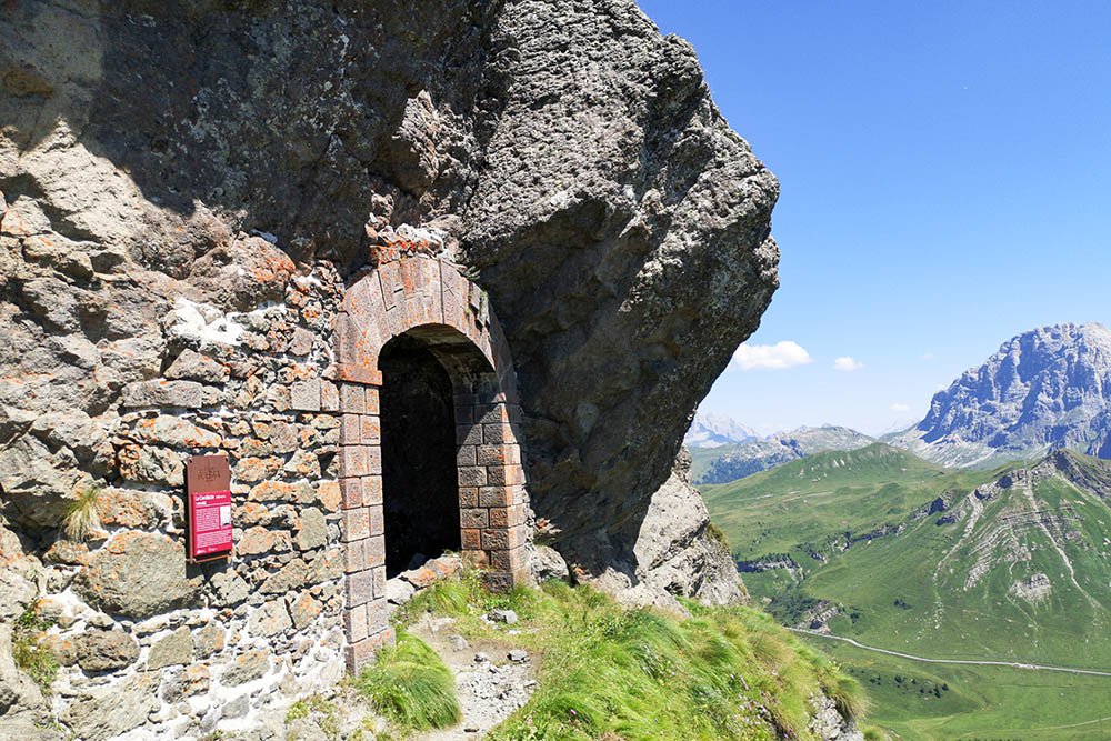
Fotificazioni della Grande Guerra
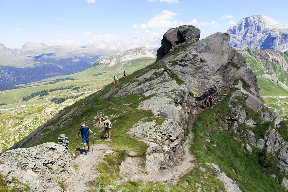
Manca ancora poco alla cima del Monte Cavallazza
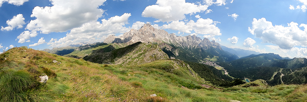
Panorama dal Monte Cavallazza verso Le Pale di San Martino
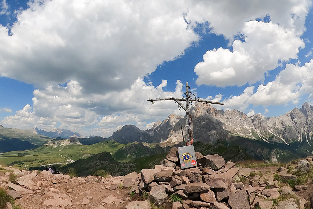
Cima Cavallazza
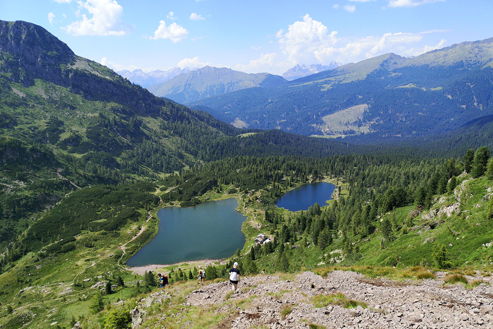
Scendiamo ai Laghi di Colbricon
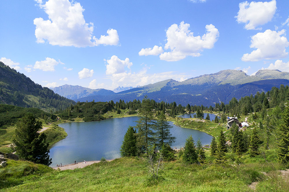
I Laghi di Colbricon


