


![]()


Durata
 5:40 h
Distanza
 14,5 km
 Ascesa
 1086 m
Discesa
 1086 m
H Max
 2547 m
H Min
 1481 m
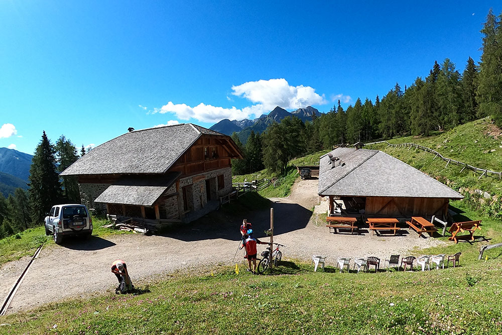
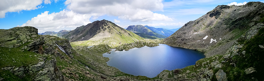
Corvo Lake and Rifugio Stella Alpina at Corvo Lake
DESCRIPTION
Suggestive excursion in the upper Val di Rabbi - Stelvio National Park - to the Corvo lakes.
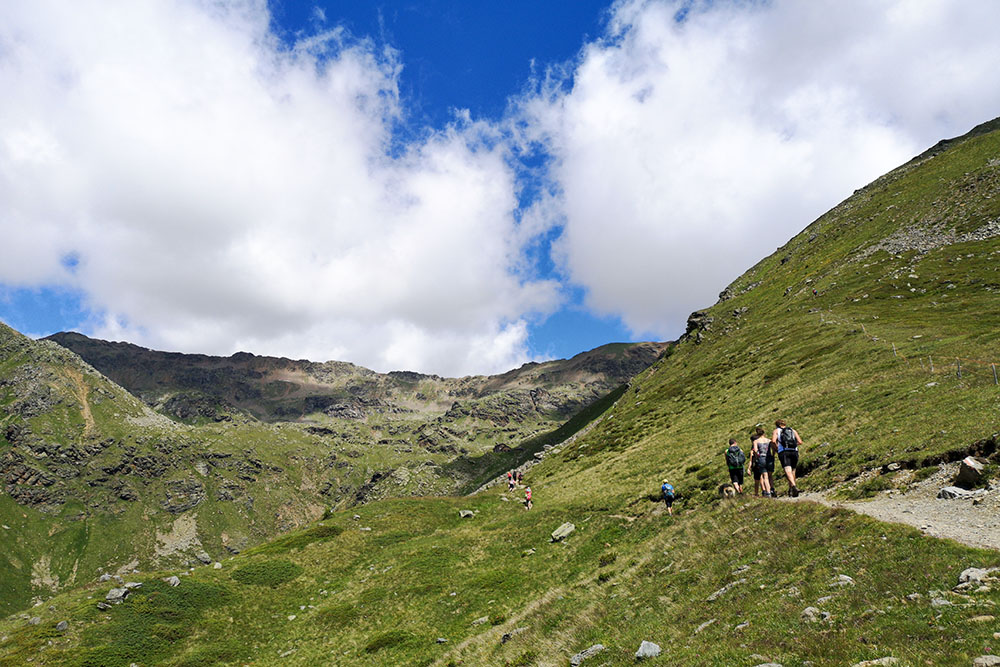
Corvo lakes, there are five, are located at an altitude between 2465 m and 2630 m. What is called Lago Corvo is the largest one, the one near the Rifugio Stella Alpina. Not far away is the Passo di Rabbi which connects the Val di Rabbi (Trentino) to the Val d’Ultimo (Alto Adige).
ITINERARY
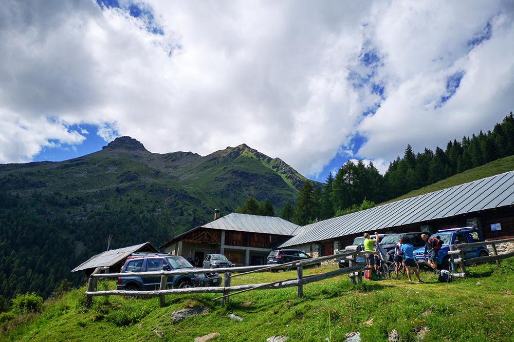
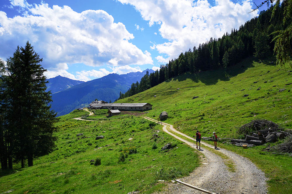
From the Cavallar car park (1,481 m), take path 108, which, passing through Malga Palù de Caldès Bassa (1833 m), takes you directly to the Rifugio Stella Alpina at Lago Corvo (2425 m). From the hut on path 145 you first reach Lago Corvo (2465 m) and then to Lake Kirchberg (2544 m). Now return to the same road, pass the Rifugio Stella Alpina and descend on 108 to a crossroads. Here you turn left and go to Malga Palù de Caldès Alta. Arriving at the hut (2020 m) continue towards Malga Samocleva / Cespedé (1892 m). Return to the parking lot following the 130 and 108.
STARTING POINT
Cavallar locality
REFRESHMENT POINT
Rifugio Stella Alpina
AUTHOR’S SUGGESTIONS
Go up to the second lake, because it is beautiful and because you will have a beautiful view of the refuge and Lake Corvo.
SAFETY TIPS
The viability of the proposed itinerary, like all mountain morphology, is subject to environmental changes due to natural events and weather conditions. Therefore, before leaving, consult the competent tourist offices and / or the refuges of reference.
Our GPX tracks are only indicative, that is, the route was carried out at best with the conditions of the trails and weather of that day. So always consider what to do on site.
Also remember to evaluate the route based on your physical abilities, training and the equipment you have.
You should leave someone the route you intend to do told.
Remember that the emergency number is 112.
EQUIPMENT
It is recommended to have the appropriate equipment for the route, weather conditions and season: windproof and / or rain jacket, map and / or GPS device, goggles, sunscreen, boots, first aid kit, specific clothing, gloves, backpack with food and drink.
RECOMMENDED MAPS
Tabacco 048 VAL DI PEIO - VAL DI RABBI - VAL DI SOLE
INTERESTING LINKS
https://www.valdirabbi.com
HOW TO ARRIVE
From Cles - Val di Non - follow the SS43, take the Val di Sole SS42 and before Malè take the SP86 on the right. Once in Rabbi, take - on the right - towards Penasa, continue towards the hamlet of Piazzola and arrive in Cavallar.
PARKING AREA
Cavallar parking
GPS coordinates: 46.414389, 10.824119
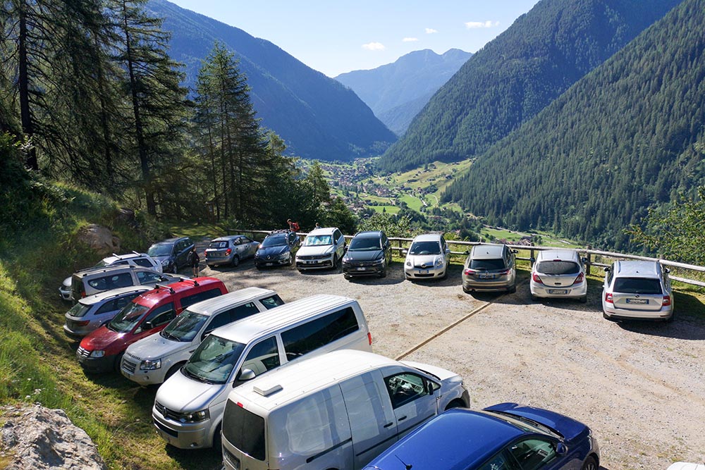
Parcheggio Cavallar
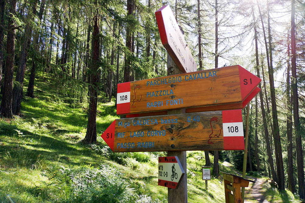
Segnavia alla partenza
Malga Palù de Caldès Bassa
Ultimo tratto per il rifugio
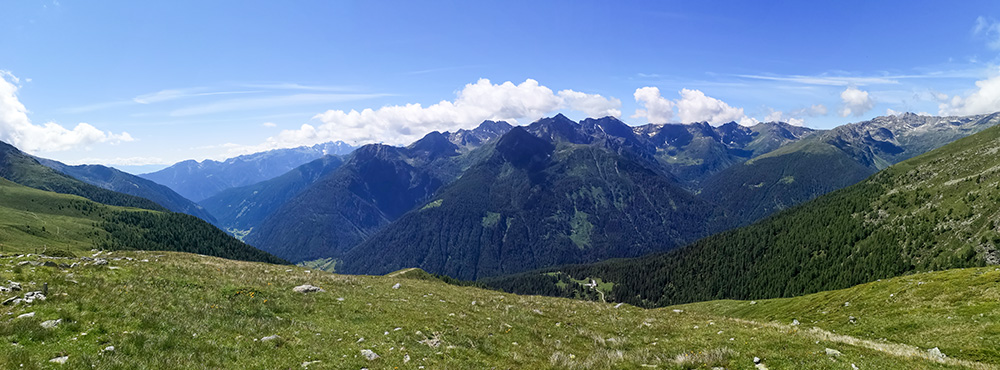
Panorama sulla Val di Rabbi
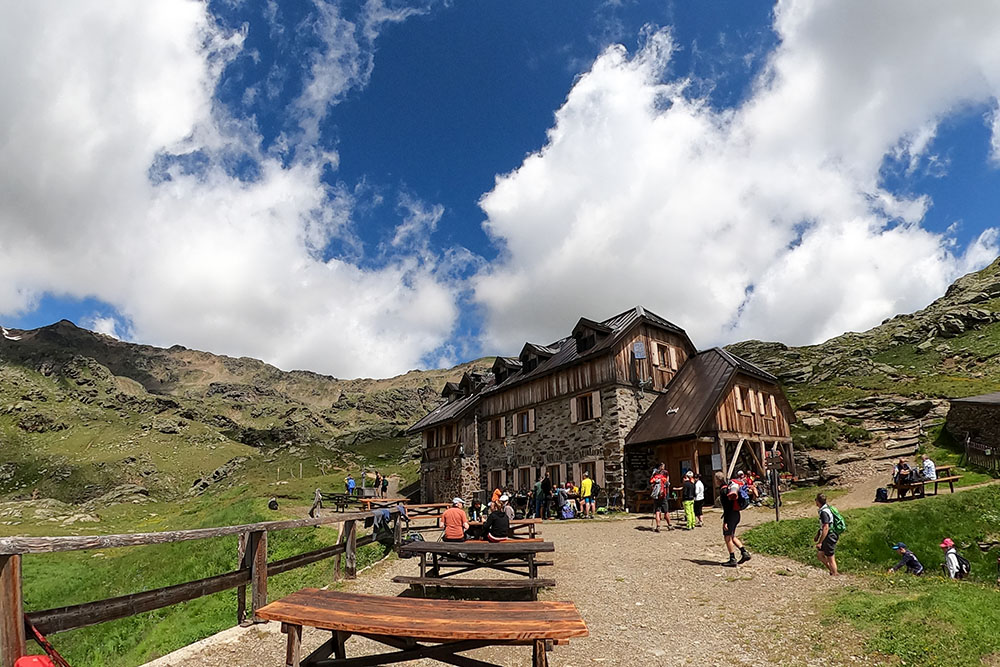
Rifugio Stella Alpina al Lago Corvo
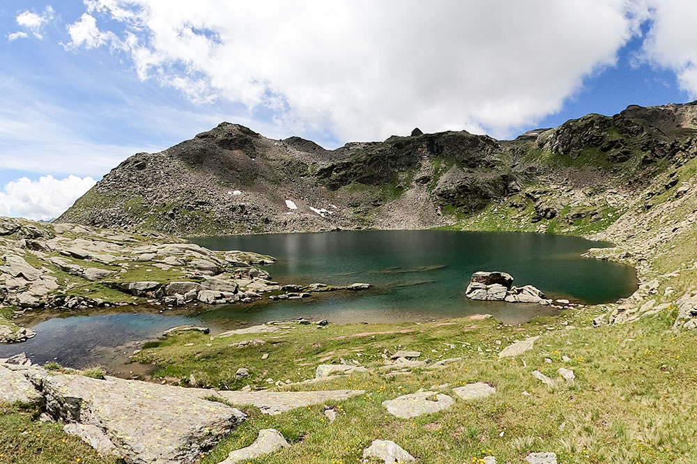
Lago Corvo
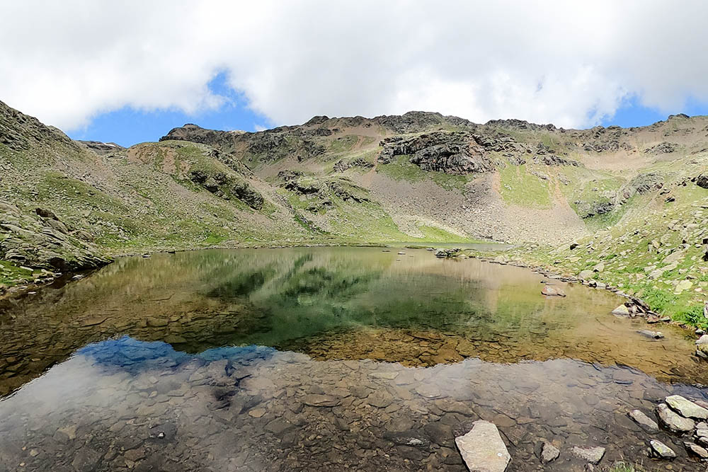
Lago Kirchberg
Panorama dal Lago Kirchberg
Malga Palù de Caldès Alta
Malga Samocleva


