


![]()


Durata
 7:30 h
Distanza
 14,1 km
 Ascesa
 1400 m
Discesa
 1400 m
H Max
 2958 m
H Min
 2180 m
Via Ferrata Oskar Schuster at Sassopiatto
DESCRIPTION
The Via Ferrata Oskar Schuster is located in one of the most beautiful Dolomite landscapes of Trentino-Alto Adige.
The via ferrata, opened by Oskar Schuster and Wilhelm Lohmuller in 1896, is a classic excursion for lovers of the Dolomites. The itinerary as a whole is classified as difficult. Not for the via ferrata itself, but for the whole itinerary: for the distance and the difference in height. Furthermore, maximum attention must be paid to the non-aided points of the via ferrata. From the Vetta di Mezzo of Sassopiatto you can enjoy a beautiful panorama.
ITINERARY
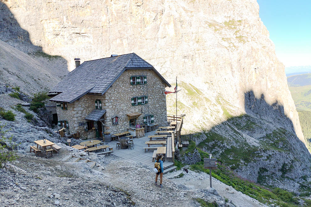
From the valley station of the Sassolungo cable car at Passo Sella (2180 m), go up the path 525 towards the Forcella del Sassolungo where the Rifugio Toni Demetz (2685 m) is located. Now continue the downhill path and at the Rifugio Vicenza (2253 m) take the unnumbered path and go up the Sassopiatto detrital basin for about 45 minutes until you reach the start of the via ferrata (2560 m). The via ferrata leads directly to the summit of Mezzo del Sassopiatto (2958 m). Now go down the path 527 to the Rifugio Sassopiatto (2300 m). Return to the starting point following the path 557 passing through the Pertini (2300 m) and Friedrich August (2294 m) refuges and the Forcella Rodela (2312 m).
STARTING POINT
Valley station of the Sassolungo cable car at Passo Sella
REFRESHMENT POINT
Rifugio Toni Demetz (2685 m), Rifugio Vicenza (2253 m), Rifugio Sassopiatto (2300 m), Rifugio Pertini (2300 m), Friedrich August (2294 m), Chalet Margherita (2266 m) and Rifugio Salei (2225 m)
AUTHOR’S SUGGESTIONS
Obviously it is not recommended for people suffering from vertigo.
SAFETY TIPS
On the via ferrata, in the gully, watch out for falling rocks.
The viability of the proposed itinerary, like all mountain morphology, is subject to environmental changes due to natural events and weather conditions. So, before leaving, consult the competent tourist offices and / or the refuges of reference.
Our GPX tracks are only indicative, that is, the route was carried out at best with the conditions of the trails and weather of that day. So always evaluate what to do on site.
Also remember to evaluate the route based on your physical abilities, training and the equipment you have.
You should leave someone the route you intend to do told.
Remember that the emergency number is 112.
EQUIPMENT
It is recommended to have the appropriate equipment: technical mountain clothing, boots with vibram sole or similar, via ferrata set, harness, helmet, via ferrata gloves, goggles, sunscreen, backpack with drinks.
RECOMMENDED MAPS
Tabacco 05 VAL GARDENA/ALPE DI SIUSI
INTERESTING LINKS
https://it.wikipedia.org/wiki/Ferrata_Schuster
HOW TO ARRIVE
From Val Gardena: SS42. From Val di Fassa: SS48 and then SS42
PARKING AREA
Paid parking at the Sassolungo cable car
GPS coordinates: 46.509315, 11.756242
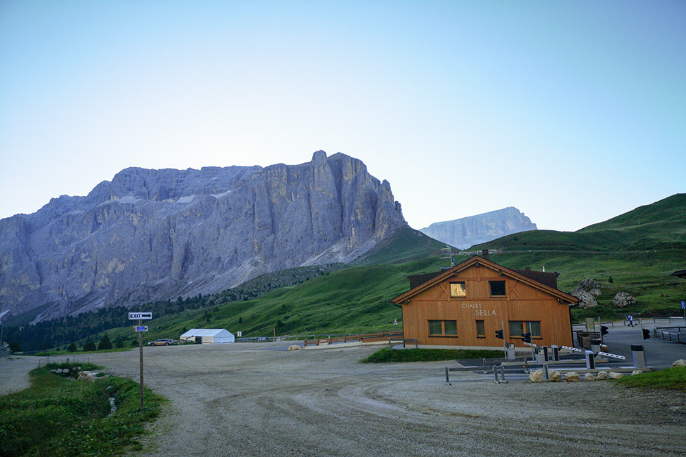
Parcheggio al Passo Sella
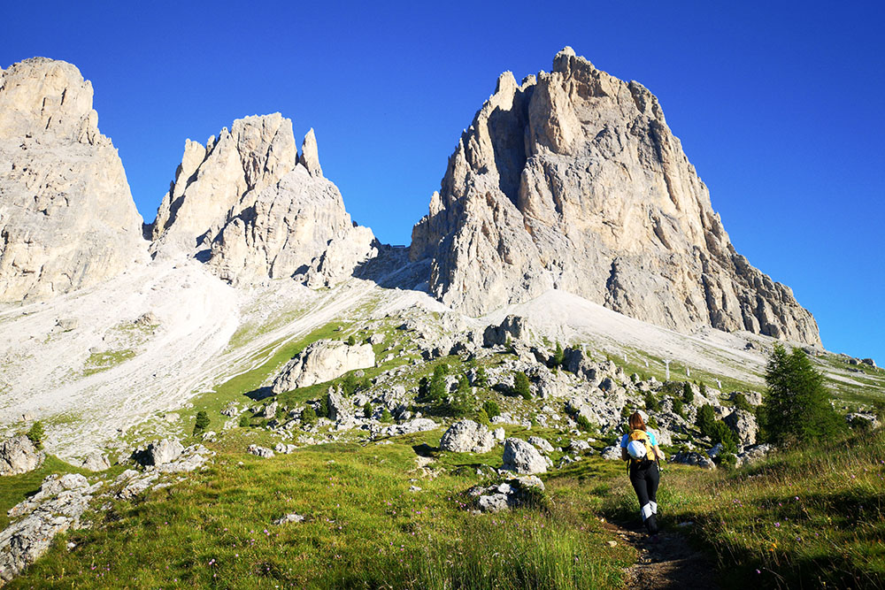
Si sale verso il Rifugio Demetz
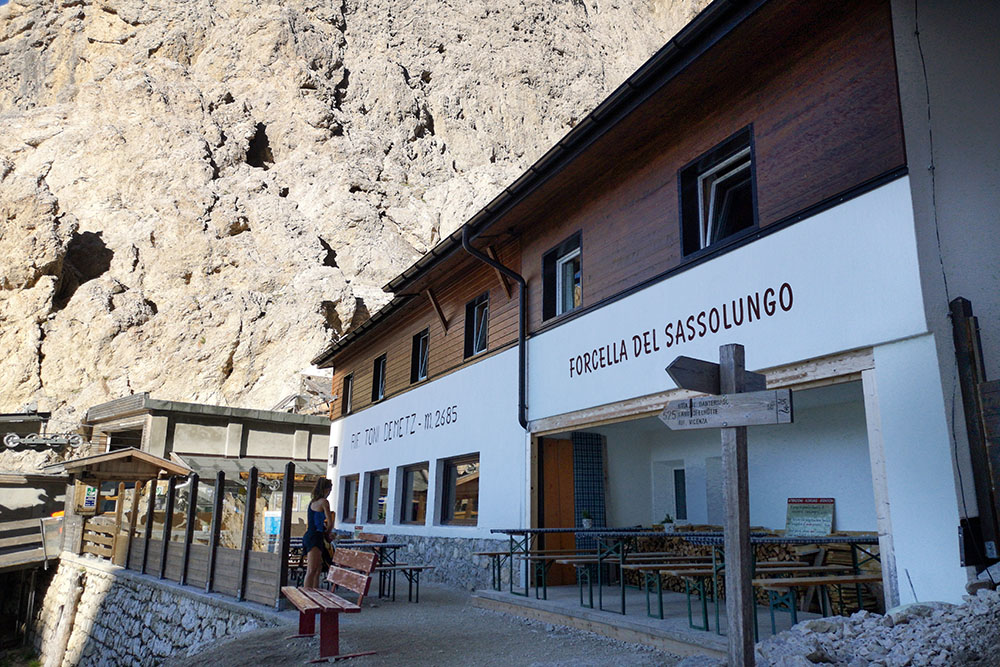
Rifugio Demetz alla Forcella del Sassolungo
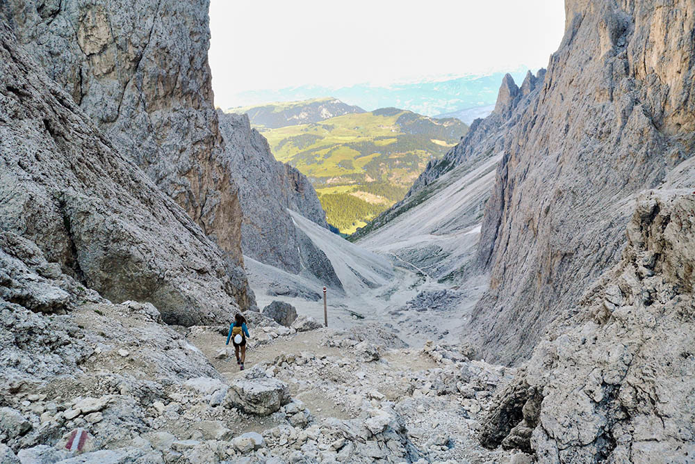
Si scende verso il Rifugio Vicenza
Il Rifugio Vicenza
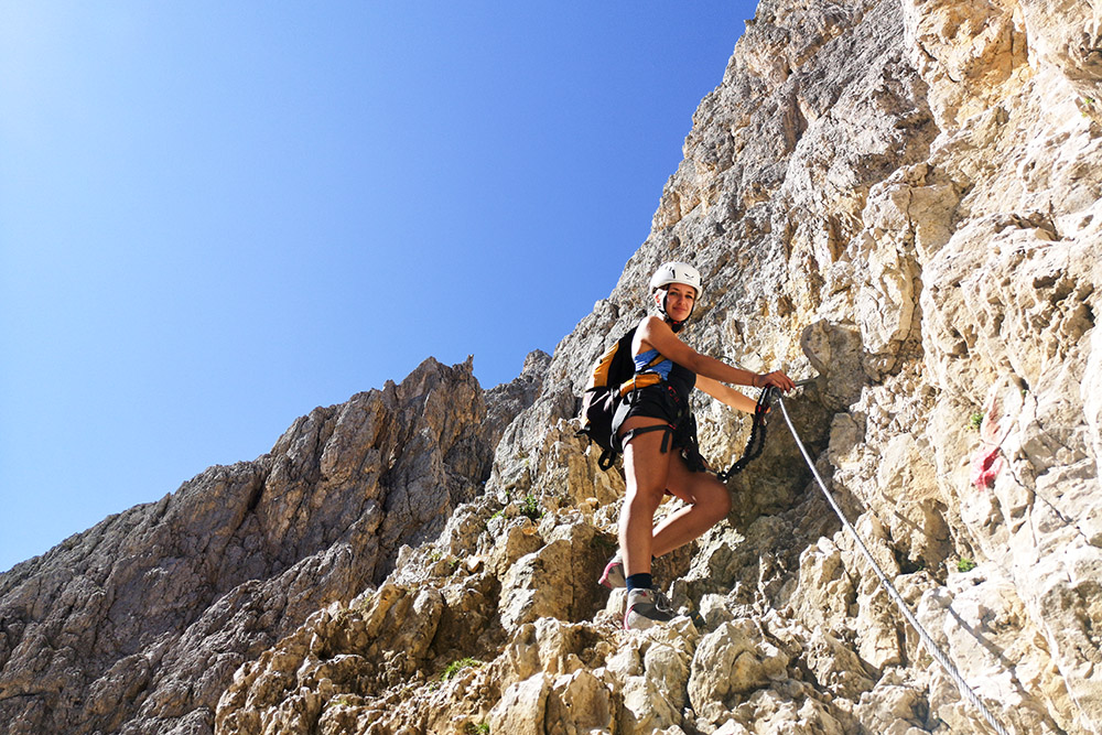
Iniziamo la Via Ferrata Oskar Schuster
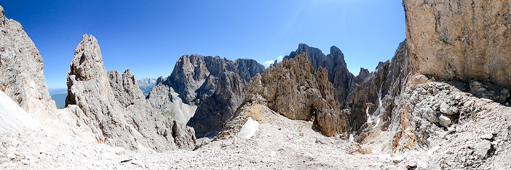
Panorama dalla ferrata
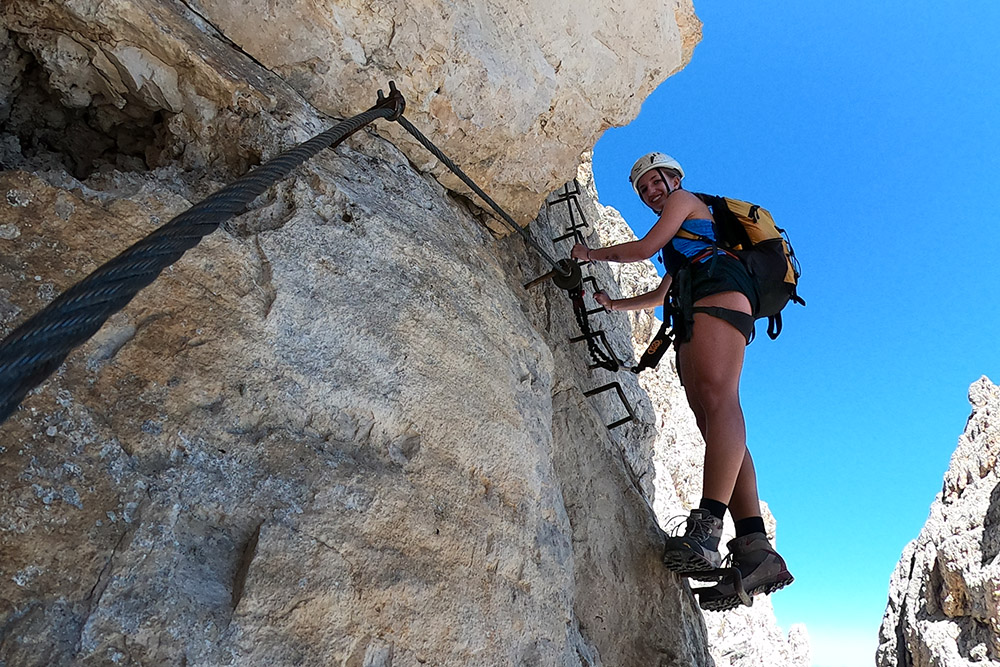
Alcune staffe sulla Ferrata Schuster
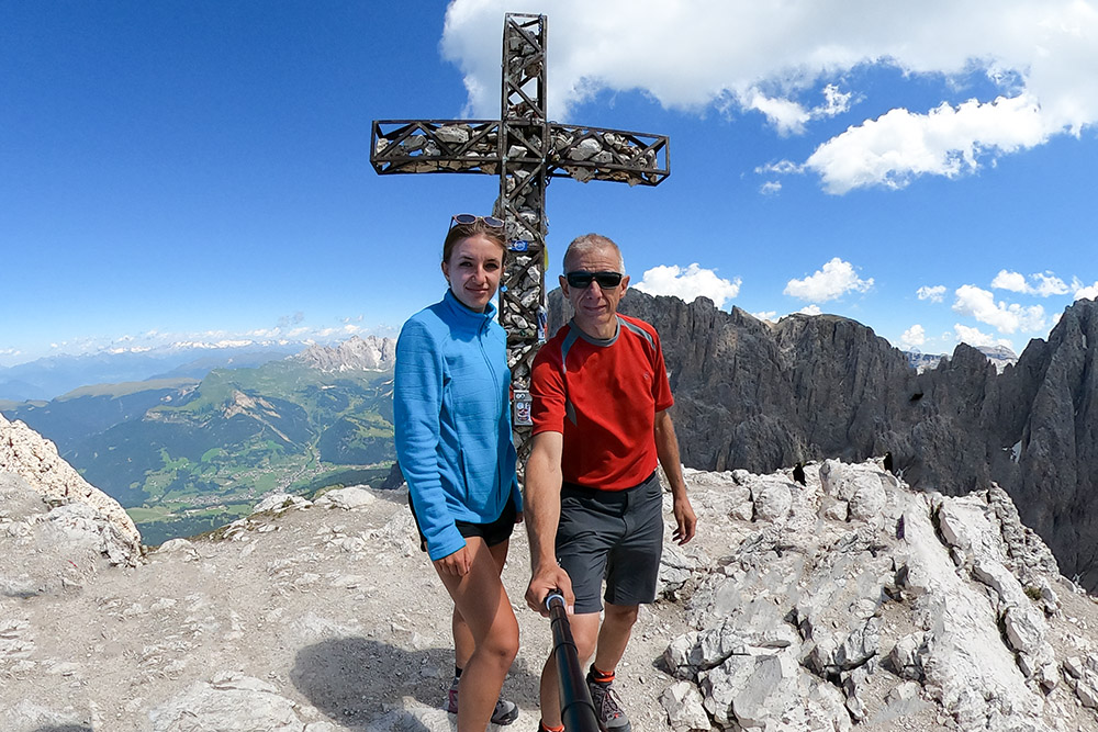
In vetta al Sassopiatto
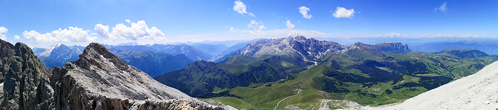
Panorama dalla vetta
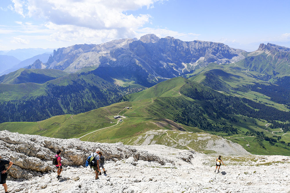
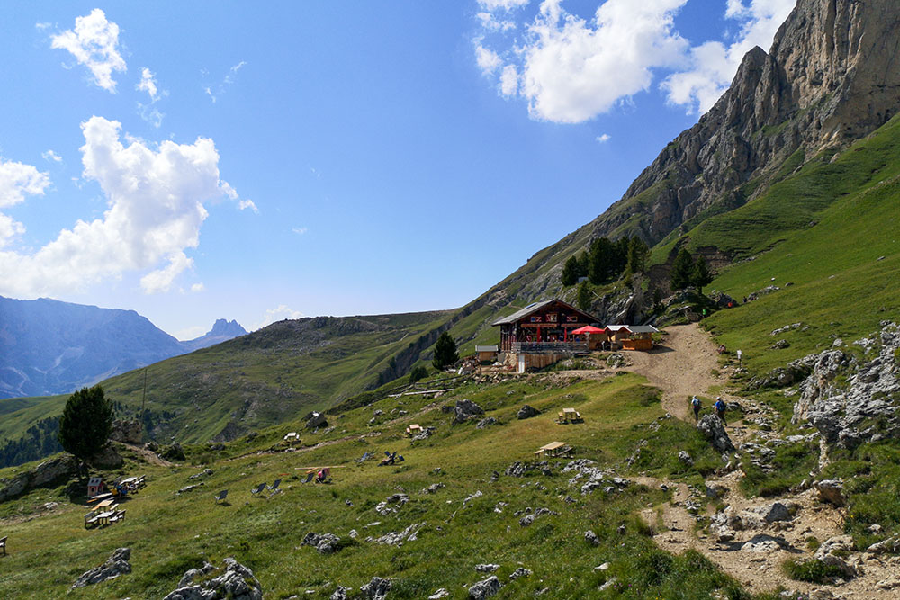
Si scende verso il Rifugio Sassopiatto
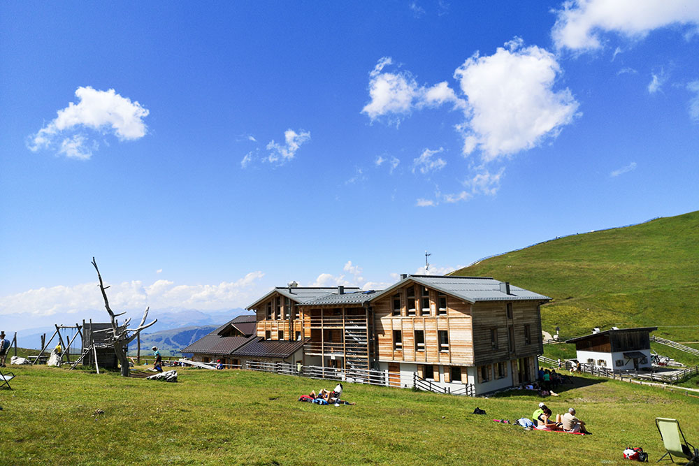
Il Rifugio Sassopiatto
Lasciamo anche il Rifugio Pertini
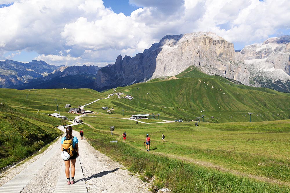
Rientriamo verso Passo Sella


