


![]()


Durata
 5:30 h
Distanza
 11,2 km
 Ascesa
 1005 m
Discesa
 1005 m
H Max
 1738 m
H Min
 827 m
827 mExcursion on Marzola mountain
DESCRIPTION
It is a beautiful and circular excursion to reach the peaks of Marzola with a fantastic view over the Adige Valley and the lakes of Caldonazzo and Levico.
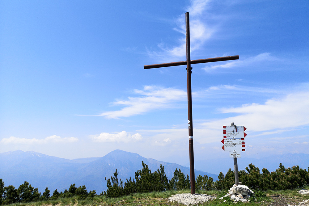
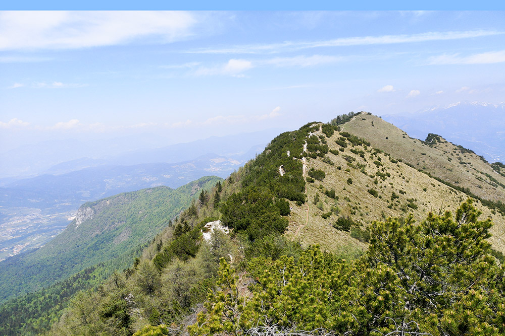
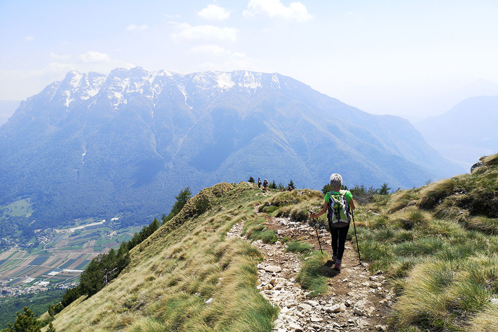
The top of Marzola is 1736 meters high and it is one of the most beautiful viewpoints in the Trento area. From its peaks, the South and North peak, you can enjoy a wonderful view: to the west you can see the Adige Valley and Trento city, and to the east you can see Alta Valsugana Valley and the two lakes of Caldonazzo and Levico.
During the First World war, Marzola took part in the difensive plan of Trento city. The troops located on Marzola had the task to protect the city from possible attacks from Valsugana. On Marzola mountain you can see clearly the remains of war’s fortifications, despite now the wood has partially covered them.
ITINERARY
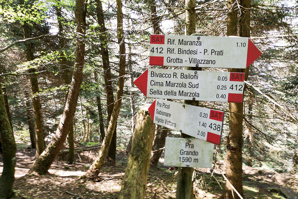
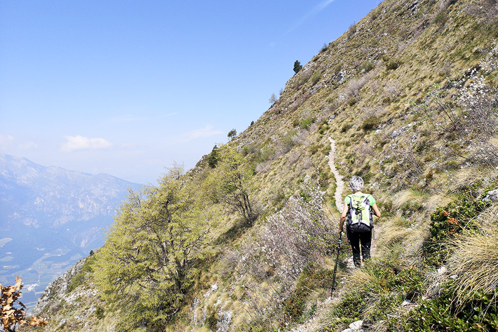
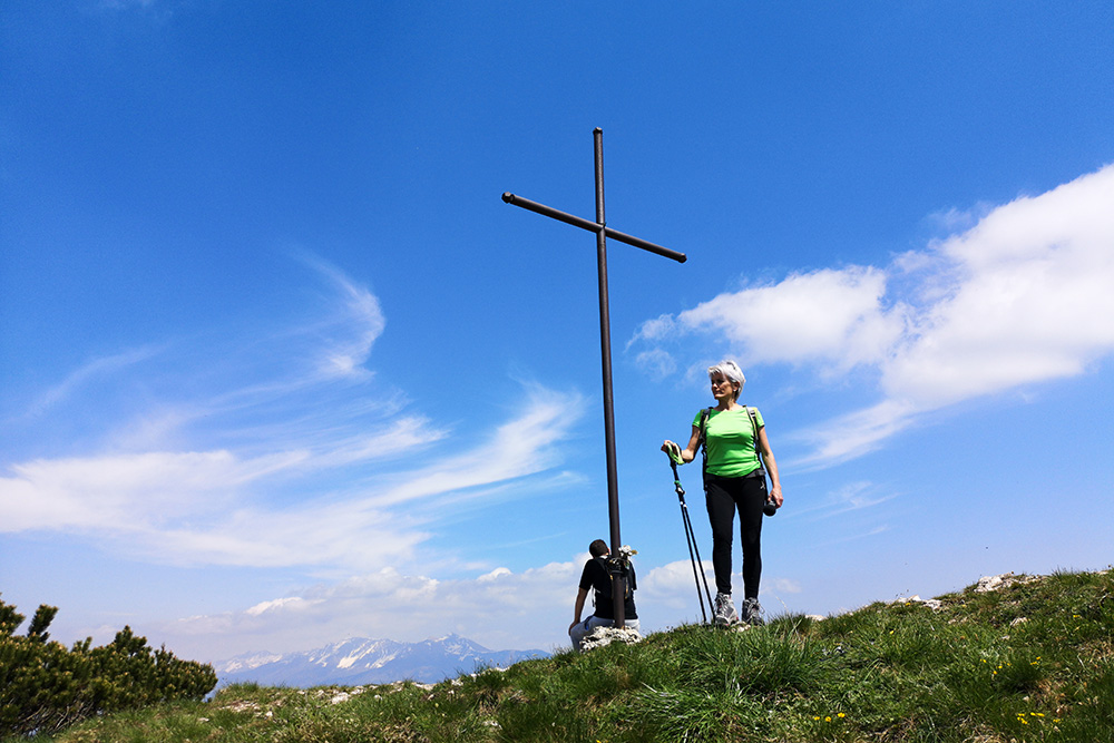
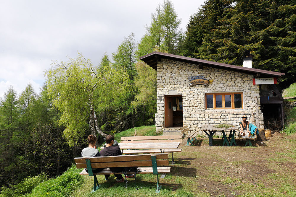
From the car park take the “Croz de le ore” path number 440. The path is steep and so you climb up very quickly in altitude. At some point you will find some remains of Austro-Hungarian fortifications of the First World war. Then there are two short sections with a metal sling to reach the Prà Picol locality at 1390 meters high. Here you continue to climb up along the path number 438 and when you reach Prà Grand locality (1590 meters) you have to take the 412 path. After about 5 minutes you arrive at Bailoni bivouac (1623 meters). Continuing on the same path for 20 minutes you arrive at south Marzola peak (1736 meters). Here descend to the “sella della Marzola” (1694 m) and then climb up to north Marzola peak (1738 m).
For the return take same path to arrive at Bailoni bivouac. Then descend along the 412 path to reach the Maranza refuge (1080 meters). From the Maranza refuge take the 429 path to return to the starting point.
STARTING POINT
Vigolo Vattaro
REFRESHMENT POINT
Rifugio Maranza 1080 m
AUTHOR’S SUGGESTIONS
We suggest to make this excursion counterclockwise.
SAFETY TIPS
Pay attention to the two short sections equipped with a cord.
The viability of the proposed itinerary, like all mountain morphology, is subject to environmental changes due to natural events and weather conditions. Therefore, before leaving, consult the competent tourist offices and / or the refuges of reference.
Our GPX tracks are only indicative, that is, the route was carried out at best with the conditions of the trails and weather of that day. So always consider what to do on site.
Also remember to evaluate the route based on your physical abilities, training and the equipment you have.
You should leave someone the route you intend to do told.
Remember that the emergency number is 112.
EQUIPMENT
In hot weather bring plenty of water.
It is recommended to have the appropriate equipment for the route, weather conditions and season: windproof and / or rain jacket, map and / or GPS device, goggles, sunscreen, boots, first aid kit, specific clothing, gloves, backpack with food and drink.
RECOMMENDED MAPS
Tabacco 062 ALTOPIANO DI PINÈ - VALLI DI CEMBRA E DEI MOCHENI
BOOKS
Volker Jeschkeit, Il Calisio and the Great War: the Fortress of Trento, Curcu Genovese, Trento, 2008.
INTERESTING LINKS
http://www.trentinograndeguerra.it/context.jsp?area=101&ID_LINK=250&id_context=1122
HOW TO ARRIVE
A22 Trento Sud: at the first roundabout turn right. At the second roundabout take the 4th exit on Via Marinai d'Italia, at the third roundabout take the 3rd exit on Via Edmund Mach. Continue to climb until you join the SS349. Once in Vigolo Vattaro, turn left, at the crossroads there is a large stone cross, on via Fontanelle and go up for 1.9 km until you reach the parking lot.
PARKING AREA
Vigolo Vattaro
GPS coordinates: 46.009434, 11.176613
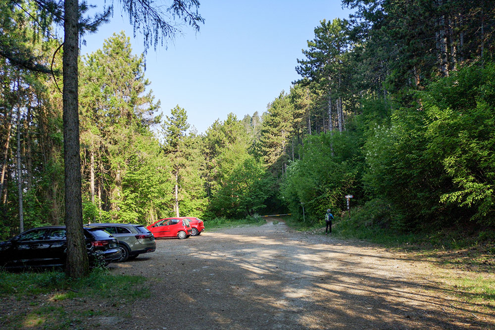
Parcheggio a Vigolo Vattaro
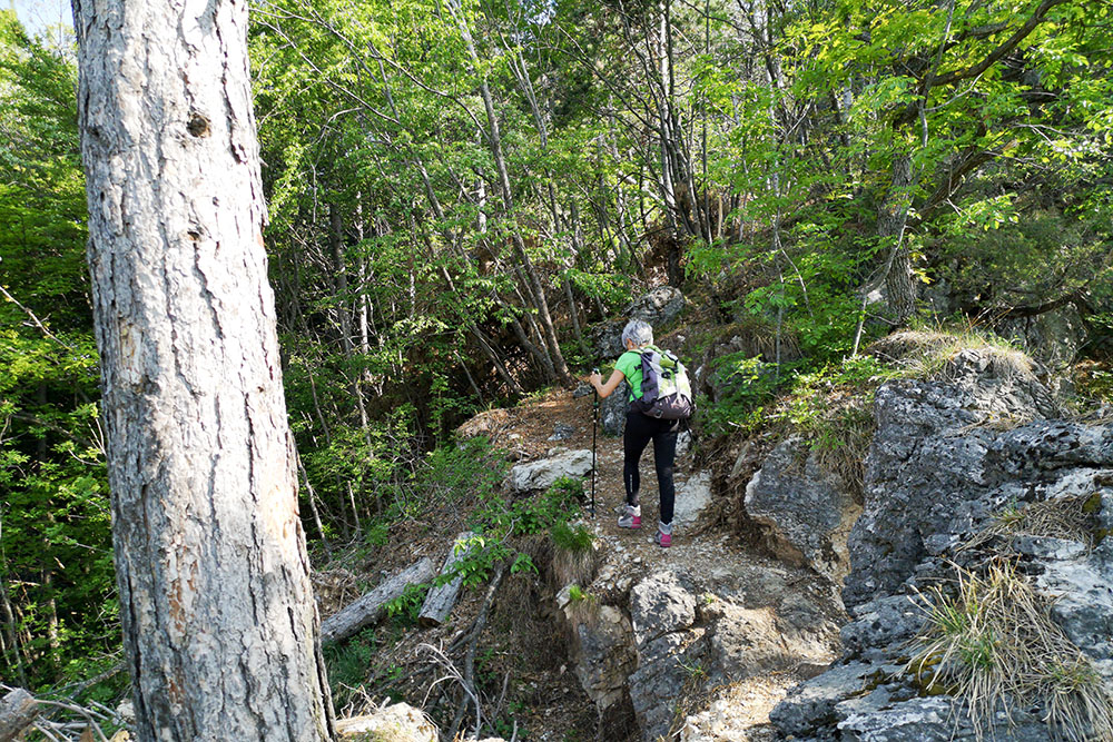
Si inizia a salire

Fortificazioni austroungariche
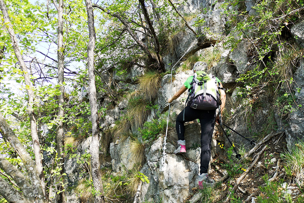
Tratto con cordino
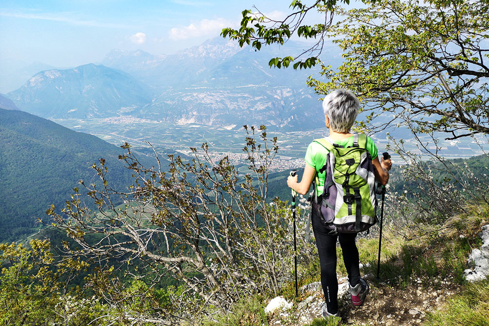
Panorama sulla Valle dell Adige
Si va verso il Pra Grando
Segnavia al Pra Grando
Cima Maranza Sud
Si scende alla Sella della Marzola
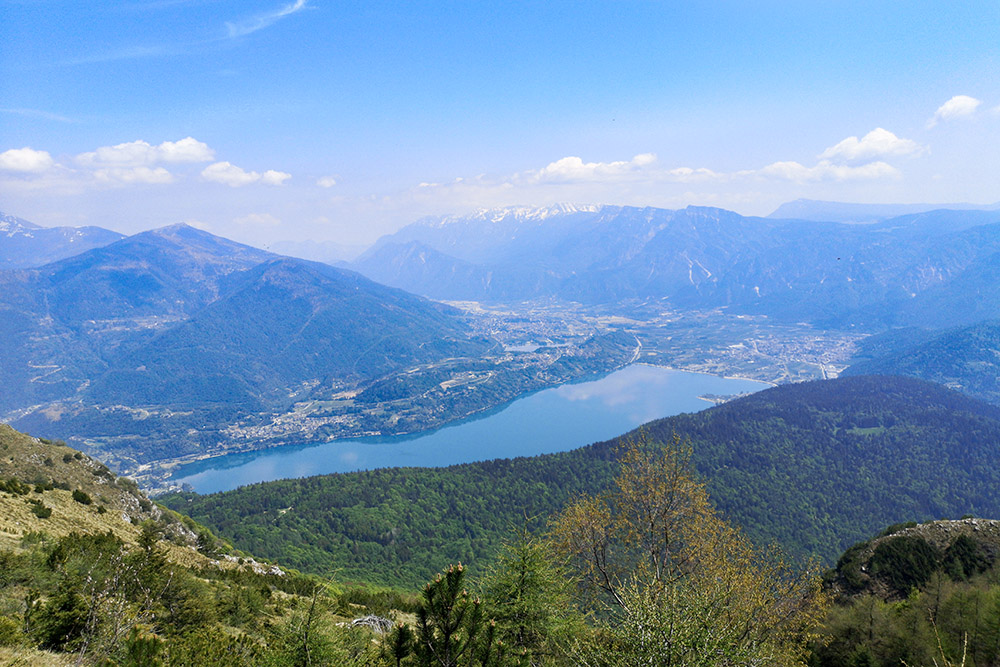
Panorama sui laghi di Caldonazzo e Levico
Cima Maranza Nord
Si ritorna al Bivacco Bailoni
Bivacco Bailoni
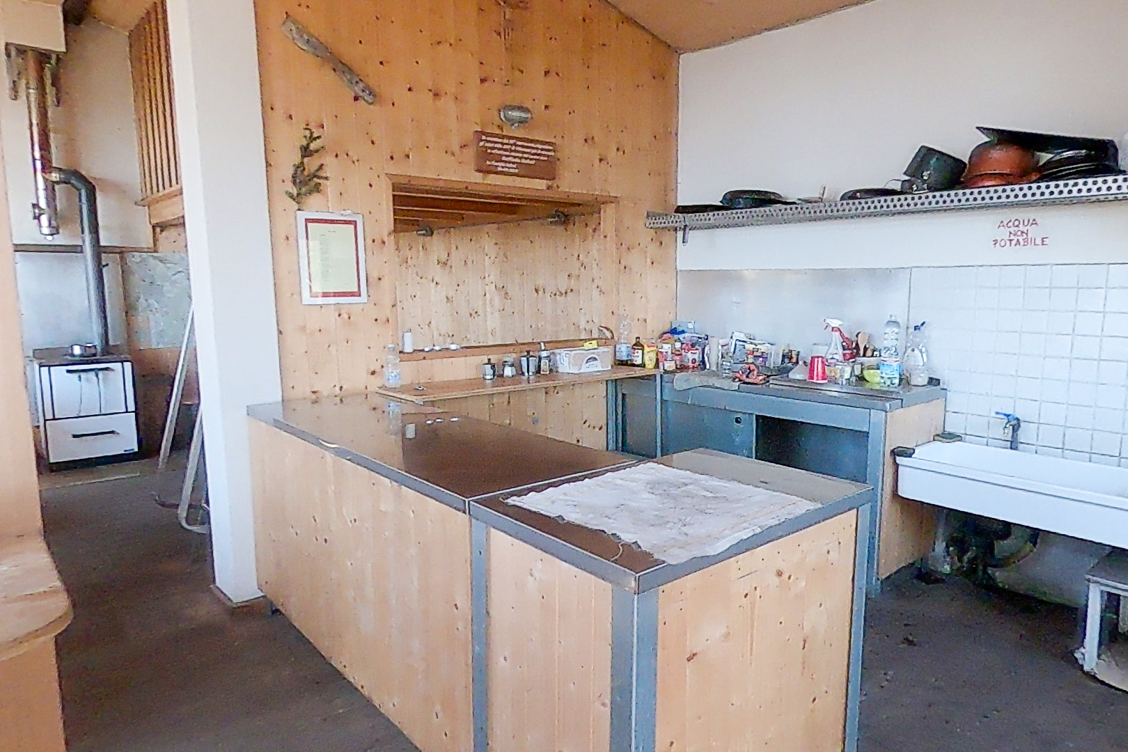
L'interno del Bivacco Bailoni
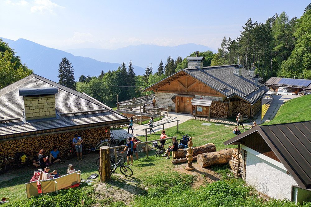
Rifugio Maranza


